Whilst our little adventure into the Prince Regent River had been nerve wracking at times, I was still very glad we had come. It had been a great experience. But we weren’t going to linger and risk being stranded, so we were off downstream as soon as we woke up, with more water under us than when we had arrived. Always a reassuring sign!
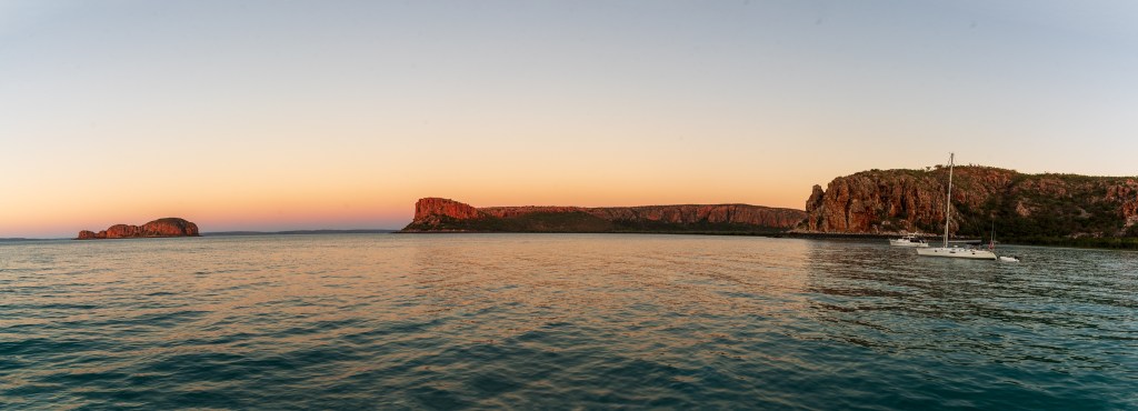
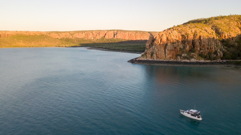
Following our track back out, we waved farewell to Robyn as we passed Kathmandu anchored in Camp Creek and continued down and out of the river. We picked up speed again around Strong Tide Point, but the whirlpools and eddies at Whirlpool Point were a non-event this time. Making good time, we bypassed a possible anchorage in Dennis Bay and continued sailing over and around Augustus Island.
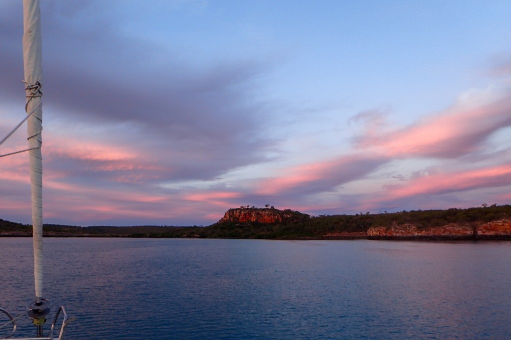
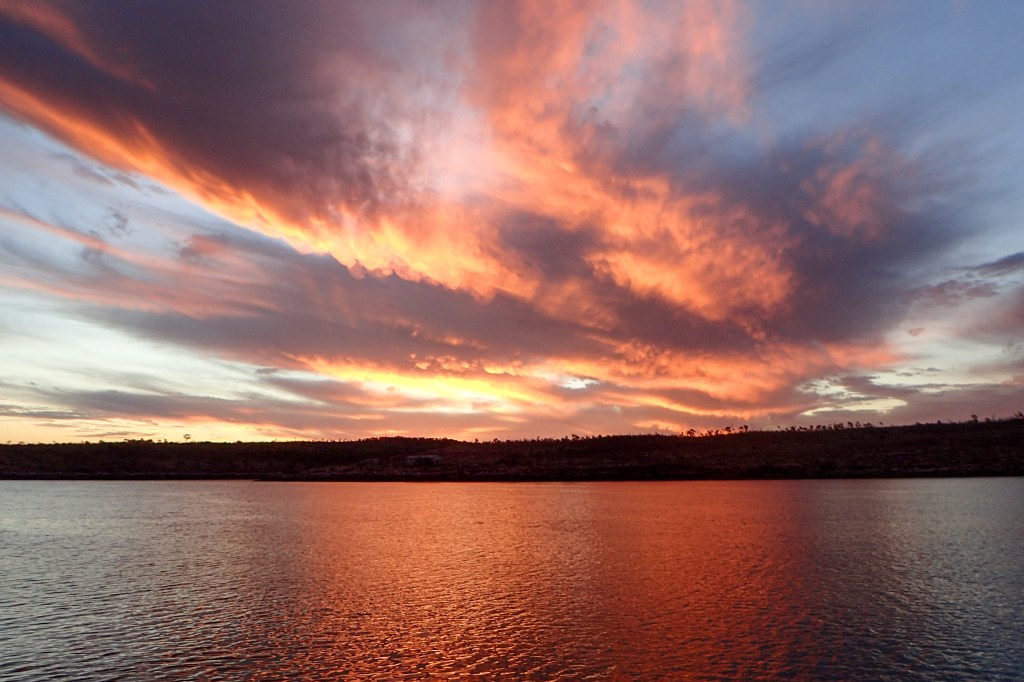
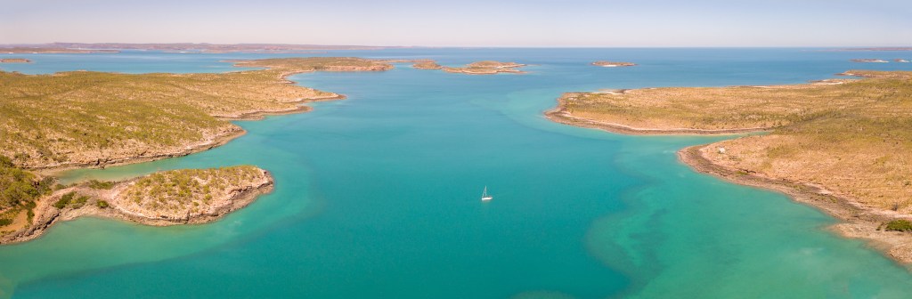
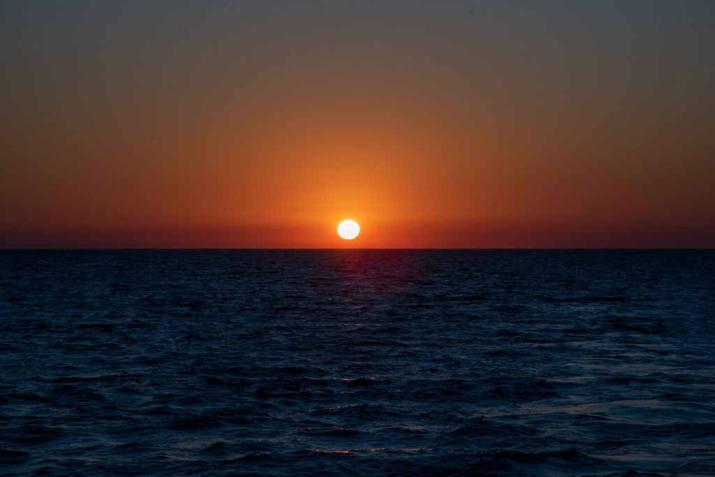
In the unnamed deep bay on the west-southwest of Augustus Island, it took us nearly an hour to find somewhere shallow enough for our anchor. It was very pretty and there were no pearl farms as indicated on the chart. Finally we were safely anchored and enjoyed an extraordinary sunset; 360 degrees of beautiful colour surrounding us.
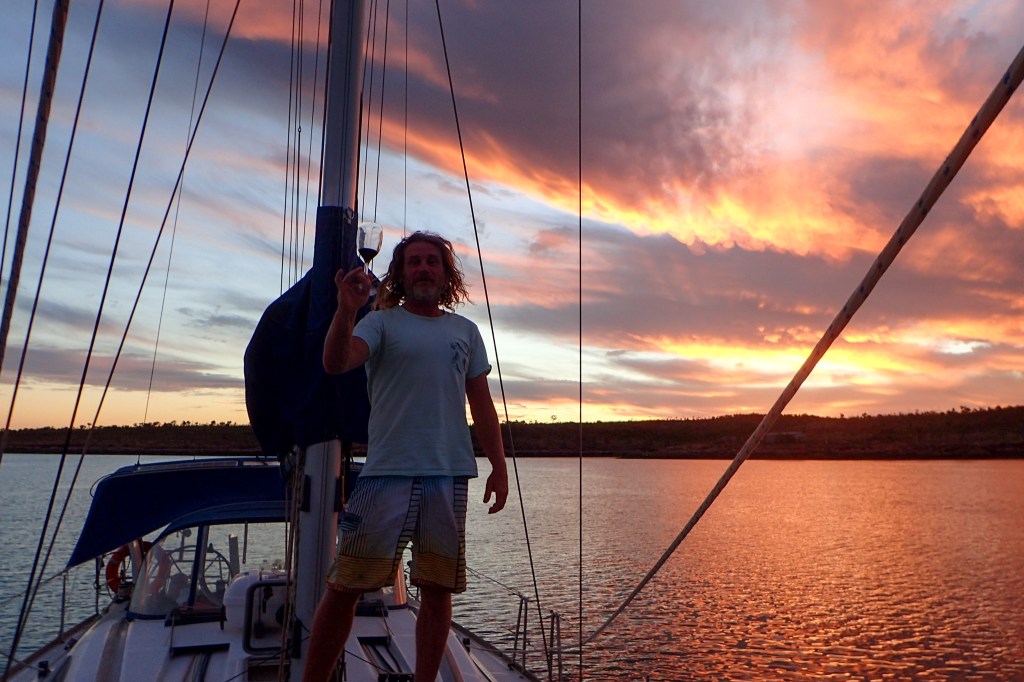
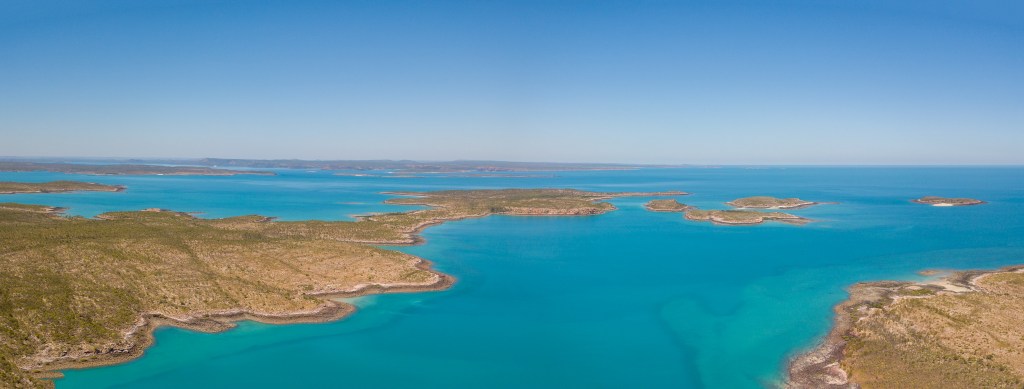
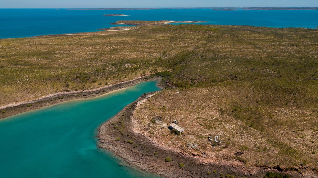
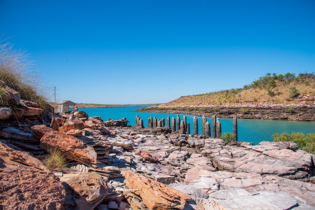
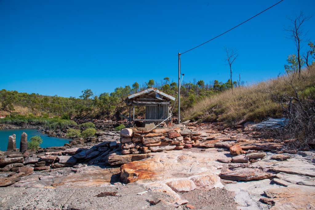
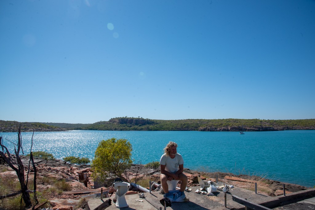
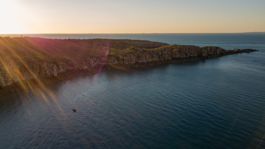
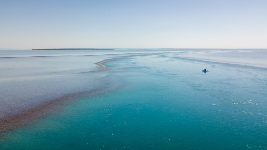
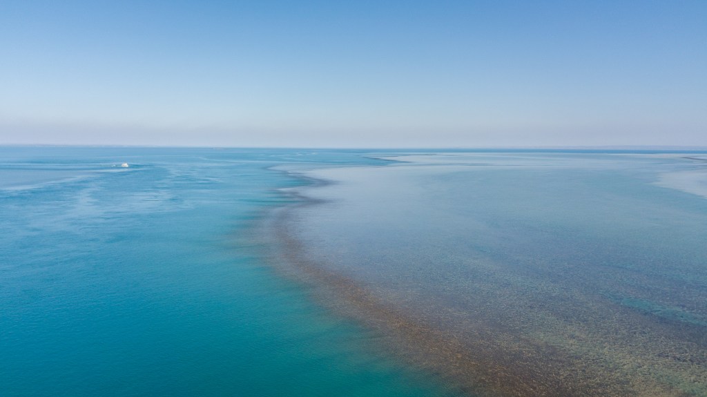
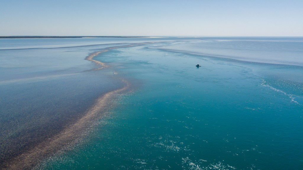
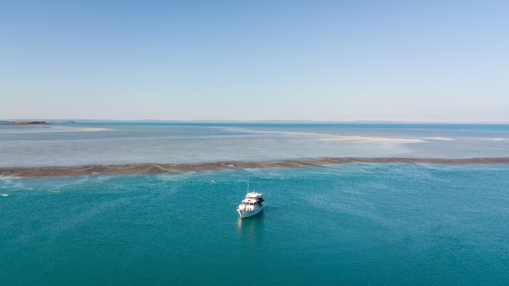
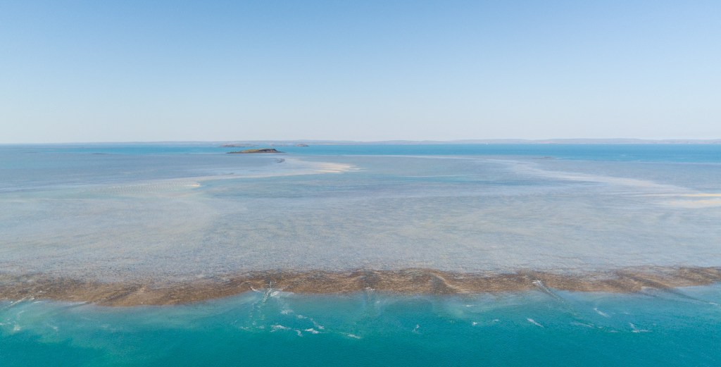
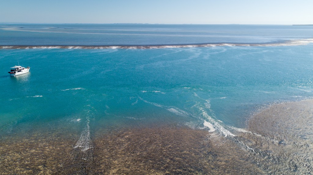
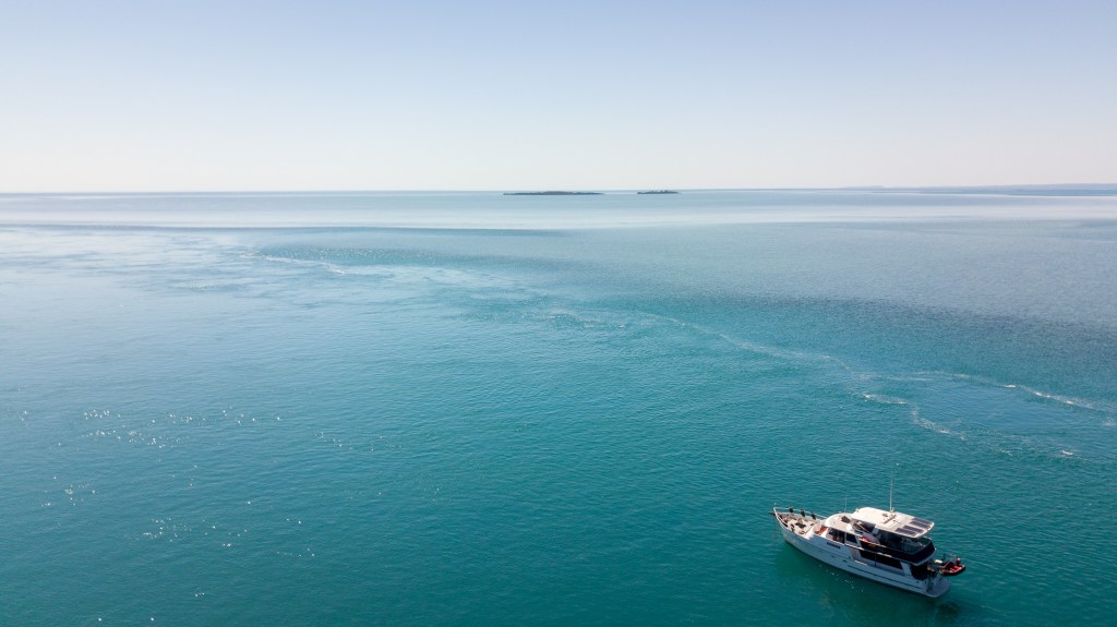
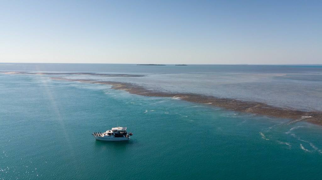
The following day was spent relaxing on the boat and exploring on shore, as we waited for the right current to carry us south. There was an abandoned pearling station that we wandered around, but unfortunately I didn’t find any leftover pearls. We did find an old toilet though! Part of the island had a heap of crystals growing in the rocks and I spent ages foraging for and collecting a good sample. Matt also put the drone up to photograph the extraordinary turquoise coloured water.
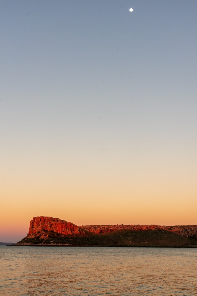
Mid afternoon, when my ‘nibbles’ had finished baking, it was time to leave for the short passage to Deception Bay where we were meeting up with Sens de la Vie and Sealeaf. In the fifteen knot headwind we had to use the motor, and the current wasn’t as strong as I’d expected, so it was nearing dusk as we entered the strait between Wailgwin Island and Lulim Island, just north of Deception Bay.
About halfway through the strait, we could see a small boat flying past, but then it became clear that it was actually heading towards us. We were about to have our first encounter with WA Fisheries, and it wasn’t to be a pleasant one. Matt realised who they were and motioned for them to use the radio to communicate their intentions. They declined and instead came right up close, yelling to us that they wanted to board. What followed was neither professional nor safe.
We tried to tell them that we were going to Deception Bay, just up ahead and that they could follow us in there and board safely in the calmer waters. However the Fisheries staff member driving the tender very forcefully and quite rudely demanded that we maintain course in the middle of the strait and that they would board us there. I was pretty nervous, navigating a narrow and unknown stretch of water in choppy conditions. We were more than happy to have fisheries board us, as we both had current fishing licenses and no fish on board, so had nothing to hide.
Matt offered to grab a line so that they could board safely onto the stern of our boat, but this was refused. So Matt tied a couple of fenders onto the side of Cool Change and opened up one of the lifelines. The tender roared up to us, spraying water all over our cockpit and our electronics that were sitting there. I was not happy, and this had me yelling out for the first time. I don’t know what this #### thought he was doing.
Boarding a commercial fishing vessel made of steel is an entirely different proposition to boarding a small fibreglass yacht with only two people onboard, but this guy didn’t seem able to grasp that. Matt describes him; ‘ A great example of someone who has accreditation but not much else between the ears, no idea except that he thinks his badge is shinier than anyone else’s.’
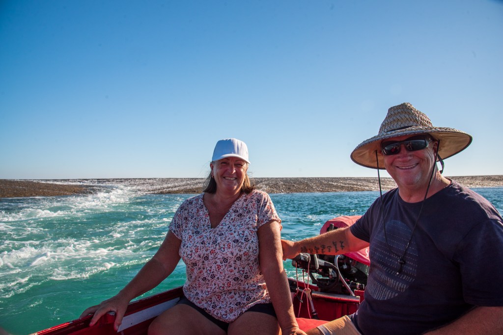
On the second attempt, two of the Fisheries staff awkwardly climbed on board; it was a difficult and dangerous manoeuvre in the choppy waters. They checked our fishing licenses, had a quick look in our freezer and that was it. I’m really not sure what they expected to find on a cruising yacht. Satisfied that we did not have any undersized fish, or half a dozen illegal refugees processing dugong or turtle, they departed.
The two Fisheries staff that came on board were very courteous and professional, but the same cannot be said of the oaf who was driving the tender. I see no reason why they couldn’t have waited for us outside the strait, where their mother ship was waiting anyway, or have followed us into the calm anchorage at Deception Bay. The only reason seemed to be to fulfil some type of macho need for the idiot who was driving the tender. A very disappointing experience.
We figured out later that the reason they did not want to have a conversation on the radio was so as not to broadcast their position. It is also why their ship and tenders have their AIS switched off. AIS is a tracking device that most large vessels and cruising yachts have. The navigation equipment uses the AIS to place a symbol on the map showing the locations of other ships. Even on a clear day, a vessel will appear on our navigation equipment well before we can see it. So it seems that Fisheries try to sneak up on boats. Again, it baffles me just what they think a cruising yacht would have on board and be trying to conceal.
After Fisheries had boarded us, a small cruise ship on the other side of the strait contacted them on the radio, offering for them to board him and engaging Fisheries in a long conversation for all to hear. Matt decided to try the same tactic the next time we saw them, a few weeks later. ‘Fisheries vessel at Karakata Bay, Fisheries vessel at Karakata Bay, Fisheries vessel at Karakata Bay, this is Cool Change, would you like to board and have a look?’ ‘No’ was the response the second time. ‘Copy that, Fisheries vessel at Karakata Bay,’ replied Matt.
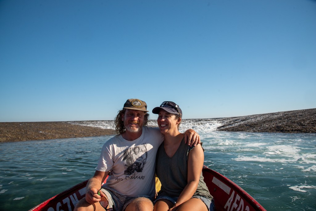
Arriving in Deception Bay, we anchored and went straight over to Sealeaf for dinner and drinks where we debriefed our Fisheries encounter with Brian, Sandra, Terry and Leonie.
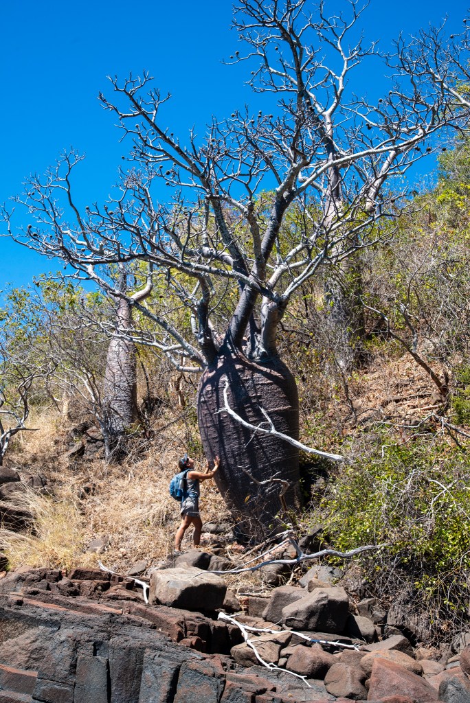
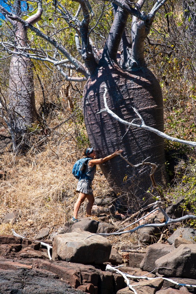
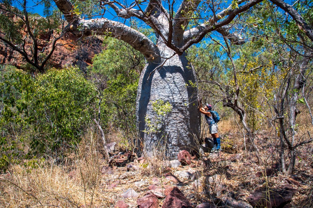
At this point in the trip our Spotify app was no longer working as we’d been out of internet reception for so long. The others were all missing their music too. So the next morning, when we managed to get some internet by hoisting our phones up the mast and restoring our Spotify, we invited Brian and Leonie over to our internet café to share the link. Unfortunately it didn’t work for them and after a quick trip to shore to see some of the gorgeous old boabs we all proceeded south to our next anchorage at Raft Point.
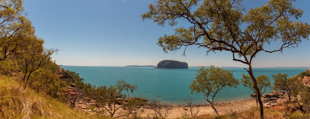
Raft Point rose out of the distance to meet us, impressive burnt orange cliffs glowing in the beautiful twilight. Matt put the drone up to try to capture the magic.
We spent three nights at Raft Point and on one of the days we all hopped aboard Sealeaf for a day trip out to Montgomery Reef. I was so excited, I felt like a kid at Christmas! The weather seemed to have picked up on our festive mood and it was absolutely perfect with beautiful, calm seas. We spotted a few whales as Brian drove us out and anchored in the middle of the narrow channel just after High Water. Then, with a delicious spread laid out on the veranda of Sealeaf, we proceeded to sit back and marvel at the spectacle that is Montgomery Reef.
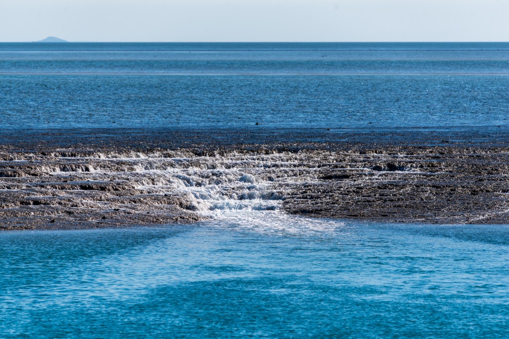
The 80 kilometre long Montgomery Reef is famous for the spectacular show that occurs twice every day as the huge tides go in and out. As the tide subsides, the reef seems to magically rise out of the water and hundreds of cascading waterfalls start appearing along the edges. It was really something to sit and watch as the reef began to gradually emerge around us and then the waterfalls began cascading over, getting bigger and bigger. It was a very special experience and we all felt quite awed to be there, right in the middle of it. We were lucky enough to be there at a spring tide of nine metres, so the effect was about as dramatic as it gets.
Brian and Sandra dropped their tinny and took us all for a close up tour of the waterfalls and Matt put up the drone several times, getting some amazing ‘before and after’ shots from above.
Arriving back at Raft Point just after sunset, we remained on Sealeaf toasting our wonderful day and our wonderful friendships.
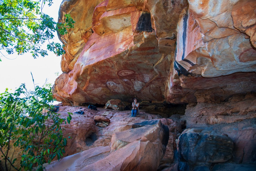
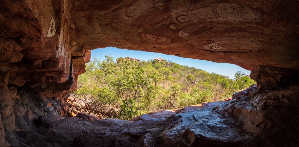
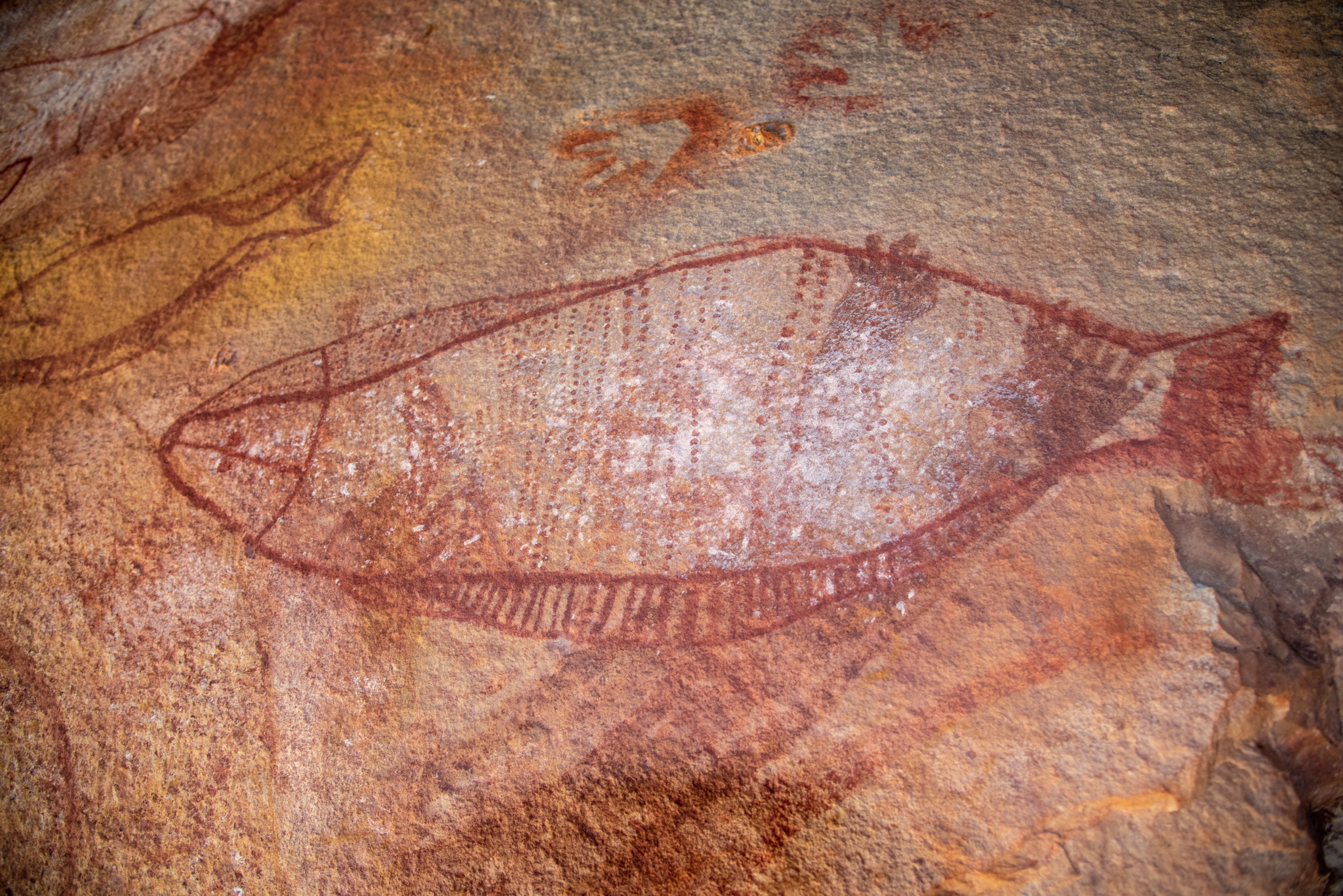
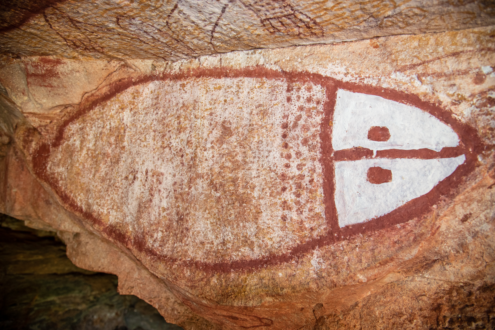
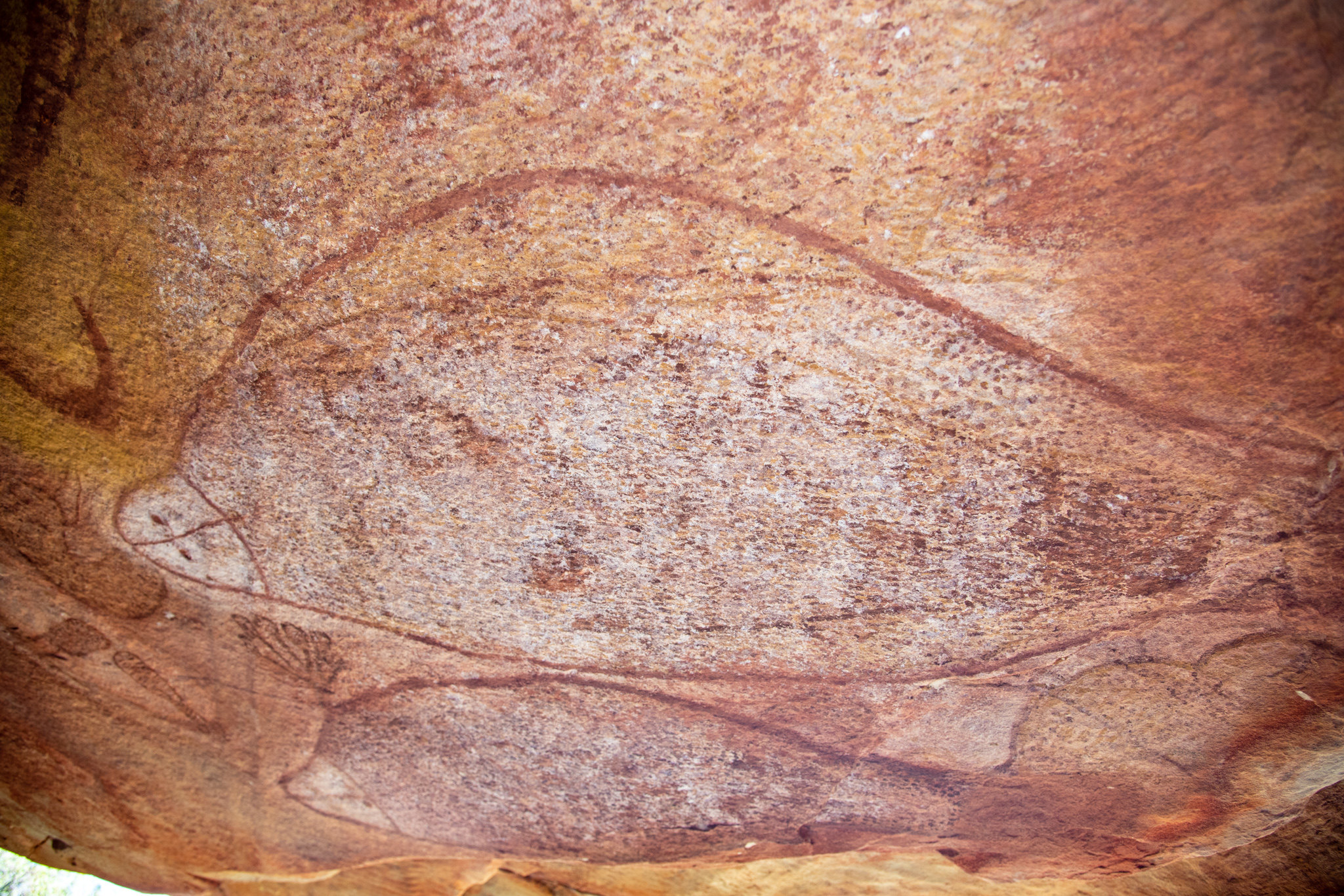
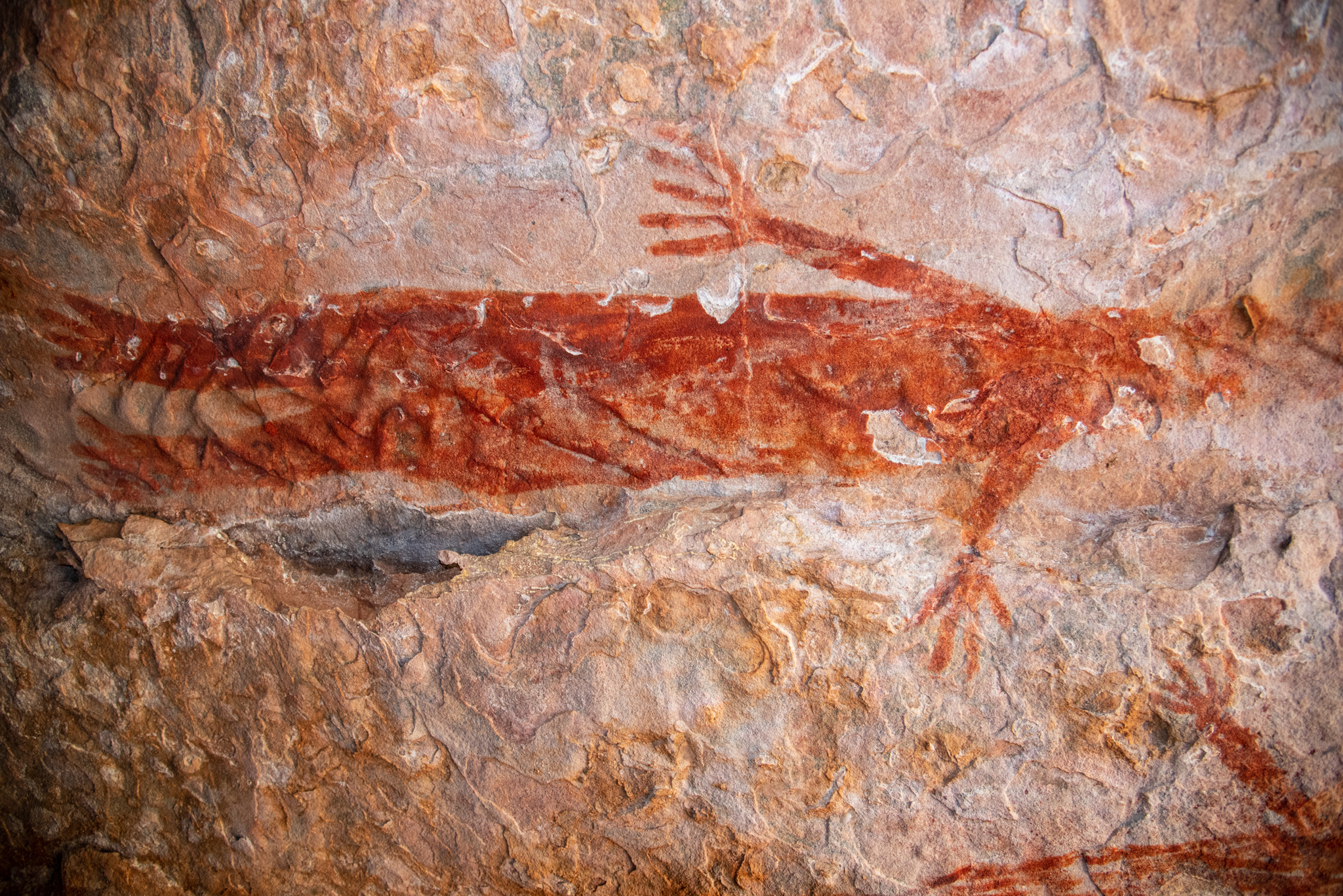
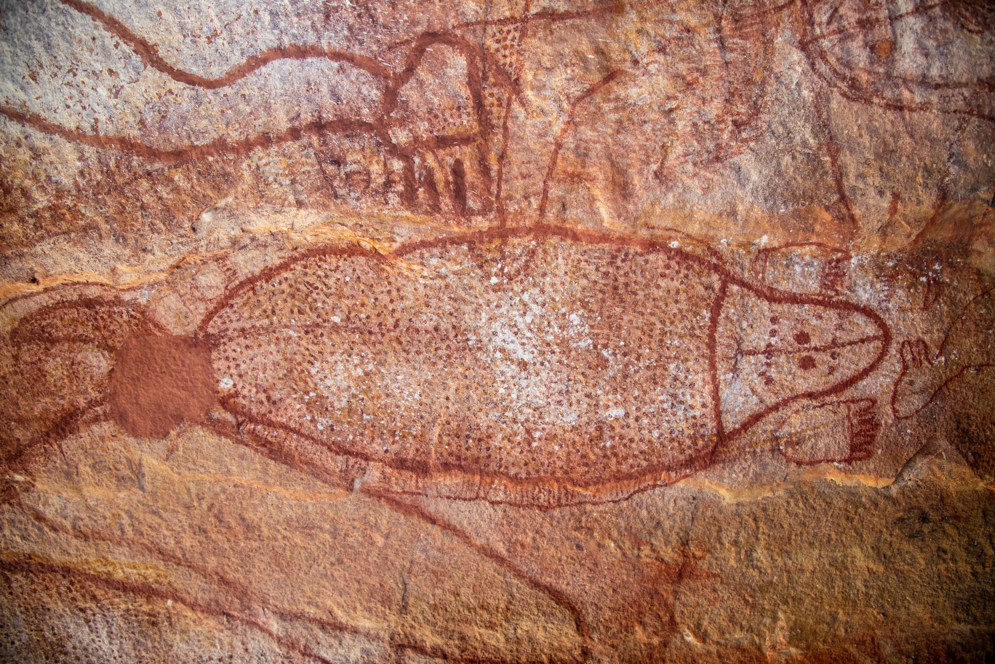
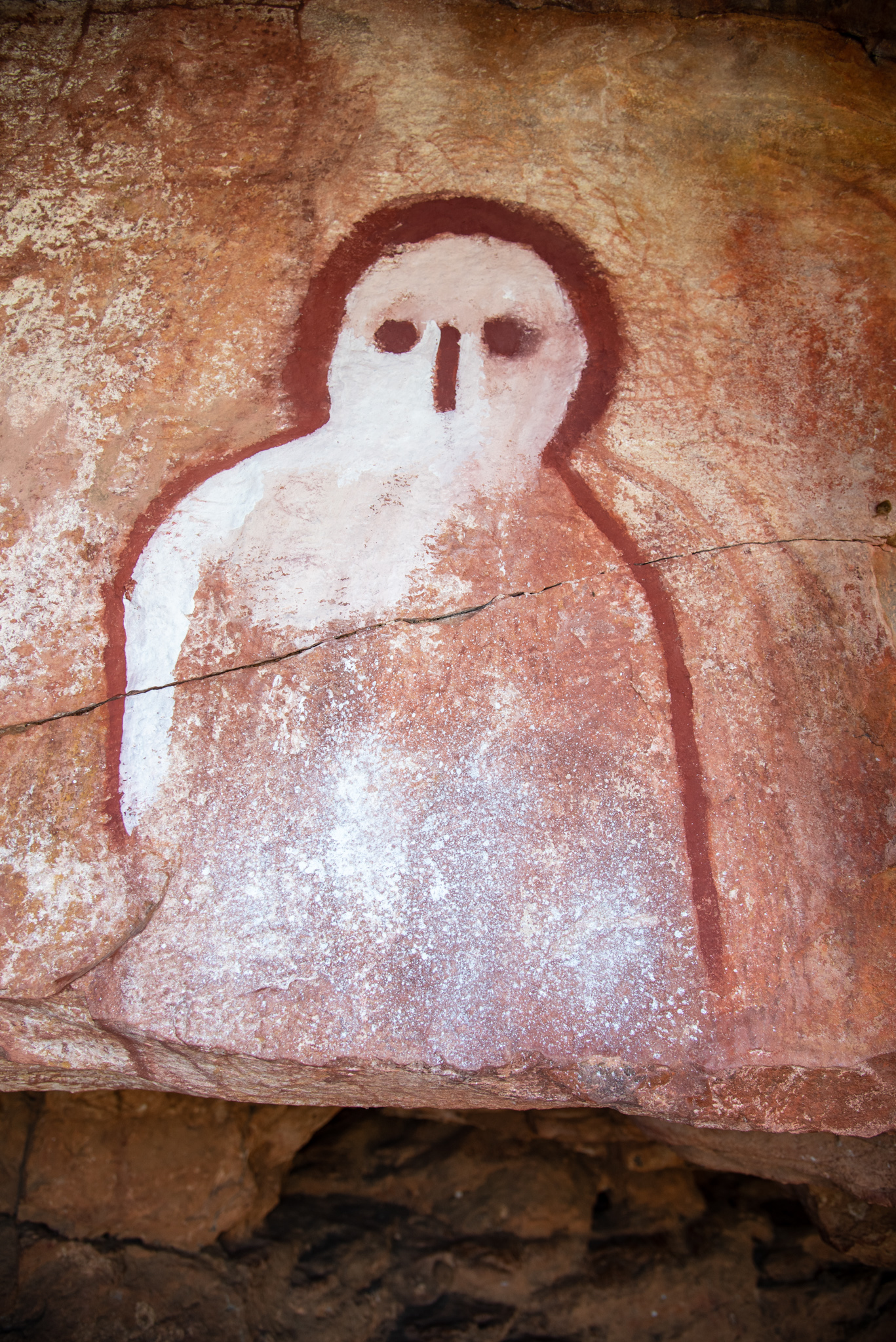
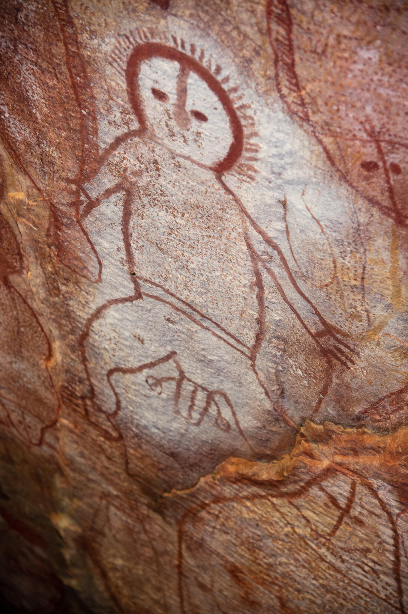
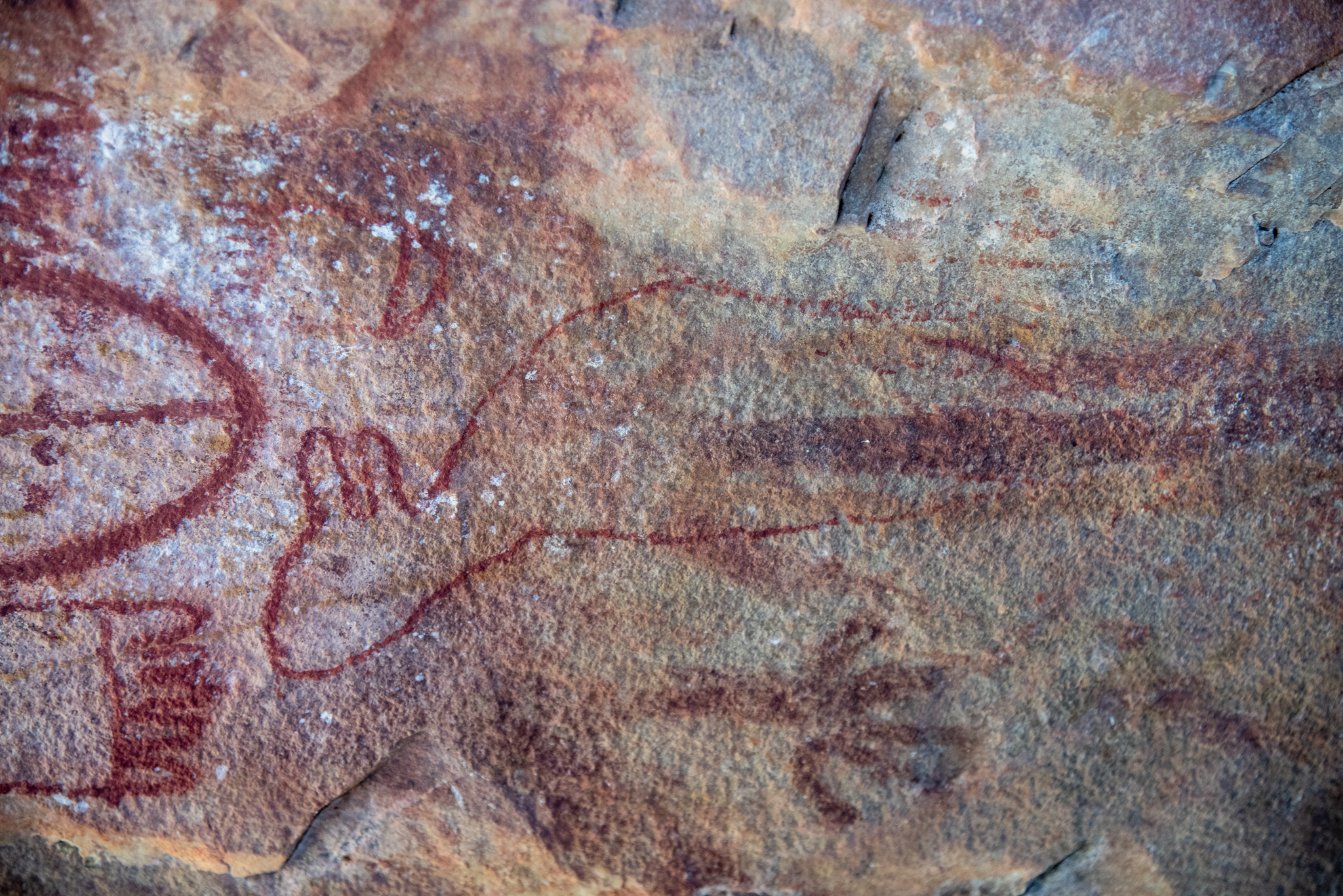
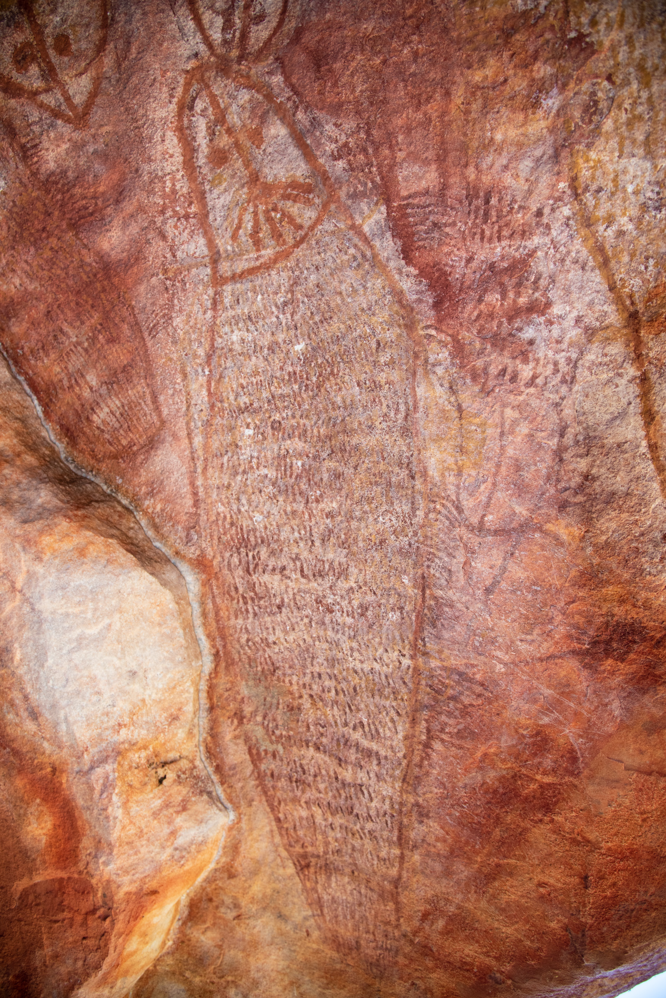
Another day was spent exploring on land at Raft Point and hiking up to some caves to see the rock art there. It was a very hot walk up the dusty track to the caves but there were some beautiful views on the way and some gorgeous old boab trees.
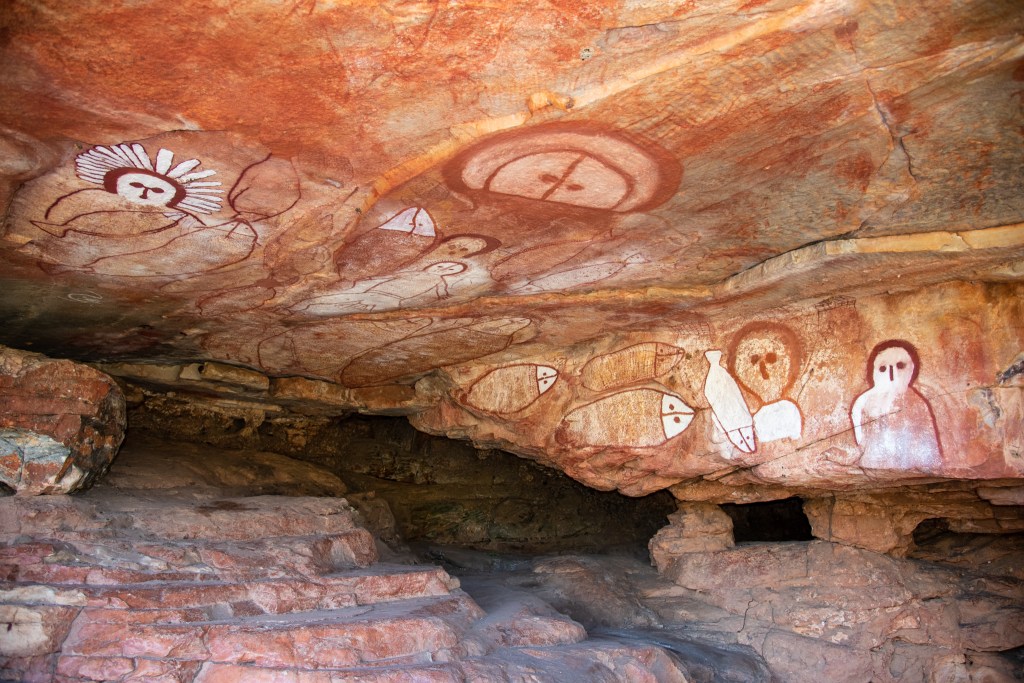
I had read that the rock art at Raft Point was the singularly most visited rock art site on the entire North West coast. Upon reaching the caves, we could see why. A large number of big, clear and elaborate paintings in a cave that was not so challenging to walk up to. However, it appeared that the art had been ‘touched up.’ It was a truly bad restoration effort, if that’s what it was, and left us scratching our heads as to why anyone would do that. You could clearly see where fresh white paint had been painted over the older picture and there were even paint drops on the floor of the cave. One picture was only partly painted over, perhaps they ran out of paint?!
It was truly weird, because the whole point of going all the way to these remote places to view Aboriginal rock art is to see the paintings in their original site and current state and to wonder and marvel at how old these etchings may be. I’m not interested in seeing paintings covered up with the Dulux. When we had internet coverage later, we googled about the Raft Point artwork but could find no articles about graffiti or desecration, which led us to believe that it was a misguided attempt to brighten up the artwork for tourists. What a shame!
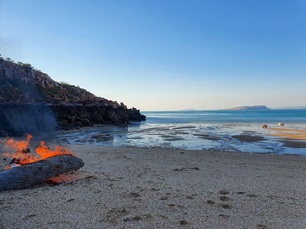
That afternoon we tendered around the corner to a beach with Brian and Sandra to have a little fire to burn our paper and cardboard rubbish. It was very relaxing sitting on the beach, watching the flames and throwing sticks to Tilly, the dog. Before too long the midgies stated biting and it was time to go. However, the tide had other ideas.
We had thought that as it was nearly the turn of the tide, the water would go out past our tinnies and then return in, floating our tinnies once again, so we could be off, nice and easy. But as ever, in the Kimberley, picking the exact timing of the tide was a challenge. And we got it pretty wrong. The water just kept going out and out and out, leaving our poor little tenders stranded on the rock strewn beach. ‘No way I’m dragging that over those rocks,’ Matt and Brian were both saying.
So we waited and waited, as it got darker and darker, peering out at the beach, trying to work out if the water was indeed coming in or if we were just imagining it. Finally, we were pretty certain that it had turned and made our way down. It was well past sunset now, but there was a bit of light from the moon so we could see fairly well. Tilly kept running off and I was worried about crocs sneaking up on her in the darkness. We ended up dragging the boats just a little and then pushed and rowed them out into water deep enough to get the motors going. Never a dull moment in the Kimberley!
I didn’t really get a photo to demonstrate the huge tides in the Kimberley, but here is the beach not long after we arrived. In the enlargement, you can see the tiny figure of Matt standing next to the rocks. The dark colour of the rocks is the tide line, that is, the darker rocks are all completely under water on a high spring tide. The sheer volumes of water involved make the mind boggle!
We had had a wonderful couple of days travelling and exploring with our friends and we were looking forward to sharing the final week of our Kimberley cruising with them. Next post will detail our final adventures in this most incredible and special of places.
If you truly love nature, you will find beauty everywhere.
Vincent Van Gogh
