It was time to leave the Ningaloo Reef and head down to the next part of the coastline, Shark Bay. I didn’t feel ‘done’ with Ningaloo Reef, but time was ticking; it was mid October and the strong southerly winds would only be getting stronger and more relentless. The forecast showed a little window of calm weather so we decided to go for it. It would be an overnight passage all the way to Monkey Mia at the bottom of Shark Bay.
The 180 nautical mile trip took us 26 hours and was pleasantly uneventful. We rotated shifts of four and a half to five hours, and by the time we arrived at Monkey Mia at 11.30 am we were both feeling pretty good. Sealeaf had arrived just ahead of us, as had Laros, with Beaujolais, the fourth yacht that departed with us, arriving a day later. It was lovely and calm as Matt drove us into the anchorage, through the narrow channel that is right alongside the beach. We had bacon and eggs in the cockpit for brunch, and enjoyed hot showers, feeling tired but quite pleased with ourselves.
We stayed here for two nights as the wind gusted on and off. Onshore was the Monkey Mia Dolphin Resort and we made good use of their facilities. An early dinner and drinks at the Monkey Bar on the day we arrived was a godsend, Sandra and I had coffee and cake while we did loads of laundry, and Matt filled up jerries of diesel from the fuel pump.
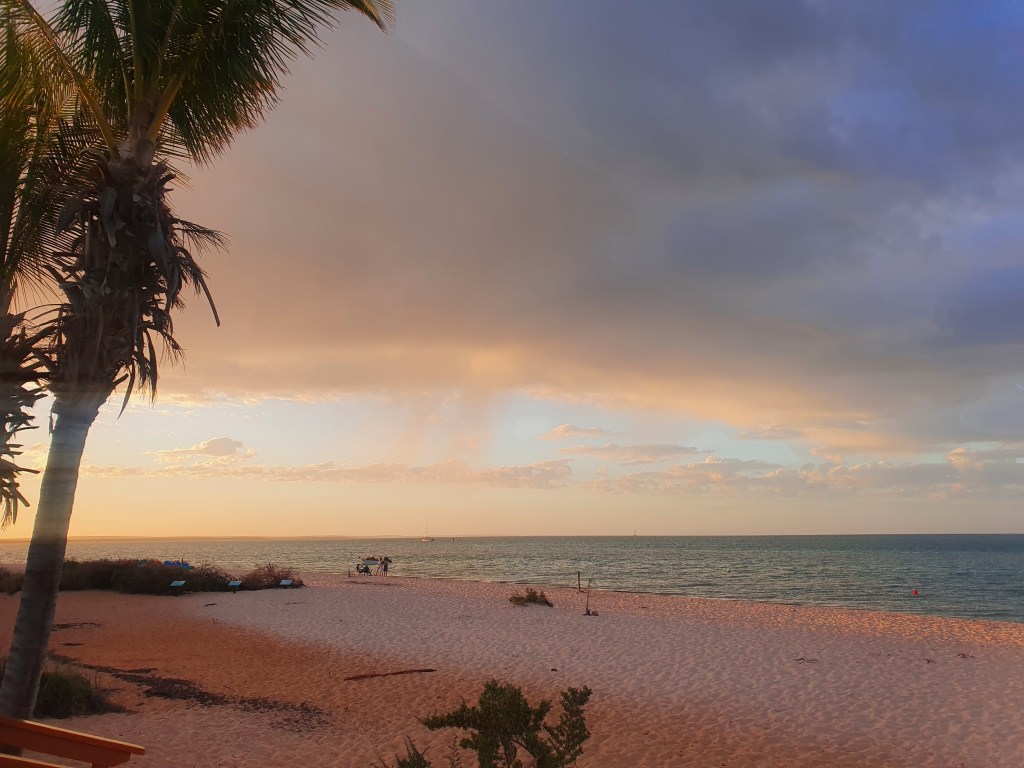
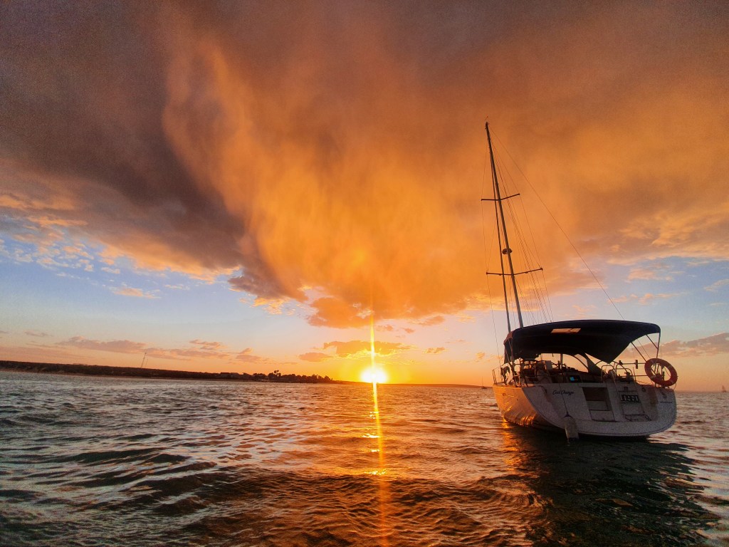
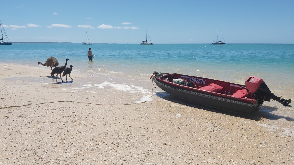
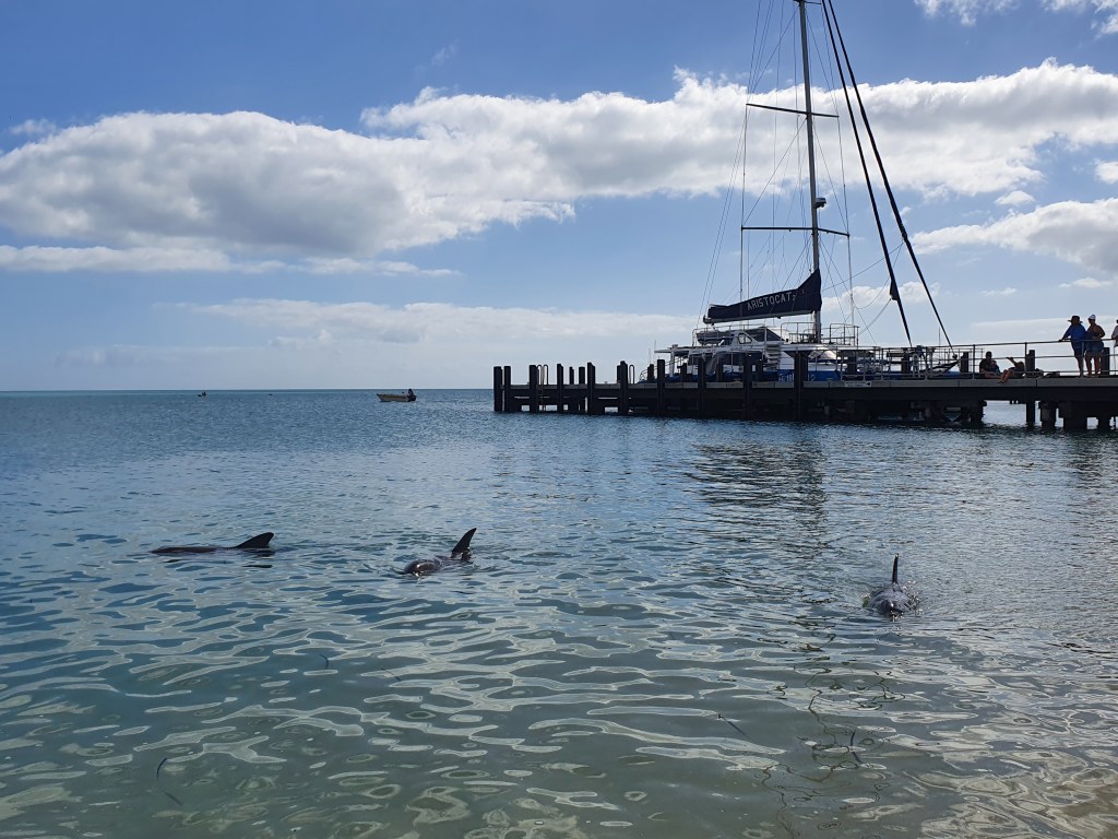
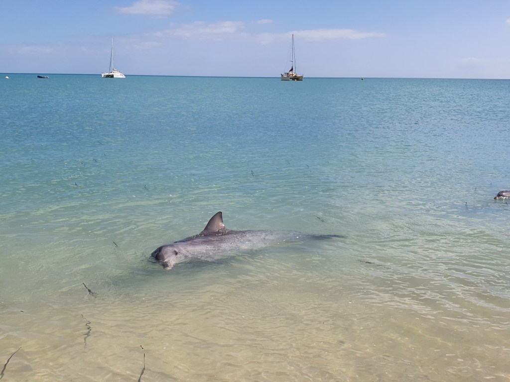
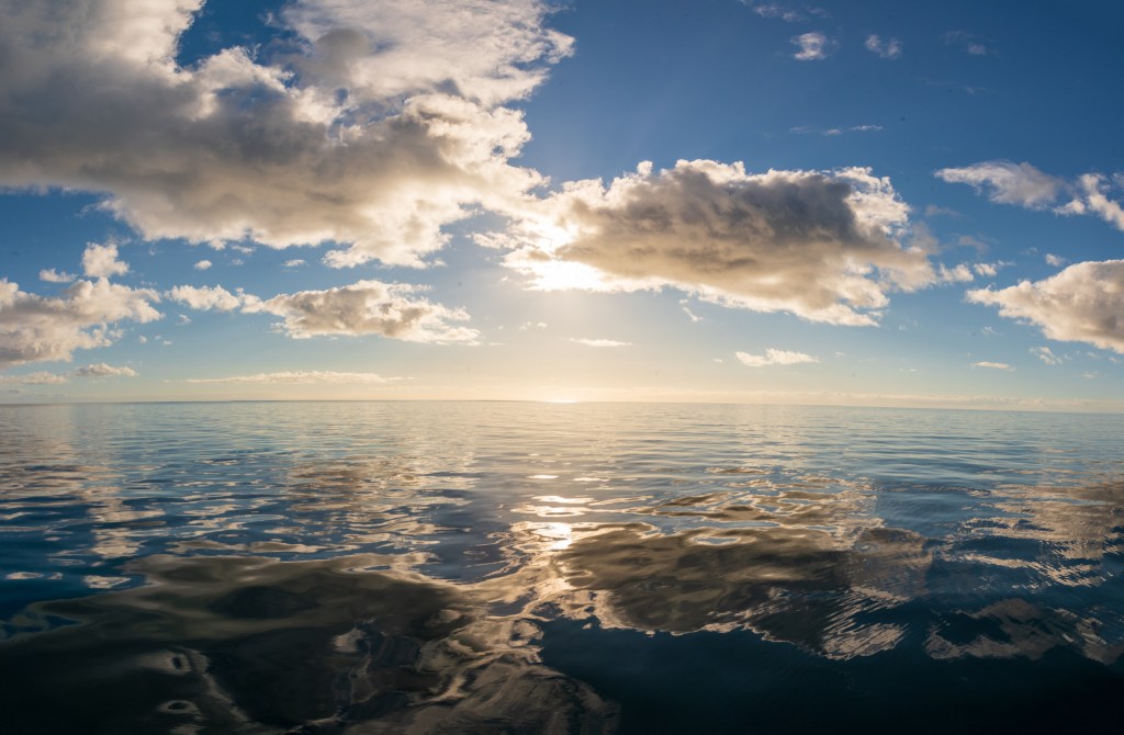
Here are a few photos of Monkey Mia. It was a pretty place and we were treated to some spectacular sunsets, with the heavy cloud cover giving quite a moody feeling.
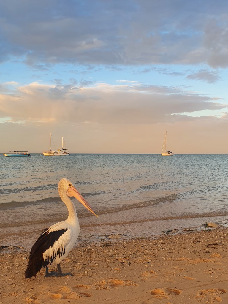
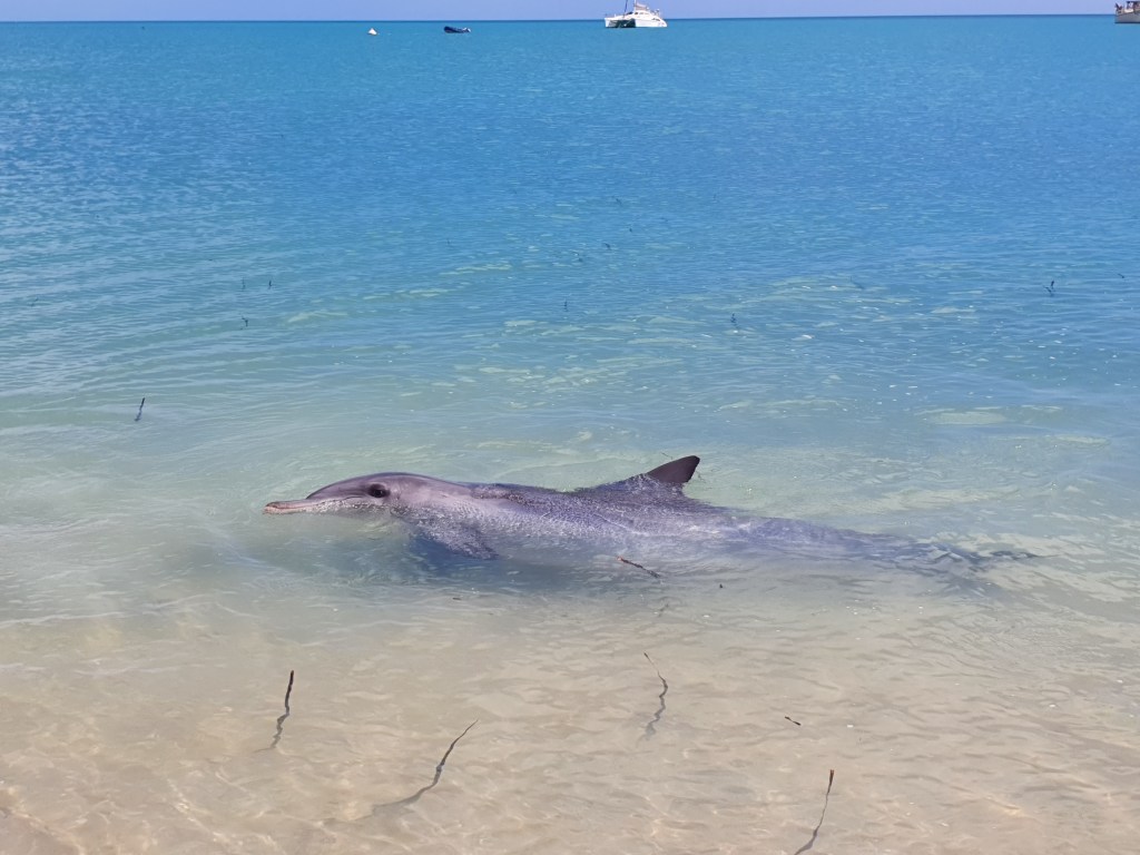
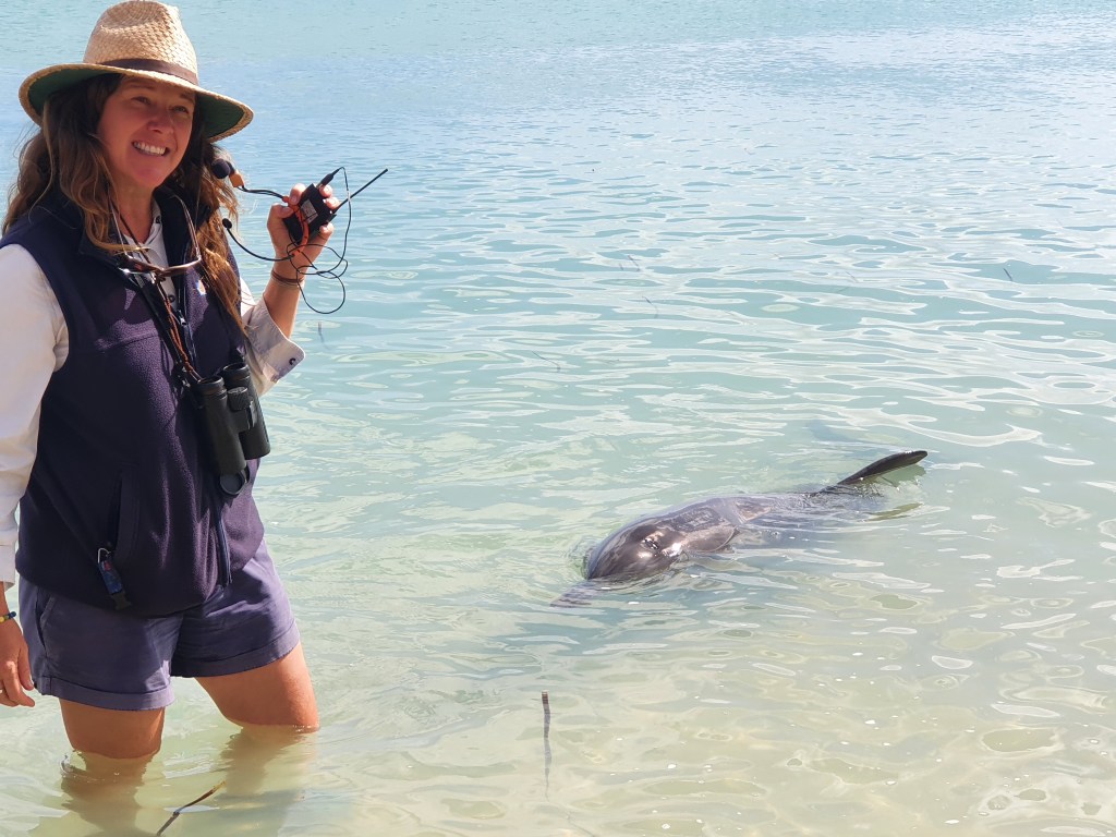
Of course, no visit to Monkey Mia is complete without a dolphin experience and we lined the edge of the water with the resort guests to catch a glimpse of the wild bottlenose dolphins who swam right up close to say Hello. It was about 25 years since I was last here as a teenager, and things had changed a lot. Only a select few adult dolphins are now fed by the rangers, and only on their first three trips into the beach each day. They are also only fed up to ten percent of their daily food requirement.
Unfortunately, in the past, the dolphins were fed too much and too often, and became reliant on the food from the rangers. The mother dolphins no longer hunted for fish as regularly and as a result their offspring didn’t learn important hunting skills. Consequently many of the young dolphins died. The rangers learnt from this and the feeding experience is now highly regulated and controlled.
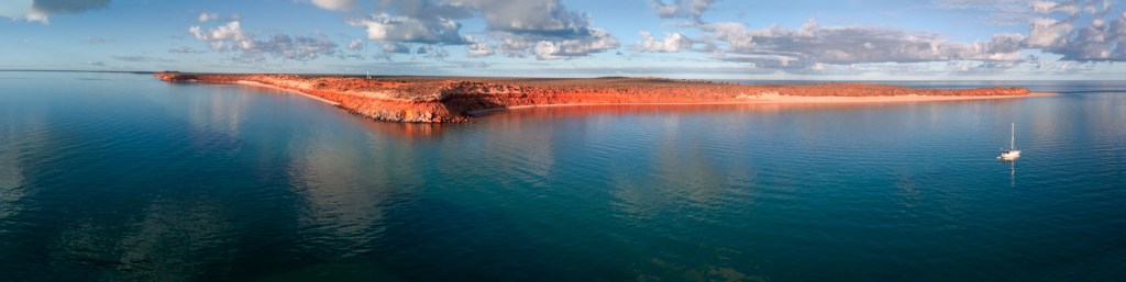
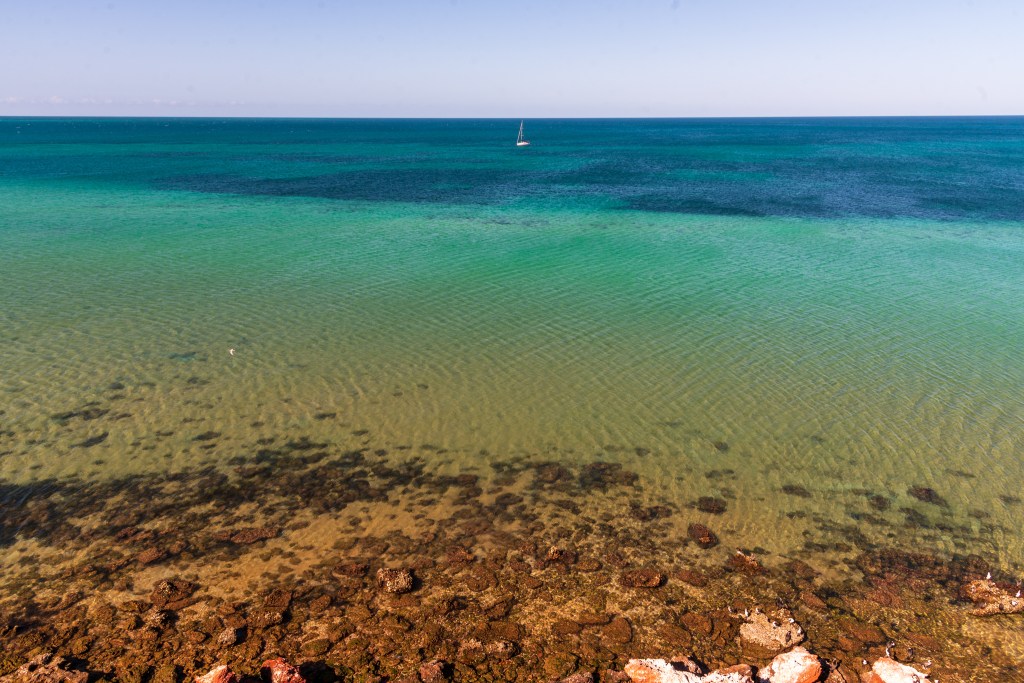
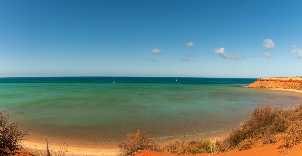
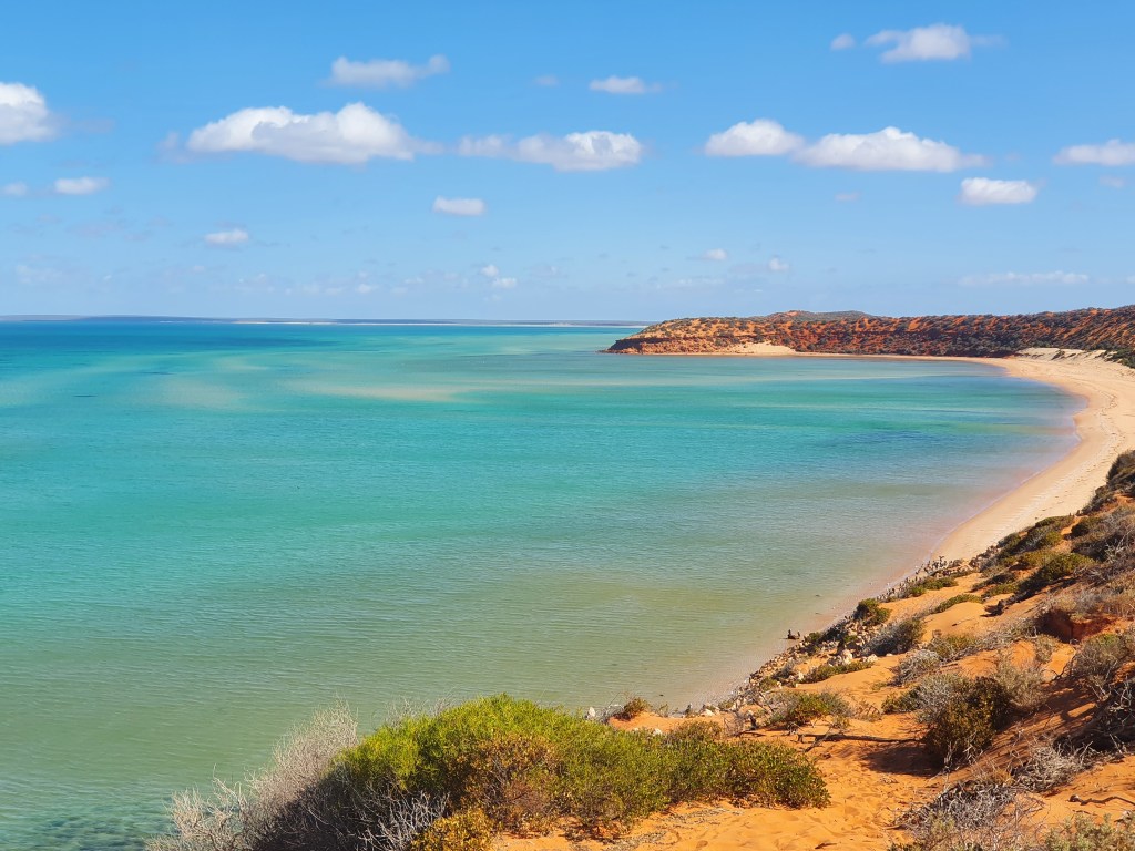
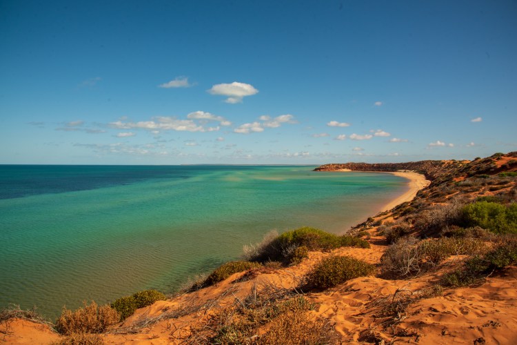
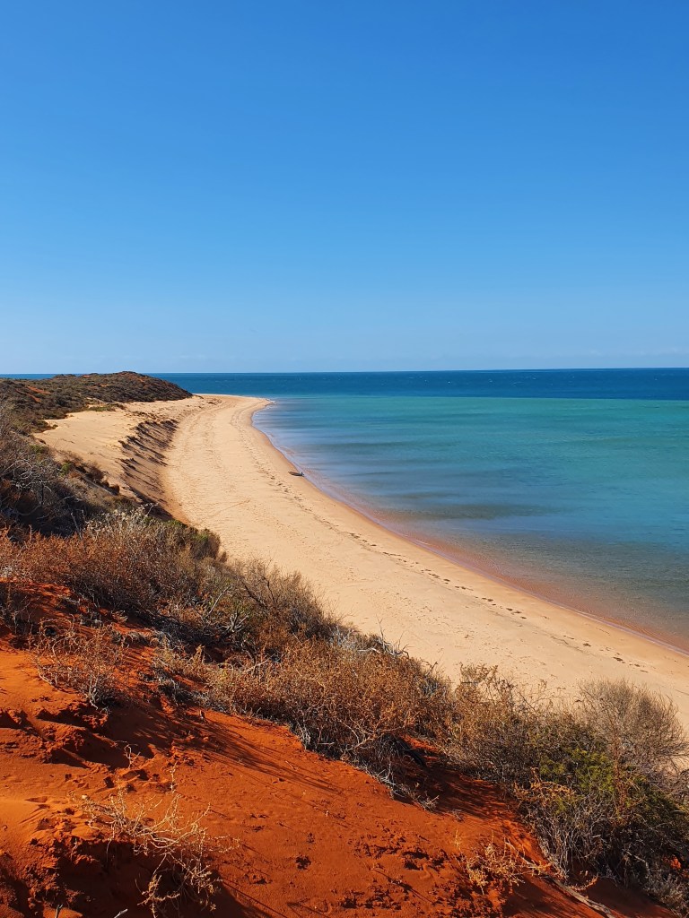
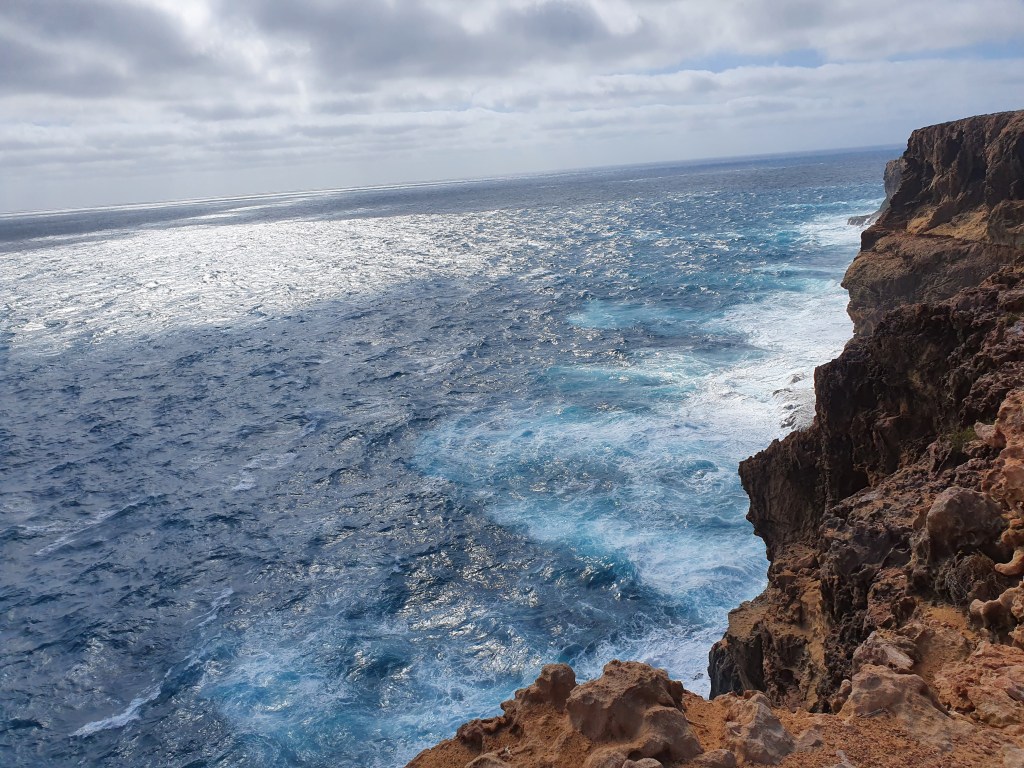
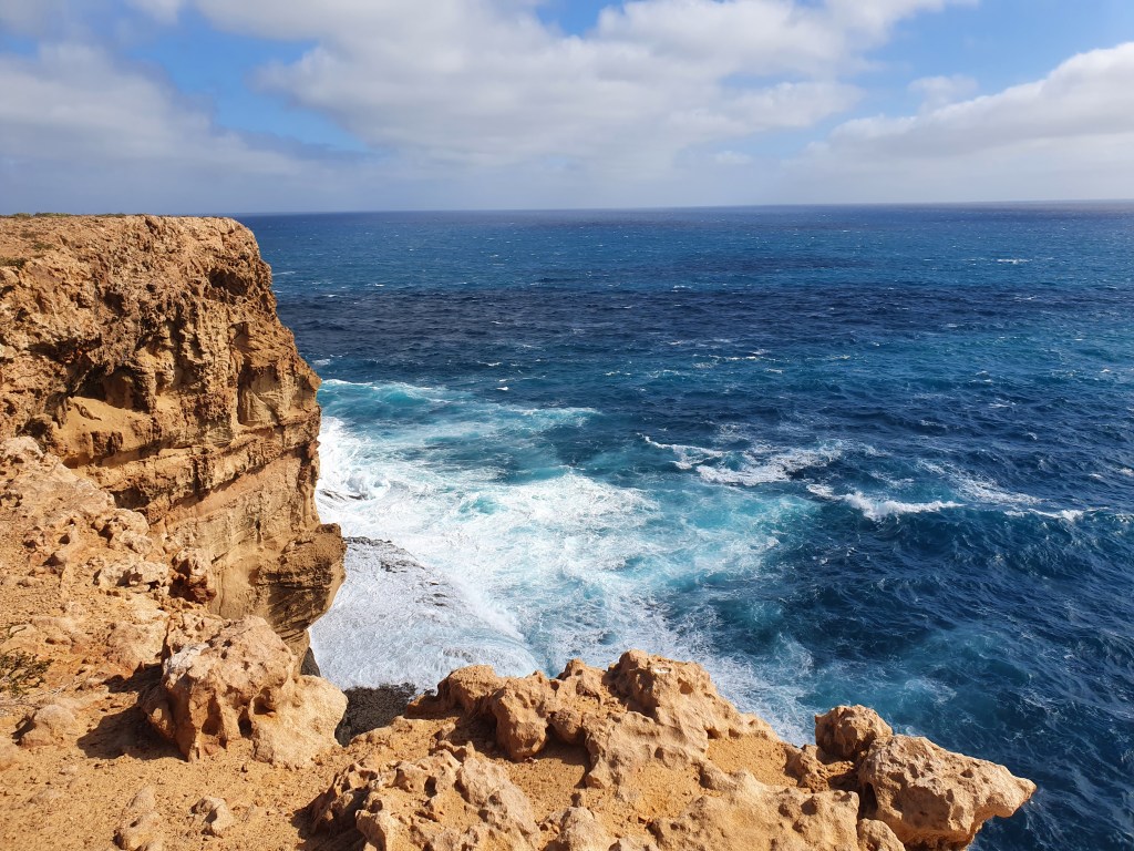
We moved north up to Cape Peron, at the very tip of Francois Peron National Park. Francois Peron National Park is famous for its vibrant and contrasting colours of red cliffs, white beaches and blue waters, and it certainly didn’t disappoint. The coastline was absolutely spectacular, the colours were stark, vivid and vibrant. Towering red cliffs, burnt orange soil, brilliant white sand and clear aqua water. It was a delight to the eyes.
We tendered to shore and wandered along the Wanamalu trail up to the lookout at Skipjack Point. The views from the top were breathtaking; I couldn’t get enough of the contrasting reds, whites and blues. From the lookout we could see a huge array of marine life swimming near the cliffs below. Dugongs, turtles, sharks and eagle rays could all be made out clearly from above.
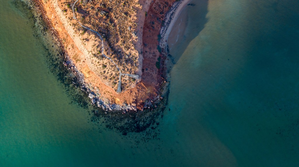
(Unfortunately, although we took the drone ashore for our late afternoon trip, Matt forgot to take his phone, which he uses as the controller. So we couldn’t use the drone in the ‘magic twilight hour,’ instead putting it up fairly early the following morning. So although the drone pictures are still good, they aren’t as vibrant and powerful as I’d hoped they’d be).
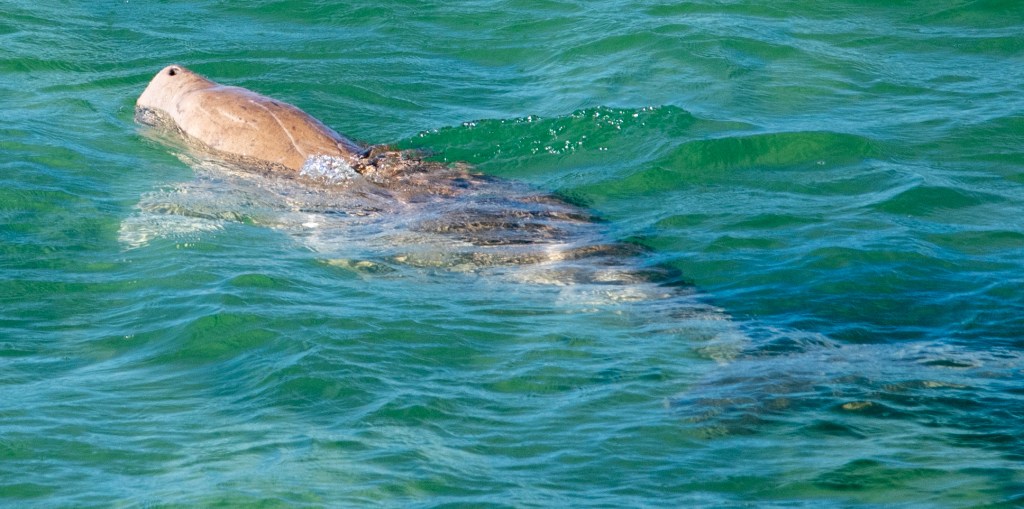
We awoke early to a serene morning. The water was calm and silky smooth as the sun poked its head over the horizon. I sat in the cockpit savouring the solitude while watching dugongs surfacing around the boat. It was pretty special to see the dugongs as they’re quite reclusive and in all our journey so far we’ve only had the briefest of glimpses.
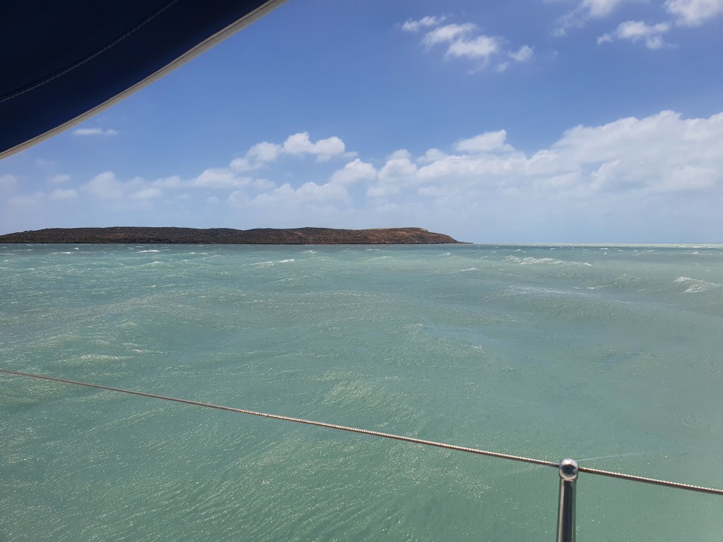
Unfortunately we couldn’t hang around too long as we knew there were some very strong winds predicted and we were hoping to be tucked away in a sheltered spot by early afternoon. As it was, we had a delightful motor over to Dirk Hartog Island, in calm seas that were a brilliant blue colour. It was most definitely the calm before the storm!!
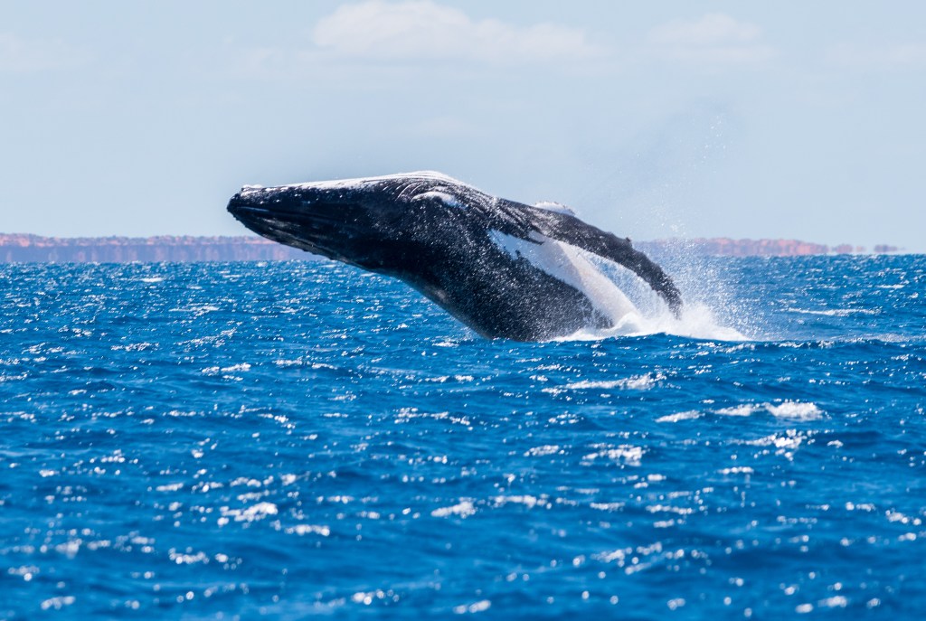
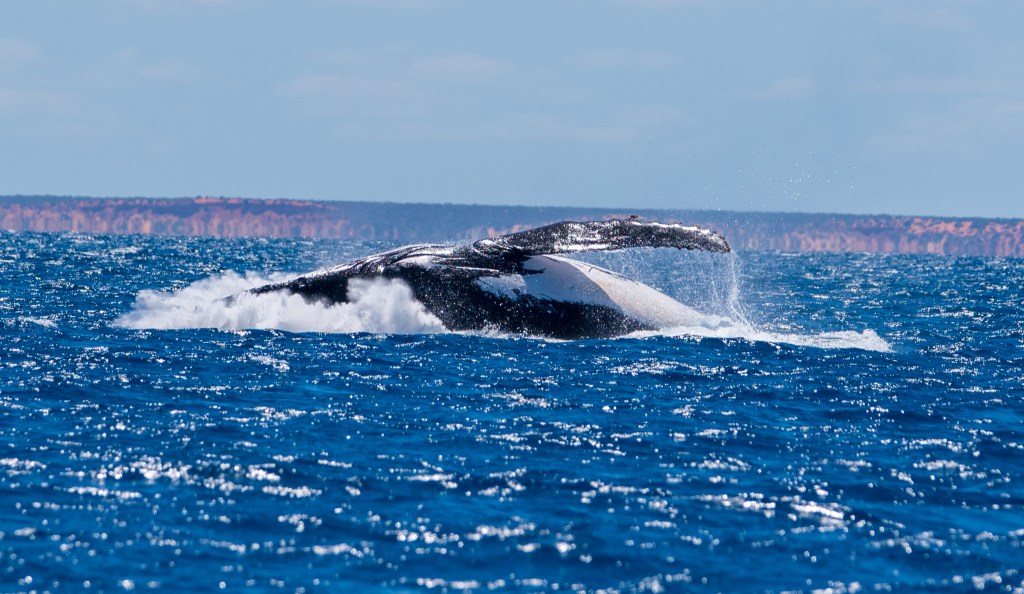
On the way, we were treated to some spectacular displays by a couple of humpback whales, and we drifted for a while, just watching the magnificent creatures.

We arrived at our chosen anchorage about two thirds of the way down Dirk Hartog Island about midday. We had picked out a little spot just below Quoin Bluff South, and above Egg Island that we hoped would shelter us from the worst of the north/north-westerly winds that were coming. Sheltered anchorages from winds of this direction seemed to be few and far between, so we had our fingers tightly crossed that this spot would be ok.
After an hour and four or five attempts at anchoring, we were beginning to despair. The bottom was either rock or covered in thick seagrass and our anchor was finding it impossible to grab. The wind was also beginning to pick up, just to add to the challenge and the urgency. We had to get this anchor in. There wasn’t really any other option. Forcing down our frustrations, we took a few deep breaths and kept trying. Finally, we had the anchor set firmly and felt confident that we would be secure.
Then the winds came up and it blew and blew. And blew and blew. Thirty to forty knots winds blew steadily for the next 36 hours. It was rough and bumpy on the boat. We didn’t get much sleep. Before going to bed, I was watching our tender bounce about in the waves, straining against its line. ‘Perhaps we should empty our stuff out of it’, I said to Matt, ‘just in case it flips.’ So we took out the few things we’d left in it and went to bed. The winds continued raging all night as we lay there. About 5.30 am Matt popped his head up to check on things. He came back down with a wry grin, ‘Do you want the good news or the bad?’
The tender was gone. It had ripped free of the painter line, leaving the rope dangling sadly over the back of the boat. Holy Moly. That was a brand new rope, purchased only recently in Exmouth and it had chafed right through with the force of the wind and the waves. We could only laugh. What else could you do?
Throughout the next day, the winds got stronger and the waves got bigger, as we sat on the boat just waiting it out. With Matt’s phone up the mast, we had some reception so whiled away the time making phone calls or watching Netflix. It was a long day. Neither of us had ever seen winds that were so strong and so incessantly relentless. I put together a cheese platter and we had a snacky dinner along with a bottle of red.
About 3 am the winds disappeared and we slept soundly. We awoke to a very calm and still sea, with little evidence of the furious storm that had passed. Apart from our missing tinny, of course! We motored over to Denham, to join Brian and Sandra who were coming around from Monkey Mia. We spent two nights at Denham, with Brian giving us lifts to shore in Sealeaf’s tender.
Unfortunately, the winds still weren’t playing nice and it turned out to be a fairly choppy anchorage. The anchorage is very exposed and chops up easily in the wind. With all four of us weighing down the tender, it was a very bumpy and very wet ride back to our boats. Getting off and on the yachts, into and from the tender was tricky and dangerous, so we had to limit our excursions to shore, particularly at night.
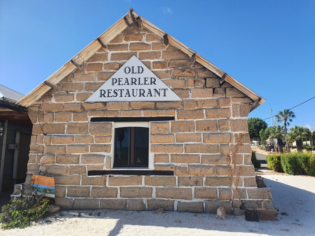
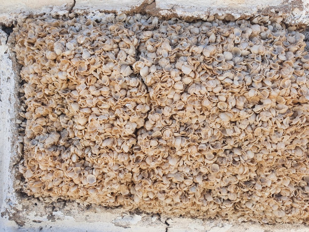
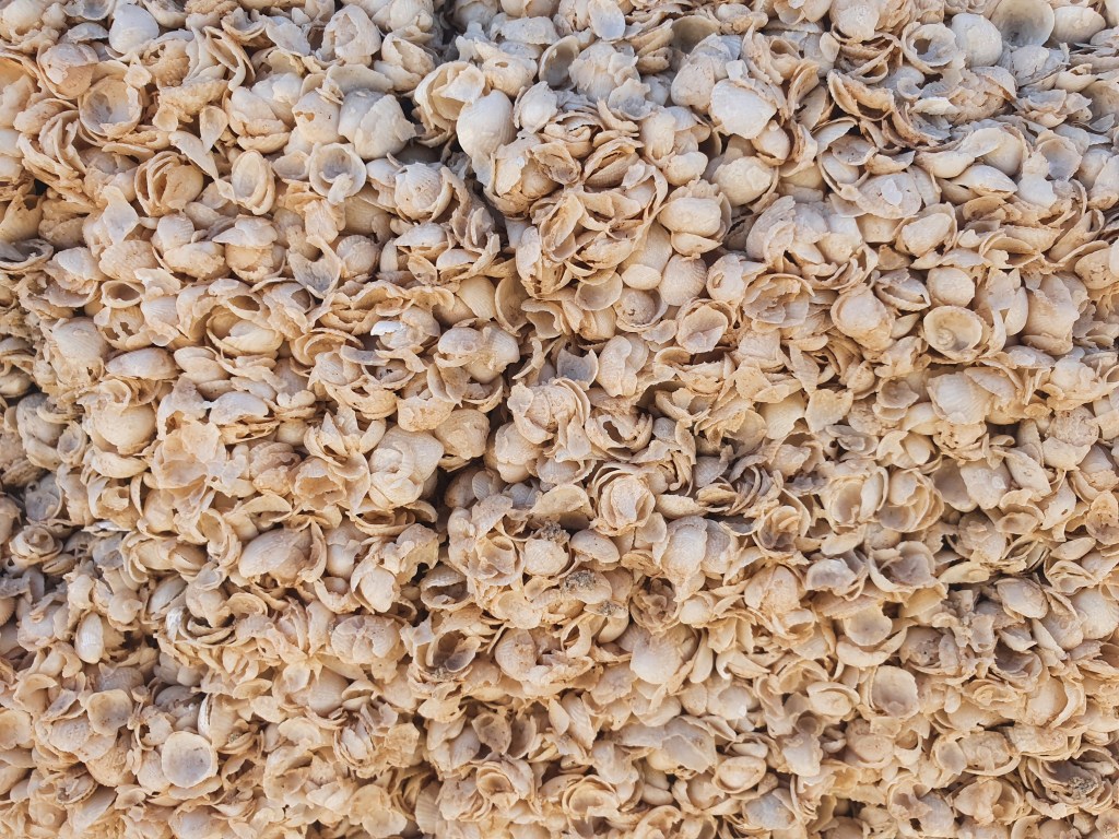
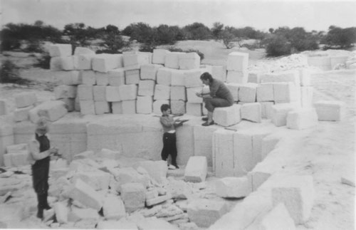
Consequently, we didn’t manage to see all that much of the town, although Sandra and I did go on a walk right around it, leaving the boys to enjoy the hospitality of the local Pub (spruiking itself as Australia’s most westerly hotel). I also managed to get a haircut and some groceries, while Matt filled up some water jerries at the jetty. Denham is home to the Old Pearler Restaurant which claims to be the only restaurant in the world built entirely of shells. The fascinating building is constructed entirely of blocks or ‘bricks’ of tiny cockle shells that have compacted and cemented into solid masses known as coquina. The blocks of coquina were cut out of a local quarry site and have also been used for several other buildings in the area.
Once again, the seagrass was a challenge for the anchor. It had taken us several attempts to set it, but we thought we were in firmly enough. One evening we were both sitting in the cabin, reading and watching Netflix as the boat bumped around on the waves. Suddenly Matt jumped up, ‘I think we’re on the bottom!’ and raced up top to check. He was right, we had indeed dragged, several hundred metres, right into the shallows, and our keel was bumping on the bottom. Oops!!
It took us about half an hour to reset the anchor in the howling wind and pitch black. I was up on the bow with our strongest torch looking out for mooring buoys and boats to avoid, while Matt tried to find a clear piece of sand for our anchor. Finally we were secure, and retired, shivering, to the warmth of our cabin. Matt put the anchor alarm on immediately. Generally we’d only been turning it on when heading to bed, but we’d definitely learnt our lesson.
We’d pretty much had enough of the winds and the ordinary anchorages in Shark Bay and thought we could see an ok weather window to get down to Geraldton. So we farewelled Brian and Sandra and made our way down South Passage to Shelter Bay which would be our jumping off point to head out of Shark Bay and around the infamous Steep Point. They were staying in Denham to have their engine serviced and we would wait for them at Geraldton.
Shelter Bay was aptly named and we anchored comfortably near a couple of other yachts. We’d previously chatted to Lindsey and Clive on My Girl when they’d also sought shelter near Egg Island and while we were in Denham they had attempted to head south. It hadn’t turned out well for them and they’d found themselves battling strong winds and pounding into huge waves and swell, the boat almost at a standstill. They’d been forced to turn back, and had then broken a forestay, so their journey south was over for the time being. It was a sobering reminder of just how treacherous the next part of the coast could be.
Lindsey kindly gave us a lift over to Quoll 2, where we met Tim and Trish and we all spent a few hours discussing the coastline and the weather patterns. These guys were all WA locals who’d been sailing this coast for years. We figured they would have a pretty good grasp of local weather systems and in what conditions it was safe to go, and were keen to see their take on the upcoming conditions.
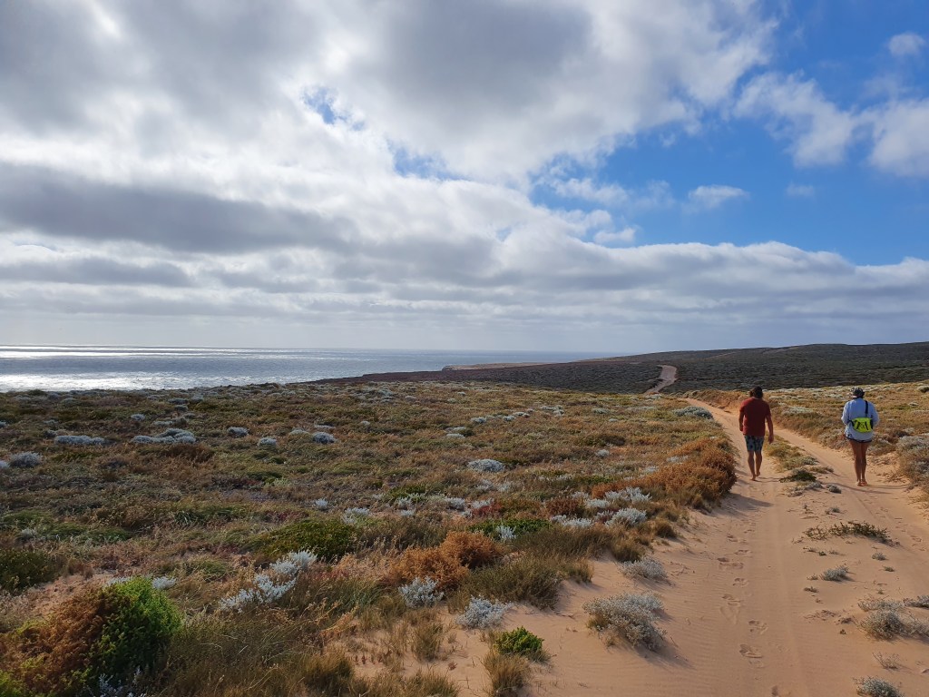
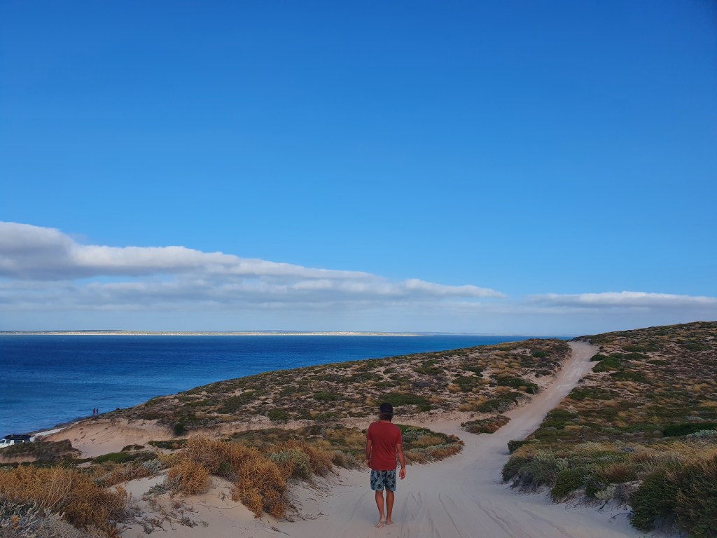
They agreed with our view that it looked like Monday might be an option, leaving in the very early hours. Trish offered to come and pick us up for a walk on shore the following afternoon (Sunday). We wandered along the trails and out to the clifftops. Peering over the edge of the infamous Zuytdorp Cliffs, we watched in amazement and awe as the massive waves crashed against the base, 200 metres below us.
The Zuytdorp Cliffs form an almost unbroken 200 kilometre arc between Steep Point and Kalbarri, and are littered with the wrecks of unfortunate vessels who strayed too close. According to our guidebook, the SW swell rebounds off the vertical cliffs, generating two opposing wave trains, and when added to the seas generated by the prevailing SE winds, it is a recipe for a very nasty and confused sea state. We wouldn’t be venturing anywhere near these cliffs in our boat!
We’d been wandering along, following little paths this way and that, marvelling at the view and chatting away to Trish, not really paying attention to where we were going, when we finally saw a sign marking a track out to Steep Point, the most westerly part of mainland Australia. Turning down it, we kept walking for a while, until Matt stopped and tried checking Google maps. Uh-oh. We were on a one-way road, heading away from the yachts, but already we were kilometres and kilometres from the boats. We’d been gone for over 3 hours and it was now late afternoon. It seemed we had a long way to walk back and dusk was approaching. We turned back immediately and started on the long trek home.
Sometimes, luck is just on your side. A vehicle approached us and we flagged it down. Matt explained our predicament and the very friendly and obliging young couple dropped the tailgate of their full to the brim 4WD for us. The three of us perched on the tailgate, hanging on for dear life and were driven up and down the steep sandy slopes as we laughed in relief about our good luck.
We were all set to leave early the next morning but thought we should once again double check the weather and so went back to Quoll 2 which had a strong internet signal. Tim had the latest update from BOM and it showed some strong winds coming in at about 11am. After checking many different weather forecasting sites and apps, the decision was made to hold off until after the 11am blow had passed and re-assess then.
We woke to find incredibly calm water and not a breath of wind. It would have been absolutely perfect conditions to motor out through the heads and away from Steep Point. We were kicking ourselves. We now felt committed to wait for the winds due around 11am to come and, hopefully, go. The winds did come in, and another yacht we’d briefly met, Infanta, also WA locals, headed out.
We were in turmoil. Should we go or shouldn’t we? It was so hard to know. Once we did go, that was it, we were committed. There would be no safe place to stop until Geraldton, 180 nautical miles away, or possibly Port Gregory, which wasn’t much closer, at 140 miles away. We felt that we had to get it right, the horror passage to Maud’s Landing still relatively fresh in our minds. Still, if we didn’t go now, when would our next opportunity be?
We agreed to wait until the 4pm update from BOM. It was a long, frustrating, nerve-wracking afternoon. I felt that we should have backed ourselves and gone. Matt was umming and aahing, caught between his own thoughts and listening to those of others, who he felt had more local knowledge. The 4pm update came; there was no change to the forecast. If we went now, it would be a bit rough at the start but we should make it to Geraldton or Port Gregory before the next strong winds arrived.
‘What do you think?,’ Matt asked. ‘I think we should go,’ I replied. He nodded. Tim called us on the radio,’ Well, we’re waiting, we’ll talk to you after the next weather update.’ ‘Nah, mate, we’re going now. Thanks for your help. Best of luck to you guys.’
Decision made, we rushed to get ready. It was 4.30 pm and we could expect to be out there for 24 to 30 hours. Warm and waterproof clothing on. Lifejackets on. Torches and tethers out. It was time to bite the bullet and make up for lost time. It was time to back ourselves.
Trust yourself. You know more than you think you do.
Dr Benjamin Spock
