Esperance is pretty much the most easterly town on the south coast of Western Australia. Heading east from here, the next major town is Ceduna in South Australia, almost 1200 kilometres away. The vast expanse of the Nullarbor Plain stretches along the coast, flat and almost treeless. It’s a long slog through the arid plains, and although driving across the Nullarbor is still on my bucket list, I’m led to believe that crossing now on the modern Eyre Highway is only a pale imitation of the challenges that the iconic journey used to entail.
The same cannot be said of crossing by sea. The Great Australian Bight, the 600 nautical mile stretch of water between Esperance and Ceduna remains unchanged. It is still a tough ocean passage through the wild and remote Southern Ocean. The Bight is characterised by submarine ‘terraces’ and ‘canyons’ with depths ranging from 5000 metres to 50 metres causing the southwest swells that prevail to become big rollers. Our cruising guide notes that in sailing this section of the coastline, one must be prepared to encounter some of the roughest weather and wildest seas in Australia, along with a rugged exposed coastline and no possibility of a safe anchorage. It is not for the faint hearted or the unprepared.
It was a part of the trip that we’d always known we’d have to complete when planning a circumnavigation, but it seemed such a long way off when we set out from Melbourne in January 2020. We arrived in Esperance on the 27th January 2022 and began to get ready to tackle our biggest challenge yet – a three to four night crossing of the Great Australian Bight.
The first obstacle to overcome was to pick the right weather window. All the advice we had been given emphasised the importance of waiting for the right weather window. Be patient, they all said, wait for the weather. This was nothing new to us, as we have always been prepared to wait for the right conditions, but we had never had to pick anything longer than about a 48 hour weather window before. And because it was so important to get the window right, Matt enlisted the help of an experienced weather router.
In order to head east to South Australia, ideally we’d like south westerlies or winds with a westerly component, but southerlies or northerlies would serve us equally well. And then there was the strength. Ideally we wanted a four to five day window with winds not exceeding 20 knots. Oh, and what about the swell. I really hate swell. It’s what makes me seasick. I’d prefer completely flat seas, but would grudgingly accept swells of two or three metres.
So, we weren’t really asking too much, were we? A five day window with ten to fifteen knot south westerlies and swells of less than a metre. Perfect. No Problem.
However, it turns out that it’s pretty windy in January and February down here on the south coast of WA. And not good windy. Not windy in the way we needed it. There was an awful lot of easterly wind coming through, strong easterly winds, which are exactly the opposite of what we were after.
We’d actually seen a number of ideal weather windows over the Bight while we were in Geographe Bay waiting to get around Cape Naturaliste and Cape Leeuwin, and then again while we were in Albany, waiting to get to Esperance. So we were hoping that another perfect little window would develop once we arrived in Esperance. But it wasn’t to be that easy.
When we arrived in Esperance, Kingsley our weather guy identified two possible crossings, one on the 30th January and another on the 7th February. Since we only pulled into Esperance on the 27th January, the 30th was too soon, so we opted for the 7th Feb. Of course, we knew that this was liable to change; the further out the forecast is, the more likely it is to change. And, indeed, it soon became very clear that it wouldn’t be on the 7th as the weather models showed some very strong winds on this day. Our departure date was moved to the 8th Feb with an arrival date in Ceduna on 12th Feb. But around the 5th, our plans looked to change again. The four day window had disappeared with some strong easterlies now forecast for the 10th and 11th. Our departure date was shifted to the 12th. Matt was incredibly frustrated and disappointed.
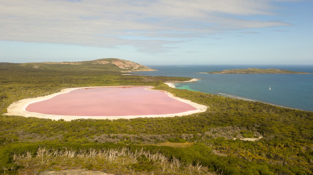
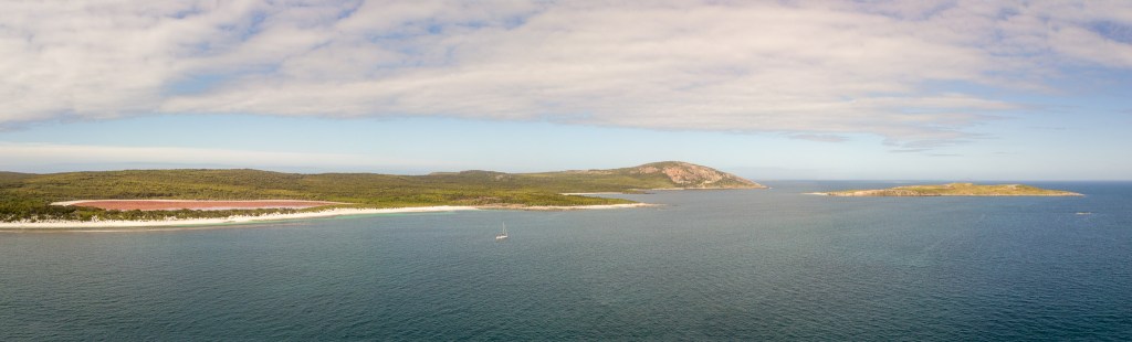
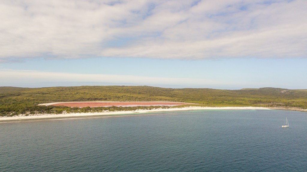
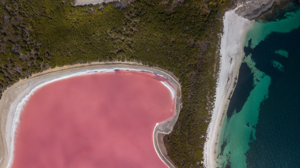
We threw around a few options. The 8th and 9th still looked ok, so we came up with the idea to head out to Woody Island and then Middle Island, wait out the easterlies at Middle Island or Cape Arid and then head off on the 12th. There were several advantages to this plan; firstly we’d get to see some of the islands, particularly Middle Island with its bubble gum pink lake that we’d read so much about, secondly, it would cut a big chunk off the crossing itself, some 70 miles or 12 hours and thirdly, it would help Matt’s itchy feet by getting underway. It sounded like a win-win to me.
A final email from Kingsley advised us to go straight to Middle Island on the 8th, then move to Arid Bay on the 9th to wait until departure on the 12th. No worries. We were ok with that. So, after a final farewell dinner with Colin, Mechelle, Jase, Sarah and the kids, Sarah dropped us back at the boat and the next day we were off, motoring out through the islands of the Recherche once again. It was a funny feeling. We wouldn’t be seeing any other people for at least a week and there would be no opportunities to pick up any more supplies. We had what we had. But I’d spent a day cooking up a storm in Aunty Mechelle’s kitchen and our fridge and freezer were well stocked. We also had plenty of fruit, plenty of snacks and plenty of treats. We had two full water tanks, a spare gas bottle and a full tank of diesel (210 litres), plus an extra 260 litres in jerries. We were good to go.
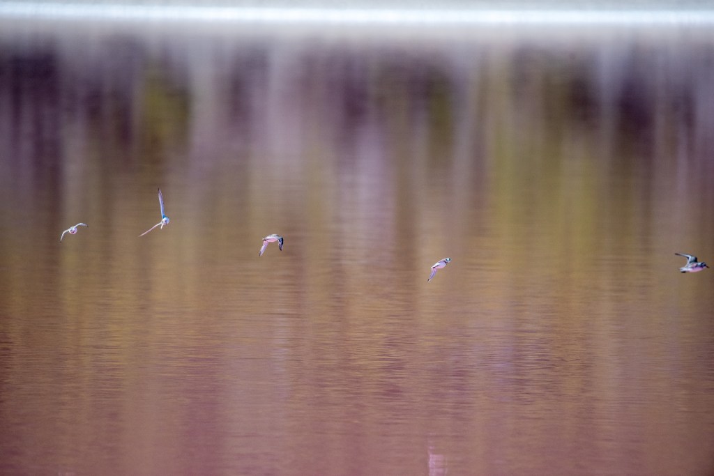
We motored through big waves and lumpy seas until we were past Woody Island where we set the sails. The seas improved as the day wore on and we settled into a comfortable motion. The sun came out and the skies were blue. This was the Recherche Archipelago at its best and we were constantly manoeuvring between and around the hundreds of little islands and reefs scattered throughout the sea. Unfortunately, it appeared that our wind instruments were playing up. The direction it was giving was accurate but the strength reading was either zero or wildly inaccurate. Matt played around with a few bits, but couldn’t determine the exact issue. This was a real bummer. What bad timing. Still, there was nothing we could do about it. We would just have to do the best we could with what we had.
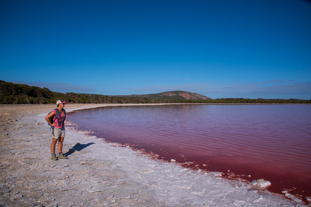
After a long twelve hours, we moseyed into the anchorage at the north of Middle Island, using our fish finder to identify a patch of sand amongst the proliferous weed to drop our anchor in. It was a little bit bouncy and rolly in the anchorage so we were up early the next morning and headed over to the shore to find the famous pink lake.
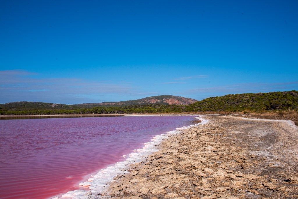
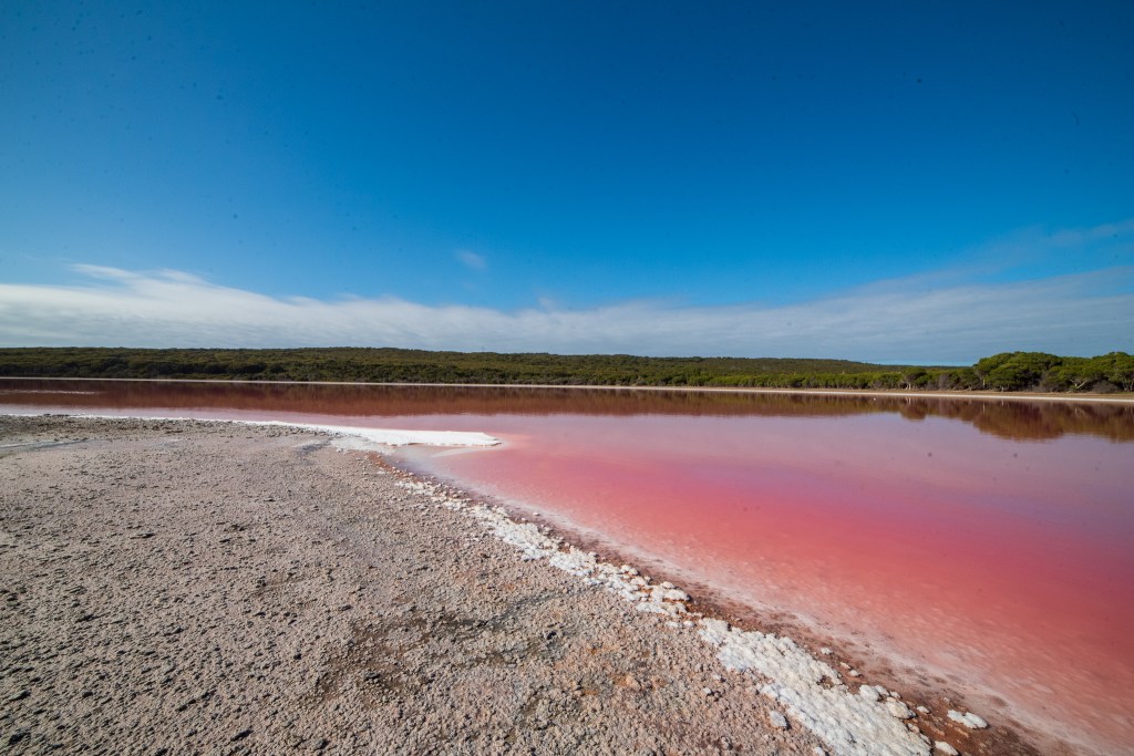
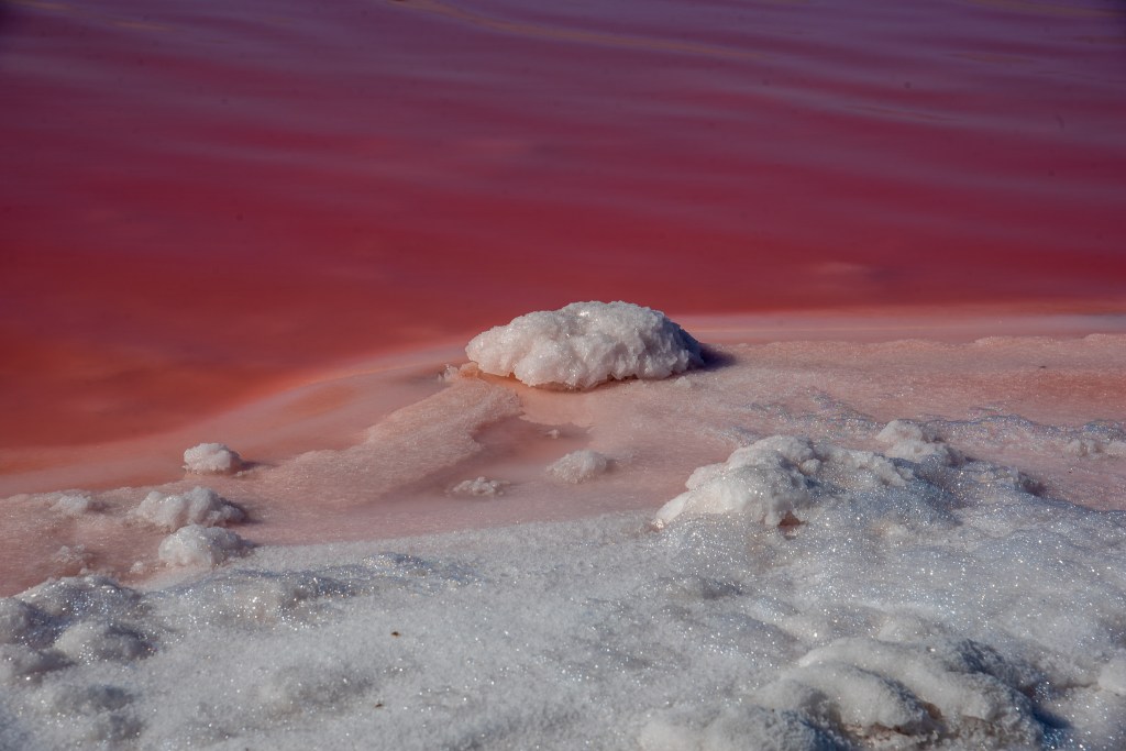
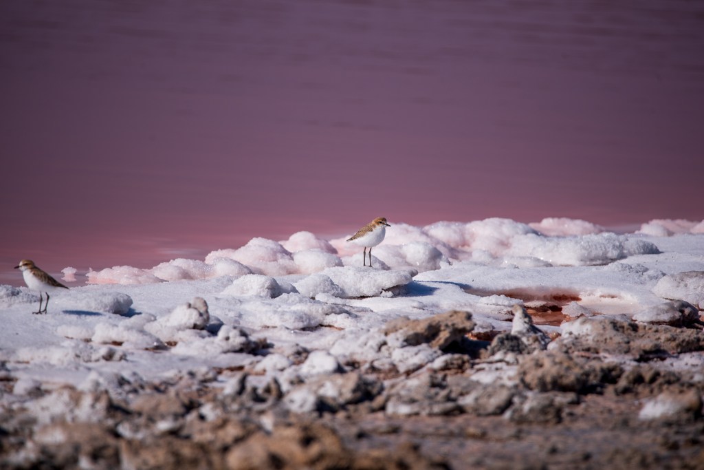
Lake Hellier is a naturally occurring pink salt lake and although there is still some disagreement as to why the lake is pink, the main consensus seems to be that species of algae and bacteria that live in the hypersaline lake produce a red coloured pigment and this is what gives the lake its striking colour.
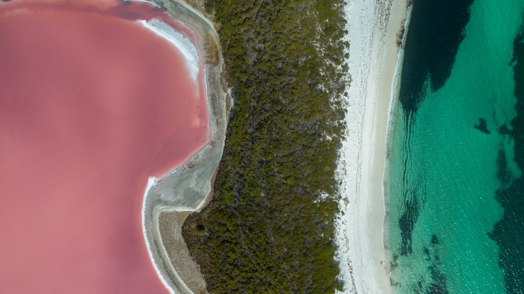
Unlike many other pink lakes around the world, Lake Hillier maintains its pink colour all year round. The closer you get to the lake the more translucent the water is, although it is still very distinctively pink. We walked right around the lake, marvelling at the colour and the thick white crust of salt surrounding it.
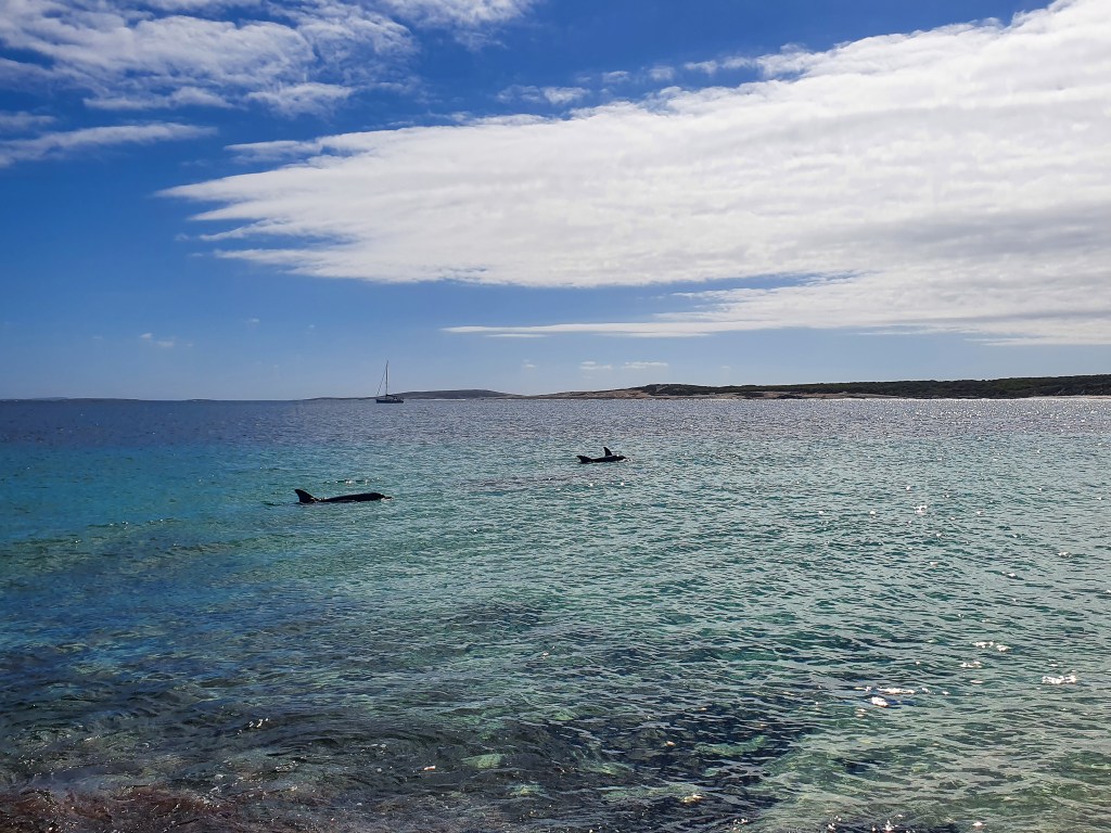
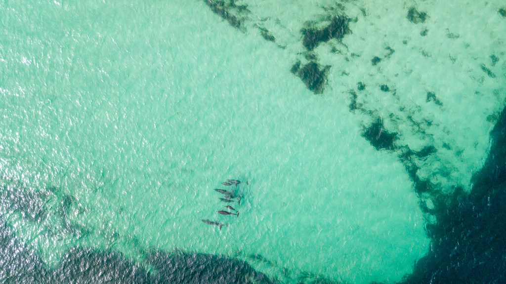
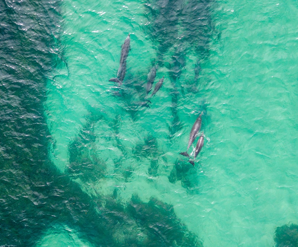
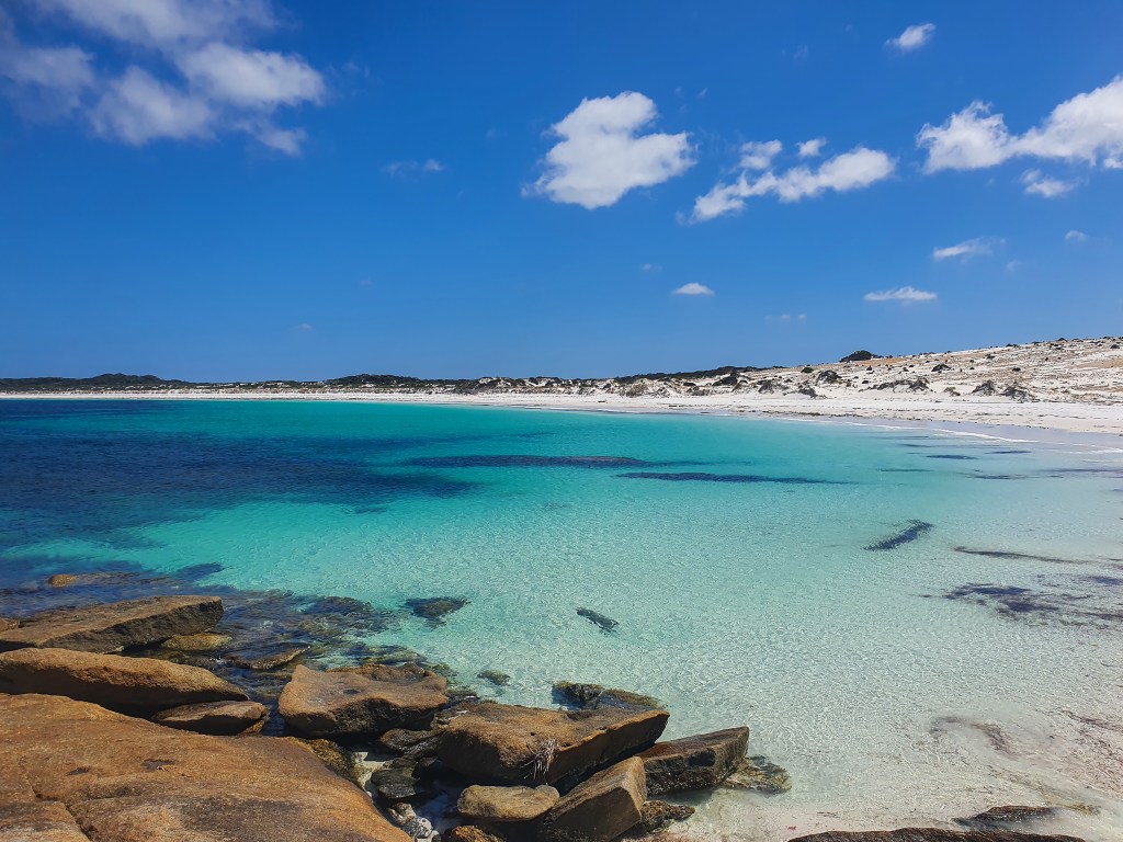
It was a very pretty little anchorage, with that same astonishingly clear turquoise water and Flinders Peak rising in the background, and as we sat on the rocks to put the drone up, a big pod of dolphins swam into the shallows right in front of us.
Deciding that we would go over to Goose Island for a look, we jumped back in the tender and sped off, only to find that our outboard motor wasn’t working properly. What the??
Cursing loudly, Matt turned us around and we limped back to the boat with the smell of burning. Now I don’t know much about motors but I do know that a burning smell is a bad sign. I left Matt to investigate because he does know all about motors. He diagnosed a failed water impeller pump and a cooked engine. It was kapoot. Unfortunately, when he pulled out the spare outboard, that too was no good. It had also suffered overheating issues when the impeller failed months ago at Seisia. He had taken it apart and got the motor working and replaced the impeller but had not fully reassembled the motor. To his dismay, he realised that a part had been put back incorrectly and the pump wasn’t pumping water to the engine. This should be a relatively easy fix, but on a rolling boat in the middle of nowhere, the likelihood of a part disappearing over the side was high and so he decided to wait until South Australia to fix it when he could take it off the boat onto a dock or jetty somewhere.
So we were without an outboard. Paddle power was our now only option for the tender. It wasn’t too big a deal as we didn’t have too many stops planned and hopefully we could either fix this outboard or pick up a cheap outboard in Ceduna or even down at Port Lincoln. There was nothing we could do about it now anyway, so no point worrying about it.
It was beautiful and sunny as we moved over to Arid Bay, but unfortunately the swell was rolling into the anchorage here. How very frustrating!! We knew that the winds were due to swing and thought that the swell would die down then, so we decided to wait it out and spent a rolly afternoon on the boat reading.
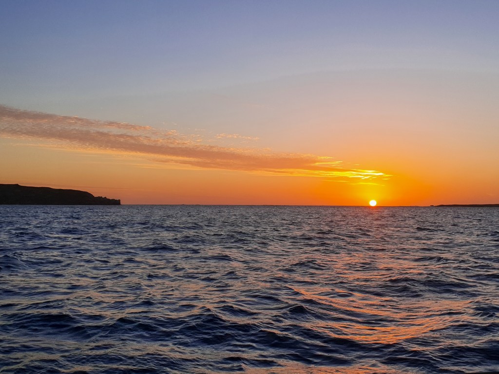
That evening, the sun was an incredible fiery ball of bright orange as we watched it set over the water; the last sunset of my fourth decade on earth. The next day was my birthday.
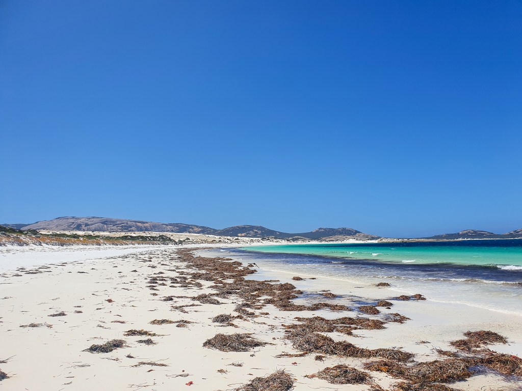
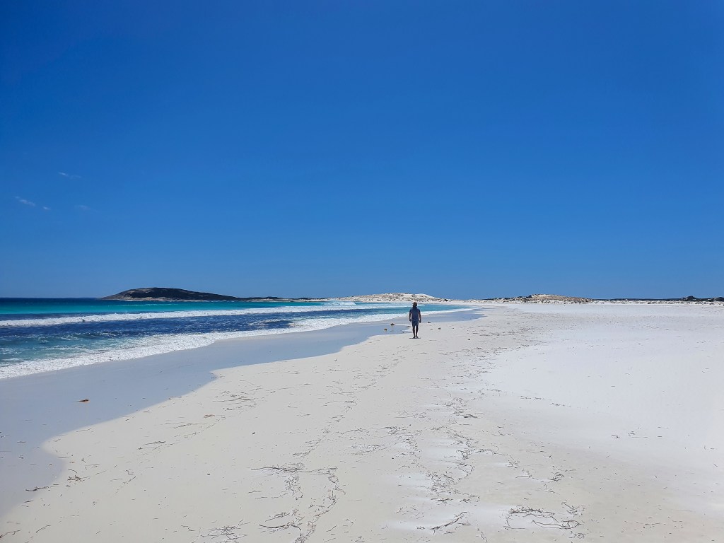
With no internet or phone reception, it was a quiet day but Matt surprised me with a couple of gifts, cooked a bacon and egg breakfast and rowed us to shore for a walk on the beach. Cape Arid is very pretty in a wild and stark manner and all the different blues, greens, whites and creams made for a beautiful serene setting.
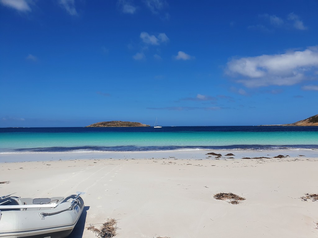
We met a random guy driving a 4WD on the sand and he told us about the buildings we could see at the far end of the beach. It turned out to be The Royale Cruising Yacht Club of Arid Bay and a fair amount of effort had been put into this little beach shack. There were even tomato plants growing and a flushing toilet.
With the winds getting stronger we had to head back out to the yacht. They really kicked in then and howled through for the remainder of the day as I lay downstairs and read my new book. In the late afternoon, Matt became worried that we were dragging. After watching anxiously for a while we decided that yes, we were moving and yes, we should reset the anchor. We didn’t have much time as it was almost sunset.
So that’s how I found myself spending the evening of my birthday driving our yacht around in circles, in howling 30 knot plus winds, with Matt and I shouting at each other to be heard over the wind and the sun setting behind us. Attempt after attempt failed. It was nerve wracking and I was incredibly tense. We had to get this anchor to set, we literally had no other options. Finally, we decided the only thing for it was to come in really close to the beach where we could guarantee a patch of sand that wasn’t covered with thick seagrass. I drove us cautiously towards the beach, while Matt shouted directions and then quickly dropped the anchor onto the sand. Thankfully it set and we were holding firm in about three metres of water.
But we were still tense and anxious and I couldn’t face cooking a proper meal so I heated up a packet of rice and added a cold sausage. What a gourmet birthday meal!! Matt has assured me that he’s going to take me out for a real slap up meal once we reach South Australia.
We had one more day to kill before we were due to head off on the 12th. The easterlies were still tearing through but we managed to find a few hours where we could have a walk on the beach. Then we waited for our weather guy’s final email, uploaded the waypoints into the chart plotter, changed our clocks to South Australian time and generally tidied and prepped for the long passage. I wasn’t as nervous as I thought I’d be and I was keen to get going.
The information from Kingsley was looking pretty good. Via the SAT phone Matt receives an email with a course, which we import into our tablet and plot on our chart as well as two weather models that provide an astonishing array of details such as wind strength, wind angles, estimated times at particular waypoints, boat speeds, rainfall and even air temperature. Kingsley’s route plan has us motoring for the first six hours or so to Round Island, with a fair chance of rain in the first three hours and then we should be sailing for the majority of the passage. Wind gusts are not predicted to be over 25 knots, the swell should be under 3 metres, air temperature should be pretty constant at between 17.9 to 21 degrees Celsius and no rain apart from the first few hours of the trip.
With a departure time of 6 am WA time on Saturday 12th February he predicts we will arrive in Ceduna at 10pm SA time on Tuesday 15th February. That’s a distance of 541 nautical miles in 85.5 hours.
How accurate will it be? I guess we’re about to find out!
Until you spread your wings, you will have no idea how far you can fly.
Unknown
