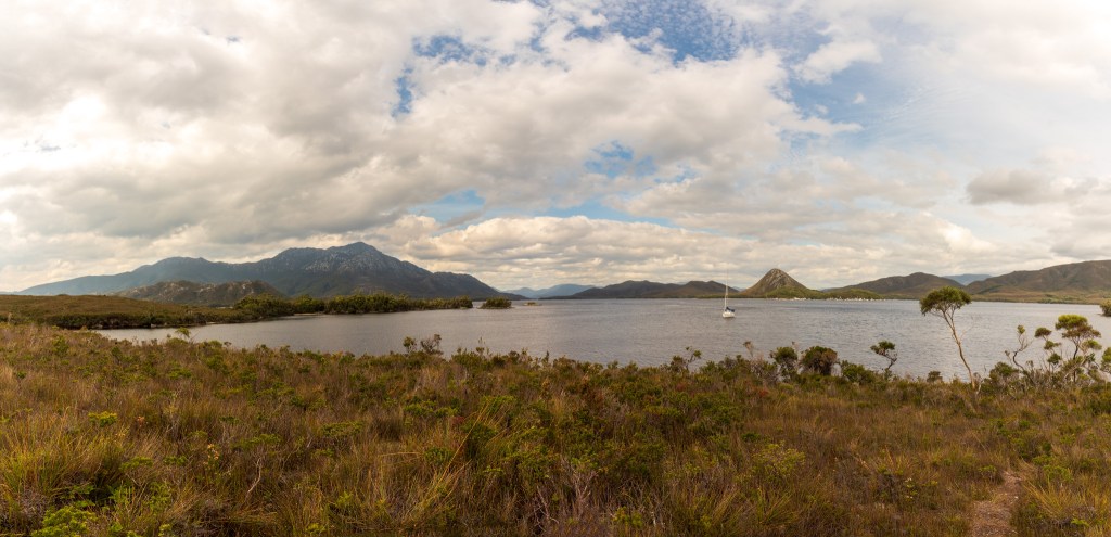
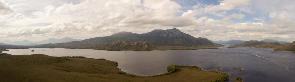
Port Davey lies in the southwest corner of Tasmania. Long heralded as one of Tasmania’s most spectacular and remote wild places, it is exposed to the strong westerly winds of the Roaring Forties and is a place of raw, untamed beauty. Together with the adjoining waters of Bathurst Channel and Bathurst Harbour, Port Davey is considered to be the most pristine estuary in southern Australia.
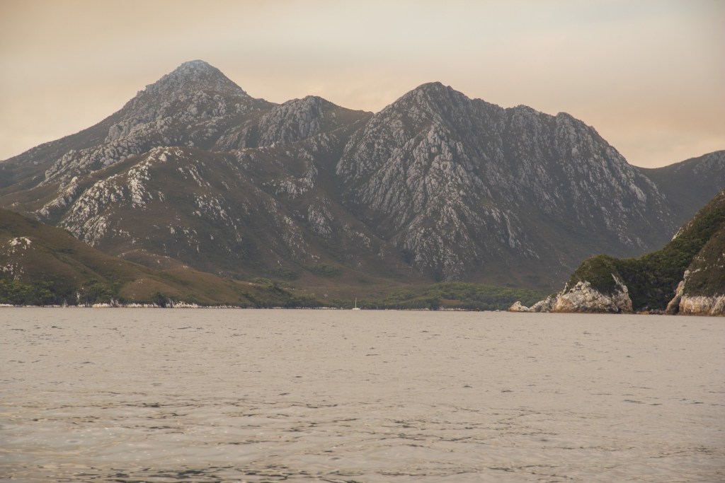
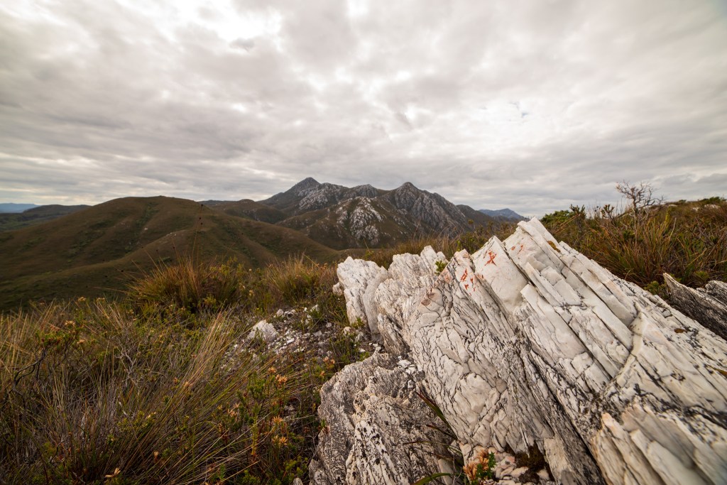
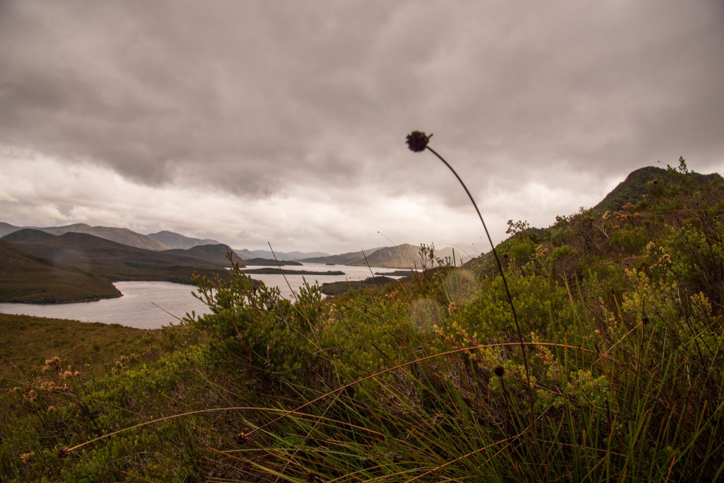
As well as an extraordinarily beautiful landscape, showcasing gold-green ranges, with bony quartzite ridges rising sharply above the rust coloured waters, there is an incredibly unique and and fragile underwater environment. The freshwater that flows from rivers and creeks into Bathurst Harbour and Bathurst Channel is stained a dark tea colour by the tannins leaching out of the peat rich soils. A phenomenon known as ‘deep water emergence’ occurs here due to the deep layer of dark coloured freshwater (which is lighter in weight than dense seawater) restricting light penetration. It means that deep sea marine species which are normally only found in deep off-shore waters, are seen here in depths of less than forty metres.
It is indeed an incredibly rare and precious environment, and both the waters and land surrounding the Port Davey area are protected by a marine reserve and a national park. The area is accessible only by boat, light plane or on foot. We had heard and read a lot about the beautiful wilderness of Port Davey and felt very priviliged to be able to experience and enjoy it in our own boat and in our own time.
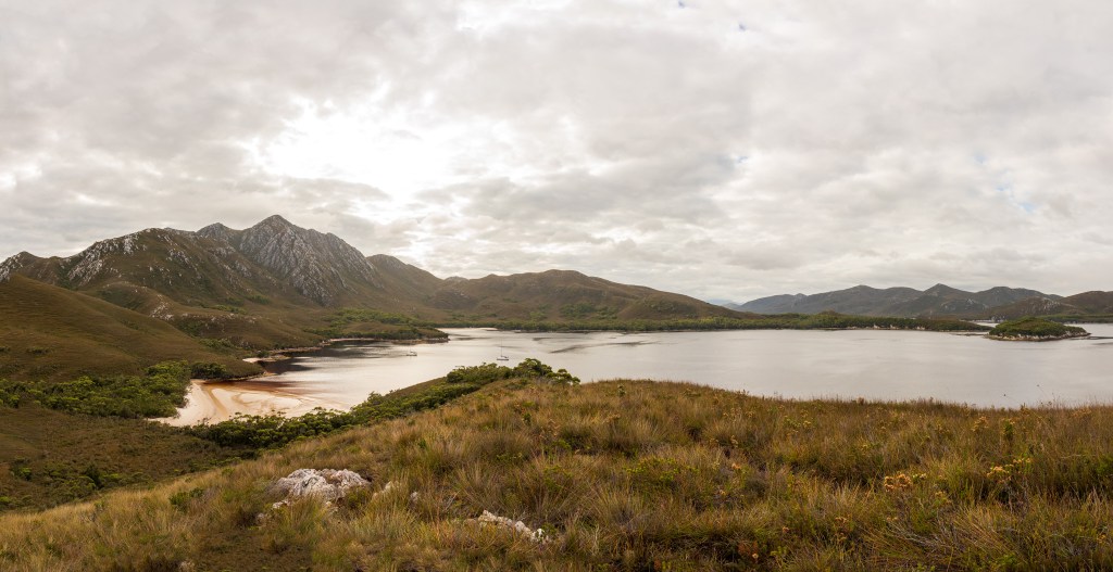
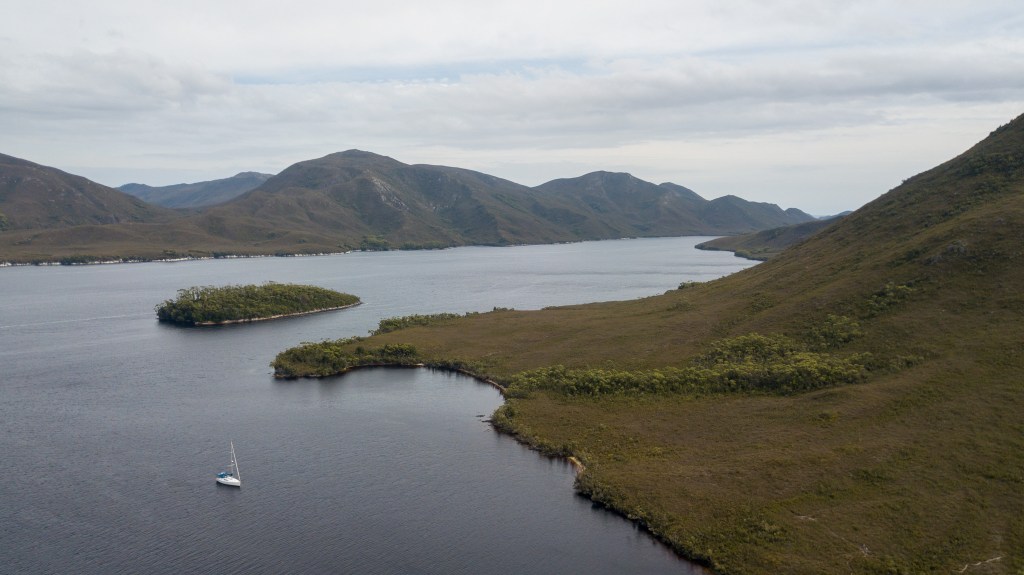
Bramble Cove, just outside Bathurst Channel and in the protection of the Breaksea Islands was our first anchorage. Nestled underneath the imposing Mt Stokes and Mt Milner, it was an incredibly beautiful and serene little bay.
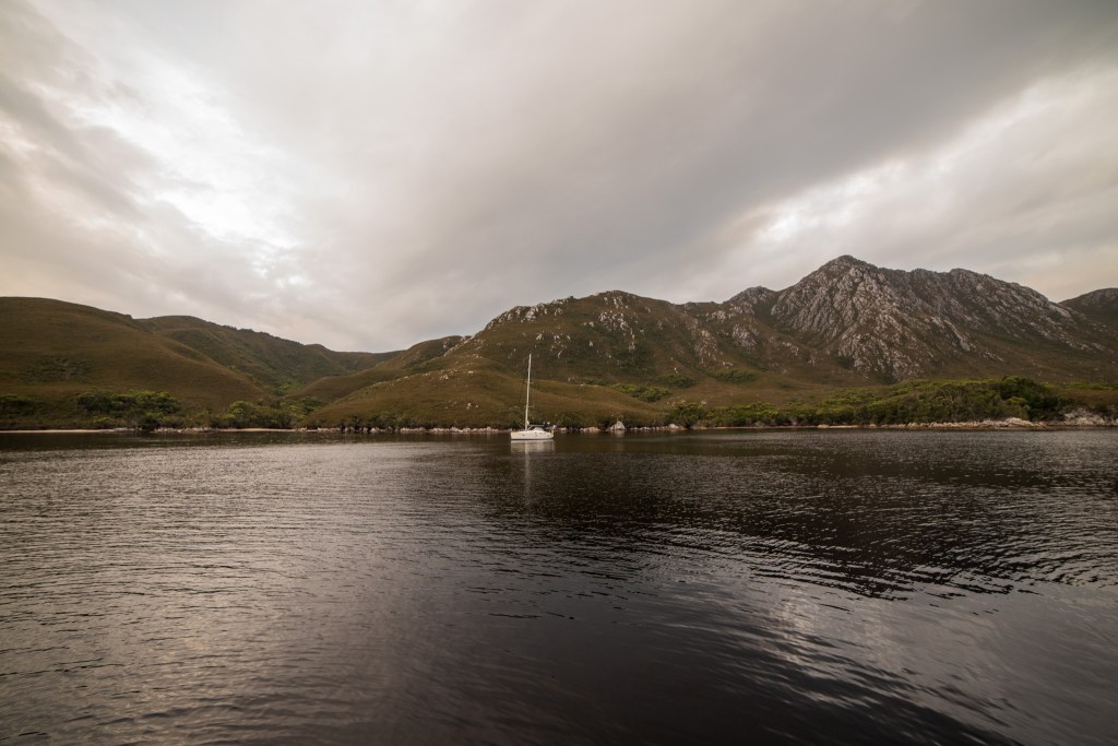
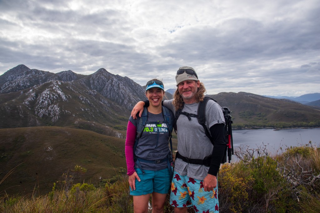
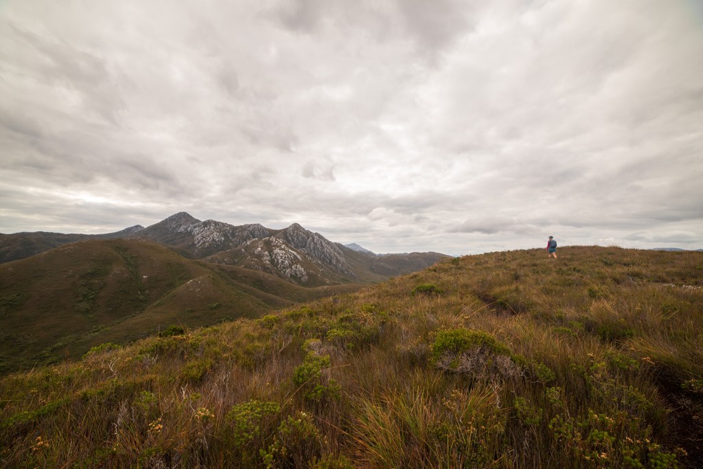
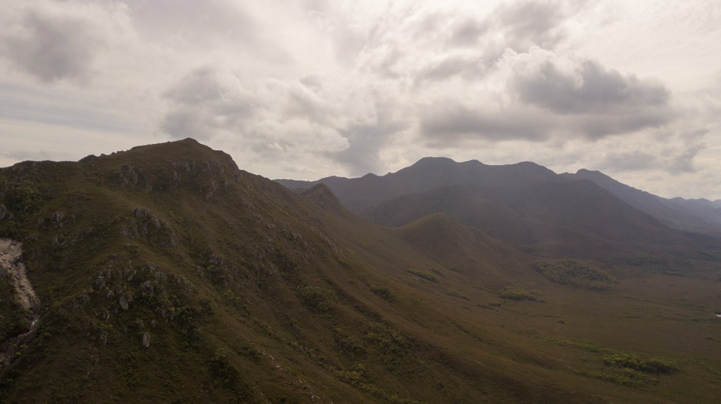
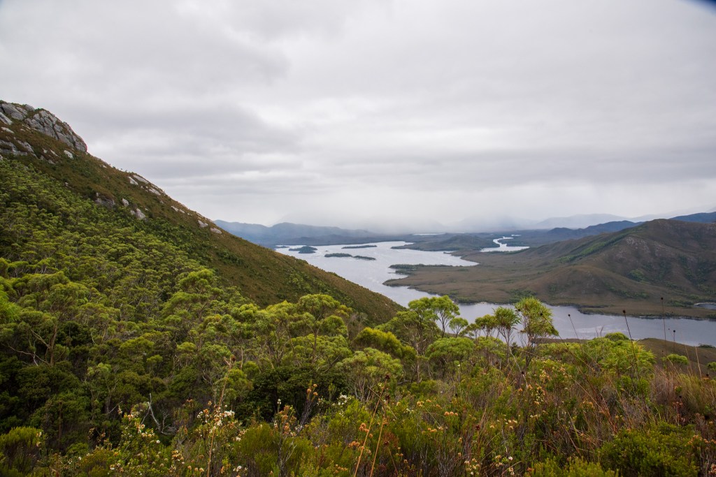
It was cloudy but very still, as we hiked up to the top of Mt Milner. The steep, narrow track was well worn and muddy in parts. Expansive views greeted us from every direction and we spent a while just soaking in the dramatic beauty, our first taste of this magical wilderness. We met Ross and Nicki from Happy Hour, who turned out to be friends of Gary and Mil from Ciao Bella. It’s a small world in this cruising community!
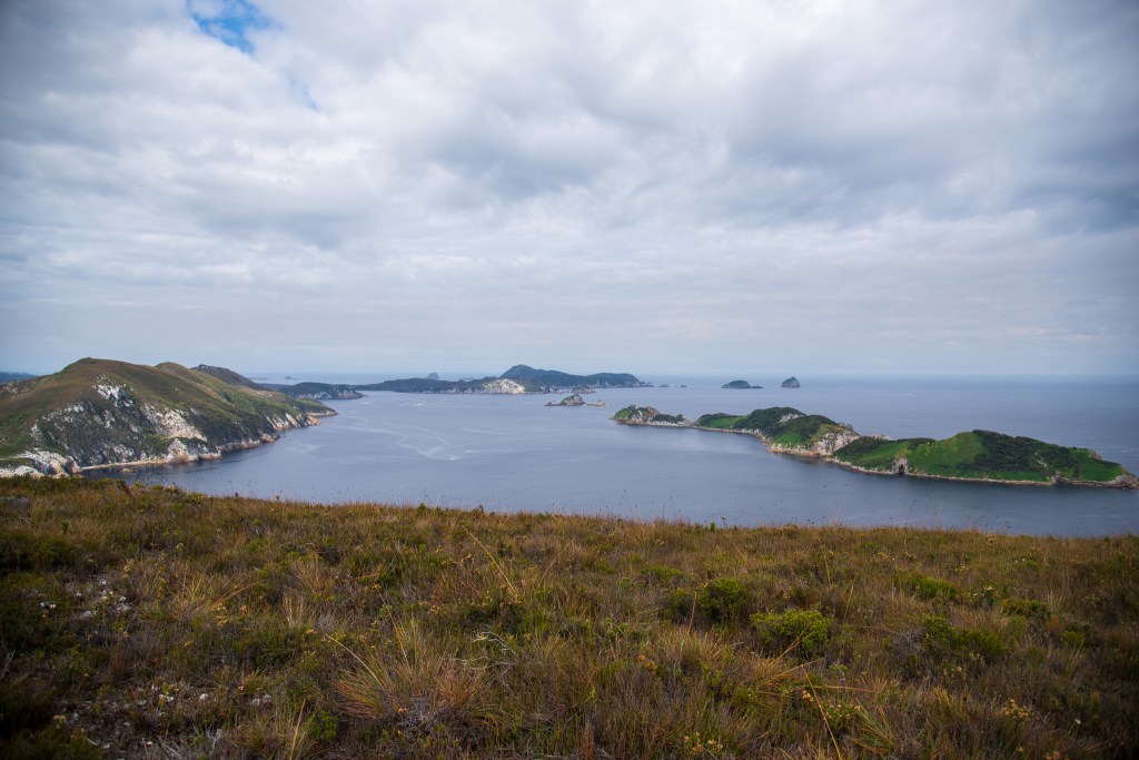
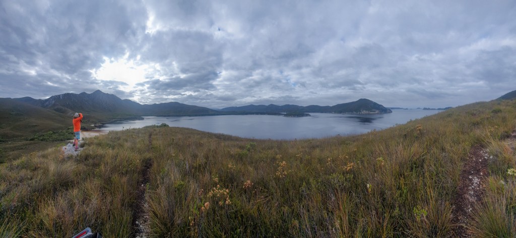
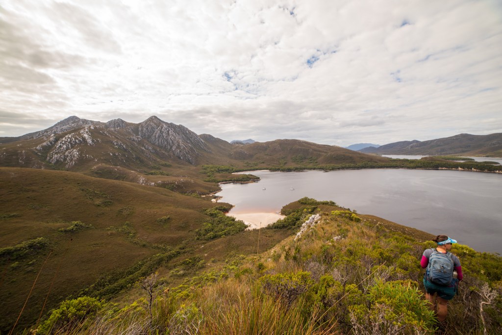
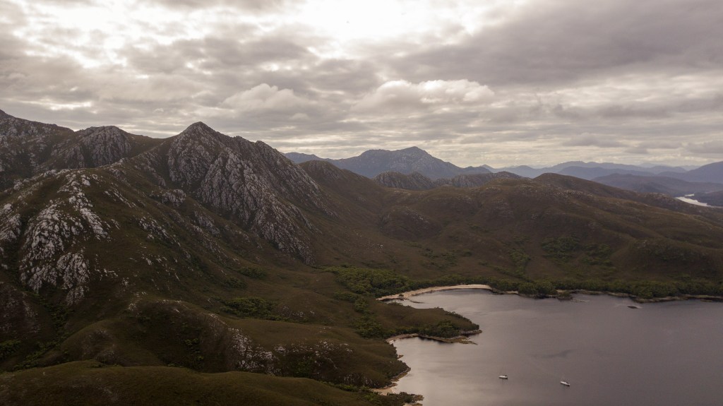
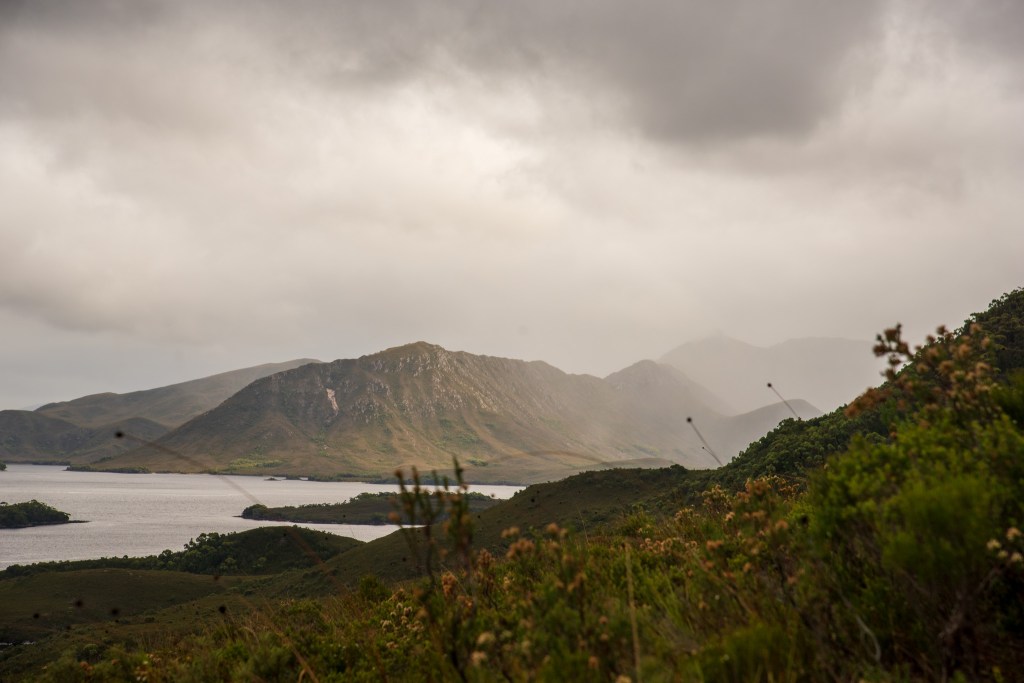
Moving on from Bramble Cove, we anchored in the tiny Wombat Cove but couldn’t find the walking track that was supposedly there, so continued on again to Parker Bay, anchoring just outside of the No Anchor Zone. Onshore we visited the grave of Critchley Parker, a hiker who perished here in 1942 and put the drone up to capture the full majesty of the towering Mt Rugby; the tallest mountain in these ranges.
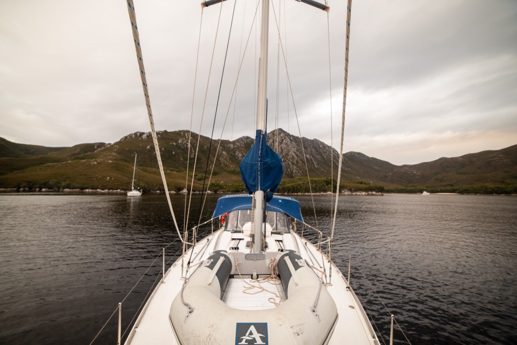
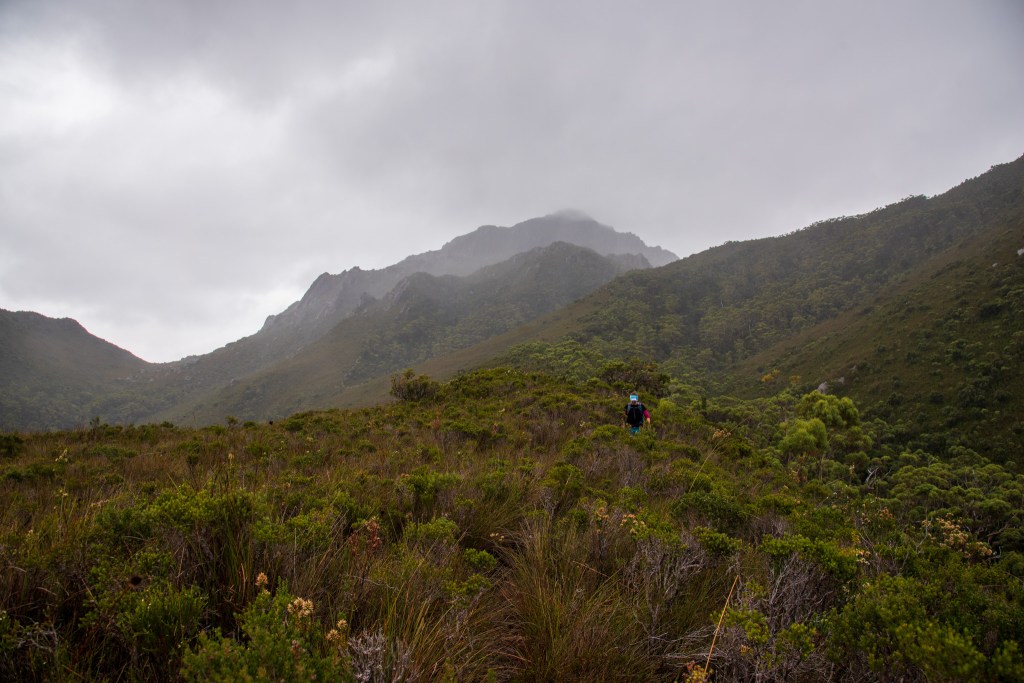
The following day dawned cold and cloudy. We had several options of where to go and what to do and kept changing our minds, but when climbing Mt Rugby became the plan, it was all action. We anchored Cool Change securely in tiny Iola Bay and took the tender almost directly across the channel to where the hiking track began. It was still and calm, but ominous clouds were building in the distance. We decided to give it a go anyway and keep an eye on the clouds. If we had to turn back, then we would.
The track was obvious, a narrow path carved out of the thick grass and shrubs which was knee high, but oftentimes became waist high or even a fully enclosed tunnel through dense trees. In the rush to get moving, I had forgotten to put on gaiters or grab my hiking poles. We were soon wet and muddy and covered in cuts and scratches all over our legs.
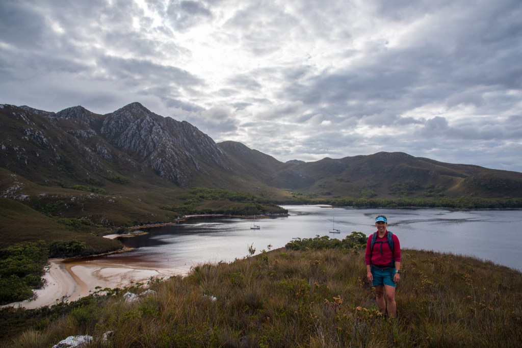
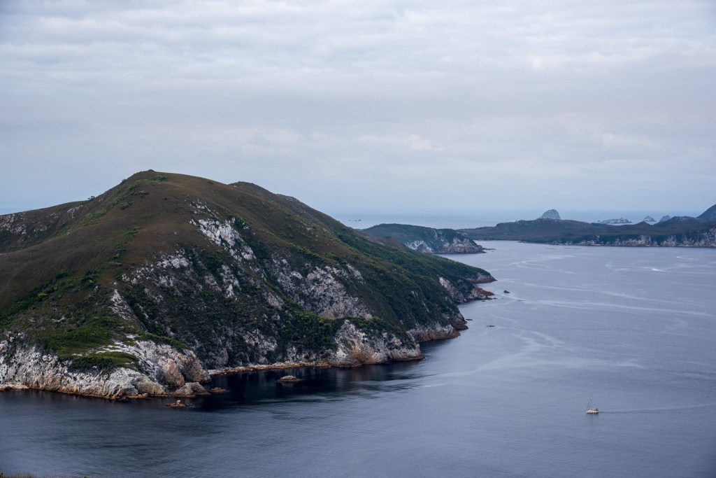
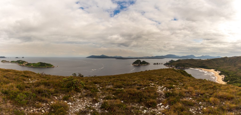
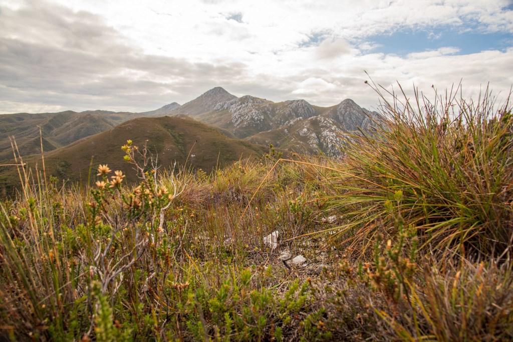
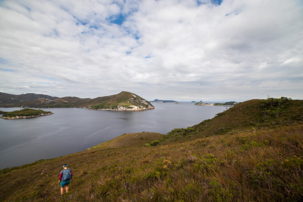
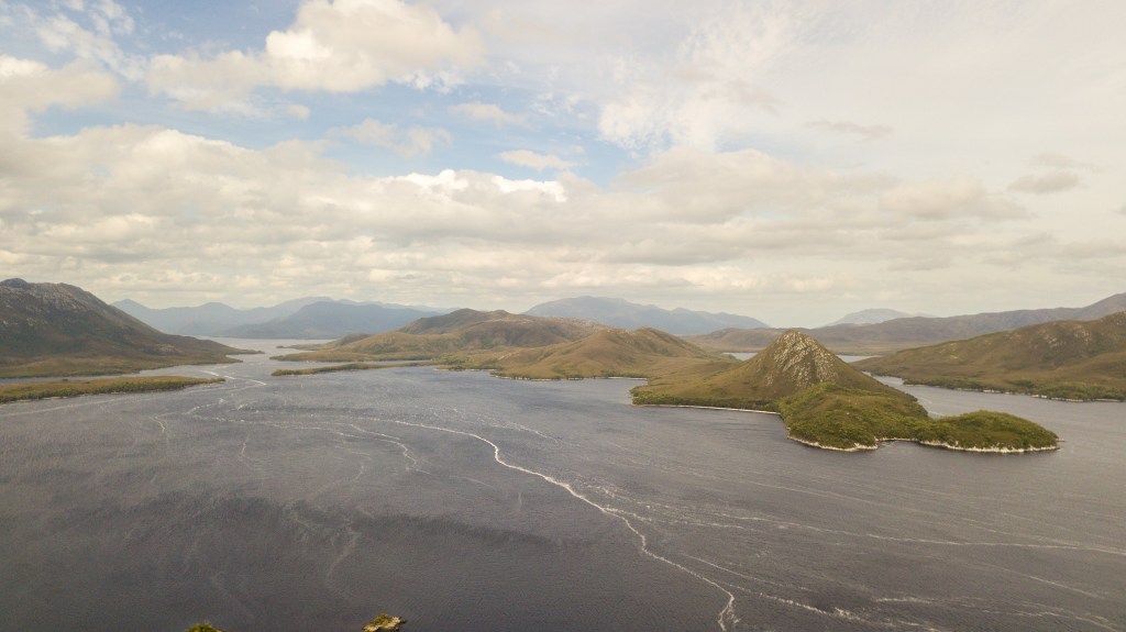
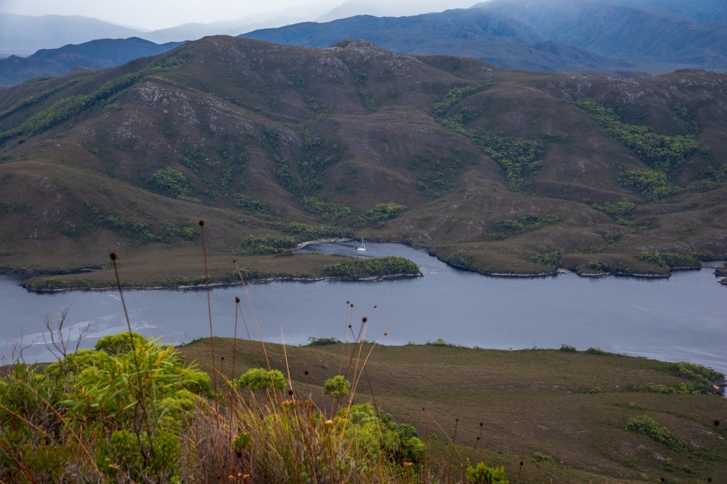
But I didn’t care, it felt great to be moving and I enjoyed the exertion of the uphill climb. And every time we would stop and pause to look around, the most amazing views, extending far down the channel, were there to enjoy. The islands dotting the water looked tiny and our boat was a miniature speck.
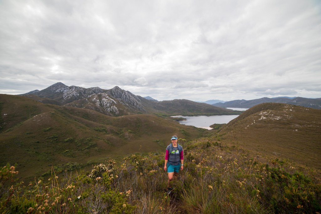
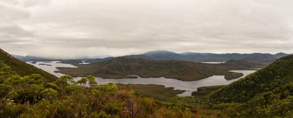
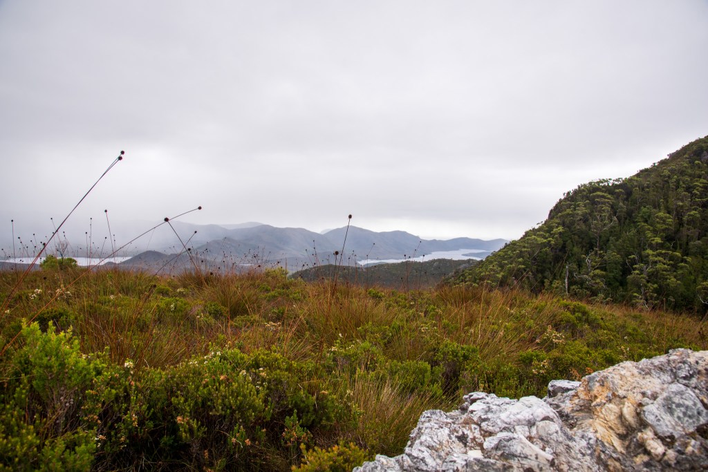
About halfway up, we stopped at a saddle where we had almost 360 degree views, including out into Bathurst Harbour. But the low dense cloud that Matt had been monitoring was rapidly moving our way. He estimated that it would soon be on top of us, most likely bringing rain. It had been a steep walk up, meaning it would be a steep and slippery walk back down.
Reluctantly, we turned around. There didn’t seem much point in continuing to the top if we were going to be in a white-out and the prospect of a long slippery walk in the rain wasn’t overly appealing. I was grateful that we’d at least been able to do what we did. An hour later we were back at the bottom of the mountain. The rain hadn’t eventuated to much but the top of Mt Rugby was covered in cloud and remained so for the rest of the day.
From here we made our way back down the channel to Casilda Cove. It was incredibly still and quite eerie. Like the calm before a storm. Securing ourselves in the little anchorage, we reflected on how lucky we were. Although it was very cold, we’d had two days of fairly dry and still weather and managed to cram in a heap of sights.
I was also grateful for our timing. In the five days that we spent in Port Davey and the Bathurst Channel, we barely saw any other people, and in fact there were only six other boats in the entire vicinity apart from the tour boats. Compare this to earlier in the season, when there were dozens and dozens of boats dotting the anchorages. We definitely enjoy socialising and meeting other yachties, but there was something extra special about experiencing this remote and wild environment all on our own. We’d had an incredible first two days and I couldn’t wait to keep exploring.
Land really is the best art.
Andy Warhol
