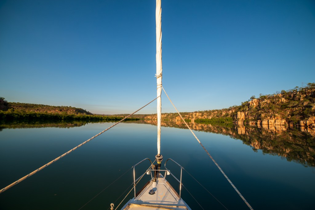
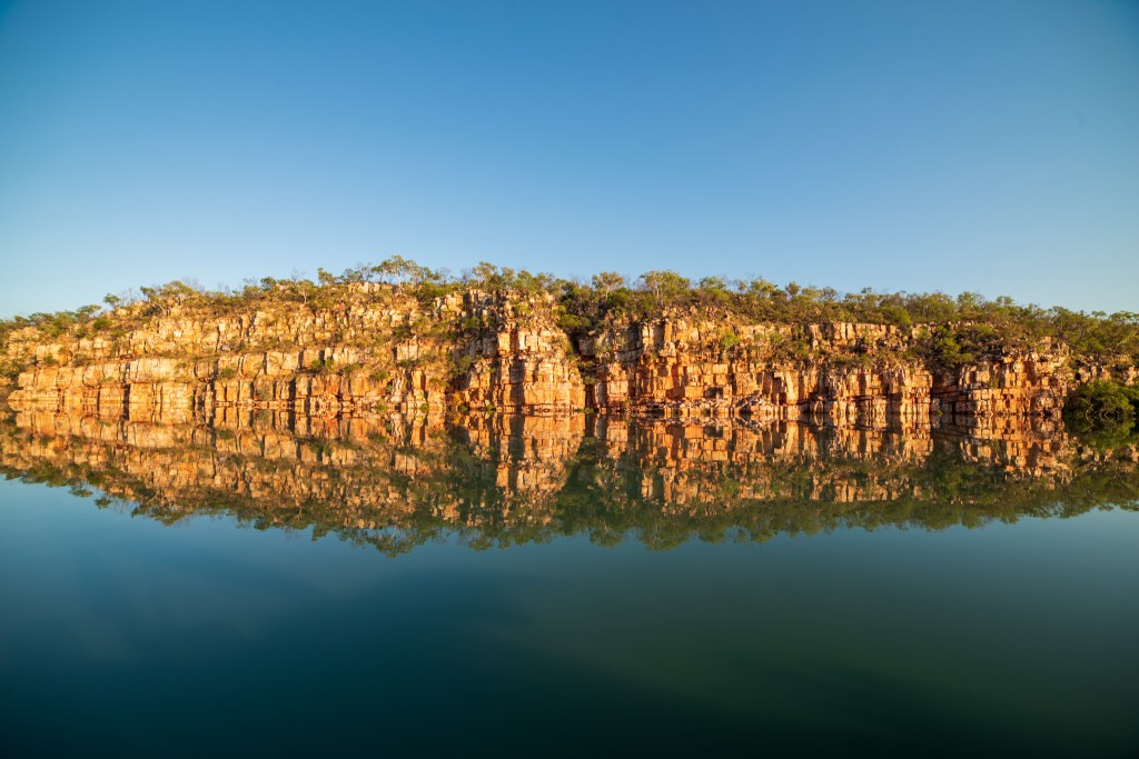
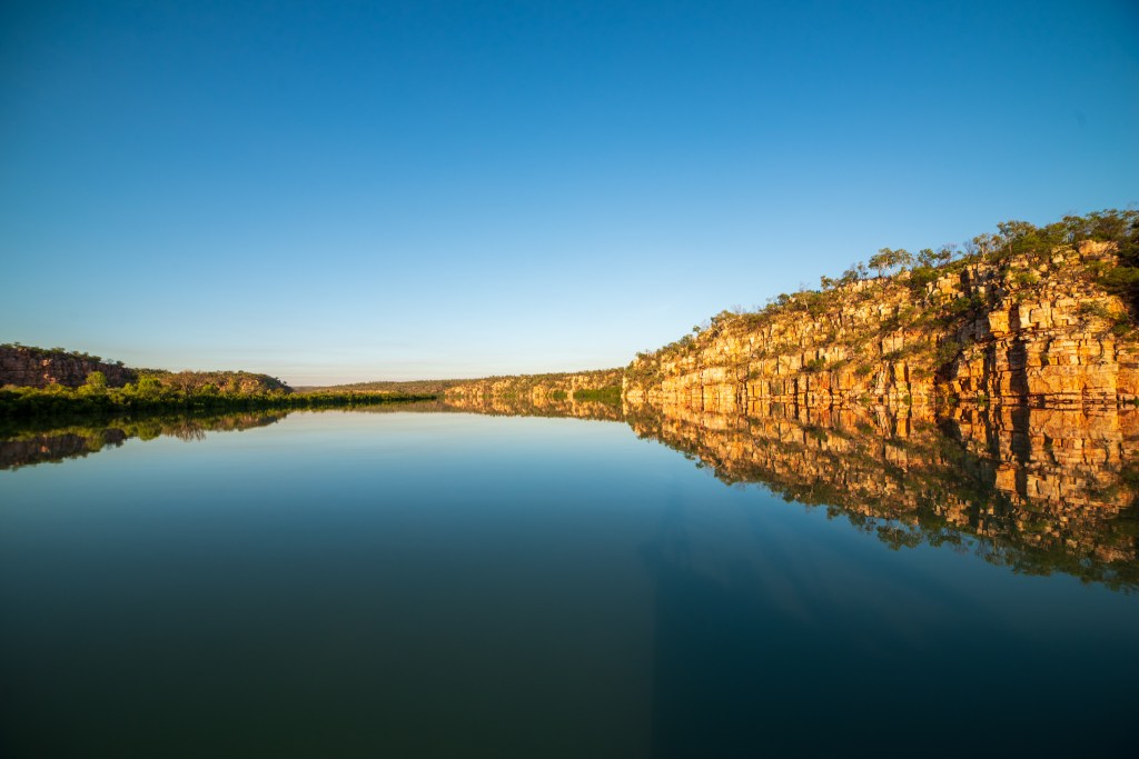
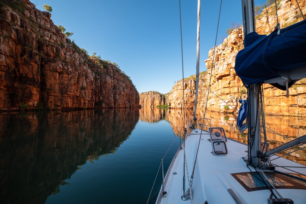
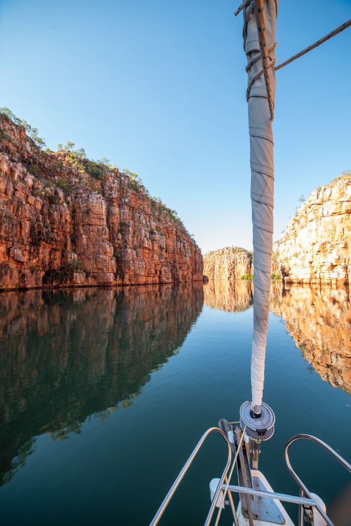
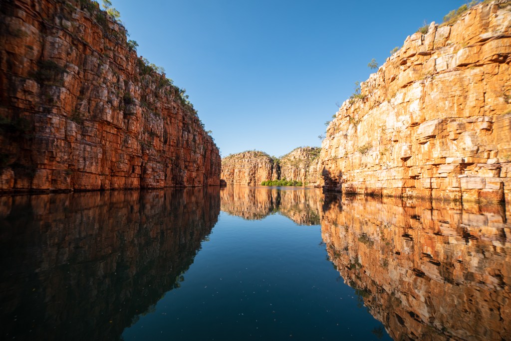
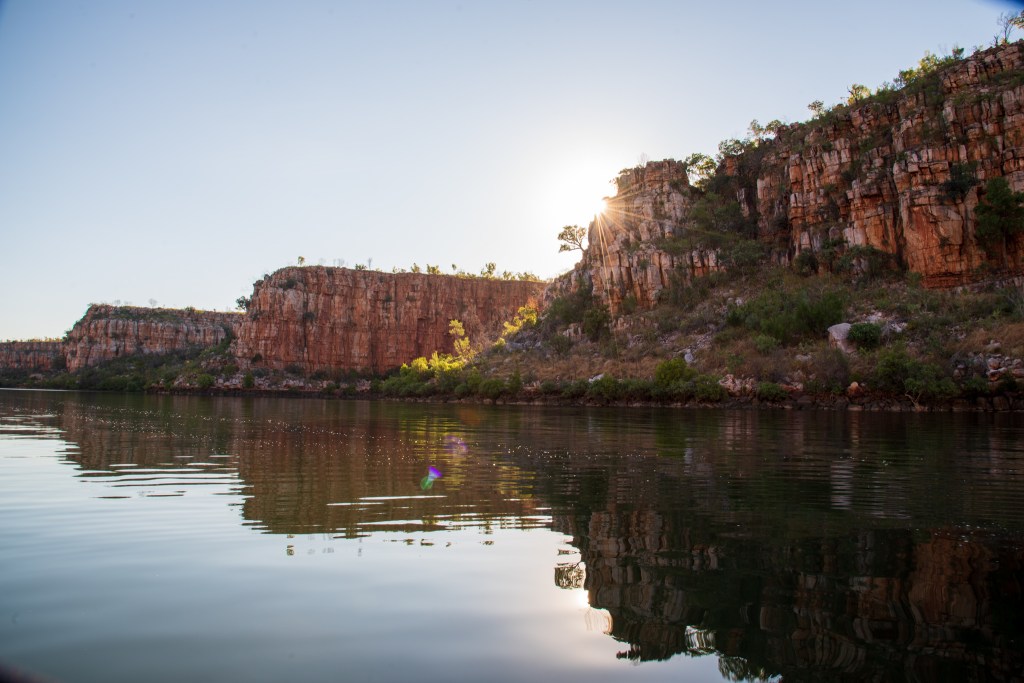
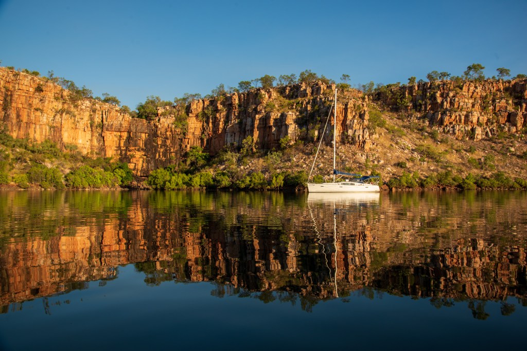
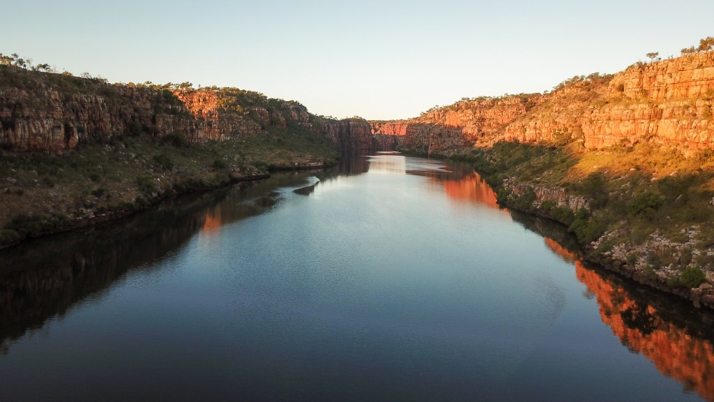
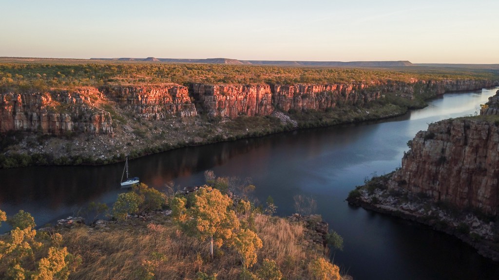
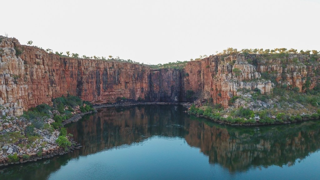
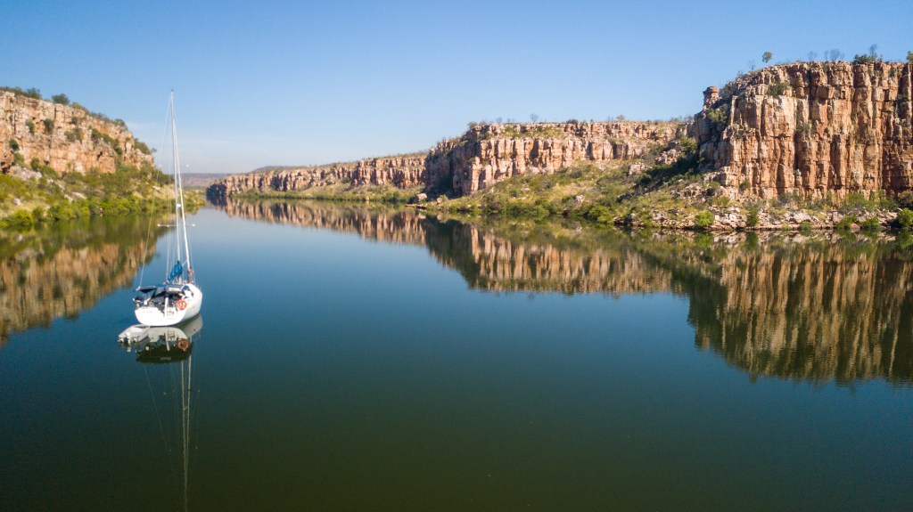
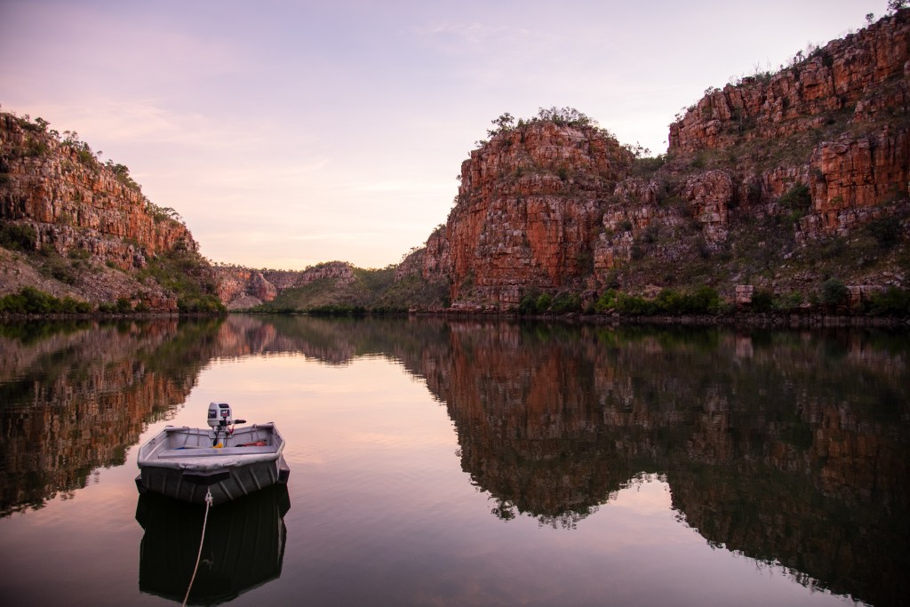
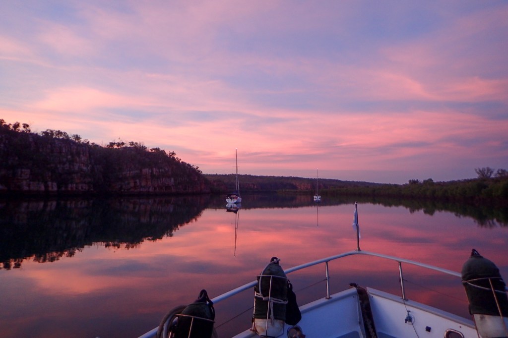
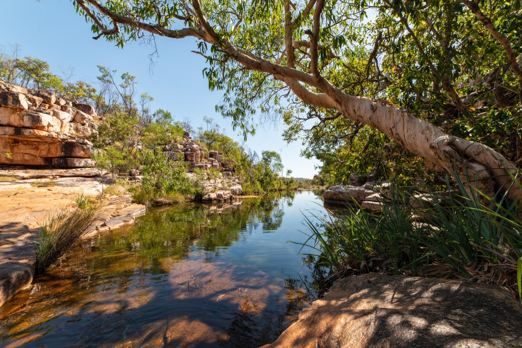
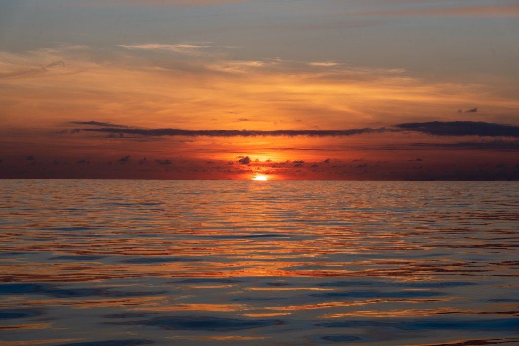
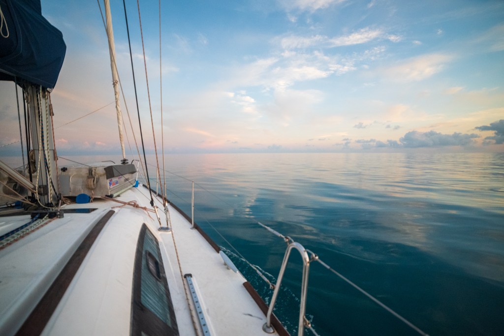
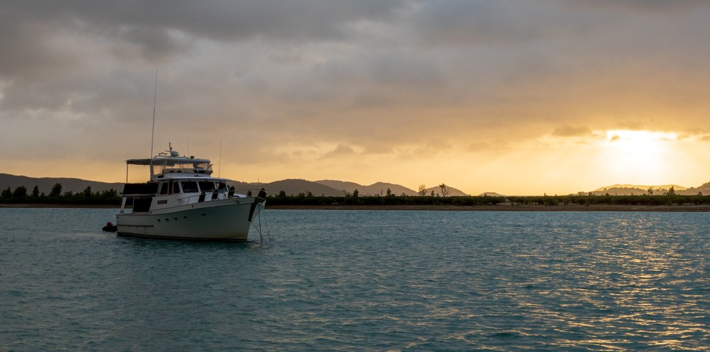
After three days exploring the lower parts of the river, we were ready to see what other wonders the Berkeley held. Early one morning we slowly made our way upstream, in what was to be one of the highlights of our entire trip. There was no wind at all and the water was completely calm and still. The reflections of the cliffs and trees lining the riverbank were mirrored perfectly in the water below, creating the illusion of a second world.
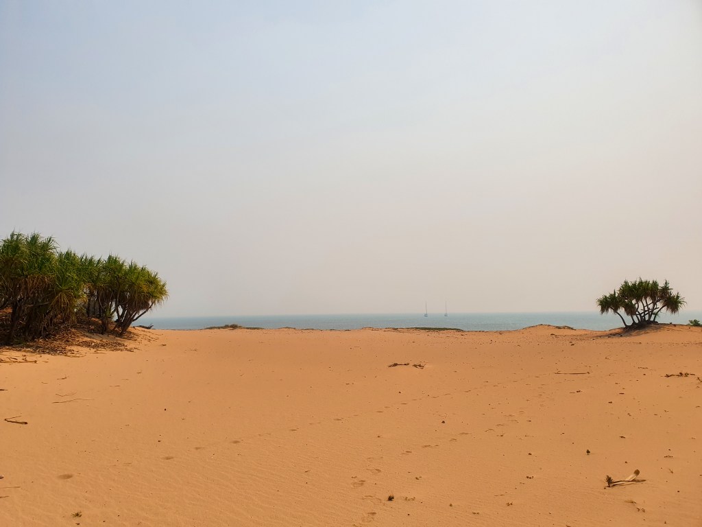
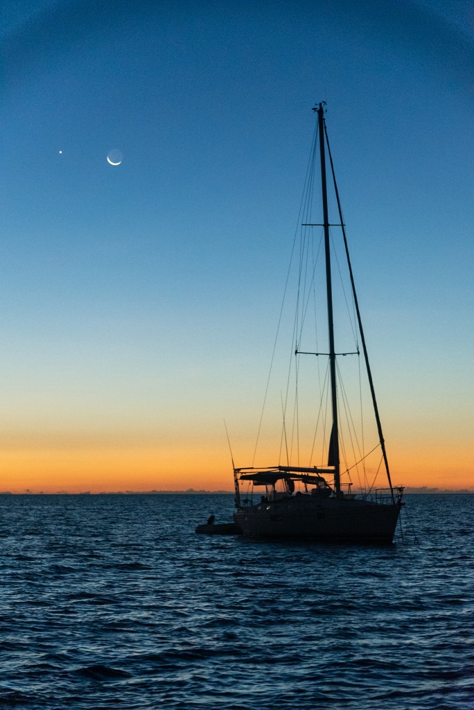
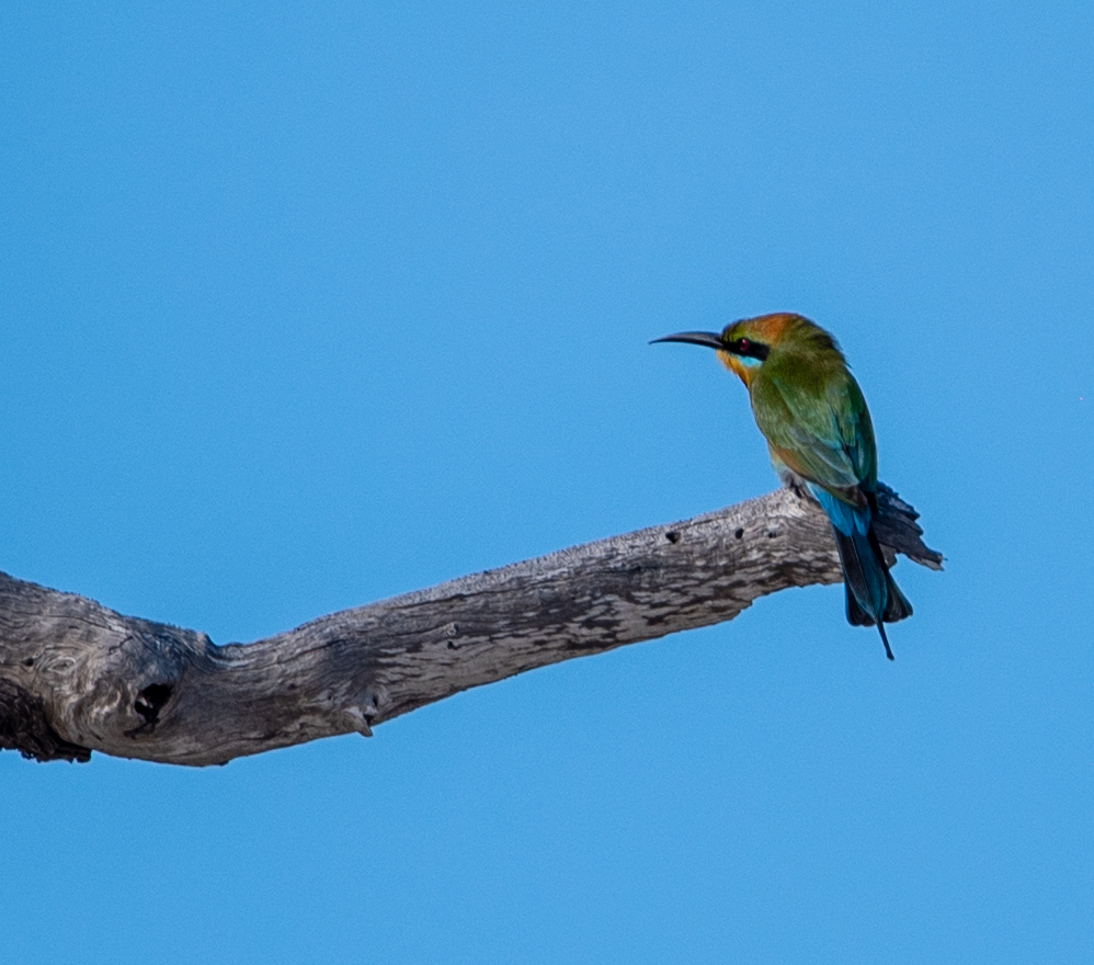
Berkeley River
Berkeley River
Berkeley River
Berkeley River
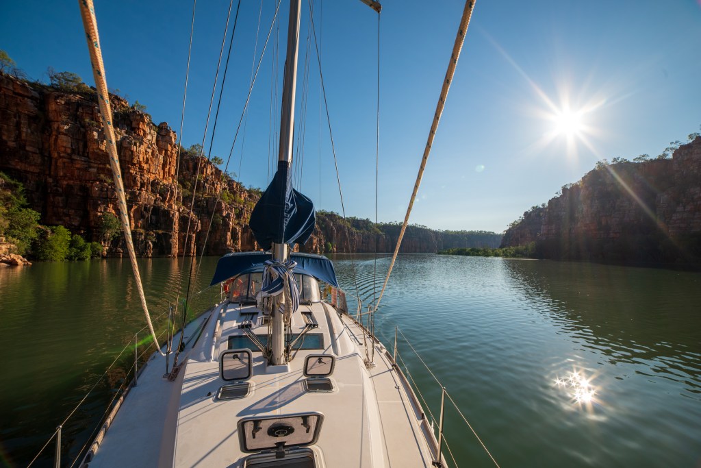
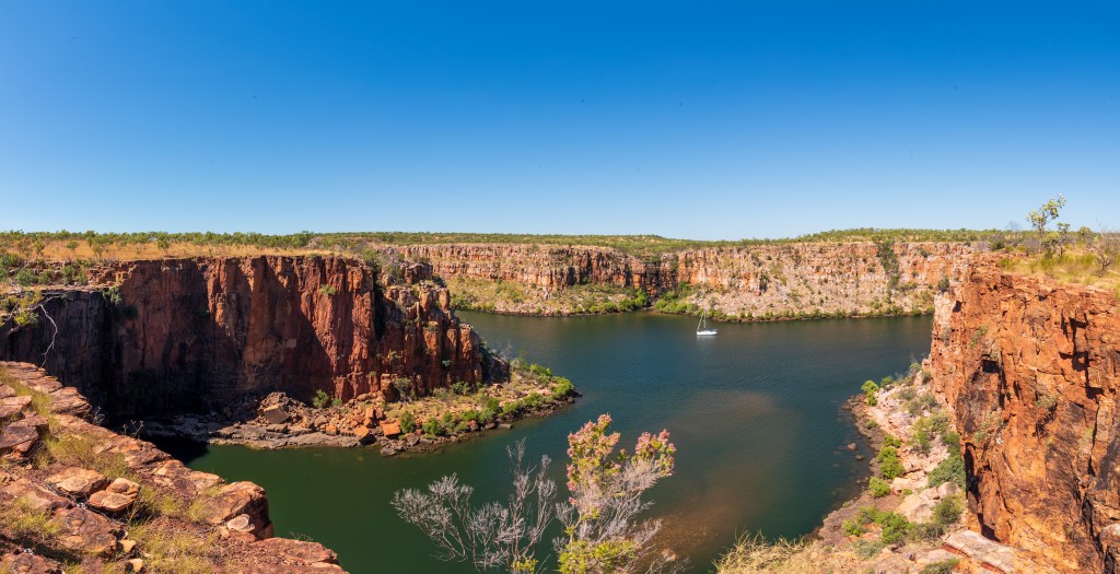
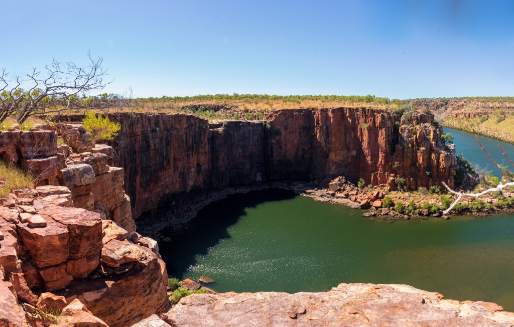
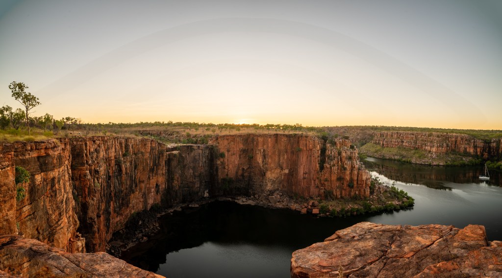
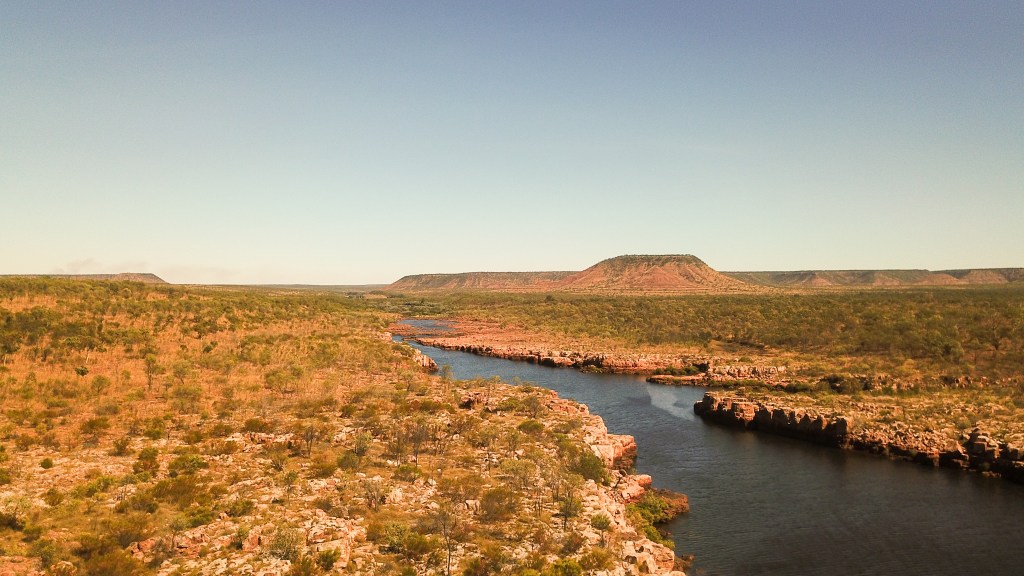
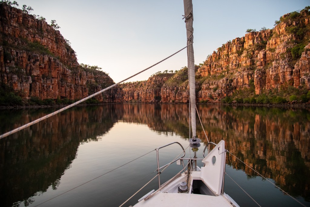
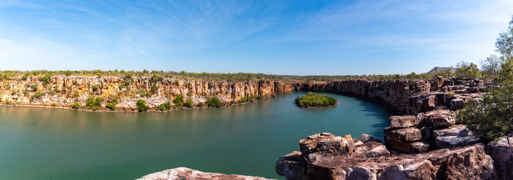
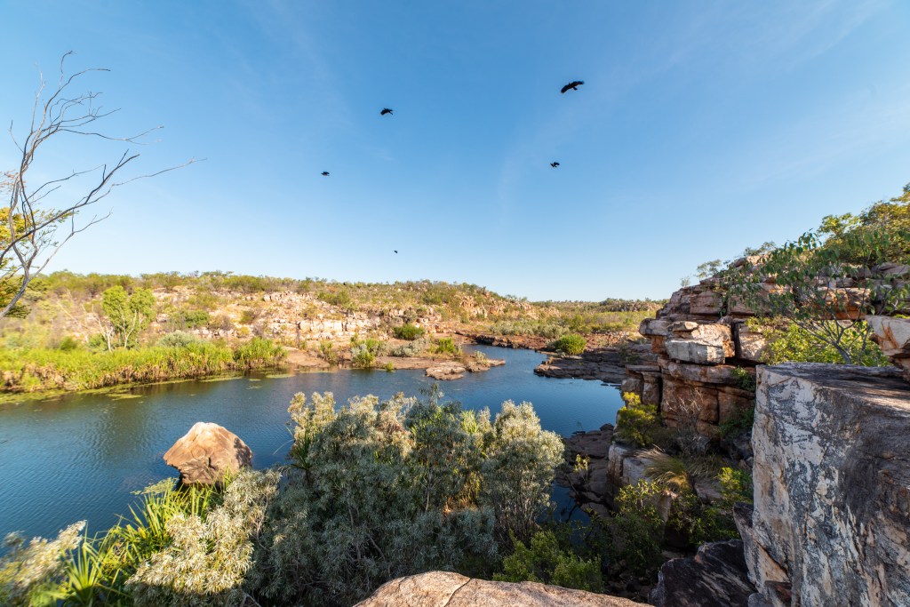
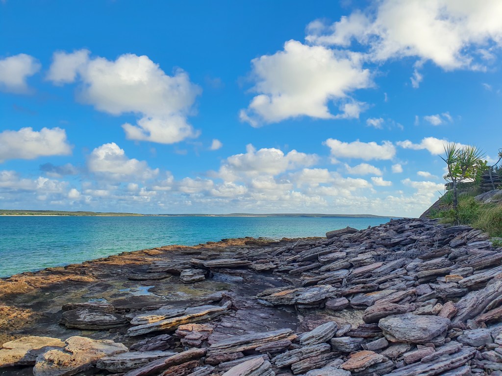
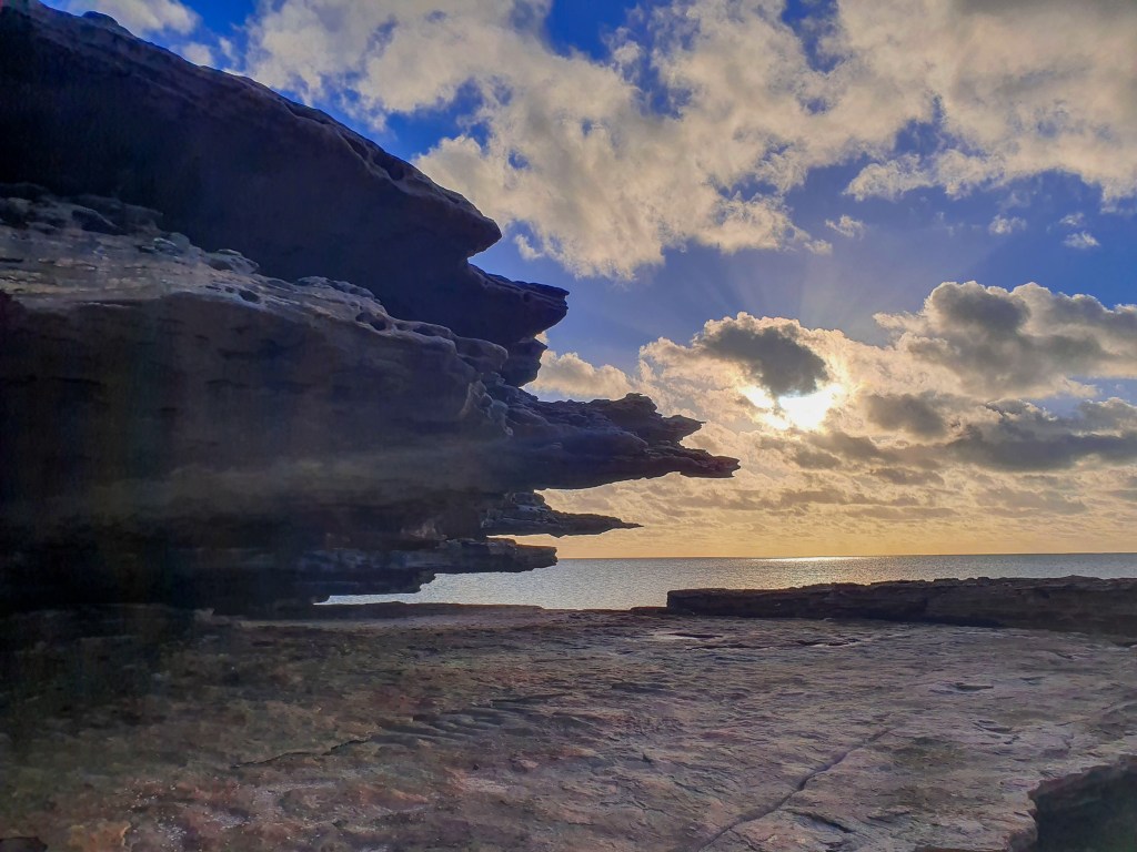
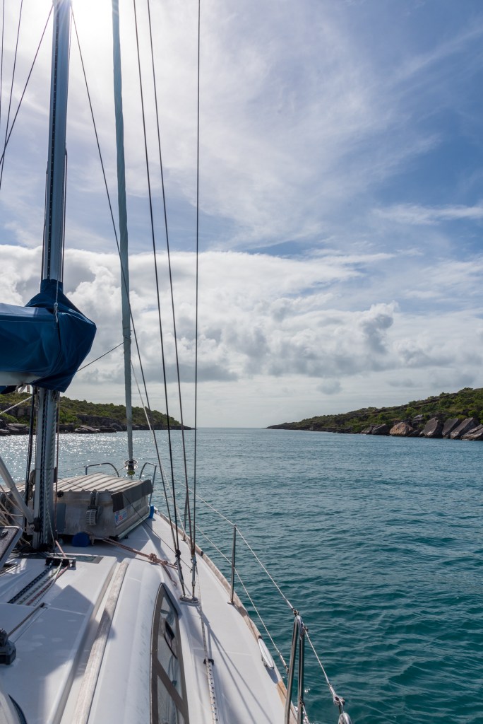
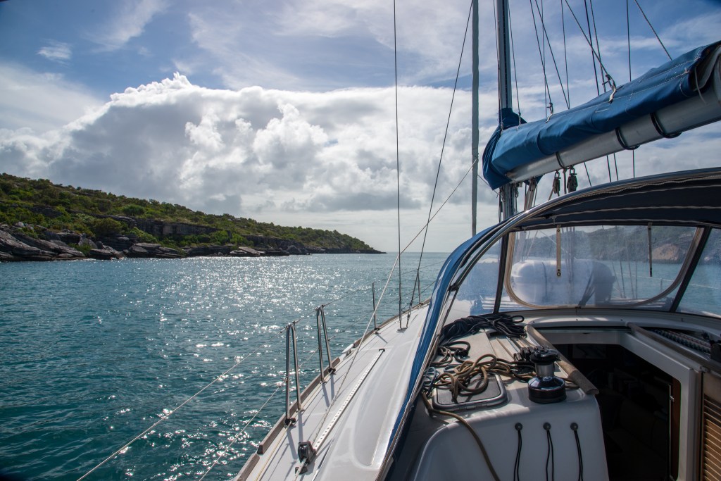
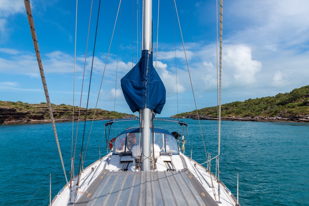
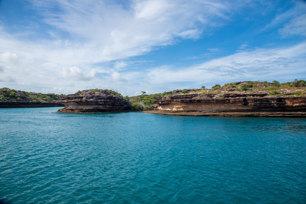
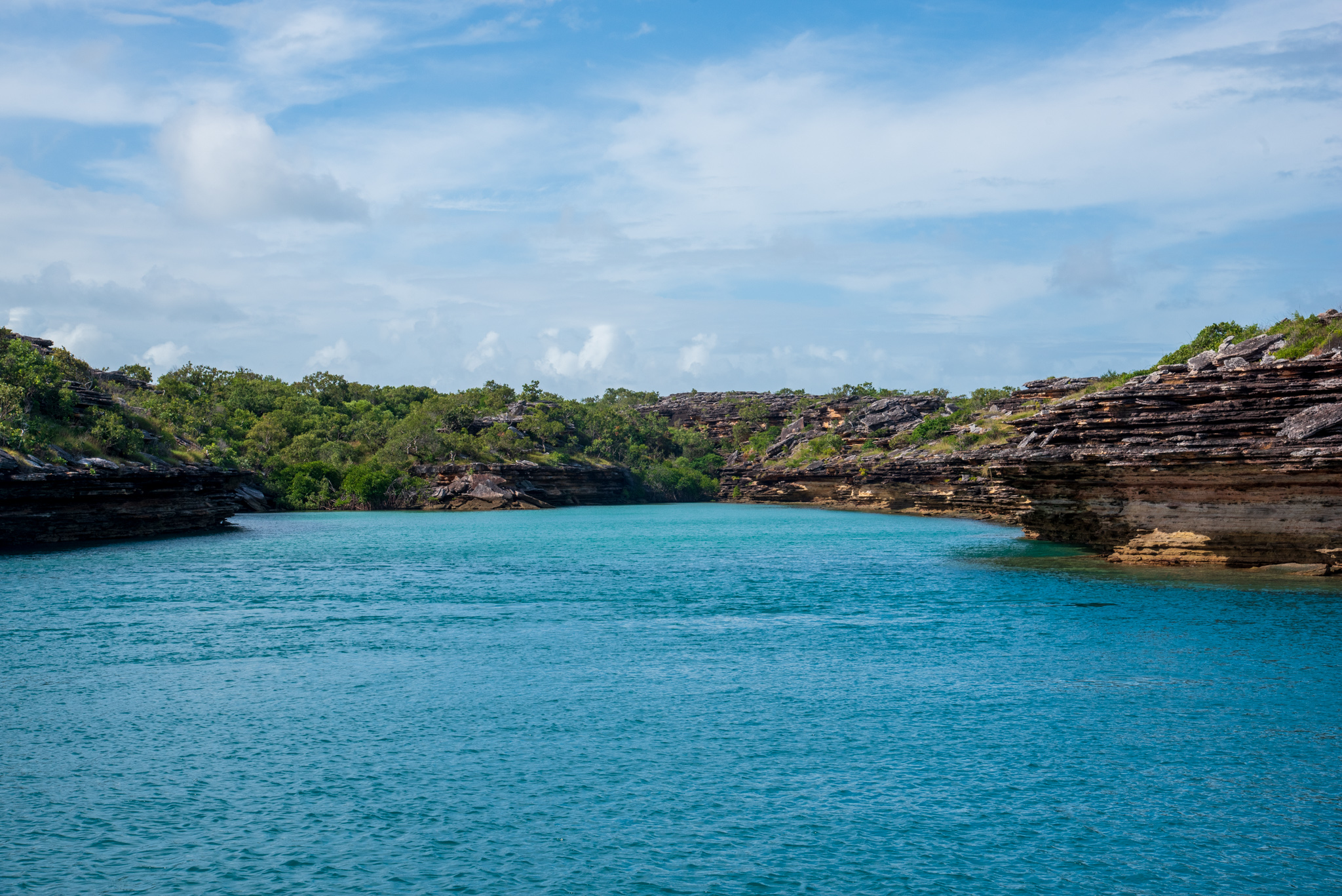
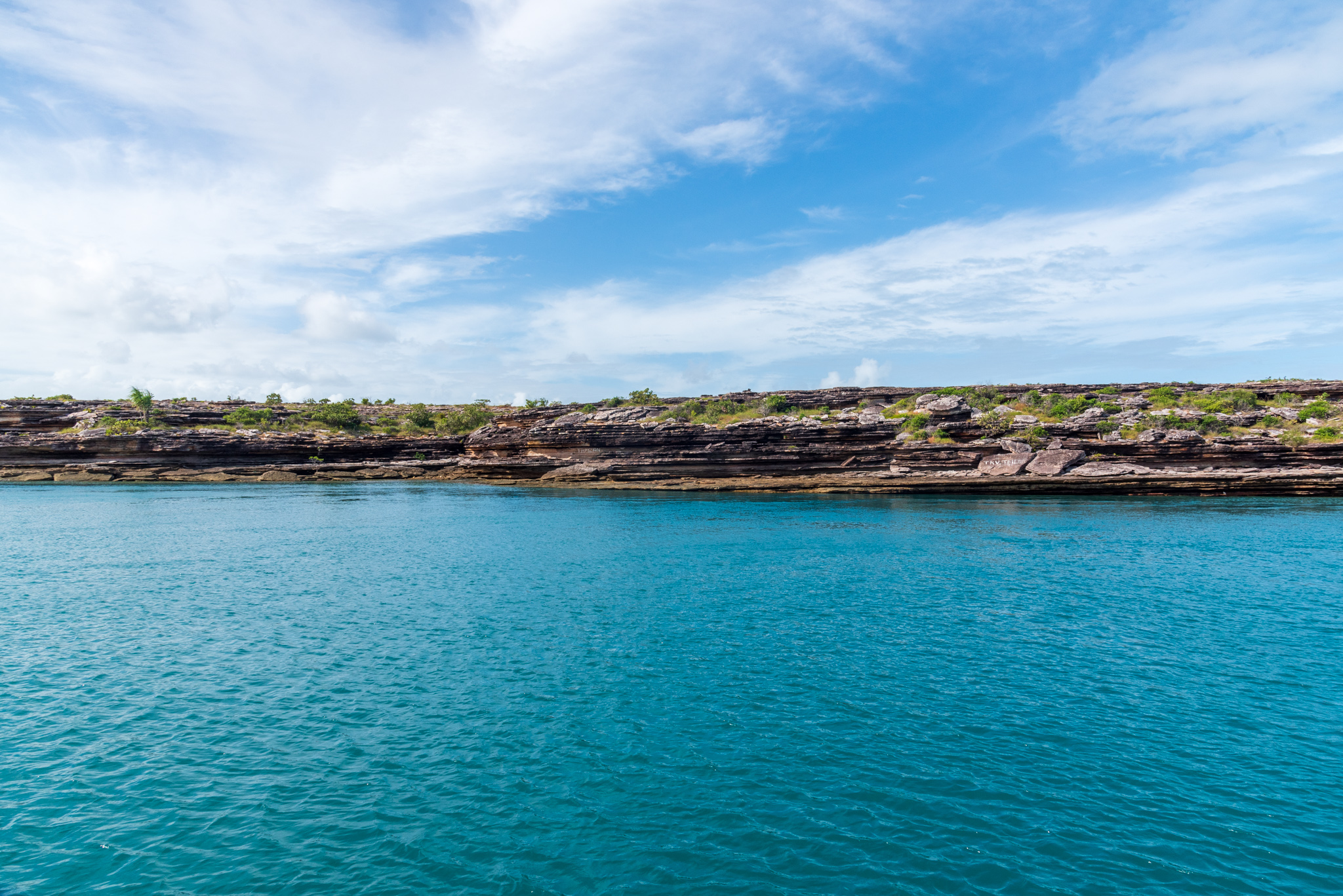
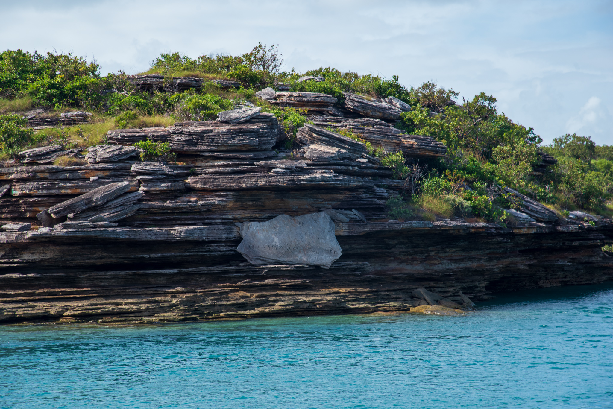
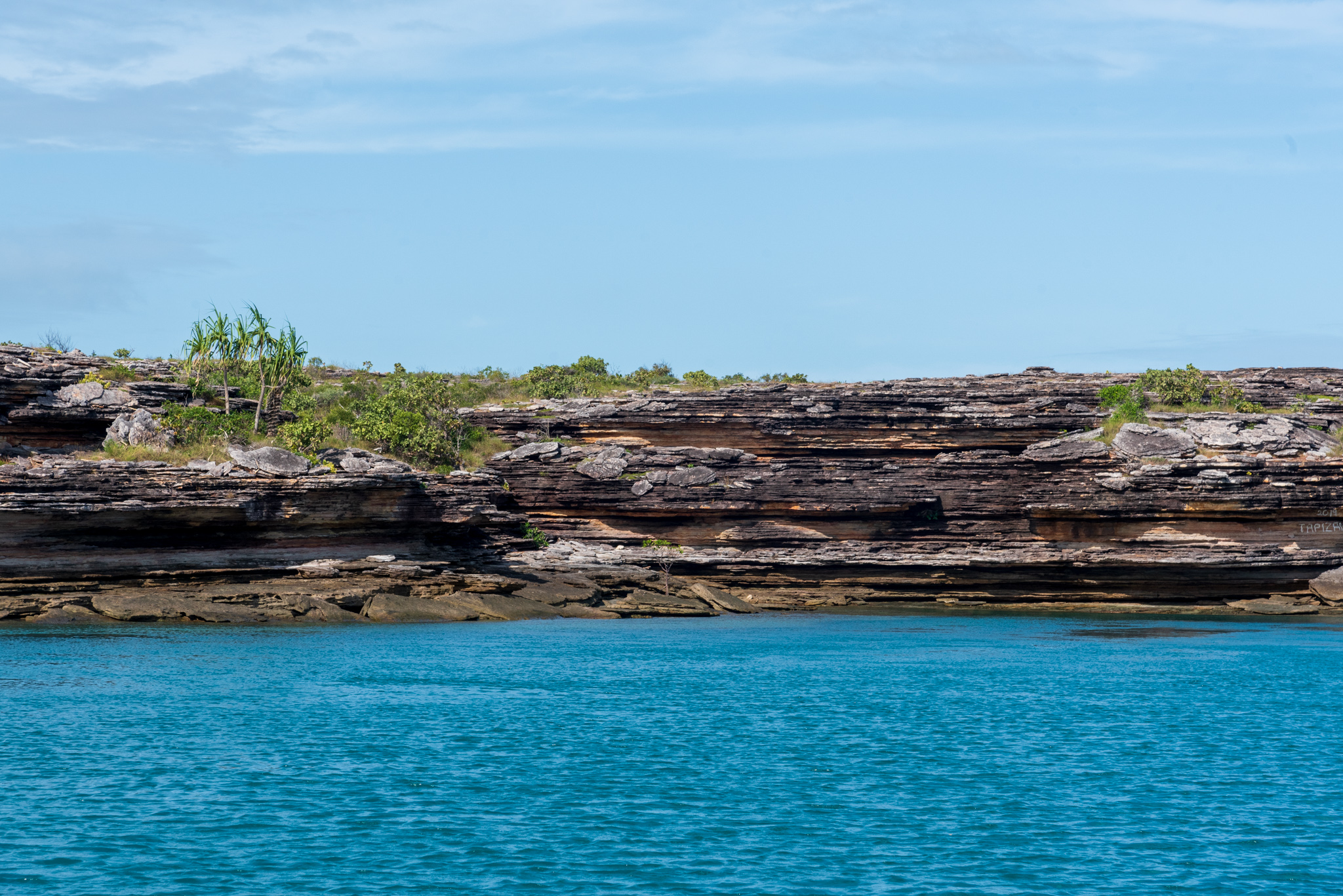
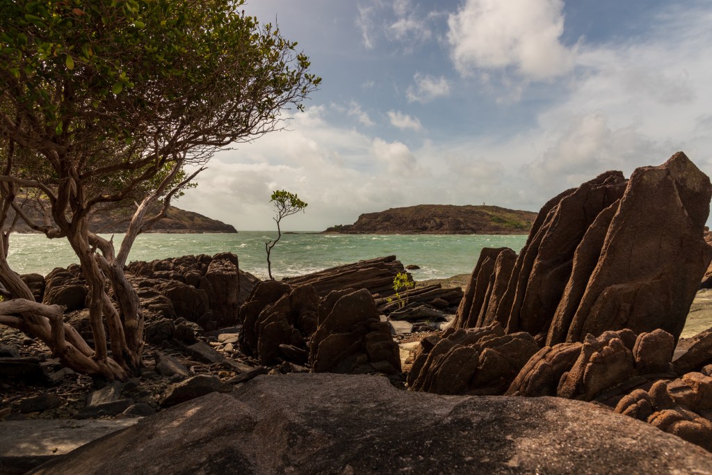
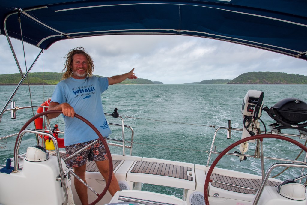
As the river narrowed we found ourselves in a long, fairly narrow gorge that twisted and turned, with towering and imposing cliffs enclosing the sides. It was incredibly beautiful. Motoring along at just three knots, we had no music on and mostly sat in silence, just absorbing and appreciating the incredible spectacle that is the Berkeley River. We took turns steering so that the other could sit up on the bow and fully absorb the experience. It was not long after sun up, and that special, magical light that you get in the first hour or so after sunrise gave the cliffs a glowing quality. I’m not sure I have the words to adequately describe what we felt in this place, but it is definitely an experience neither of us will forget.
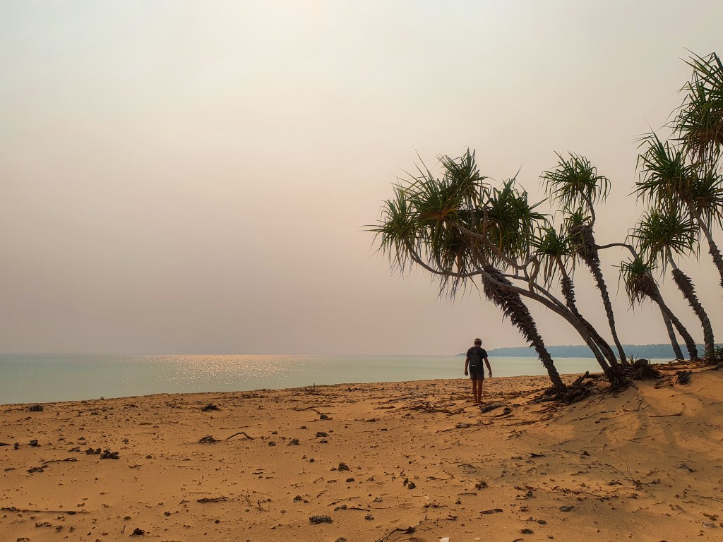
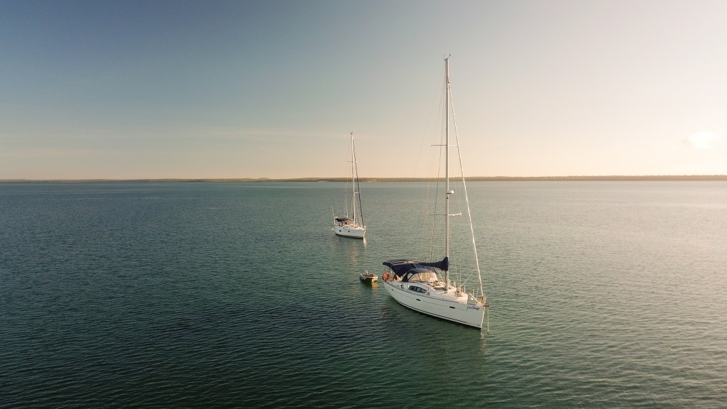
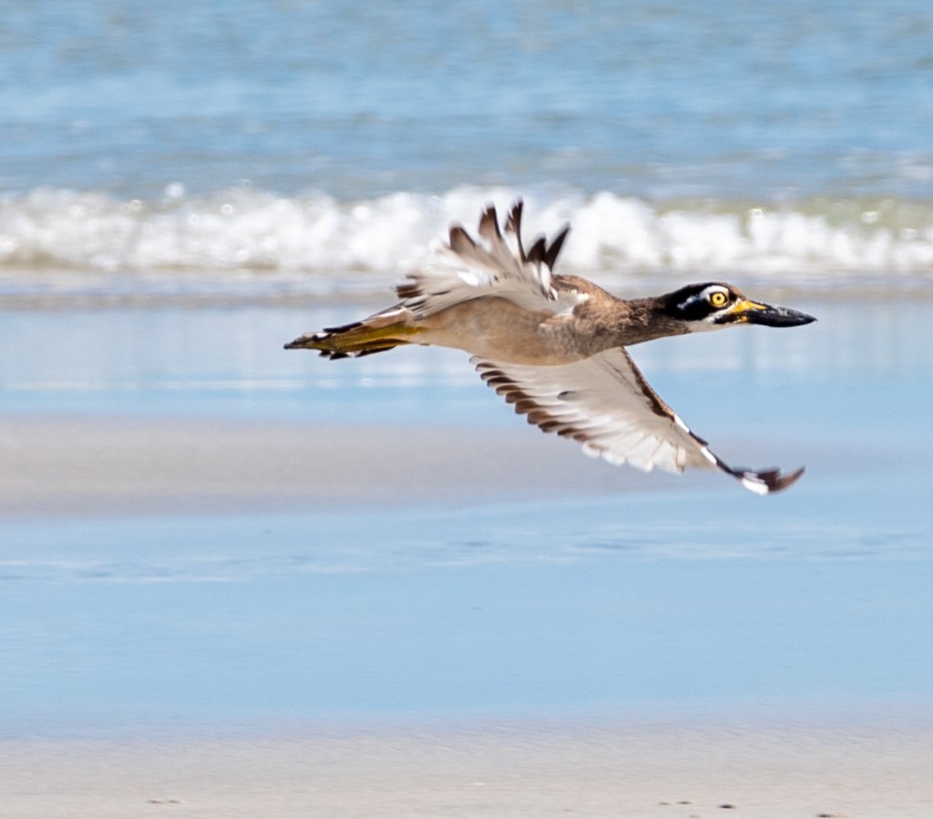
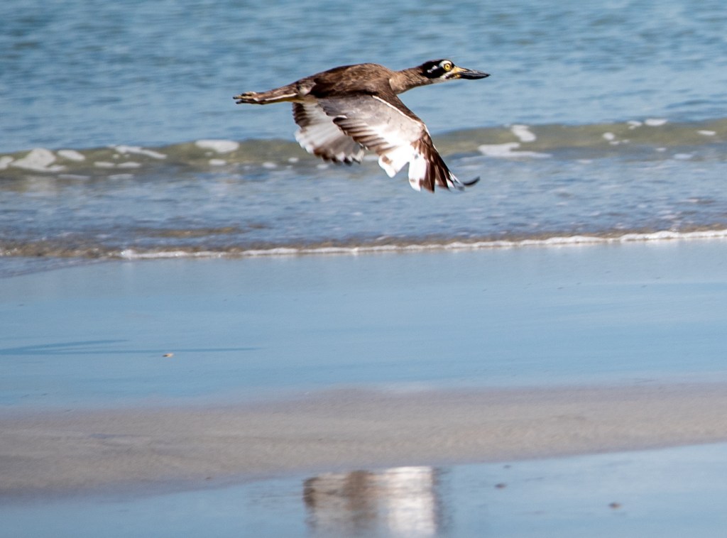
Berkeley River
Berkeley River
Berkeley River
Berkeley River
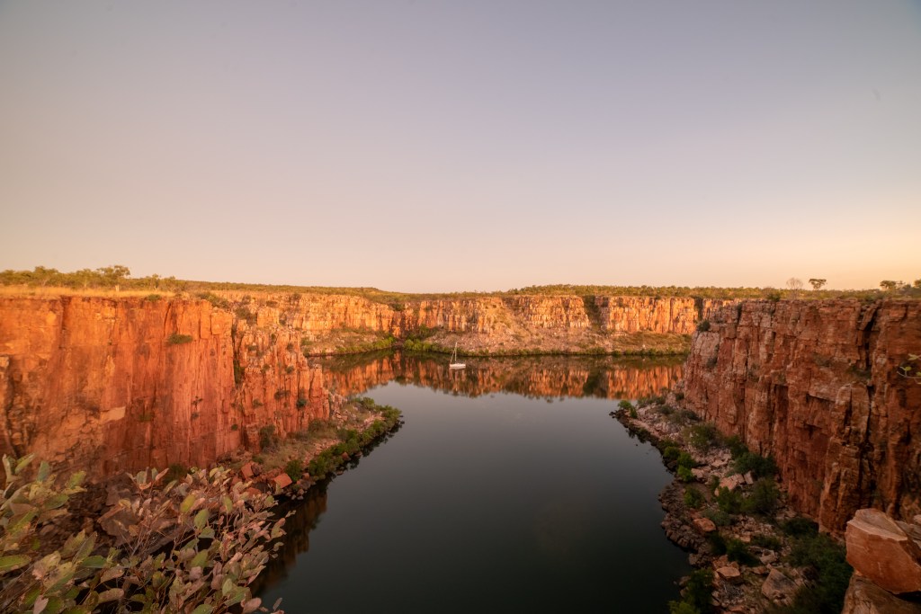
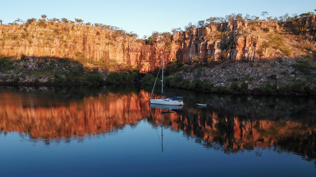
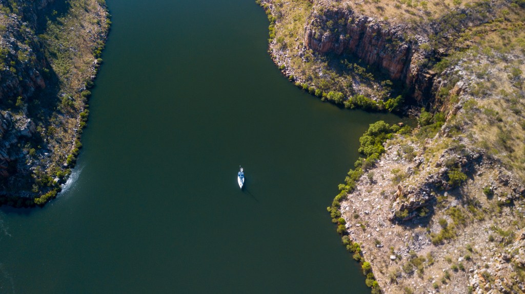
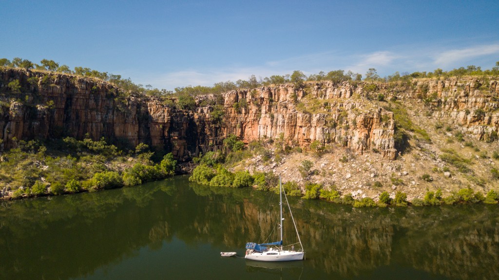
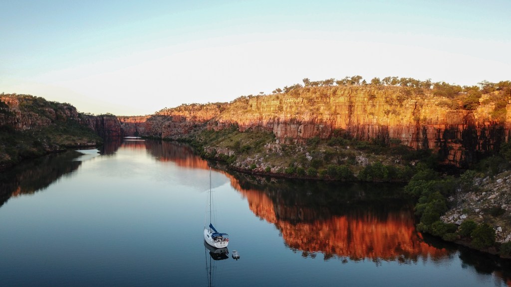
Anchoring just outside the amphitheatre, we sat on the boat for a bit relishing the incredible feelings of being alone in this ancient, majestic and awe-inspiring place.
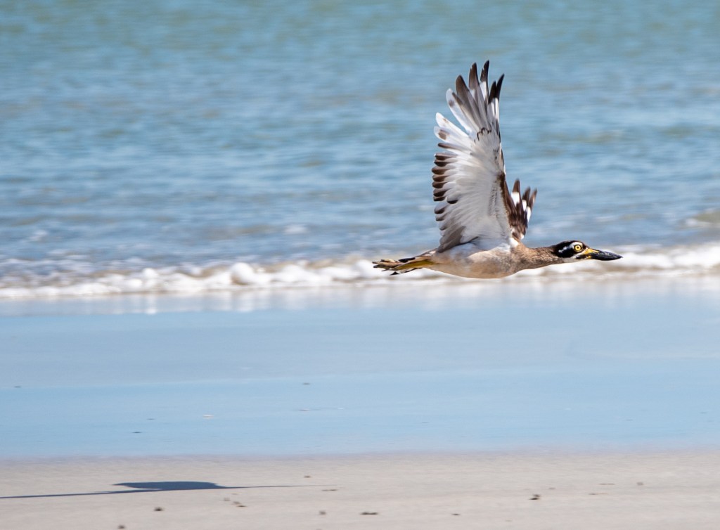
Berkeley River
Berkeley River
Berkeley River
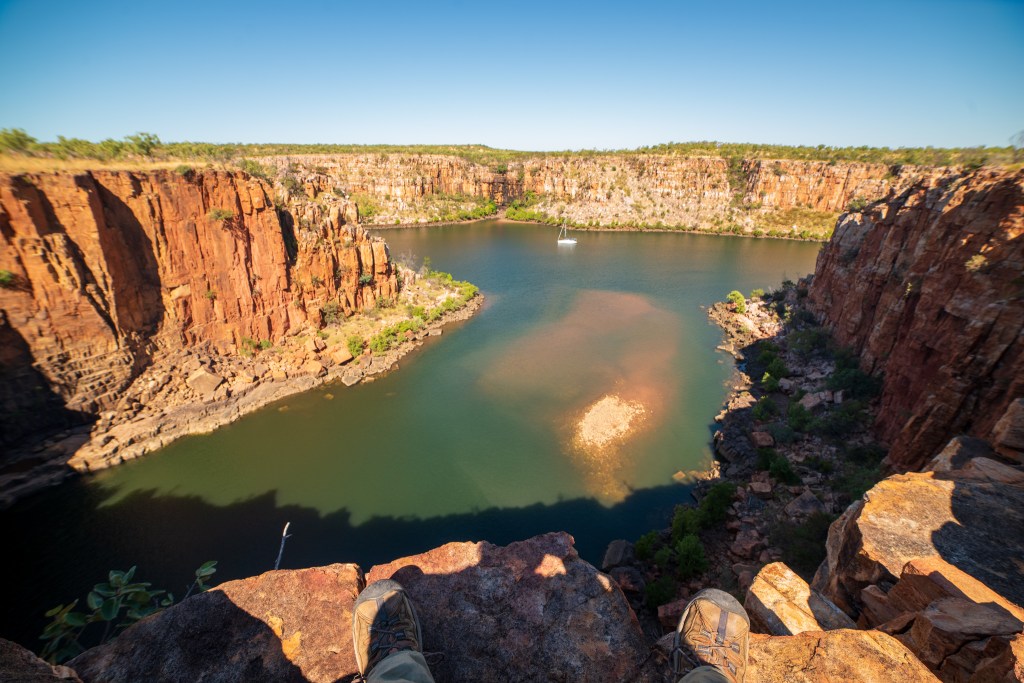
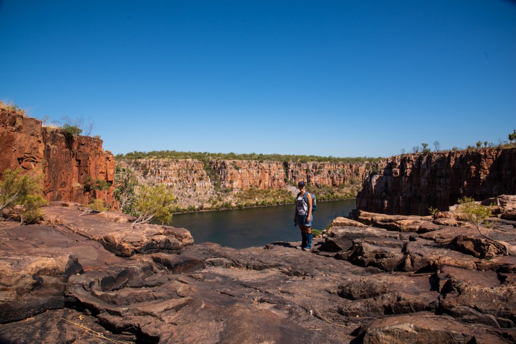
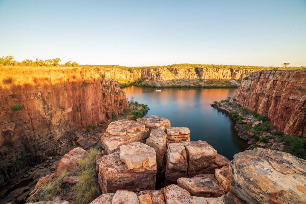
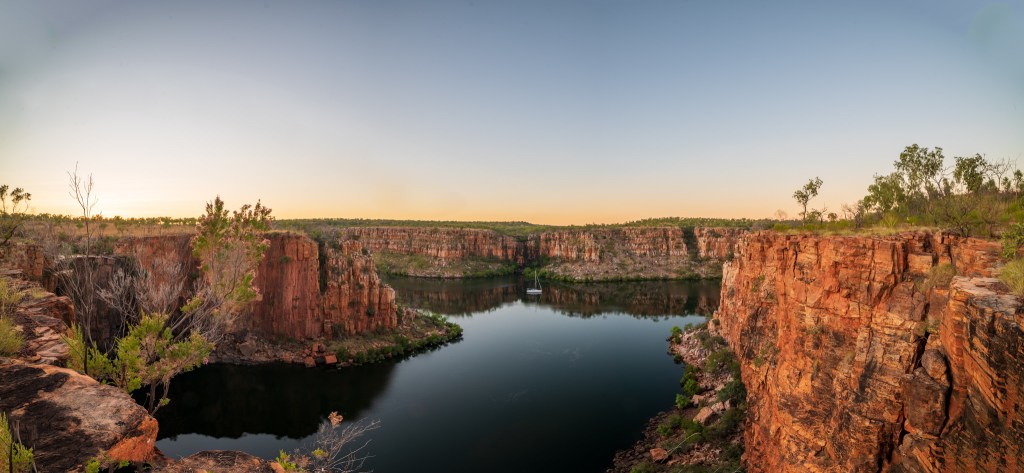
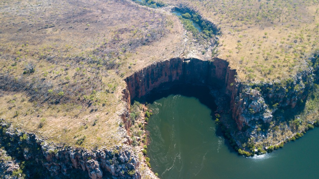
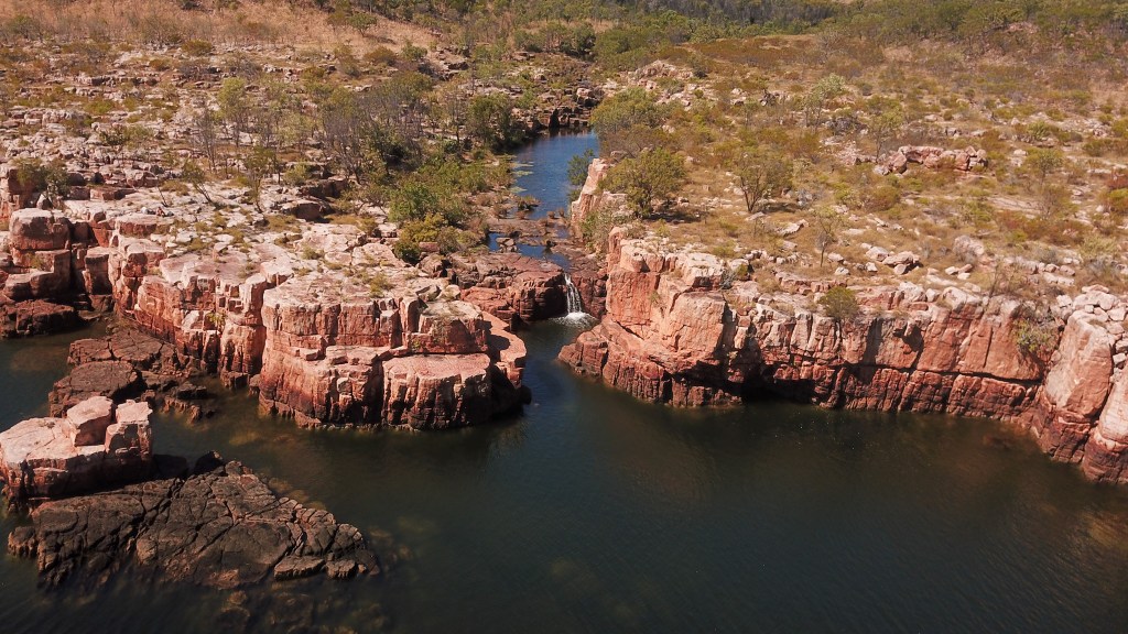
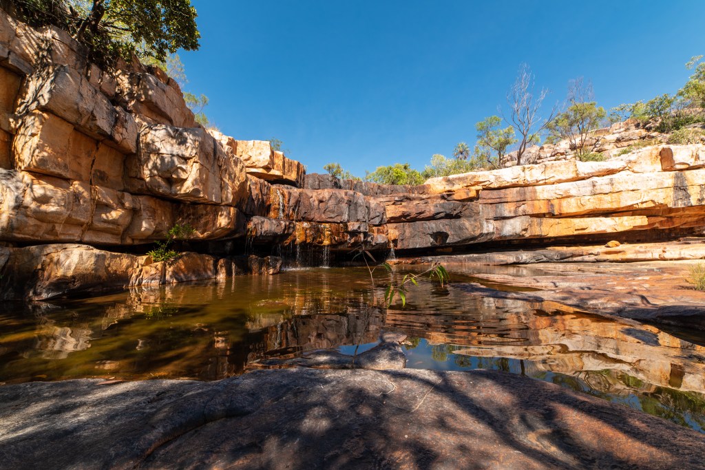
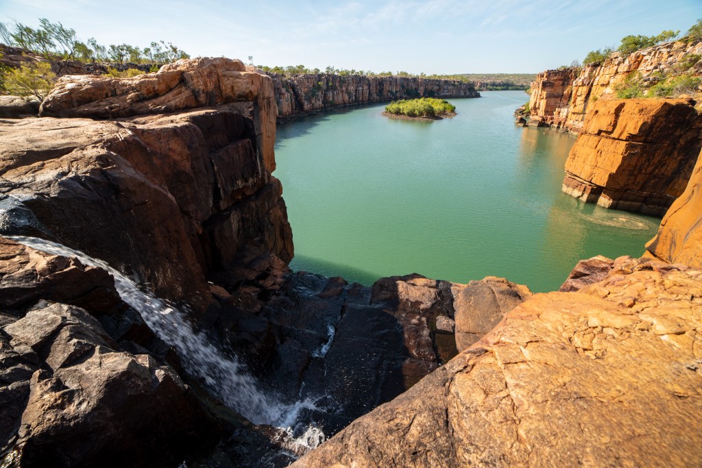
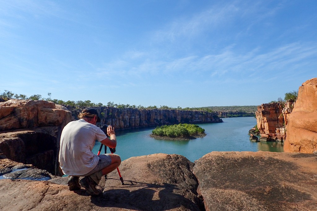
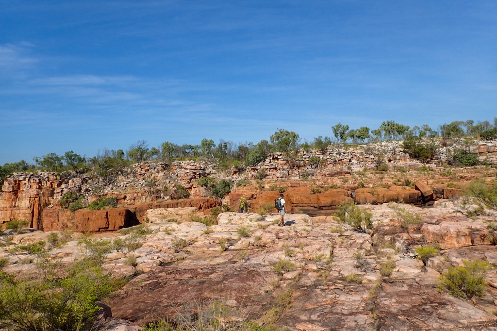
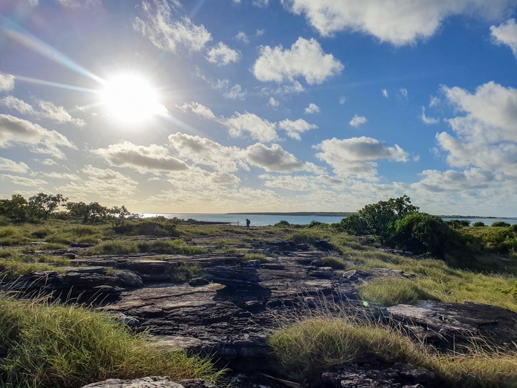
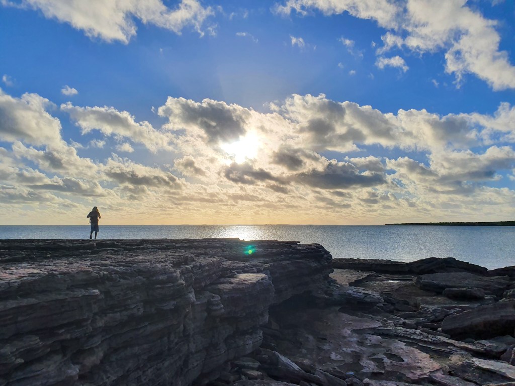
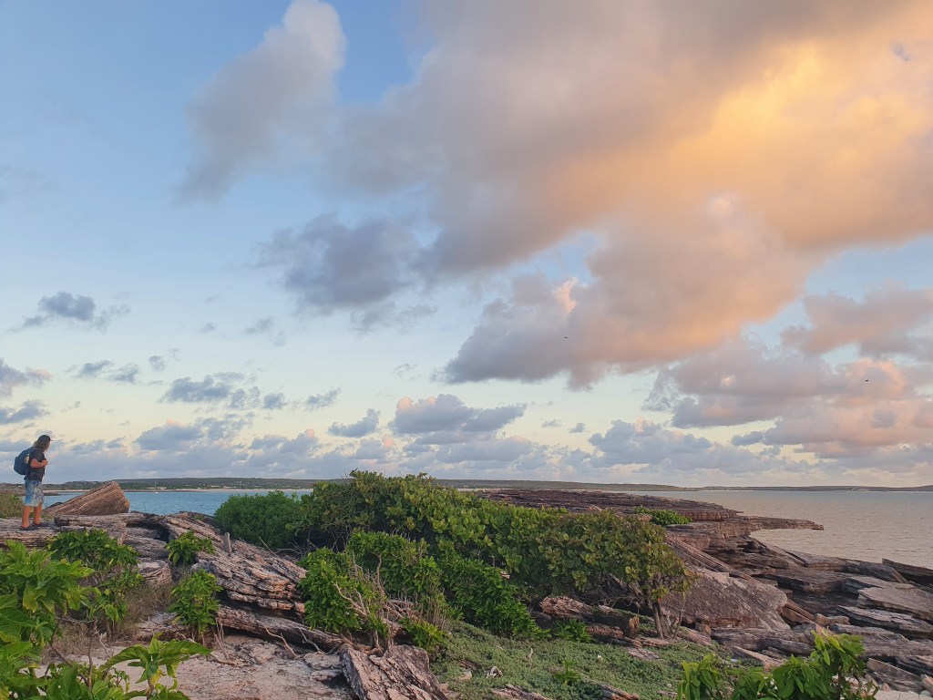
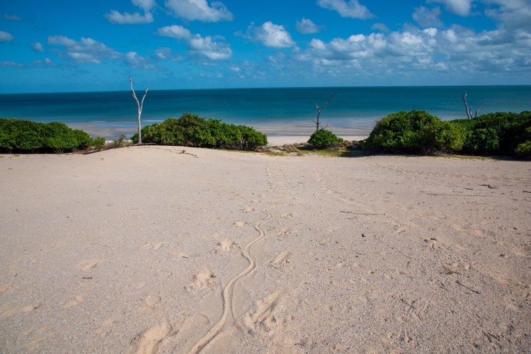
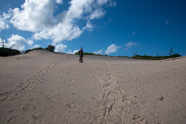
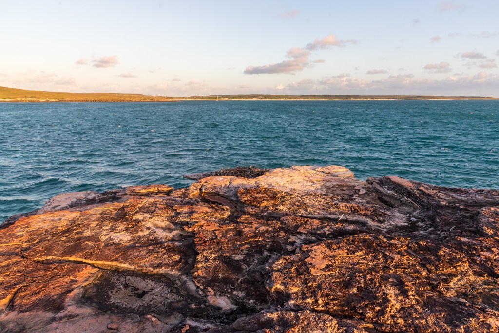
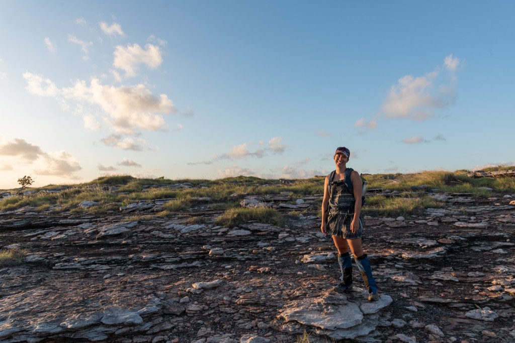
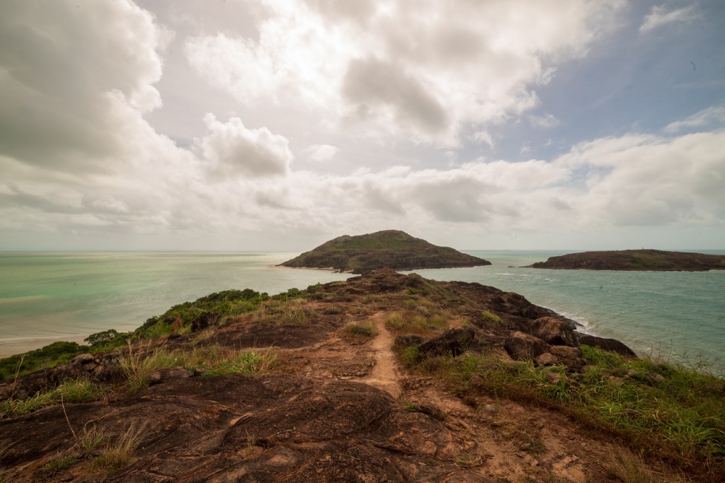
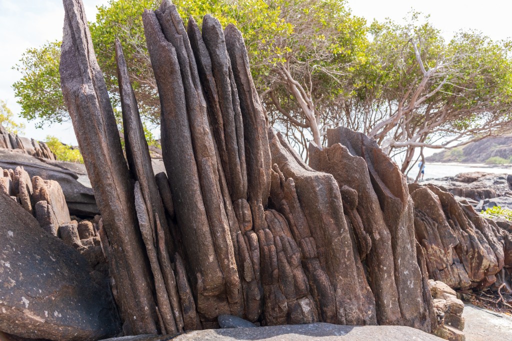
The amphitheatre is a large bowl shape jutting off the side of the river and enclosed by cliffs about 100 metres tall. In the wet season there would be a waterfall roaring over the edge, but it was just a trickle now. We put on our hiking boots and climbed up the steep gully nearby, clambering over rocks and pushing through scrub. Once at the top we wound our way around until we were staring directly down at the amphitheatre below. We could see Cool Change below, looking like a toy boat, dwarfed by the towering cliffs.
Amphitheatre, Berkeley River
Amphitheatre, Berkeley River
Amphitheatre, Berkeley River
Amphitheatre, Berkeley River
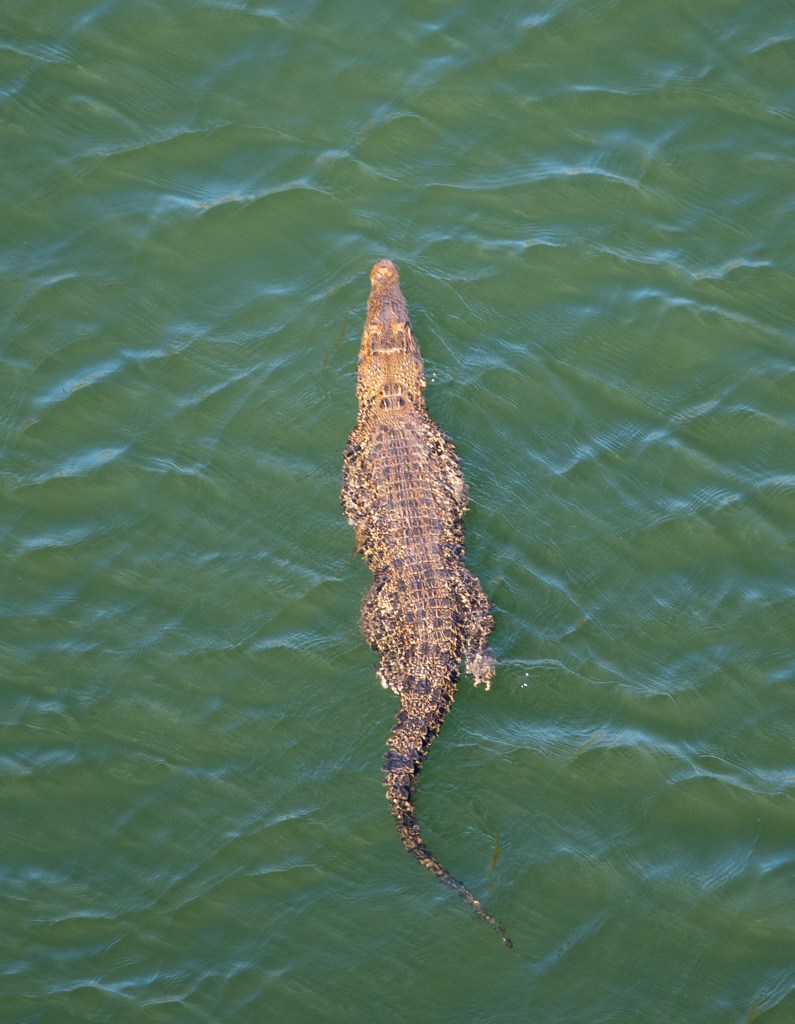
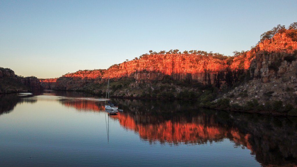
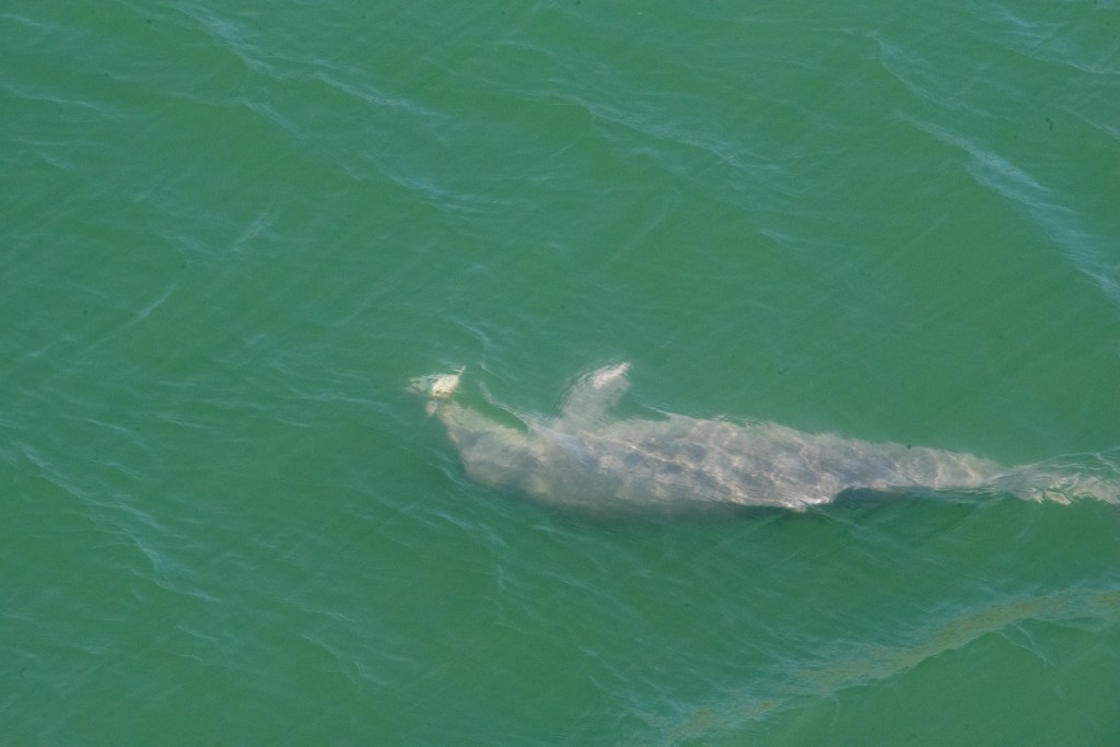
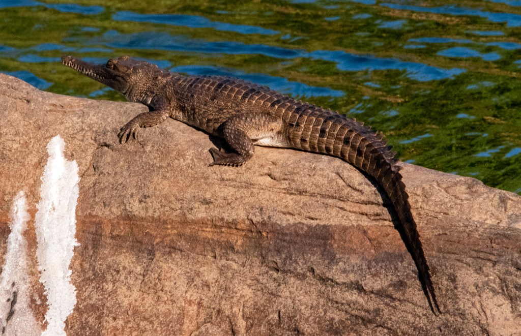
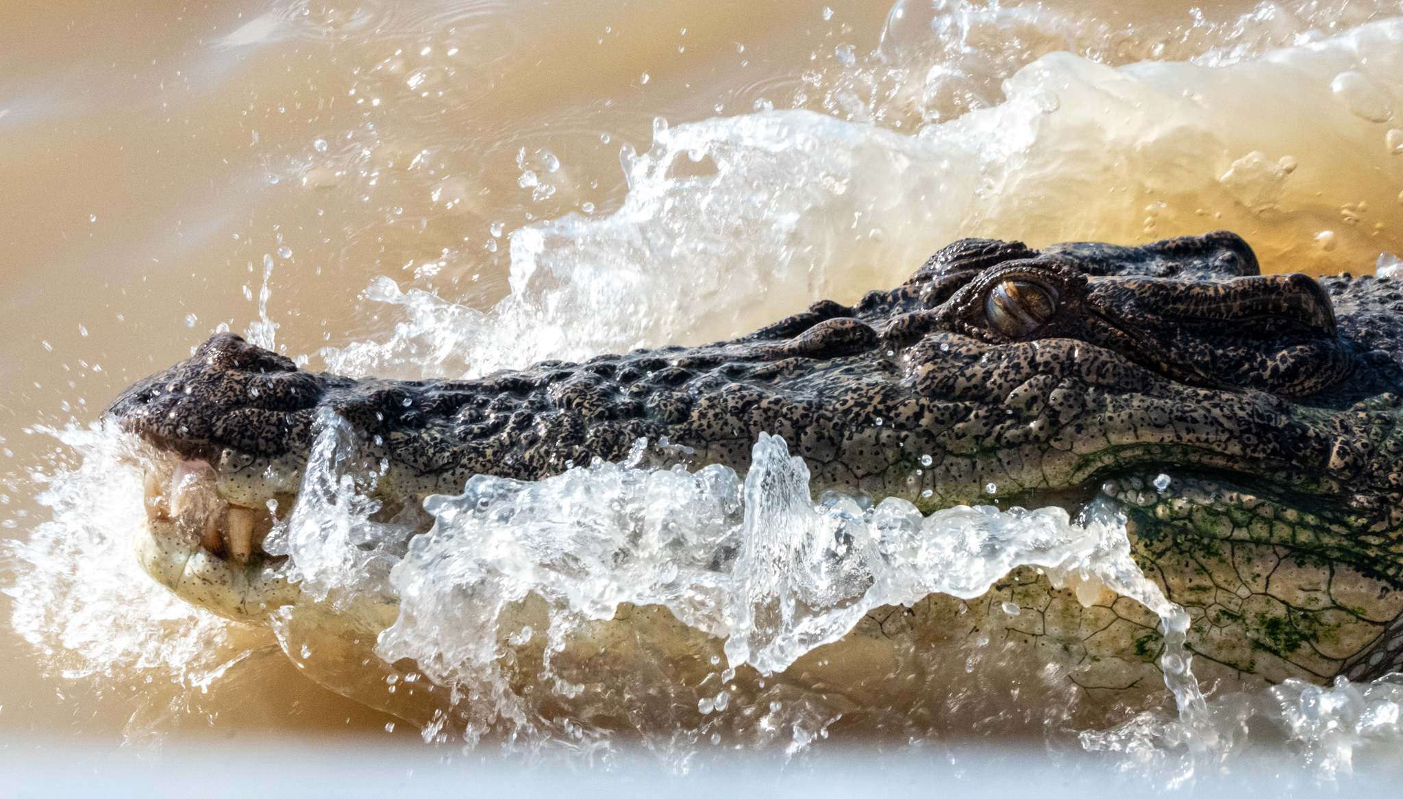
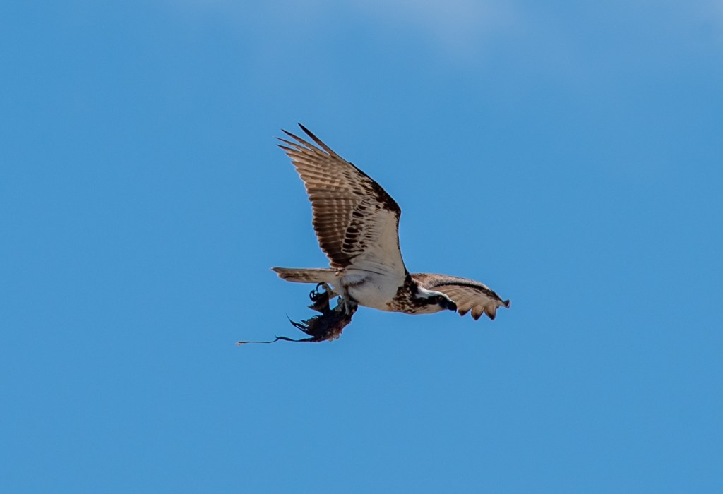
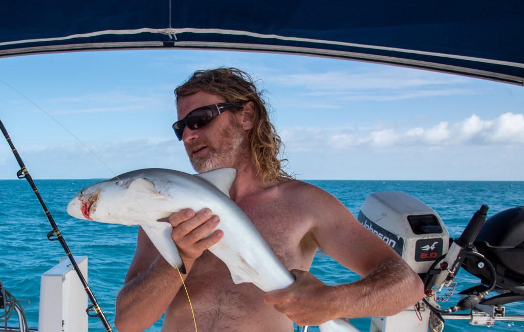
As we carefully peered down over the side, we noticed a dark shape on the water’s edge. As we watched, it began to move, swimming slowly and gracefully out into the centre of the water and revealing itself to be a crocodile. An absolutely huge one. We could see him clearly from 100 plus metres above. With Matt’s long lens on the camera, he got some great photos. From above, we could see just how big and wide he was. When looking at crocs in the water you can often only see their head and tail, making it hard to gauge exact size. This left no doubt as to the true size and heft of him.
Crocodile, Berkeley River
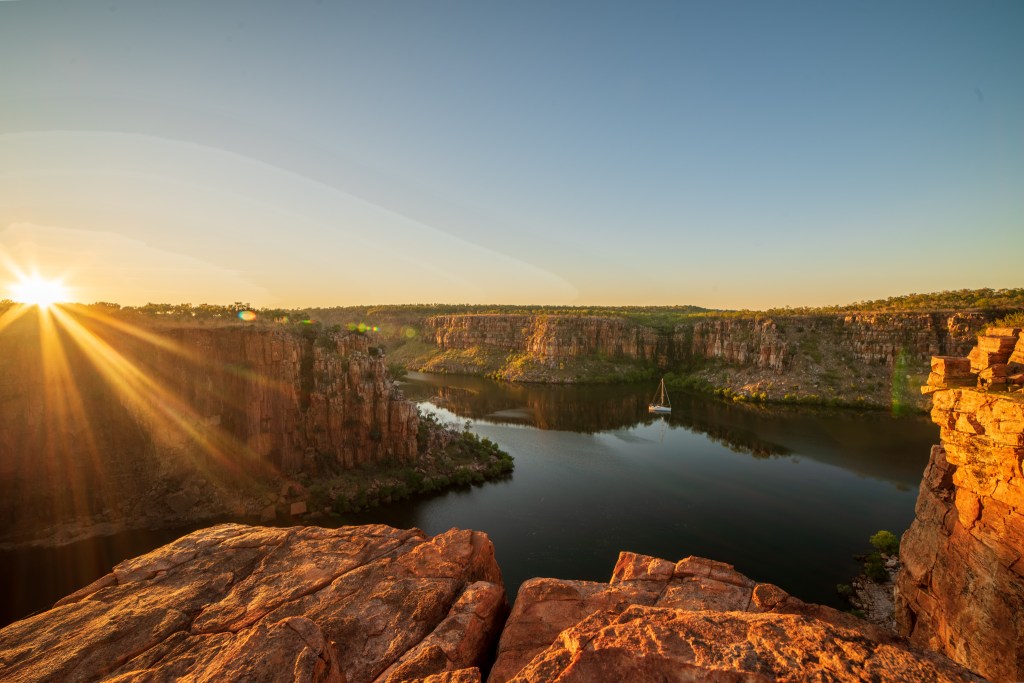
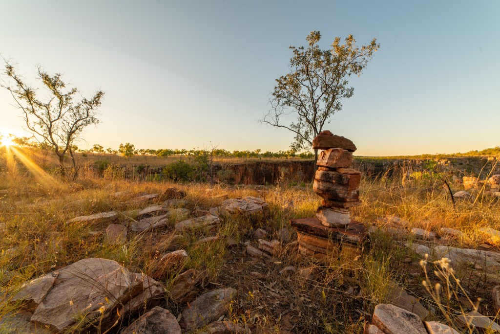
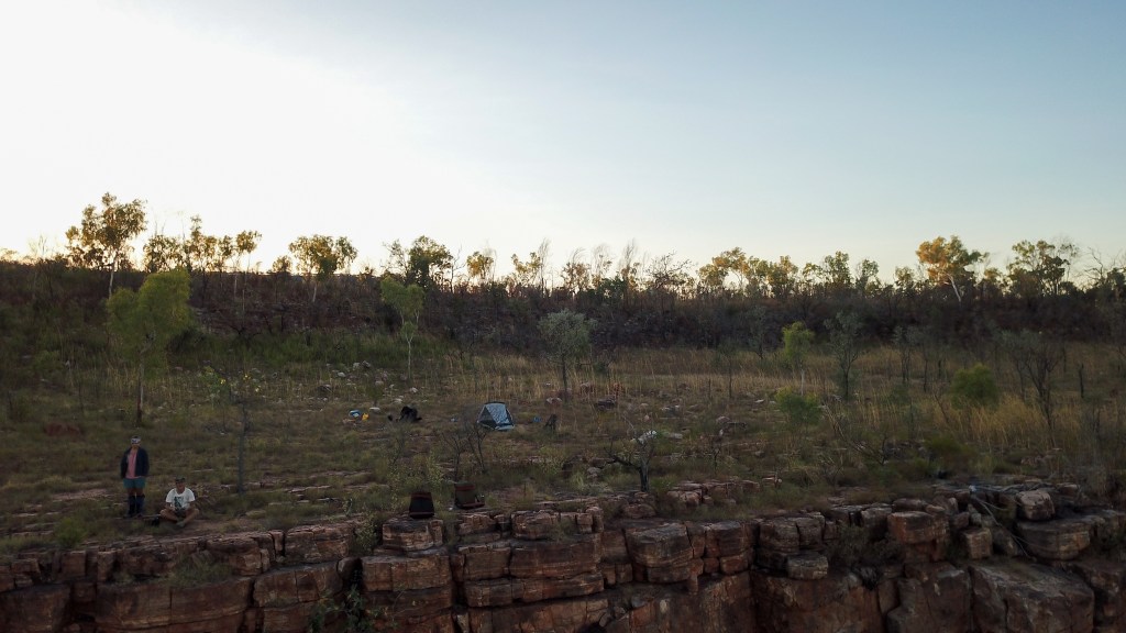
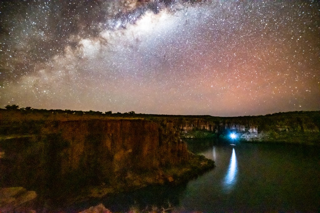
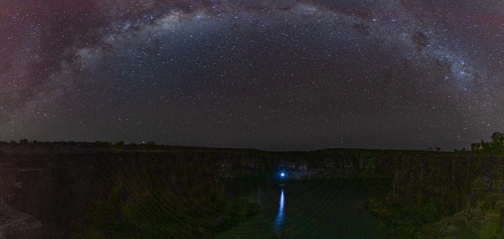
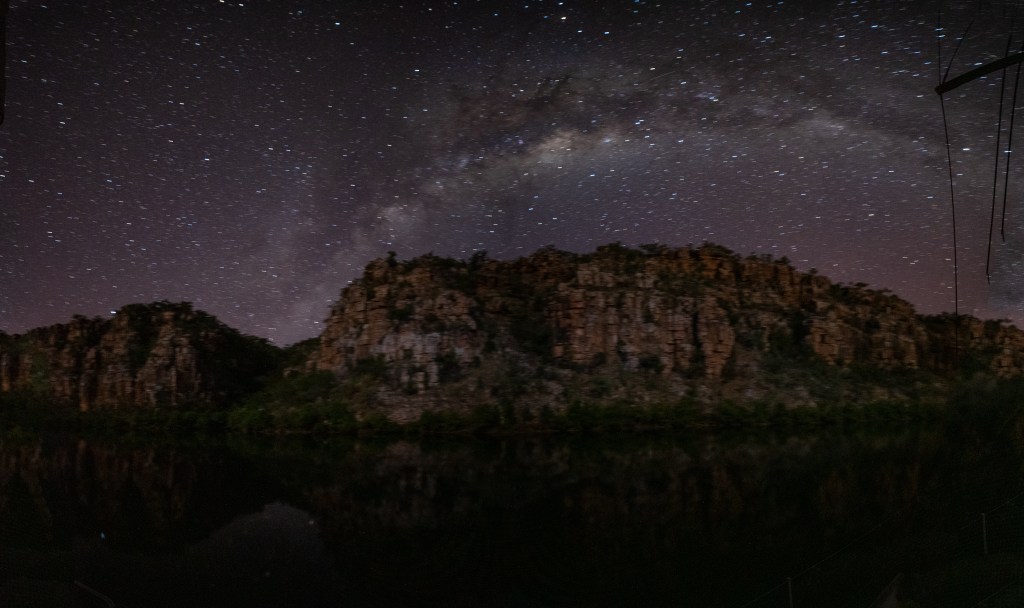
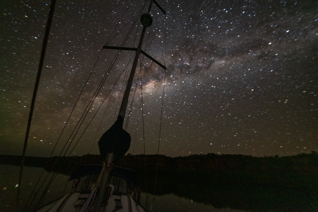
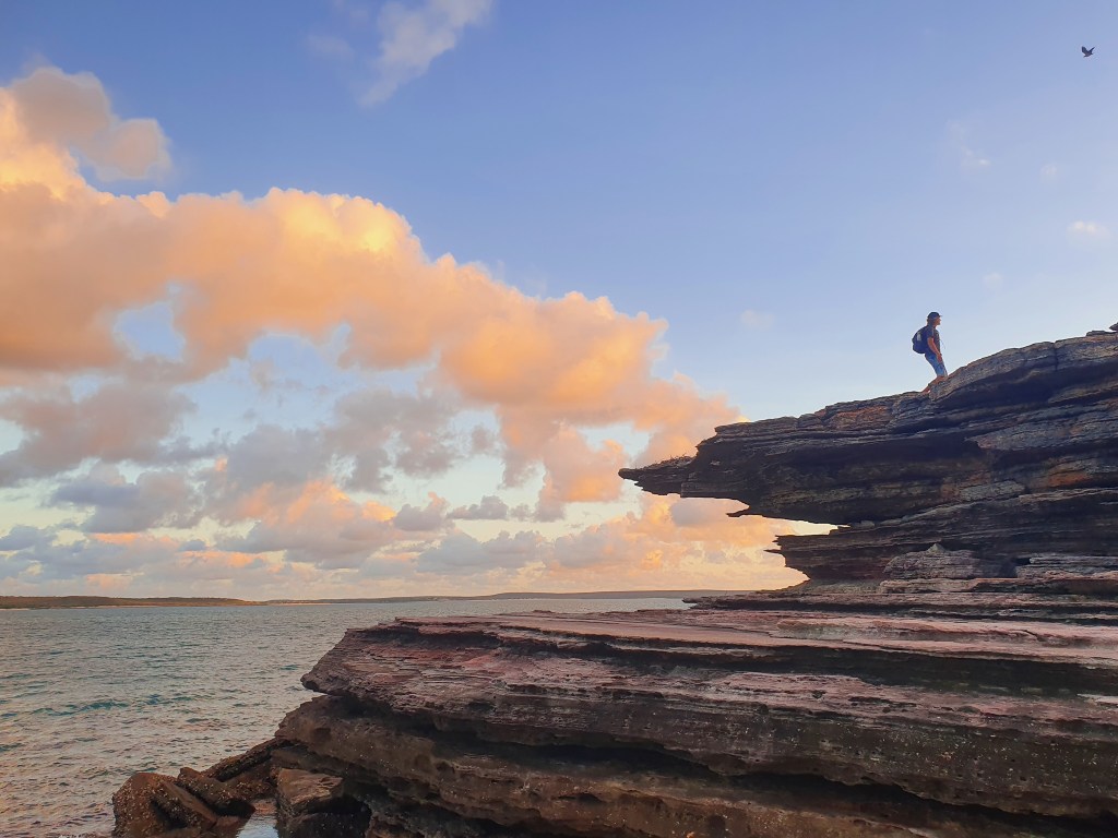
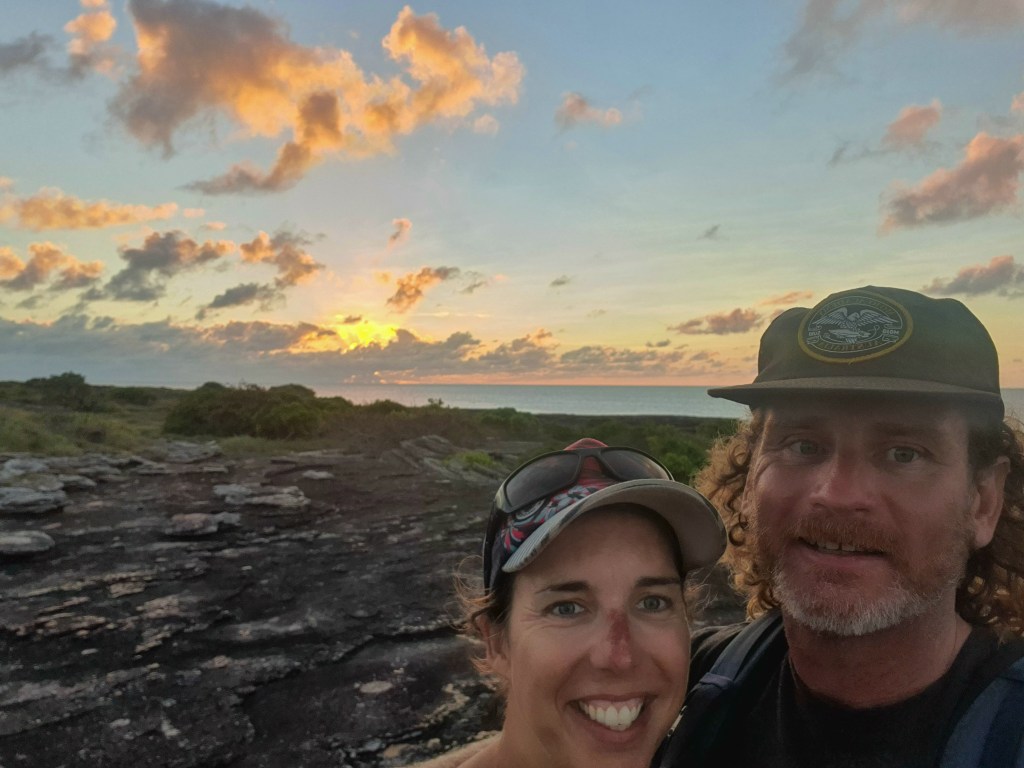
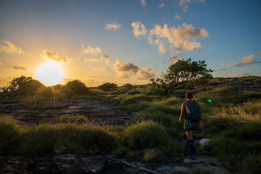
We decided to spend a night camping up on the clifftops so that Matt could try to photograph the Milky Way over the clifftops. Climbing back up the gully with our hiking packs on was a little more challenging, but we managed!! I set up camp and prepared dinner while Matt took photos in the magical sunset light and put the drone up to get another perspective.
Sun setting, Amphitheatre, Berkeley River
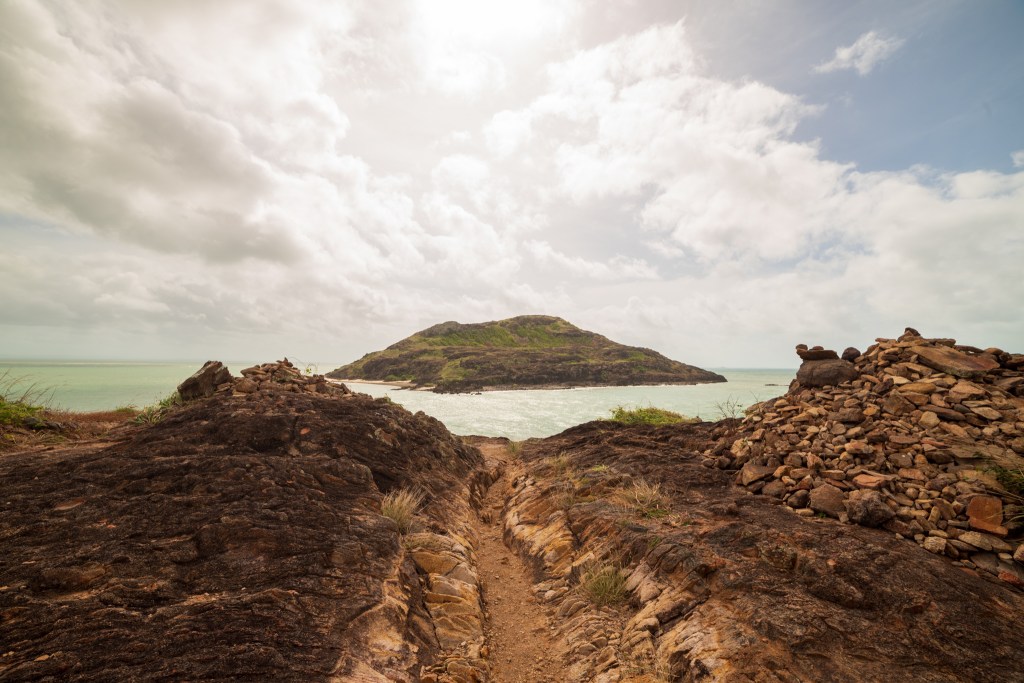
Rock cairns mark the track, Berkeley River
Sun setting, Amphitheatre, Berkeley River
Our little campsite, above the Amphitheatre, Berkeley River (Drone pic)
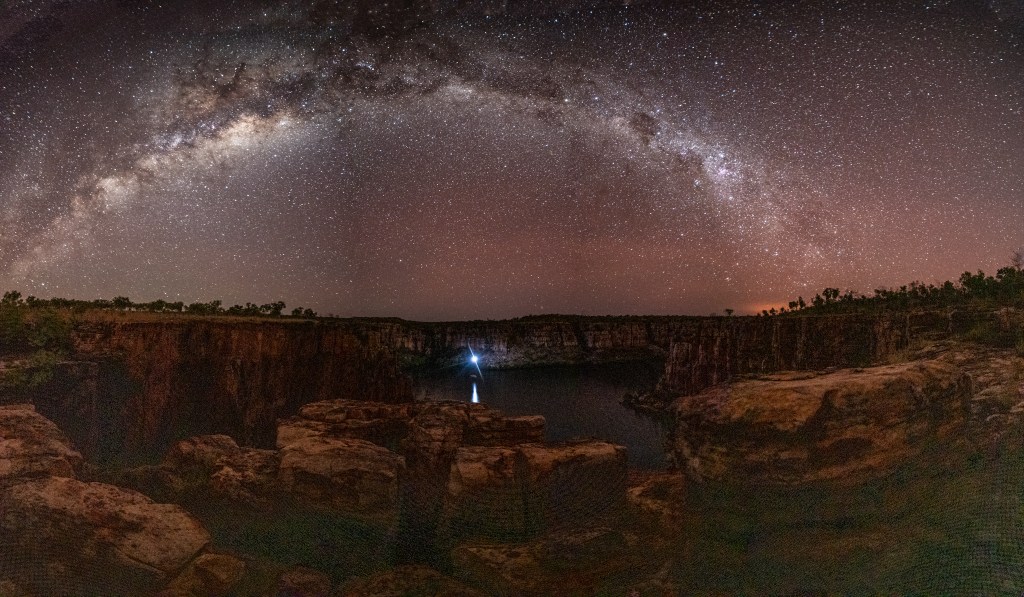
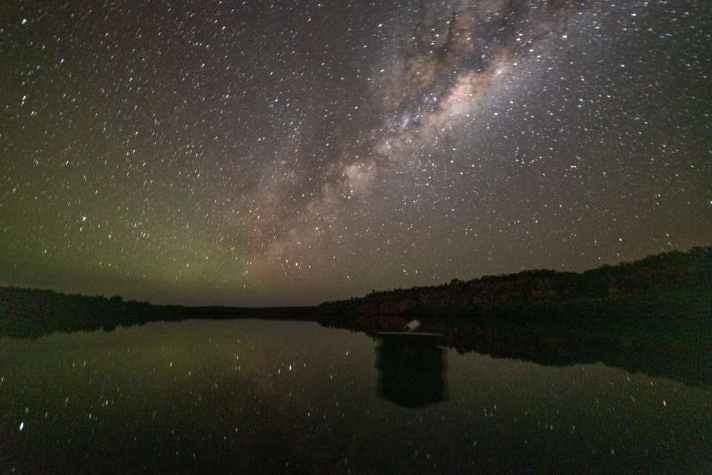
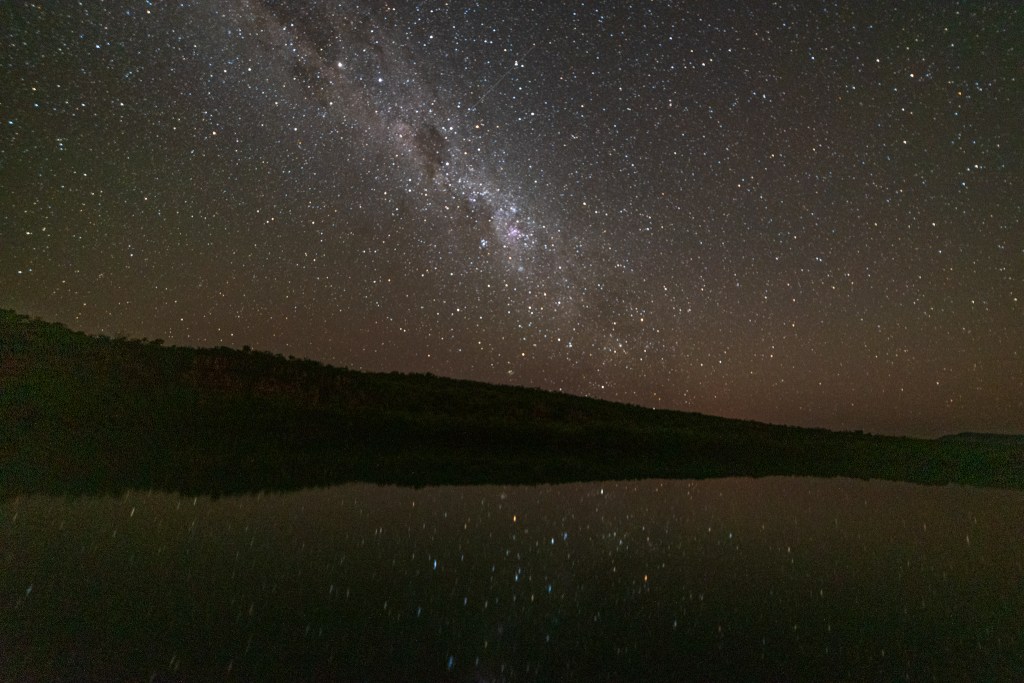
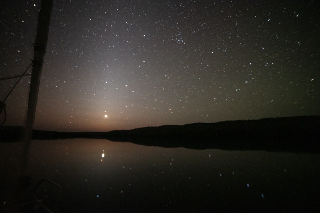
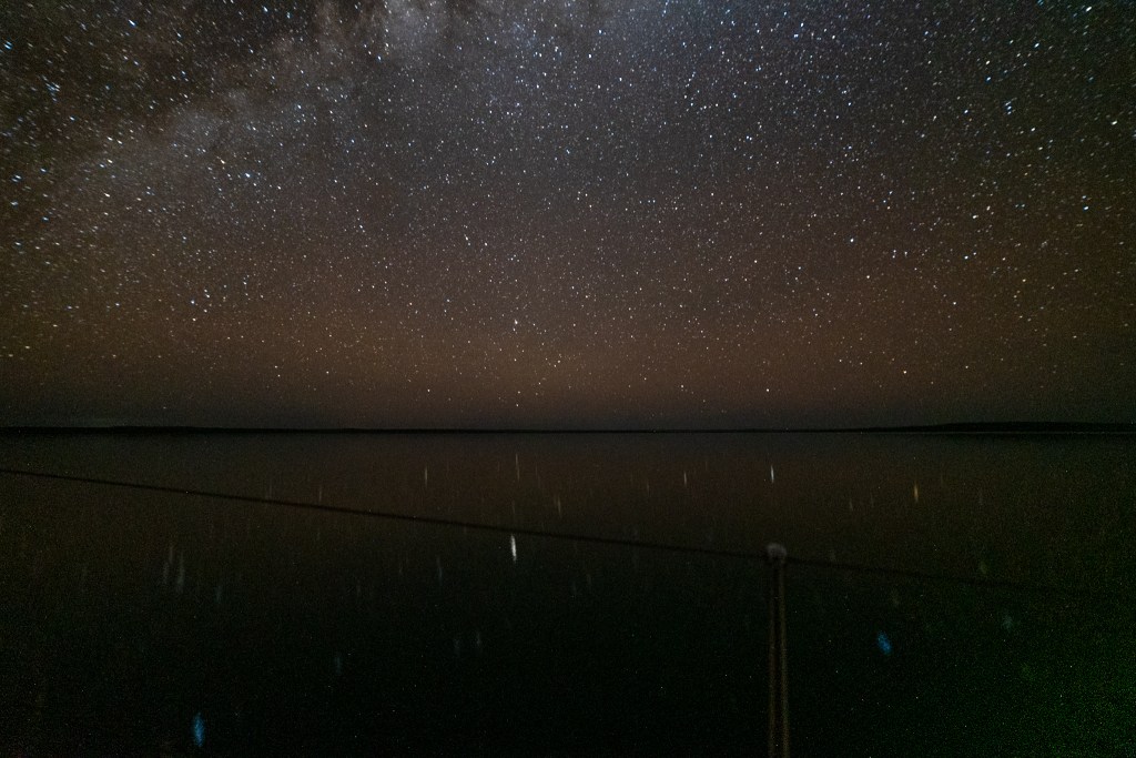
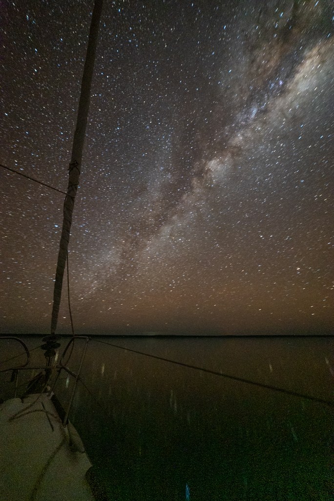
Clear skies and not much moon meant that we had the most extraordinary starry starry sky. It really was something to see the outline of the cliffs and the river below topped by the twinkling blanket of stars.
Night sky, Berkeley River
Night sky, Berkeley River
Night sky, Berkeley River
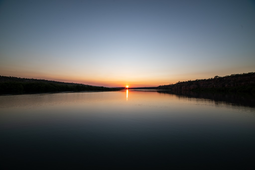
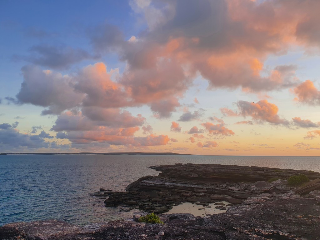
We watched dawn slowly creep over the river, and when I went to make our coffee, I returned to find Matt throwing rocks over the cliff, listening for the long silence before finally hearing the crash reverberating around the amphitheatre below. Seems boys will always be boys!
Morning light, Amphitheatre, Berkeley River
Morning light, Amphitheatre, Berkeley River
Morning light, Amphitheatre, Berkeley River
With such calm, still days and such incredible scenery surrounding us, it was the perfect place to play with the drone. We launched it off the bow of the yacht, on top of the amphitheatre and on several of our other hikes. Here are some of the best drone pics.
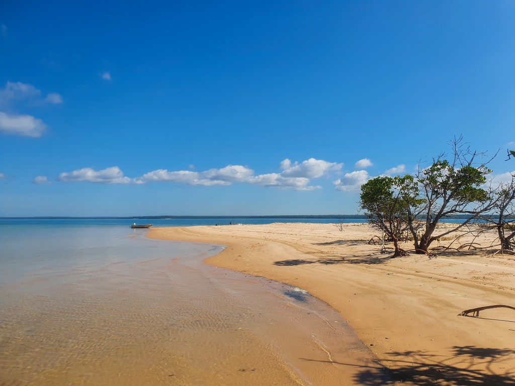
Berkeley River
Berkeley River
Berkeley River
Berkeley River
Berkeley River
Berkeley River
Berkeley River
Berkeley River
Berkeley River
Berkeley River
Berkeley River
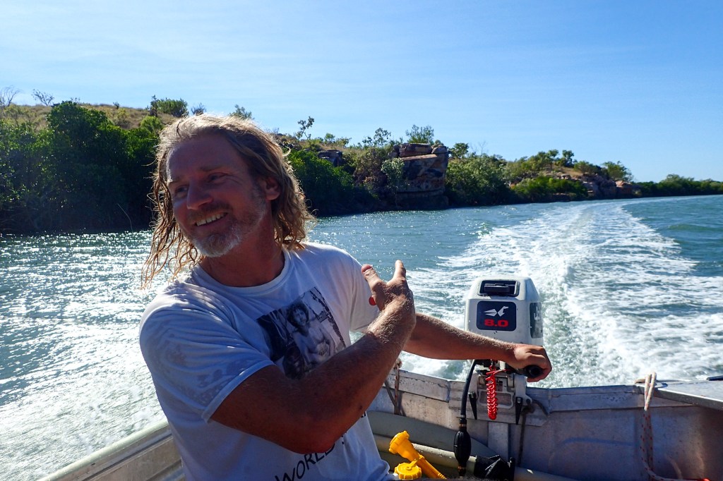
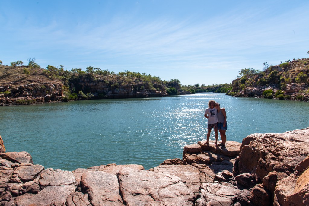
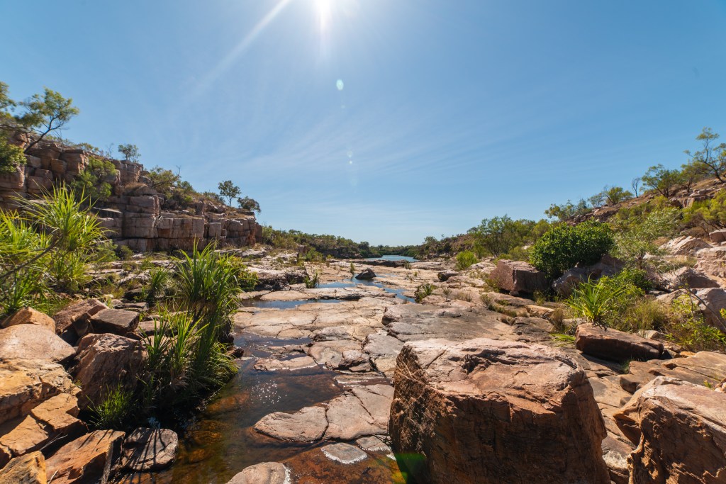
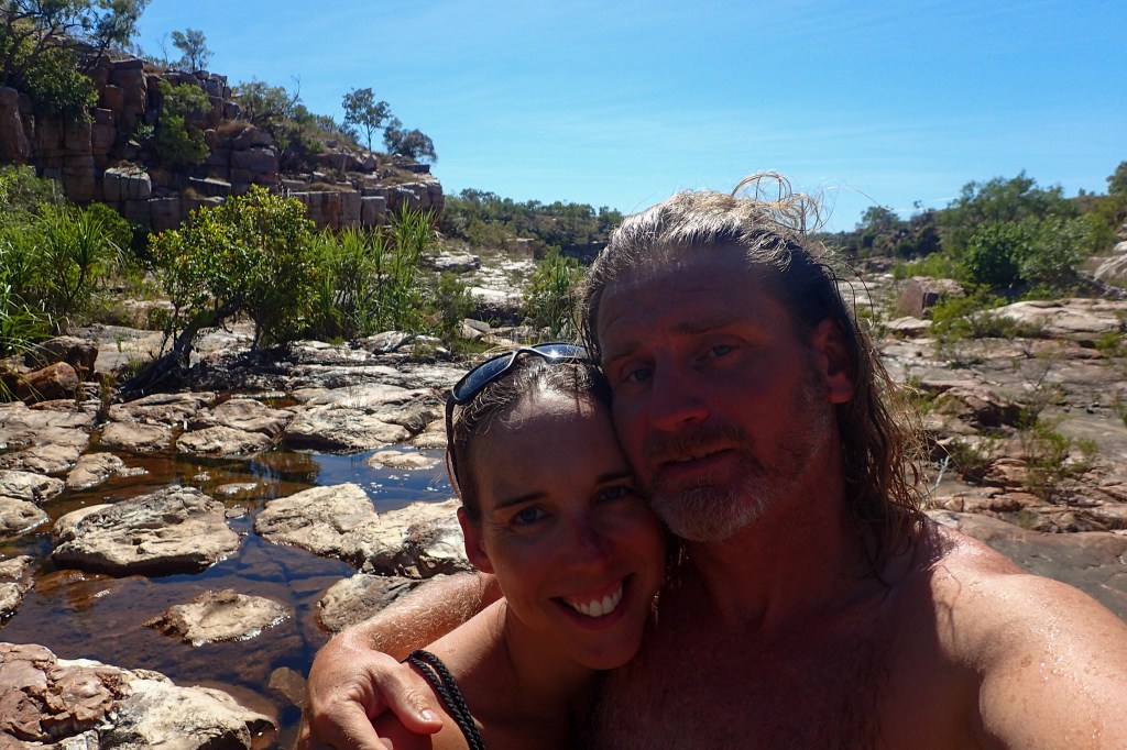
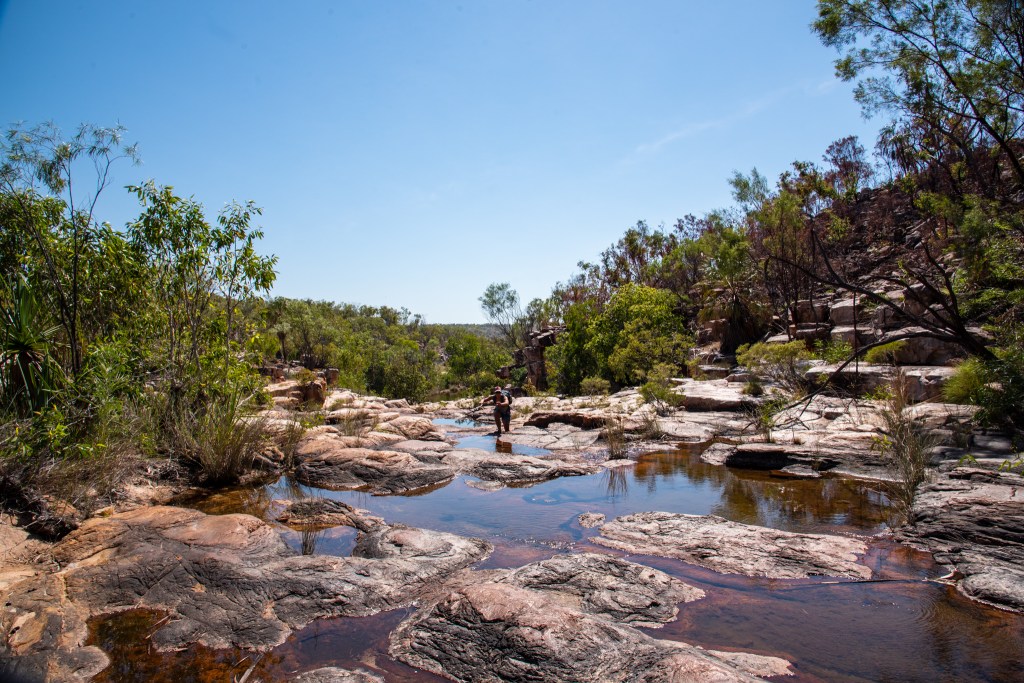
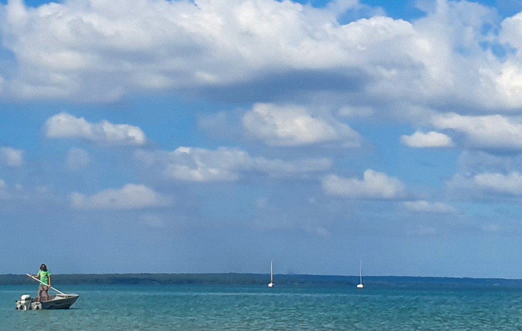
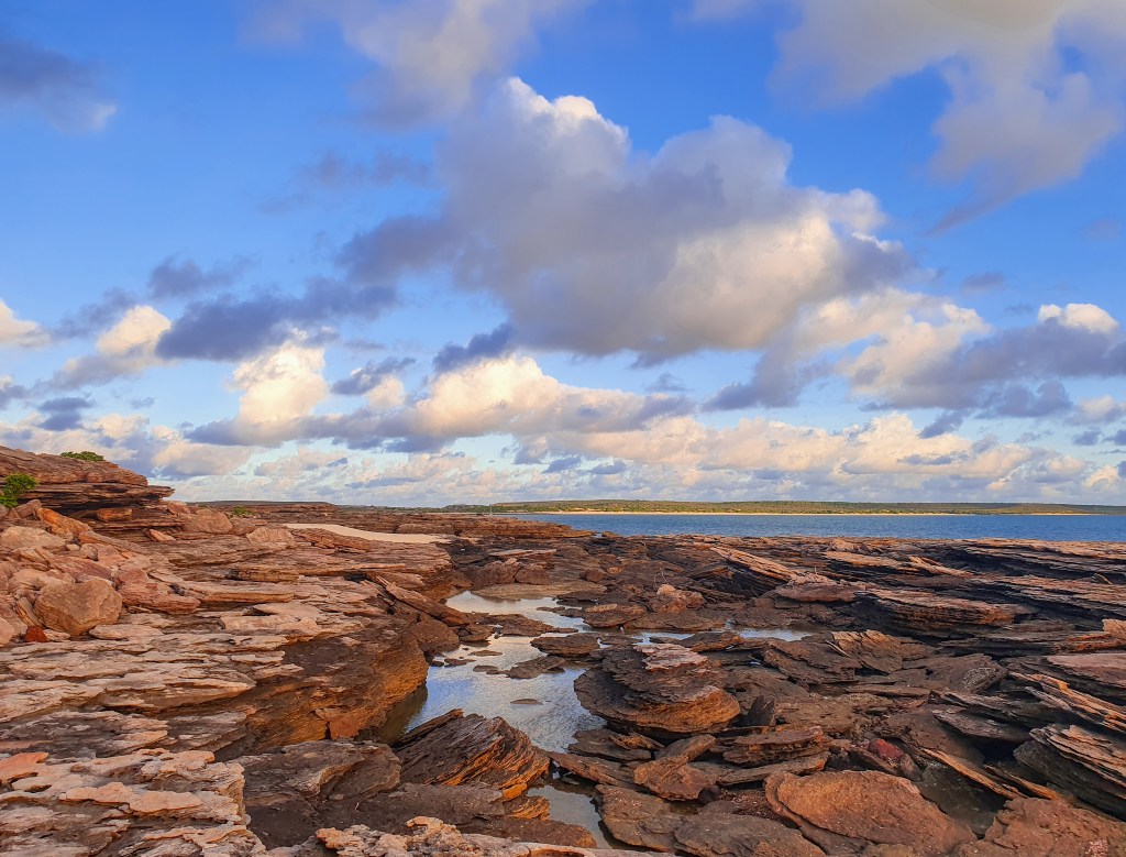
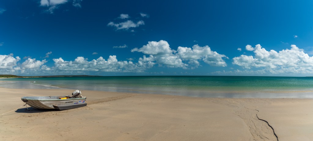
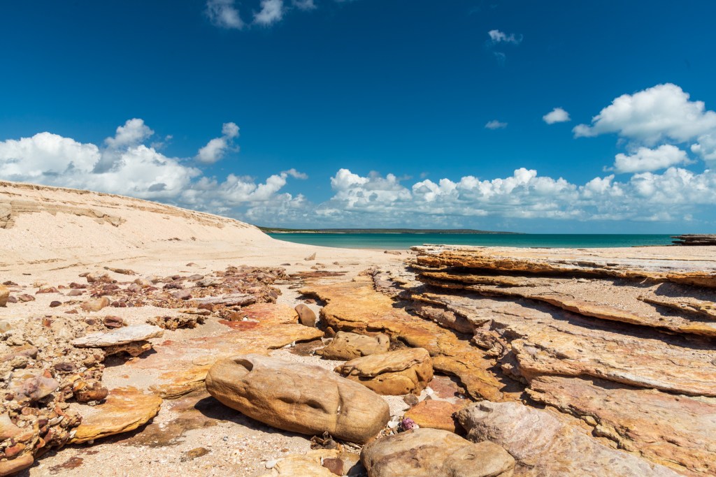
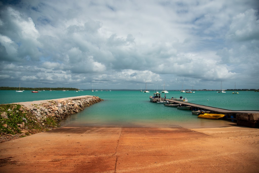
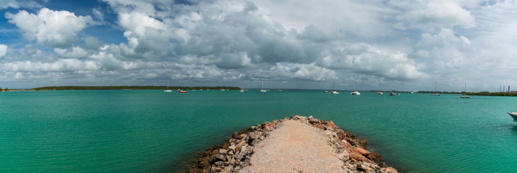
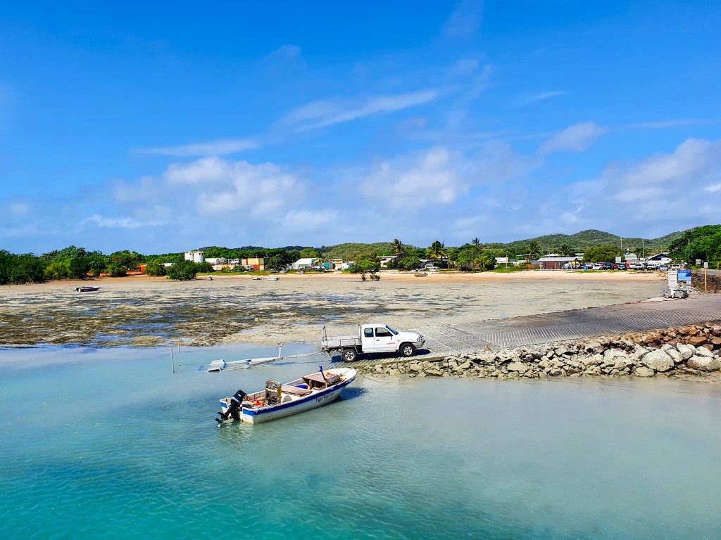
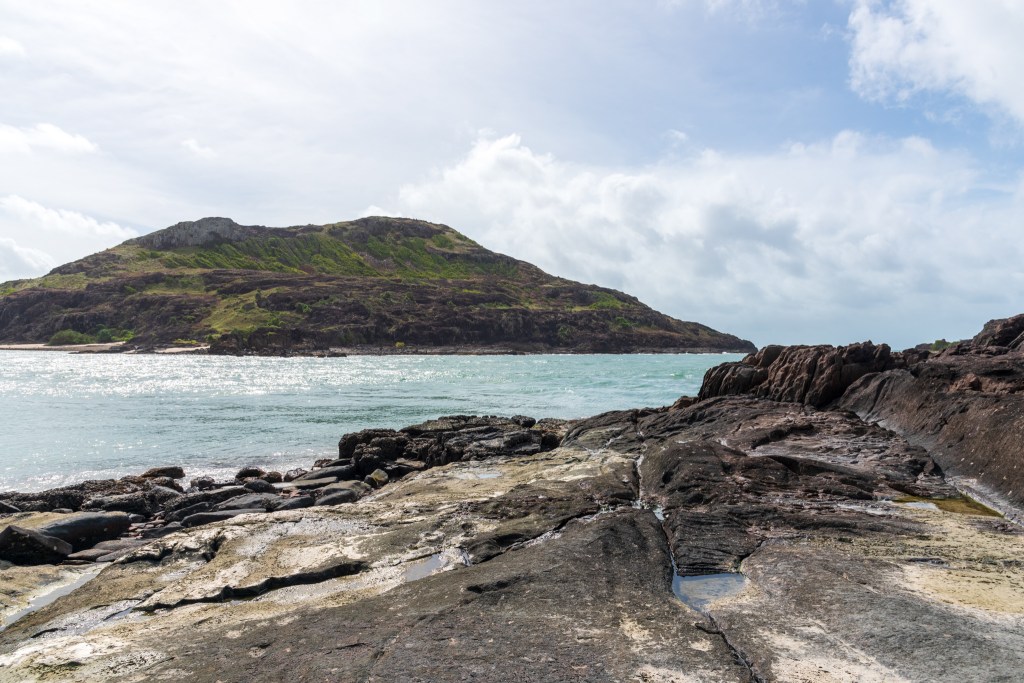
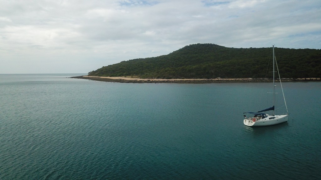
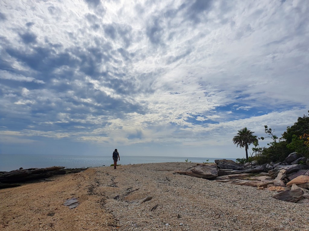
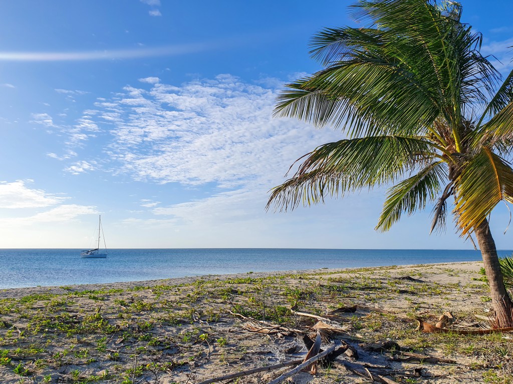
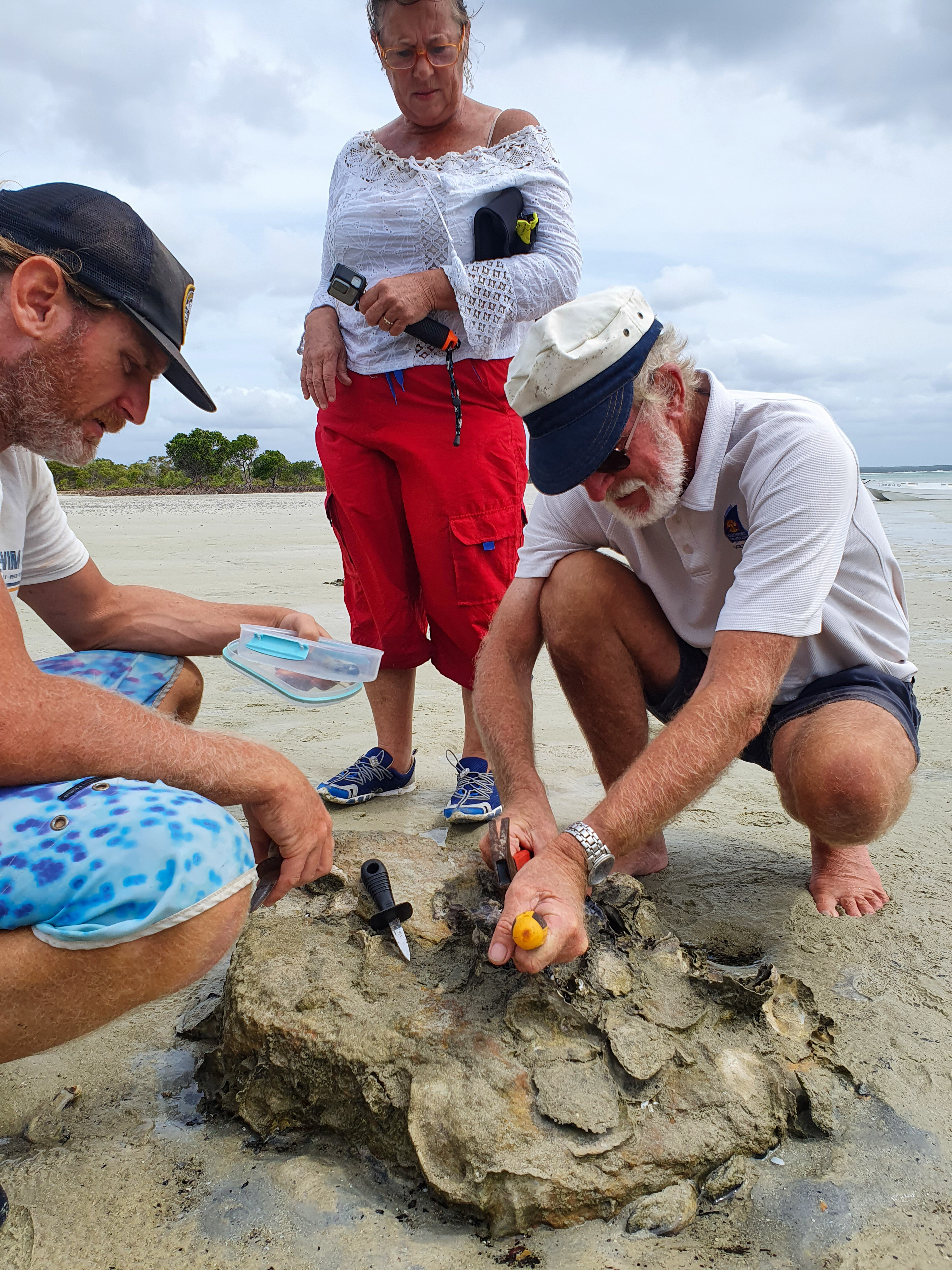
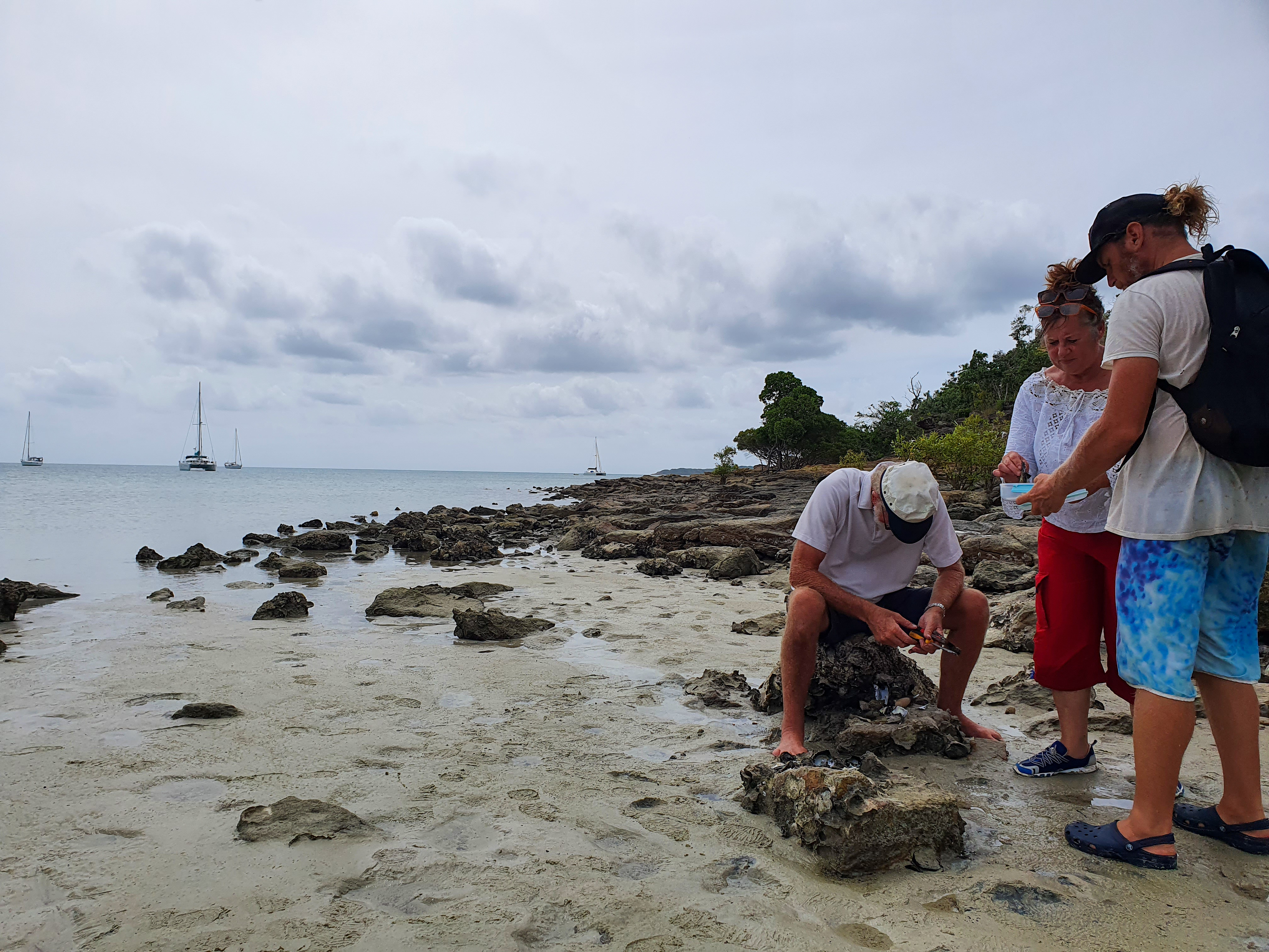
At the top of the river, as far up as is navigable in a tinny, is the Berkeley River rock bar. About 700 metres before you reach this, there is a little waterfall flowing in a small cove. We tied up here and clambered up the rocks to reach the creek above. It was a fairly easy and very pretty walk along the creek to some clear rock pools. The pools were surrounded by the most amazingly coloured slabs of rocks and stones. On our way back to Cool Change, we came across another yacht and went aboard to meet Steven and Marjery on Serenity. They were just visiting the river for a few hours but it was lovely to chat, and Steven gave us some tips and info for other spots in the Kimberley.
Creek near Berkeley River rock bar (Drone pic)
Little waterfall near Berkeley River rock bar
Lili pads in creek near Berkeley River rock bar
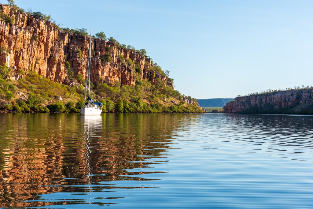
On our way back downstream we anchored right in the middle of the narrow gorge section, and spent an evening watching the stars. It was super still and incredibly quiet. There was an amazing echo if we banged or dropped something, so of course we tested it out by yelling a bit too. When a pod of dolphins came swimming past, we could clearly hear the whoosh of their breath echo throughout the gorge. A very special experience.
Berkeley River
Berkeley River
Berkeley River
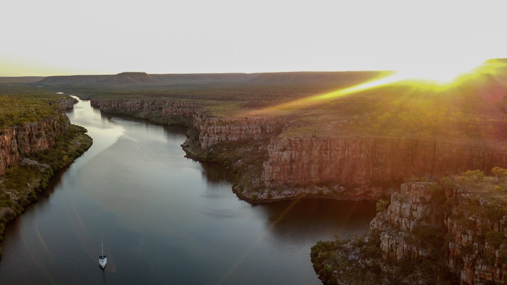
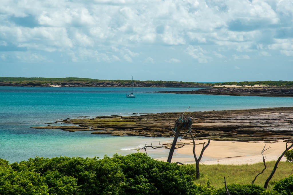
Motoring further downstream the next day, we had the video camera strapped to the mast, hoping to capture a similar experience to when we’d headed upriver. Unfortunately, a little wind meant no mirror reflections in the water this time. Approaching Casuarina Creek, we saw Sealeaf and Sens de la Vie pop up on our chartplotter. They’d finally arrived!! We all anchored there and went aboard Sealeaf for coffee. It was so great to see them all again and hear what they’d been up to. We were bursting to show and tell them all that we’d seen of the Berkeley, but decided not to show them any photos and to say very little, so that they could experience the wonder for themselves. I envied them having that first time seeing the gorges still ahead of them.
Although the others were tired after their overnighter across the Joseph Bonaparte Gulf, we stayed late on Sealeaf enjoying the company. These guys had all become very good friends of ours. We were to leave early the next morning on the high tide to make it out and over those pesky sandbars. If we stayed any longer we’d be in the river for another week or so until there was again enough water, and as much as we’d absolutely loved the Berkeley, there was lots more of the Kimberley that we were itching to see.
Sunset over Cool Change and Sens de la Vie, Berkeley River
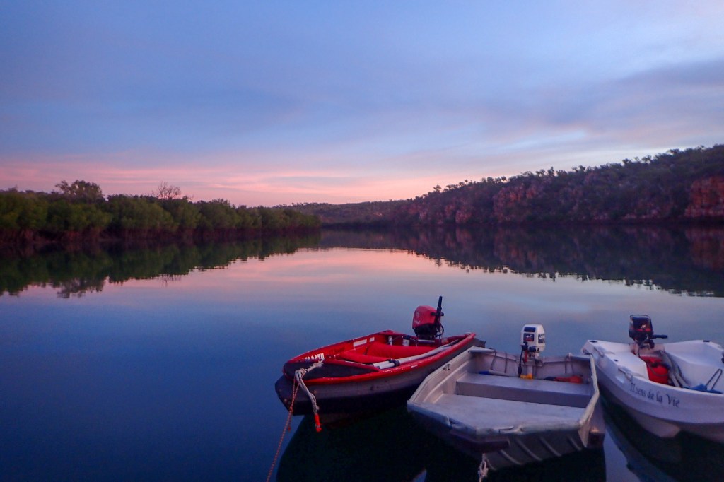
Three little tenders, Berkeley River
Farewelling the river, we reflected that it was probably one of the highlights of our entire circumnavigation. We knew that we had been in a special place and had a very special experience. And for the most part, we had been the only boat in there, having the whole river to ourselves. We’d also seen so many crocs that we stopped counting. We could definitely tick seeing a crocodile in the wild off our bucket list! And so, knowing that we’d been mighty impressed by the jewel in the Kimberley’s crown, we set off to discover how many other gems we could find.
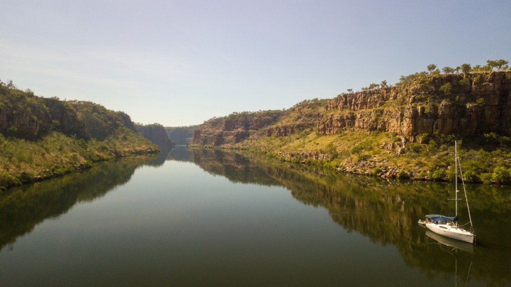
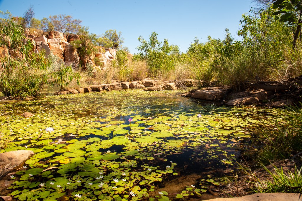
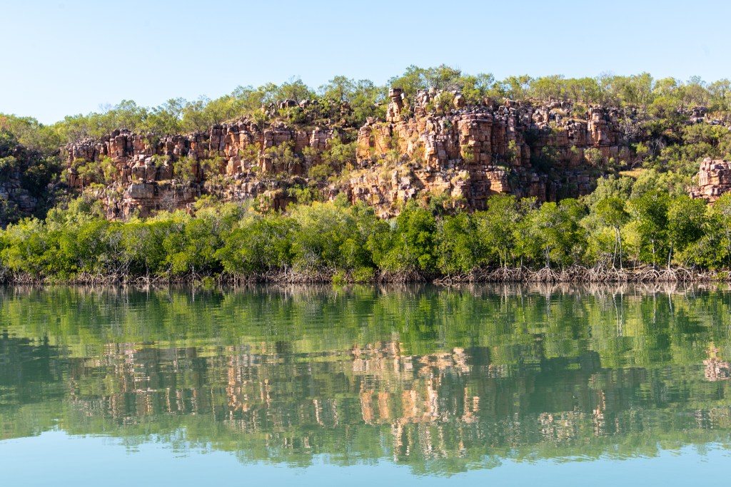
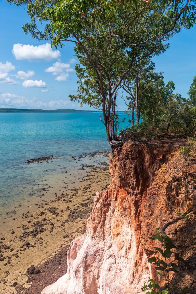
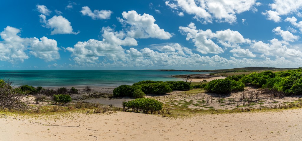
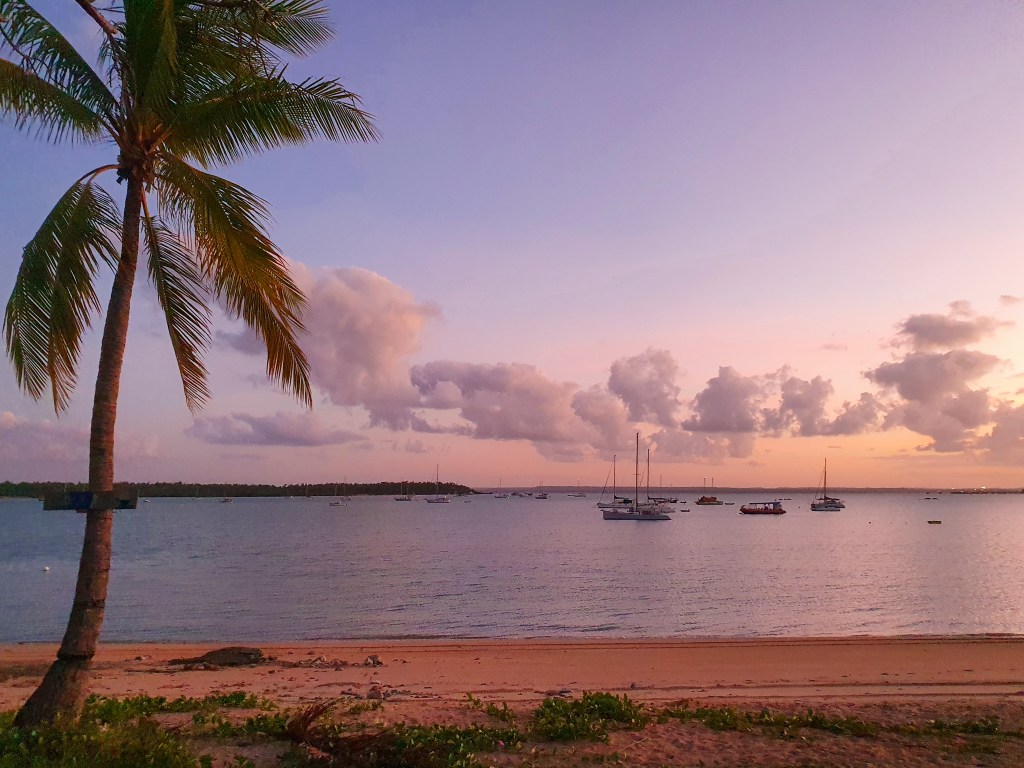
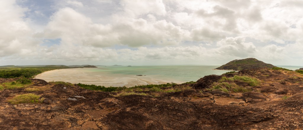
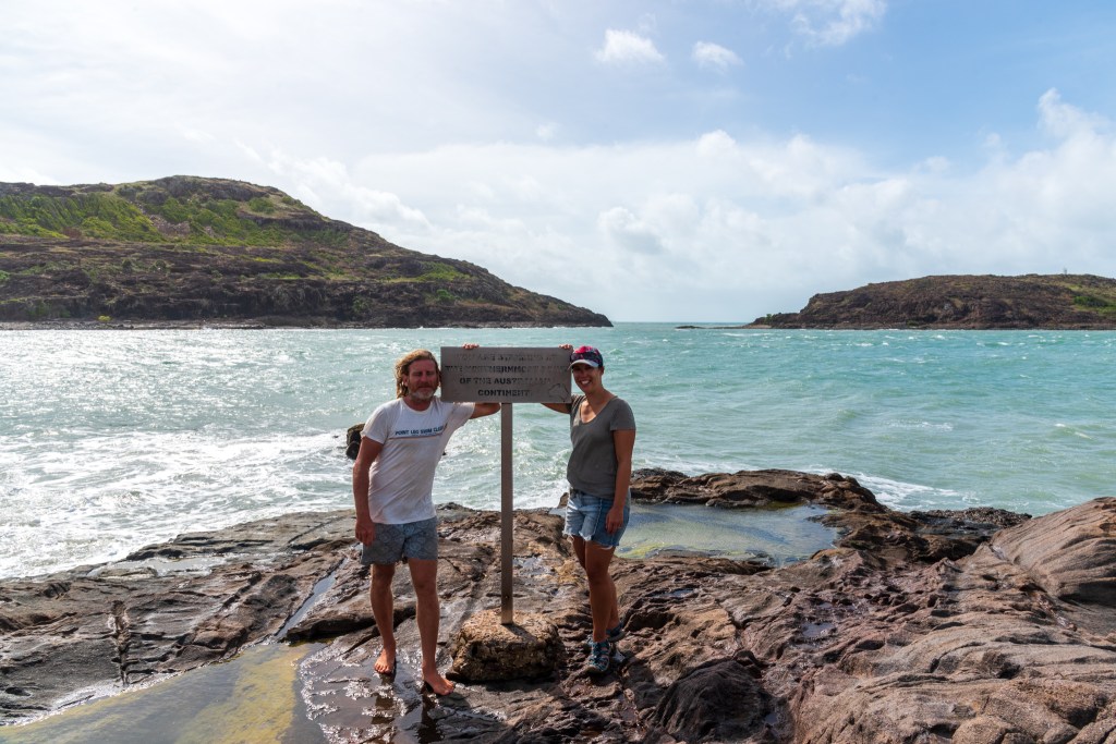
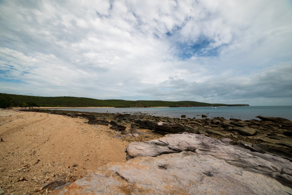
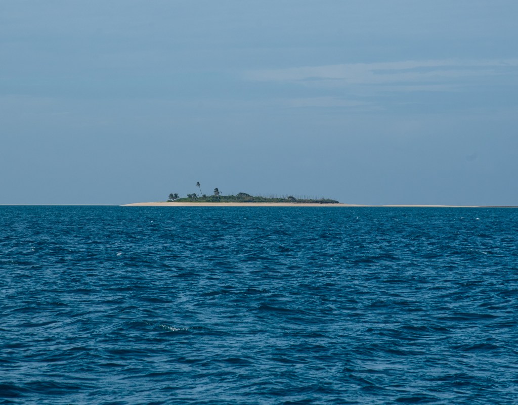
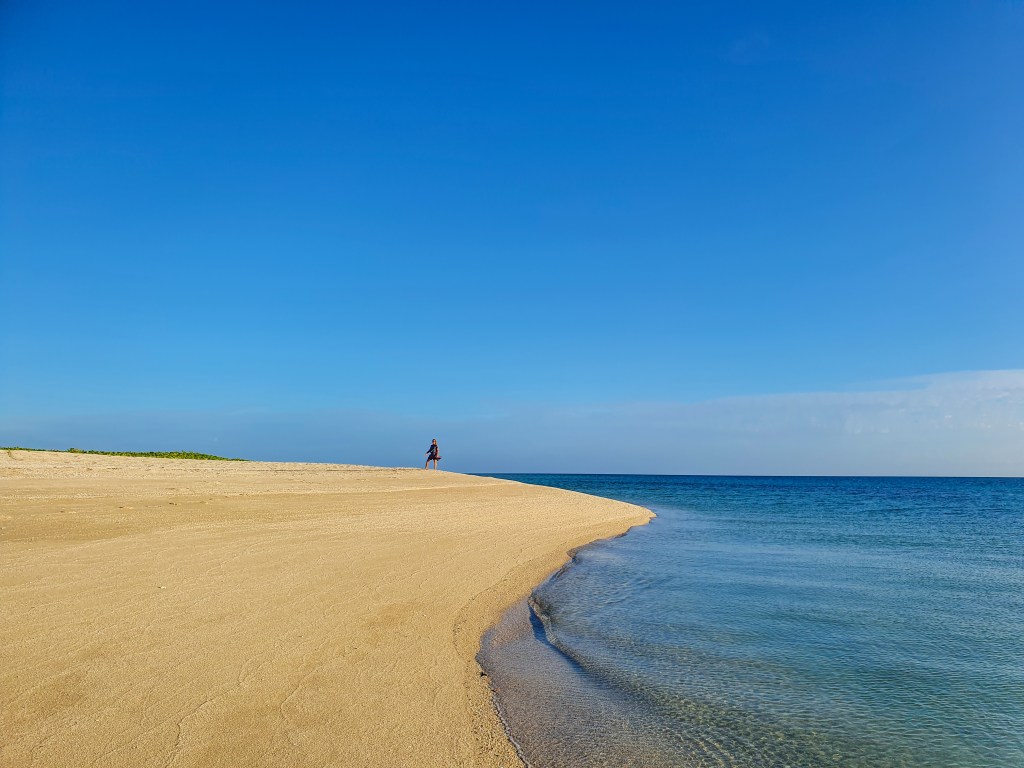
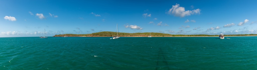
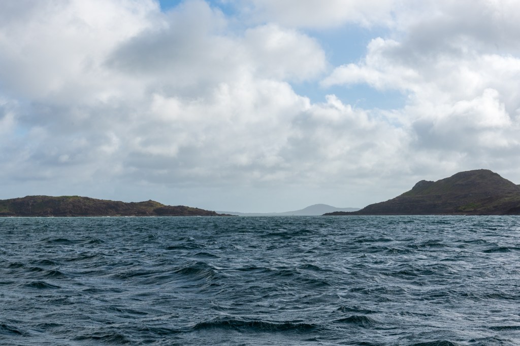
The Berkeley River, situated on the Joseph Bonaparte Gulf, is the eastern most part of the Kimberley, one of the oldest and largest wilderness landscapes in the world.
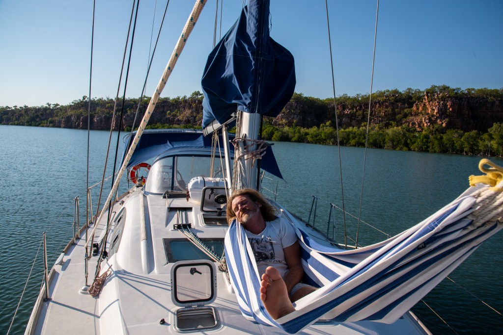
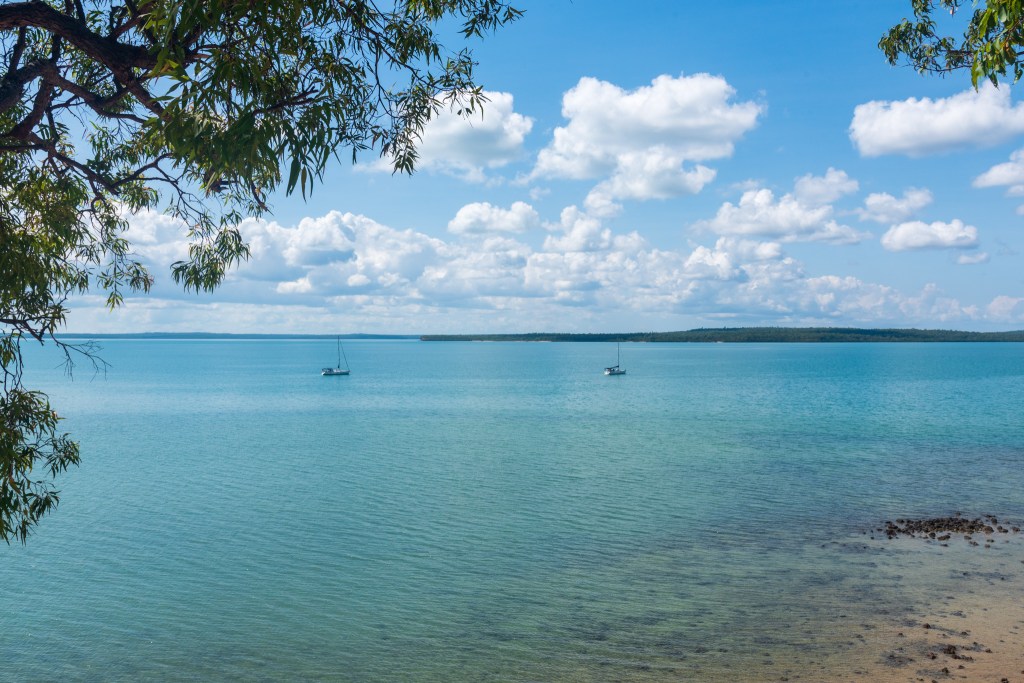
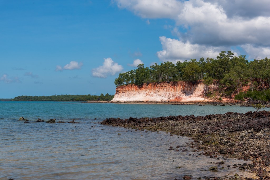
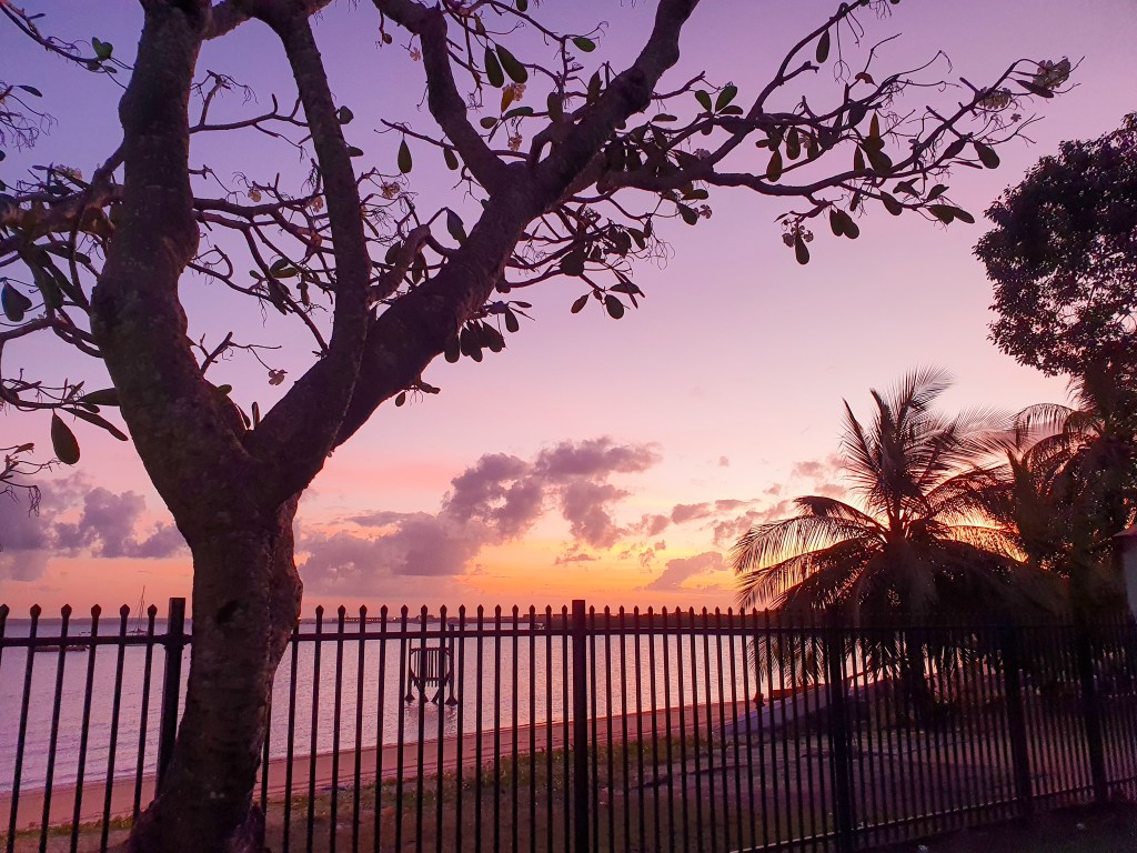
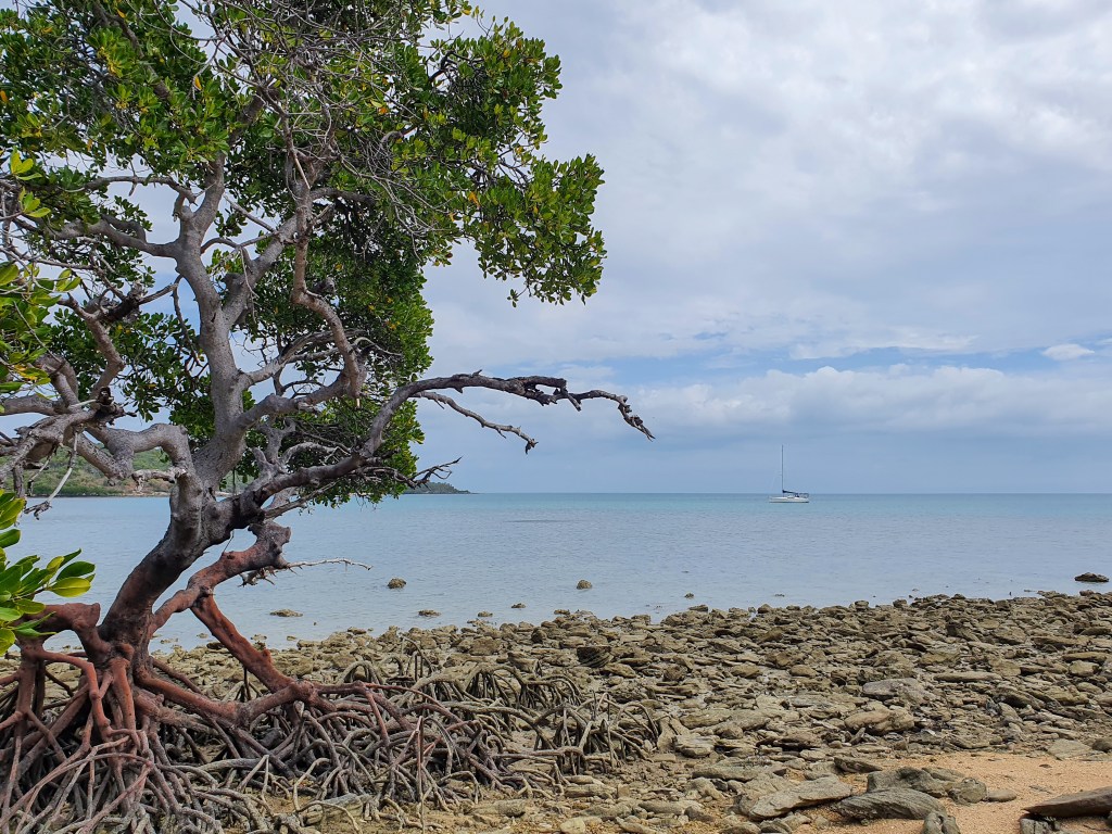
Our first peek at the Kimberley as we had approached at first light and sunrise had been a magical introduction and left us excited with anticipation for what we would find further in. As we entered the river, flat, wide and lined with mangroves, with the iconic chunky red cliffs looming, we both felt that we were in an incredibly special place. We spent two days anchored in the lower part of the river, just soaking up the scenery and the fact that we were finally here. Matt spent several hours lying in his hammock, just staring at the cliffs with his binoculars. ‘The scenery remains the same, but the colours change hour by hour’ was his profound assessment.
Berkeley River
Berkeley River
Hammock time, Berkeley River
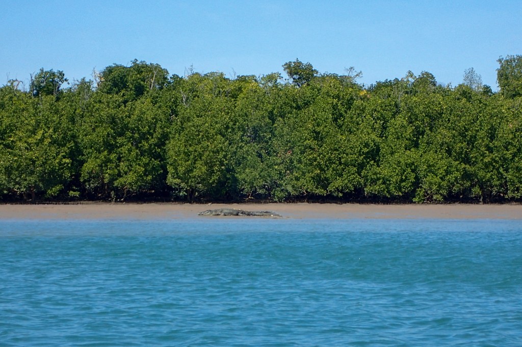
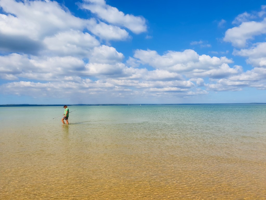
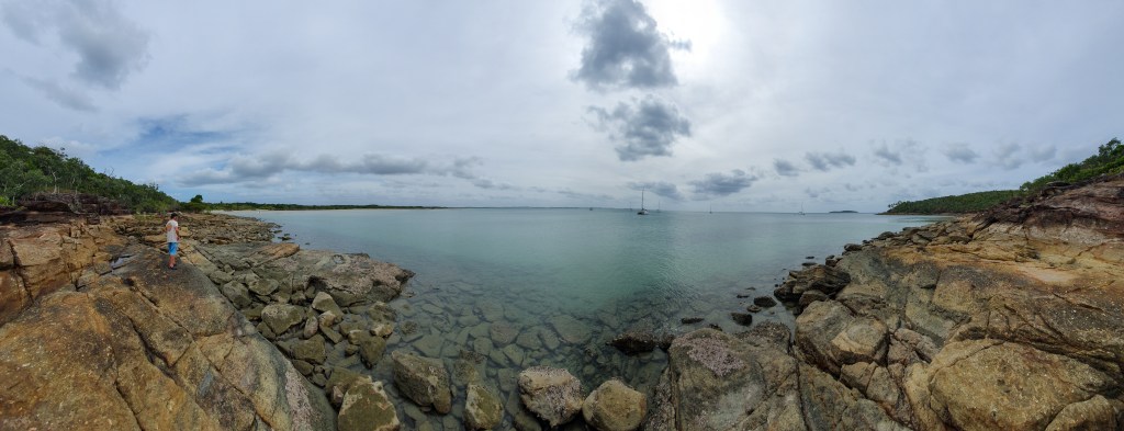
We took the tinny downstream to First Creek for our first exploration on land. Not minutes into the trip, we saw a crocodile swimming in the water on the other side of the river. He was a big one! It was a good reminder for us that we were now well into croc country. Time to be croc aware. At First Creek, we tied up to the rocks lining the small amphitheatre at the end of the creek and clambered up to the rock ledge. What an incredibly beautiful view back down the creek; the aqua water, lined with green trees and those remarkable red cliffs surrounding the sides.
Crocodile, Berkeley River
Happy out, Berkeley River
First Creek, Berkeley River
First Creek, Berkeley River
First Creek, Berkeley River
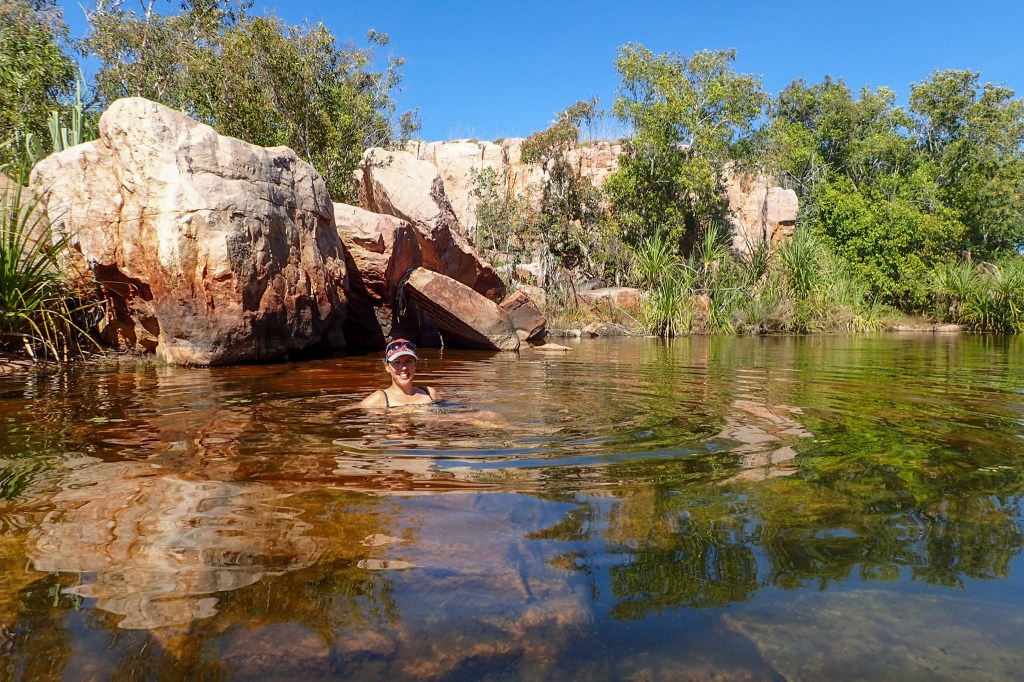
We walked back to where the waterfall would have been, but it wasn’t running this late into the dry season. We could see the large swimming hole that the guidebook described, but it was more of a puddle. There were a few small, clear, shallow pools that we had a quick dip in. Not a swim, per se, more of a plunge, but refreshing nonetheless.
First Creek, Berkeley River
First Creek, Berkeley River
First Creek, Berkeley River
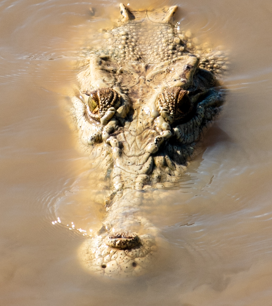
On our way back to the boat, we stopped off to say Hi to Dave and Michelle who had anchored Luna Sea near the mouth of the river in preparation for leaving the following day. We went back to Luna Sea for drinks later that day, and as we were speeding down the river, we turned a corner when suddenly we both gasped. The tide had gone out, and laying there on a newly exposed sandbank was an absolutely humungous croc. Thick and wide, he was at least the length of our little tinny. We grinned at each other, even as a shiver ran through me, now that was a croc!! Unfortunately, we didn’t have a camera with us, but there were to be plenty more.
Expressing our awe and wonderment about the river to Dave and Michelle, they told us that we hadn’t even seen the best bit yet. Not giving anything away, they just told us that it got more amazing upstream and to take our time. You’ll be the only boat up there, they added. Our stay having extended longer than intended, we waved goodbye and hopped into our tender in the dark. Very carefully and on high alert, we drove back to Cool Change, highly aware of the prehistoric monsters lurking in the river. Not something I’d want to do too often!
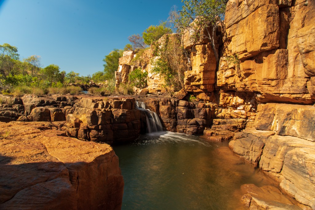
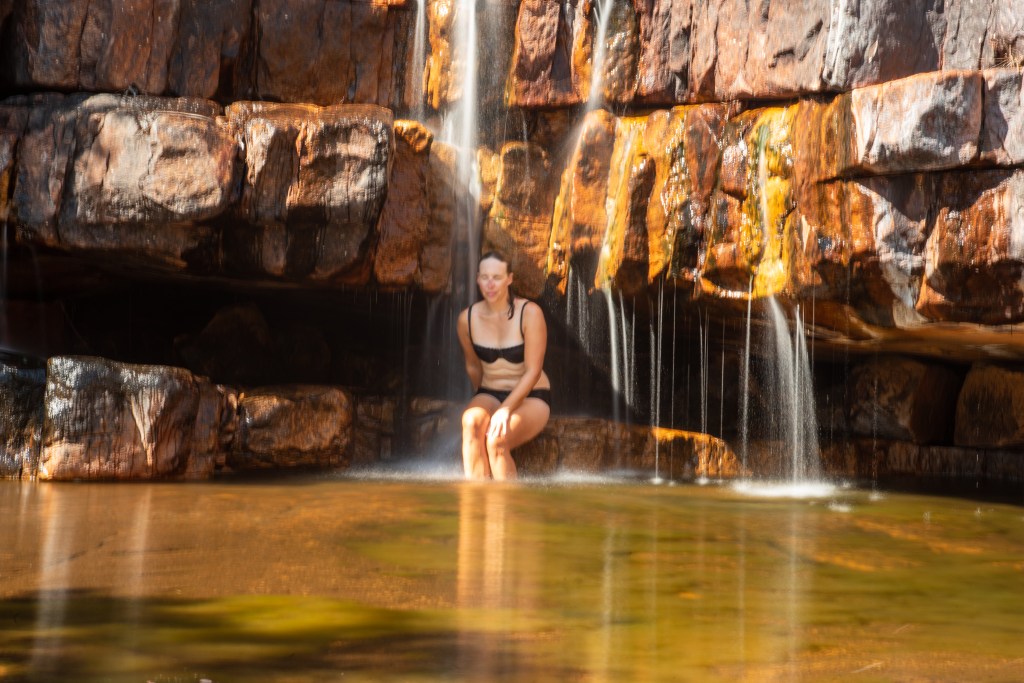
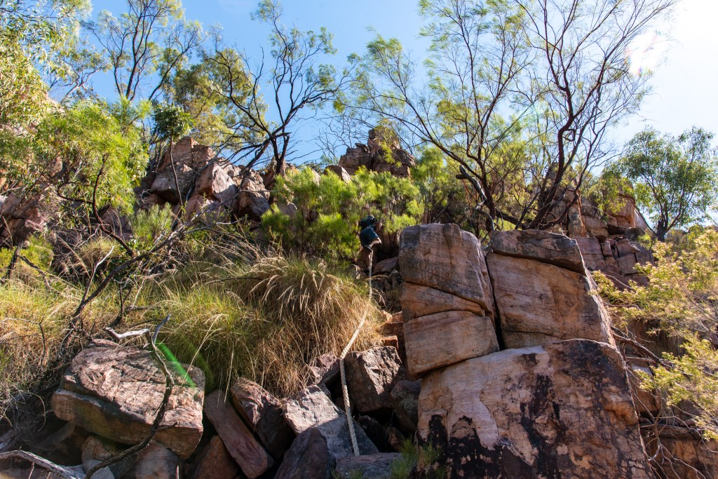
The following day we moved a little further upstream and went ashore to explore again; first to Pauls Creek and then to Casuarina Creek. Pauls Creek involved a short climb up some steep rocks, but a rope that a thoughtful yachtie put there proved very helpful. Once up the top, we followed a trail of rock cairns for a while until we dropped down into a little billabong with a large clearing, a waterfall and a swimming hole. It was a lovely, peaceful place. We wallowed in the small pools and luxuriated under the waterfall.
Pauls Creek, Berkeley River
Pauls Creek, Berkeley River
Pauls Creek, Berkeley River
Pauls Creek, Berkeley River
Pauls Creek, Berkeley River
Descending via the rope, Pauls Creek, Berkeley River
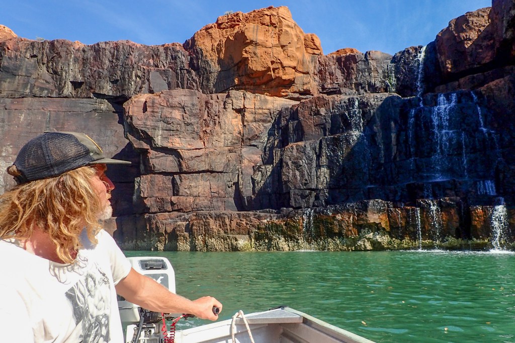
Casuarina Creek, with the little island in front of the waterfall, is an iconic feature of the Kimberley. We tendered in, gasping in wonder as the creek widened to reveal the sheer cliffs framing the edge of the bowl that the waterfall flowed over. The waterfall was only a trickle, but as Matt edged the tinny right underneath it, you could just imagine the awesome power it must hold in the wet season, cascading down all the way across the cliffs.
Casuarina Creek, Berkeley River
Casuarina Creek, Berkeley River
Waterfall, Casuarina Creek, Berkeley River
We found the spot to leave our tinny, tied it onto the rope and scrambled up the rock scree. Following the track marked by rock cairns we wound our way around until we were directly above the falls. The view from up the top, looking down at the creek was spectacular.
Casuarina Creek, Berkeley River
Casuarina Creek, Berkeley River
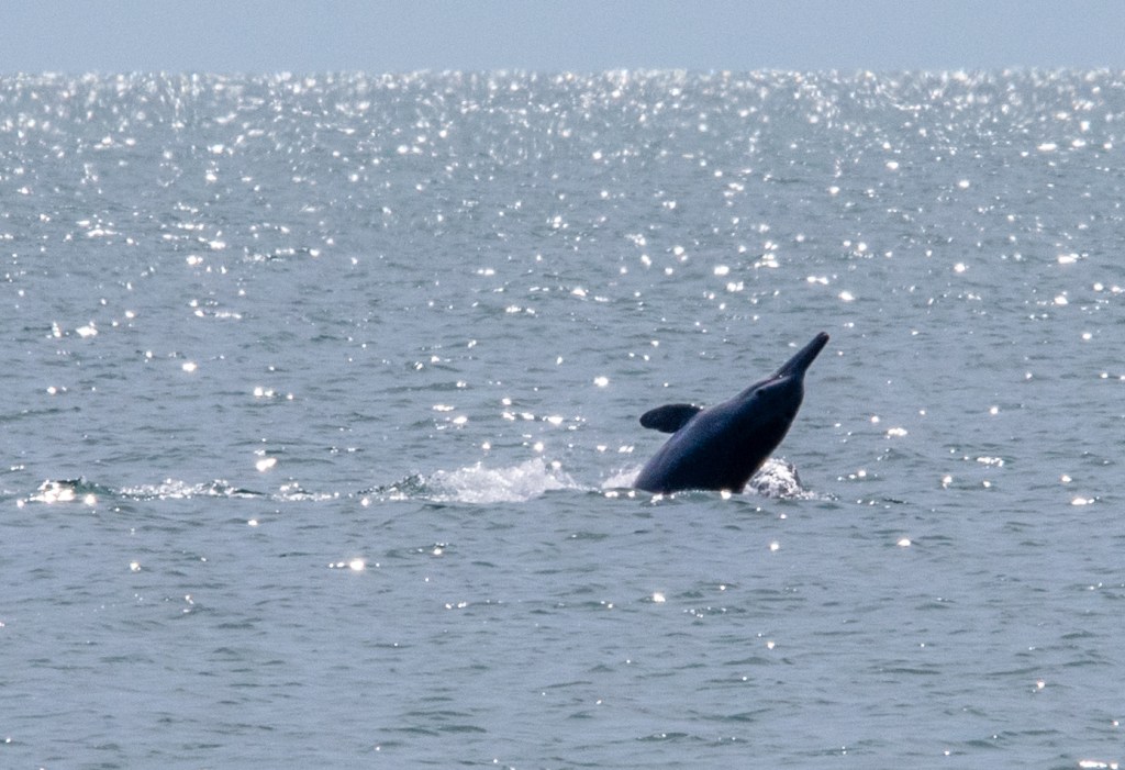
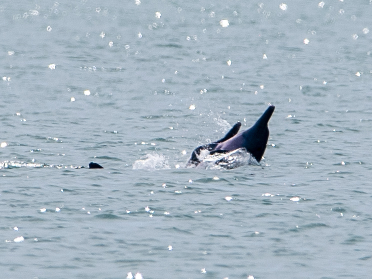
As we stopped along the way to take photos, we watched three dolphins swim into the creek, around the island and back out again. They paused a few times, and there was some violent thrashing in the water as they caught fish. It was incredible to watch.
Dolphins catching fish
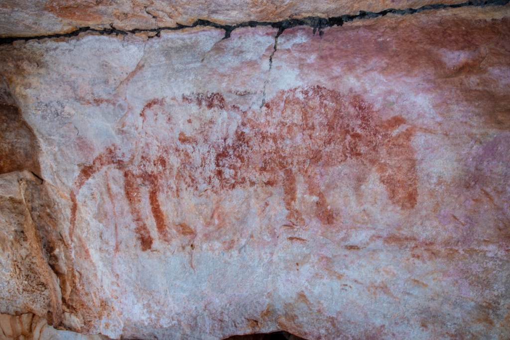
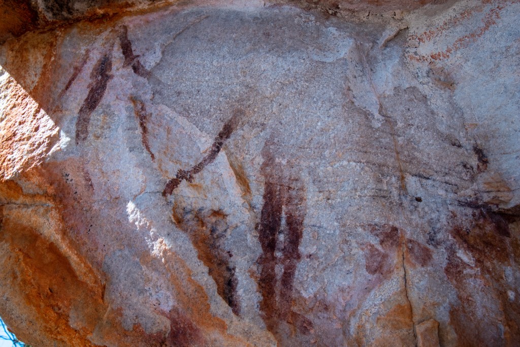
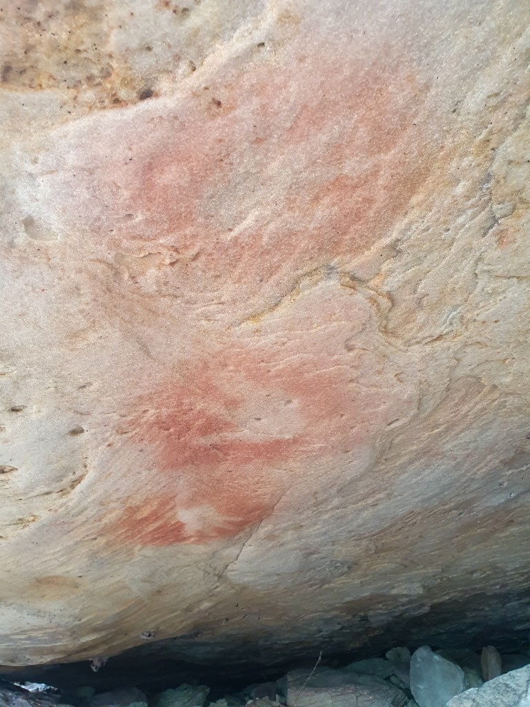
We wandered along the creek bed at the top, clambering up and over rocks of all different sizes to check the rocky overhangs for the Aboriginal art that was supposed to be easy to find. Eventually we found a couple of pictures in a small cave. Finally, success! Although we searched for ages, and again on a subsequent occasion, they were all we found. I’m not sure if there are others.
At the top of Casuarina Creek, Berkeley River
Rock art, Casuarina Creek, Berkeley River
There were lots of small rock pools that had some clear water in them, so we enjoyed a refreshing dip to cool off. On our way back down the creek bed, Matt stopped in front of me. Putting his finger to his lips, he beckoned me over and pointed to the middle of one of the larger waterholes. There, sunning himself on a rock was a little freshwater croc. Matt took some photos and we watched him for a while.
Casuarina Creek, Berkeley River
Freshwater crocodile, Casuarina Creek, Berkeley River
That night we looked up to see a sky bursting with stars that were amazingly bright. Because the night was so still, the blanket of stars was reflected in the water below, creating a magical starry landscape all around us.
Starry starry night, Berkeley River
Starry starry night, Berkeley River
Starry starry night, Berkeley River
Starry starry night, Berkeley River
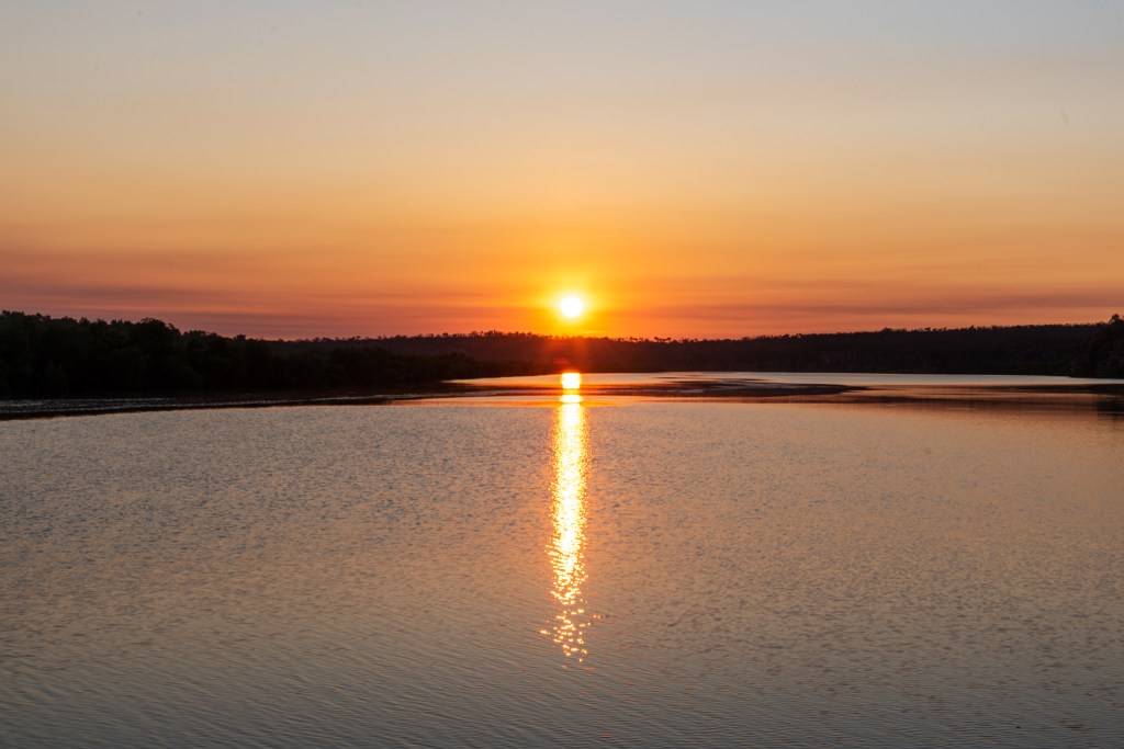
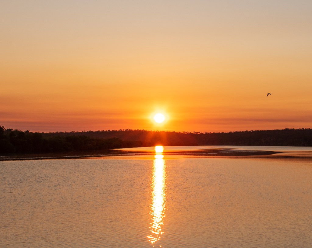
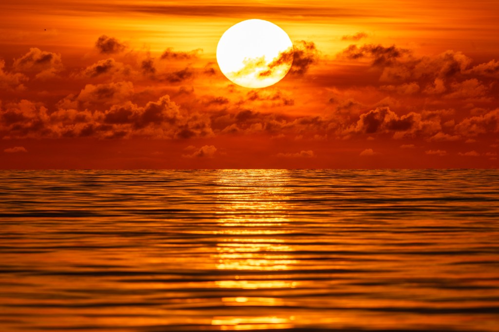
Neither of us being naturally early risers, we didn’t ordinarily see that many sunrises, but with the time zone change moving into Western Australia, our body clocks tended to wake us up at sunrise and we fell into a rhythm of going to bed not long after sundown and rising with the sun. One morning we were up and as we watched the sunrise it was an incredible glowing red colour, with its light reflecting on the still water of the river. I christened it ‘red carpet to the sun.’
Sunrise, Berkeley River
Sunrise, Berkeley River
Sunrise, Berkeley River
By this time we had spent three full days immersing ourselves in the incredible scenery of the Berkeley River. We both felt that we were somewhere truly special. Little did we know that the best really was yet to come, and that we were about to undertake a very special journey, one of the highlights of our entire trip.
I’ll leave that for Berkeley River – Part 2.
Experiences are infinitely more memorable than stuff.
It was with the utmost relief that we sailed out of Fannie Bay and away from Darwin. It was time to leave all the covid/lockdown rubbish behind us. I felt incredibly grateful that we were able to escape in this way.
Over the next four days we made our way down the east coast of the Joseph Bonaparte Gulf, stopping at Fog Bay, Cape Scott and Dooley Point. We mostly sailed, although several afternoons the wind died out completely, leading to us switching the motor on for a couple of hours to get to our anchorage. We spent a day at Cape Scott, walking along the long deserted beach.
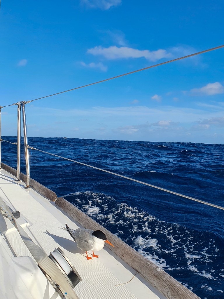
During these days we saw no other people and no other boats, although we did have a visit from some dolphins, which is always very special.
Dolphins, Joseph Bonaparte Gulf
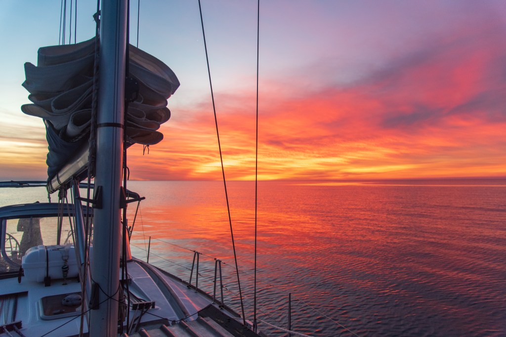
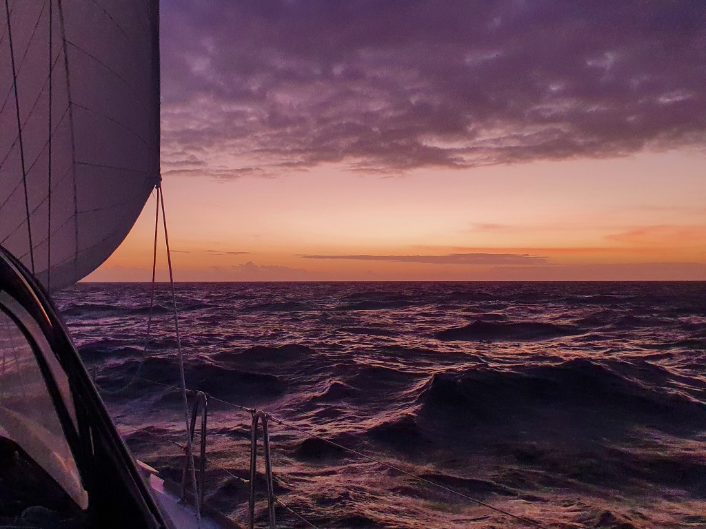
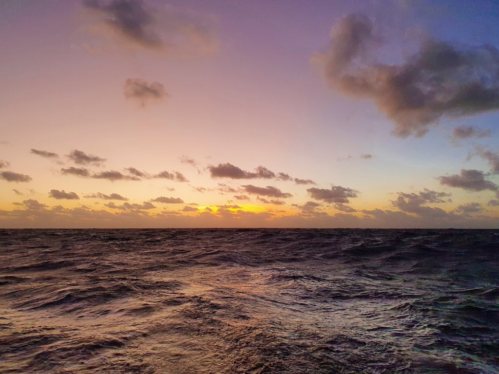
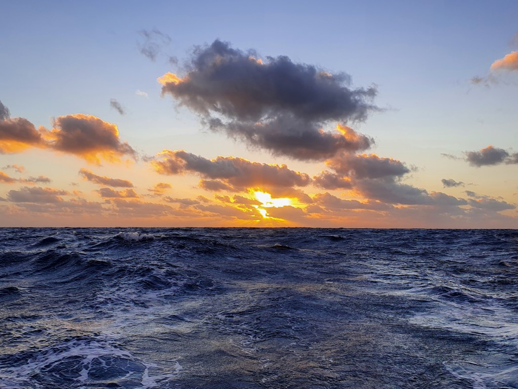
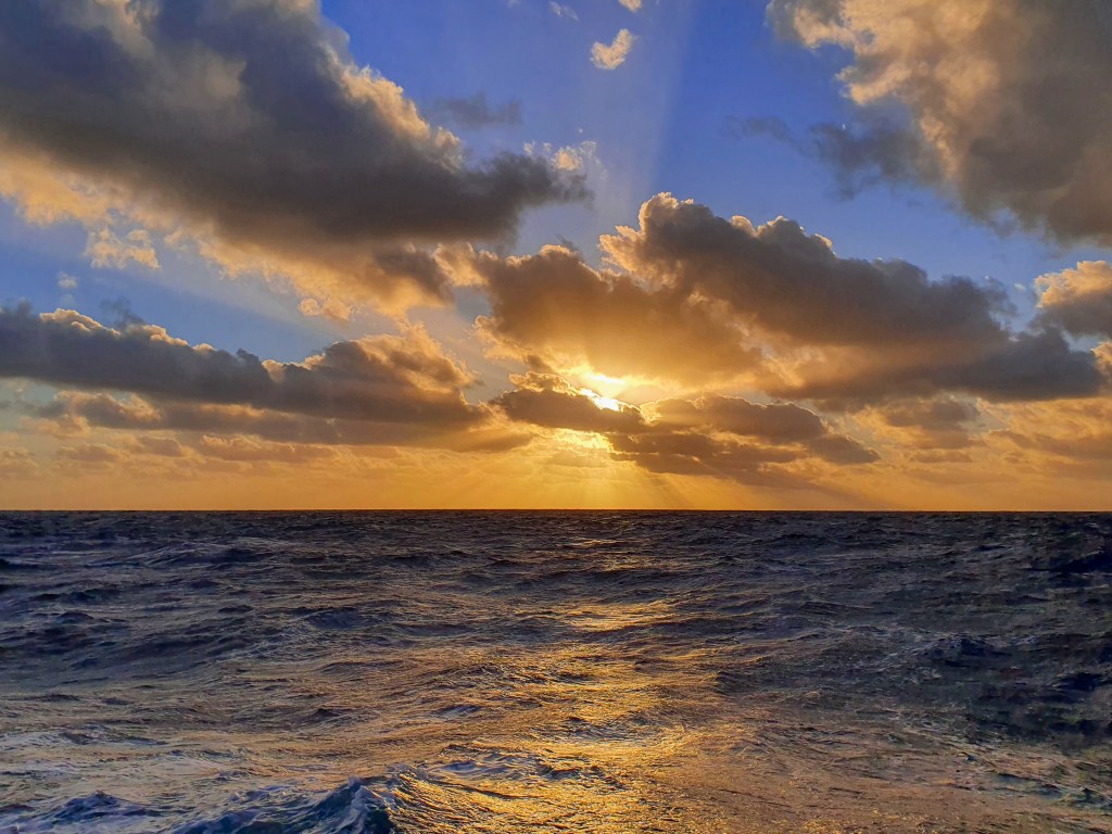
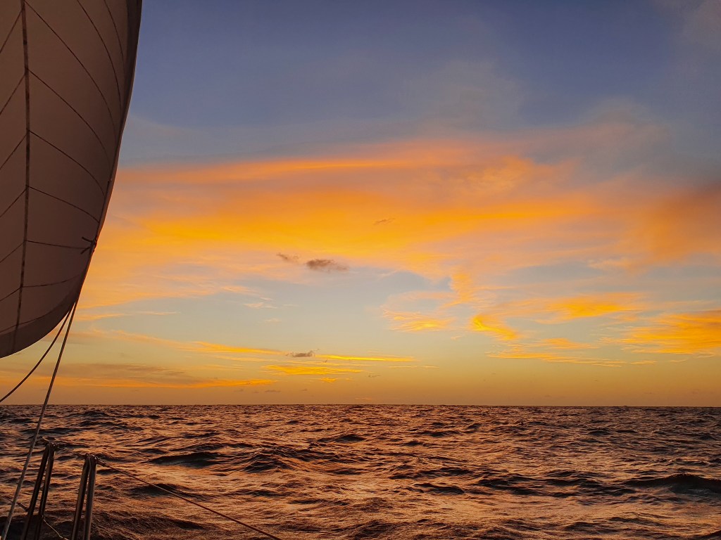
The landscape was flat and fairly uninteresting, with many small fires burning along the coastline. The sunsets however, were magnificent. Since the ocean was now to our west, the sun was setting over the water, and with the smoke from the fires still lingering in the air, the colours were extraordinary. I hoped it was just a taste of what we could expect on the west coast.
Sunset, Joseph Bonaparte Gulf
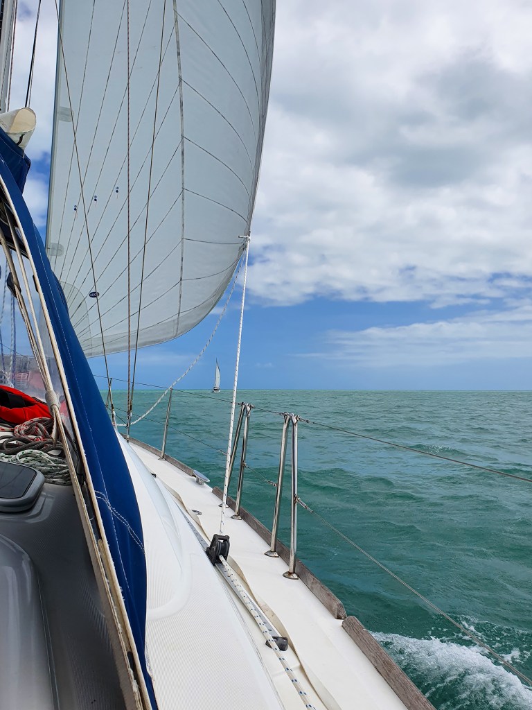
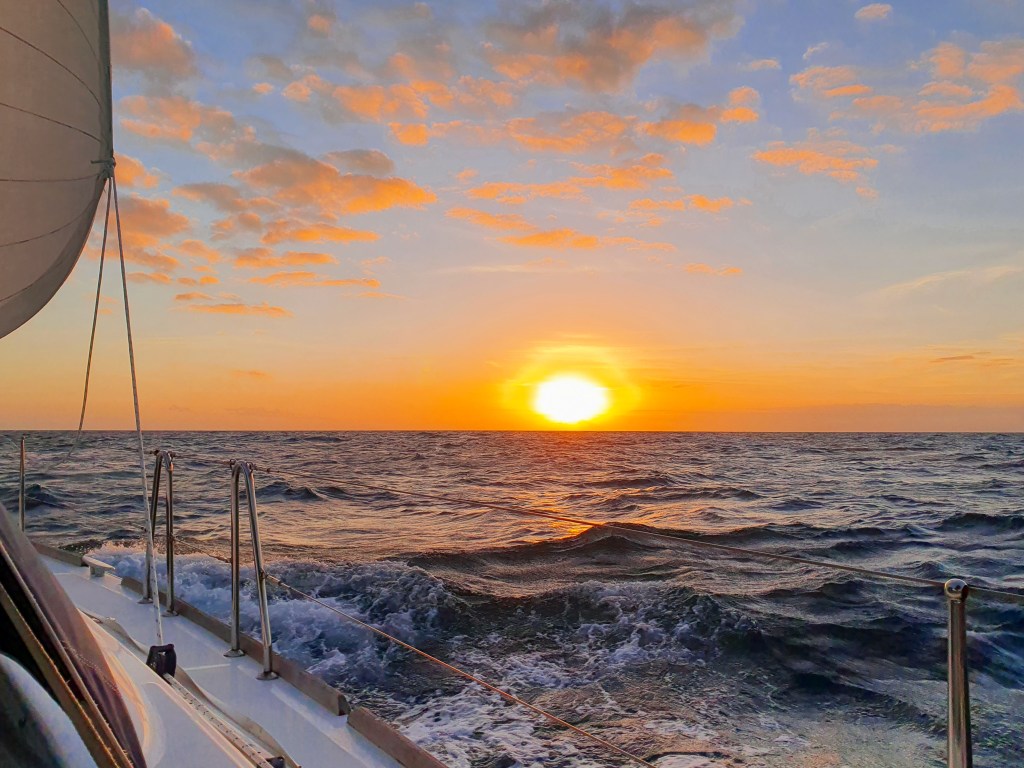
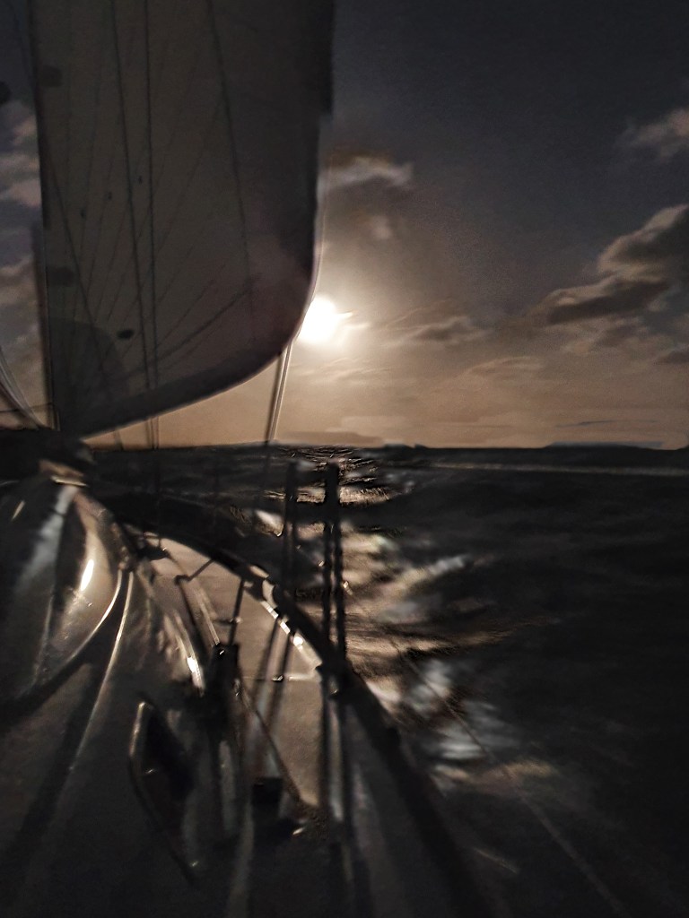
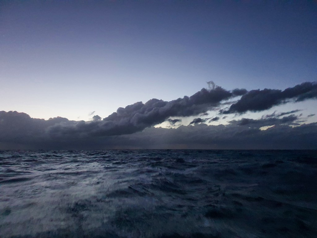
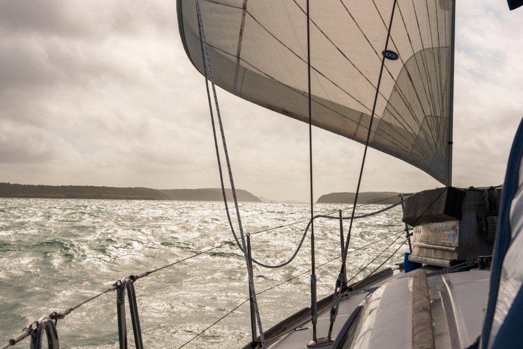
Crossing the Joseph Bonaparte Gulf would be an overnight passage, a distance of 120 nautical miles. We needed to time our trip so that we arrived at Reveley Island, outside the Berkeley River around high tide. We had been hoping to sail the whole way across, to conserve our diesel supply, but unfortunately, it didn’t look like the wind gods were on our side this time. After sailing along very slowly at two to four knots for the first five hours, we switched on the engine to negotiate some shoals, and then found that the wind direction had changed, sitting squarely on the nose. And there it would remain, although light, for the rest of the passage.
And so we motored across the Gulf. The best thing about the light winds was the extremely calm sea state. I felt fine and didn’t take any sea sickness pills. It was so calm, I was even able to read a book, unheard of for me on a passage! We are obviously becoming a lot more comfortable with the idea of overnight sails, because we approached this one without any major preparations or anxieties. Learning from our last long passage, we decided on shorter, four hour watches each.
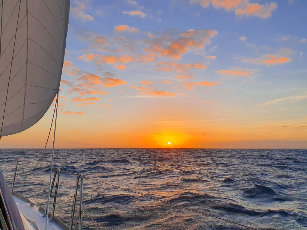
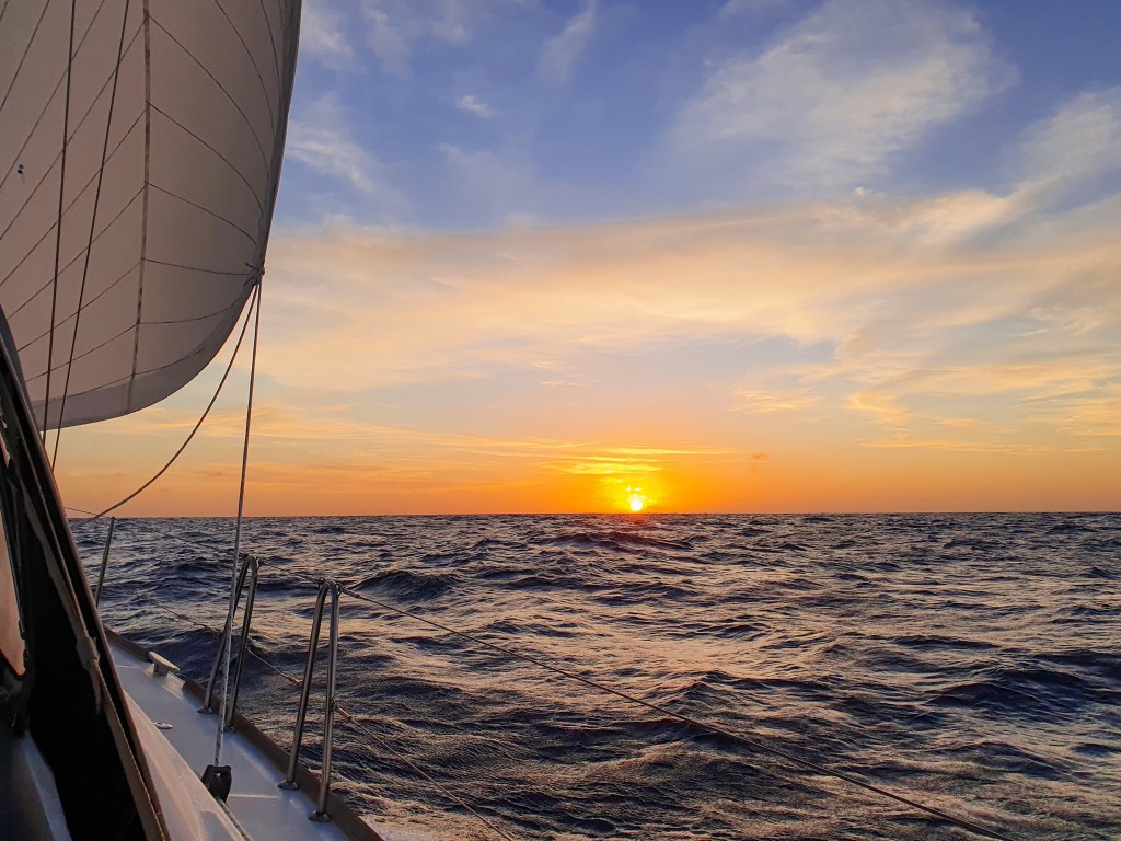
After an early dinner (of not very great pre-made pizzas) we stood on the bow together to watch the sun go down. Then I went to bed while Matt did his first shift from six to ten pm. I was on watch from ten until two am, a very uneventful shift that I spent listening to music and singing along to songs. It was quite pleasant actually. Matt was back up at two am and I gratefully retired downstairs to bed. It was during this next shift that we crossed the 129 degree line and officially entered into Western Australia. We had already changed all our clocks back so that we would be working in the one time zone on all our devices, as it was important to get the tides right entering the Berkeley River.
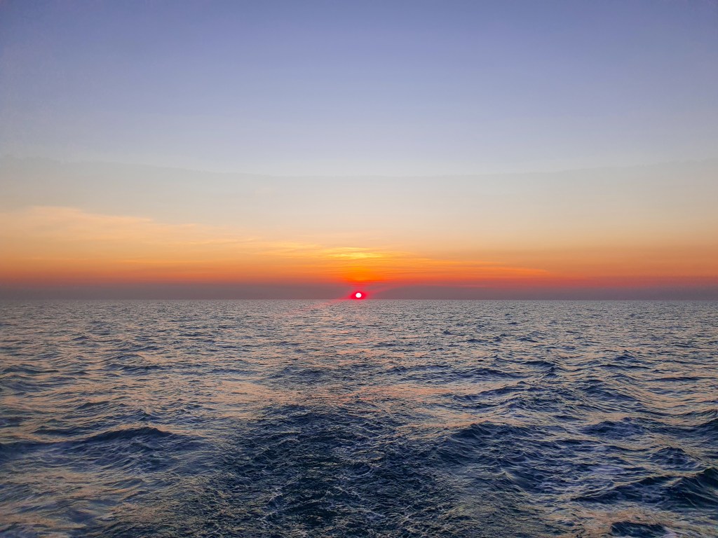
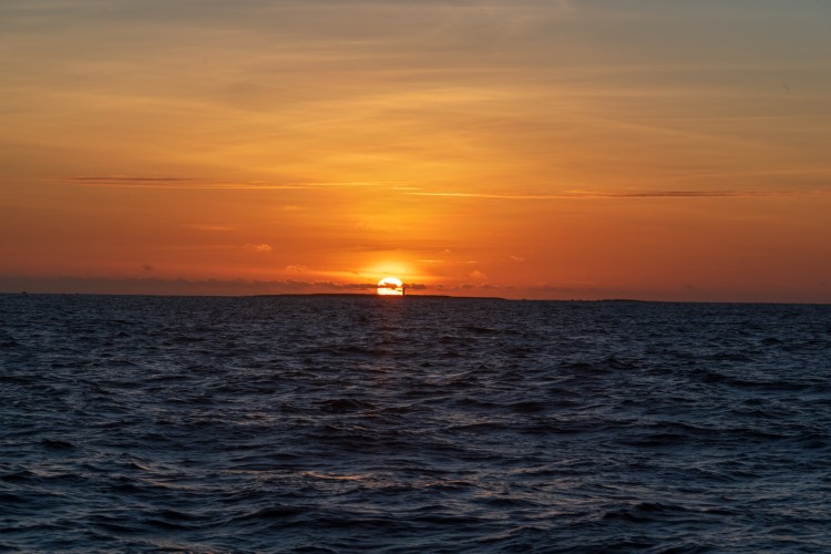
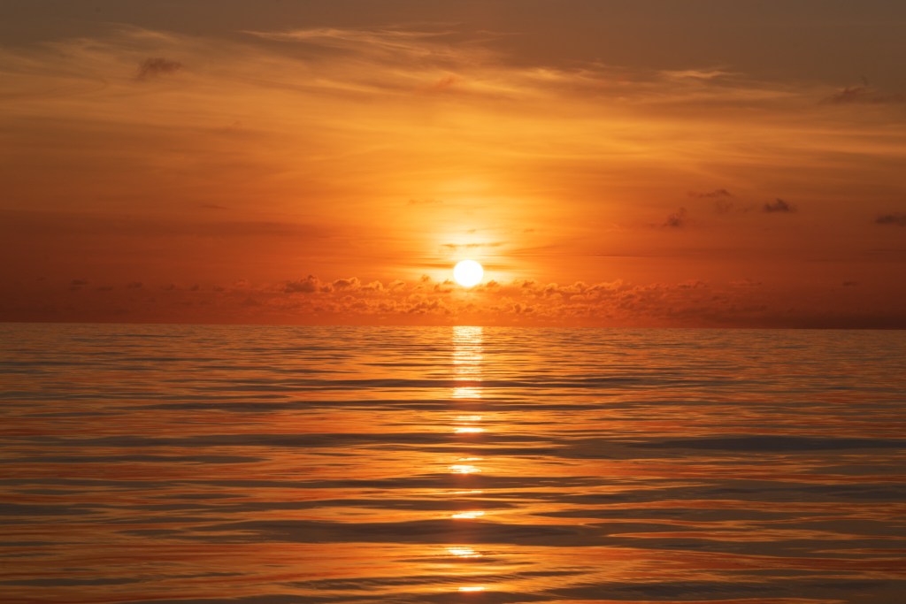
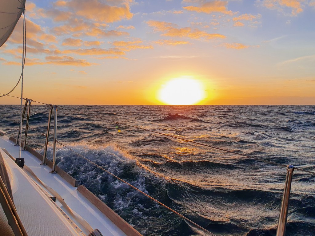
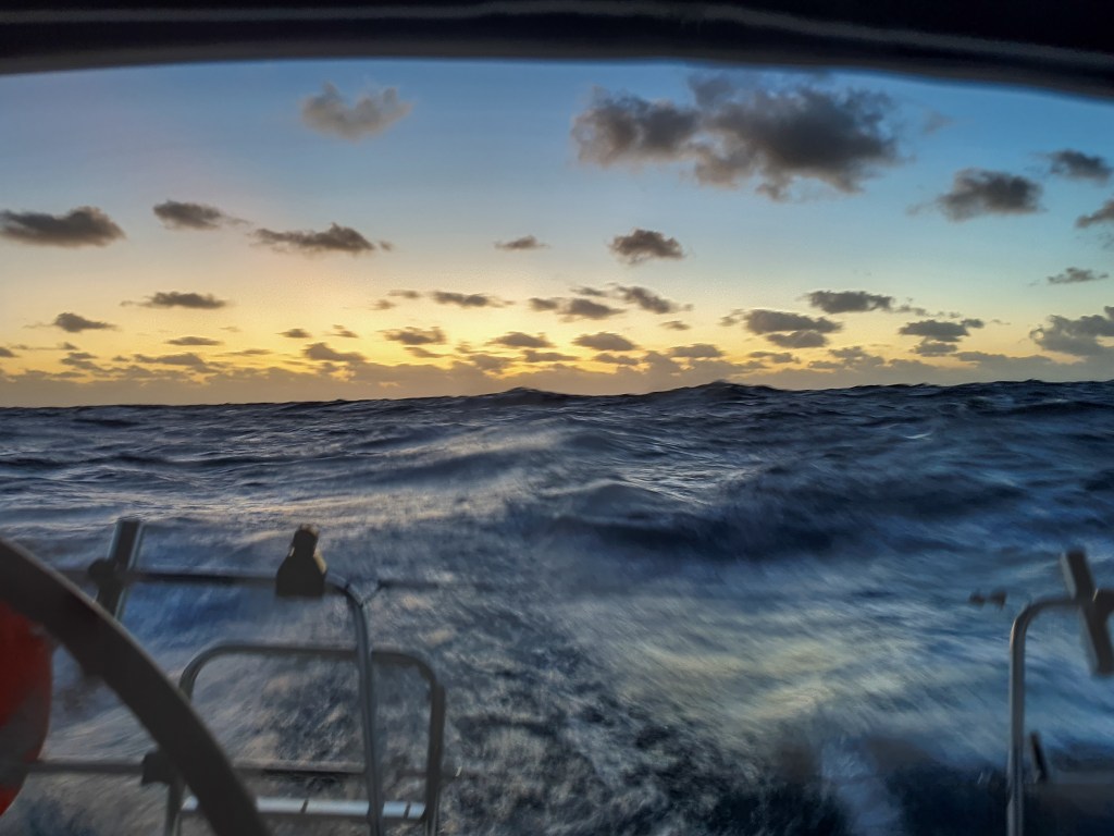
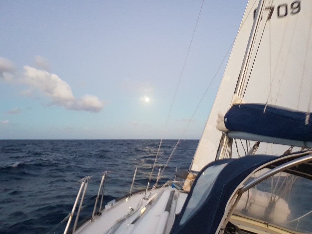
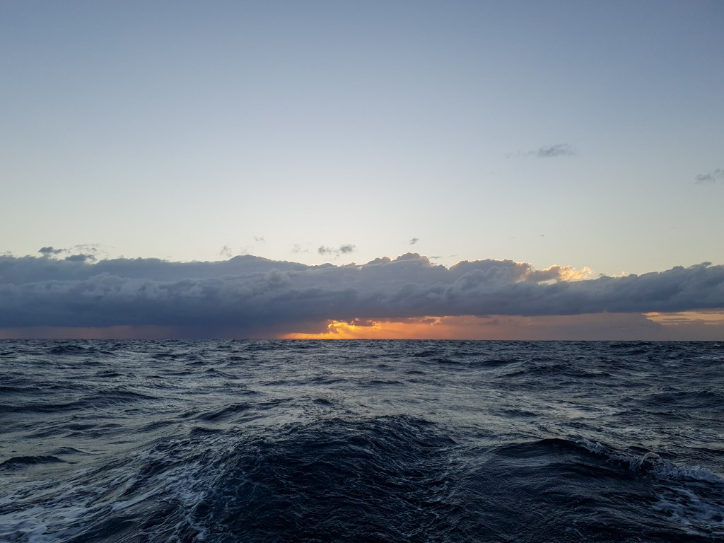
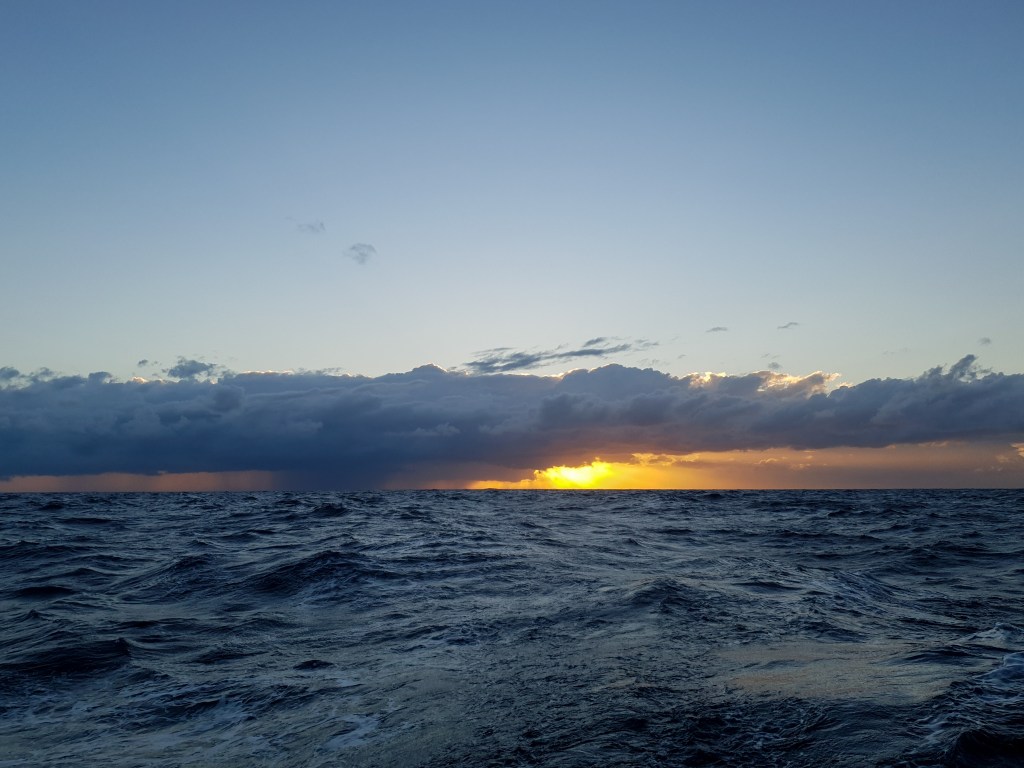
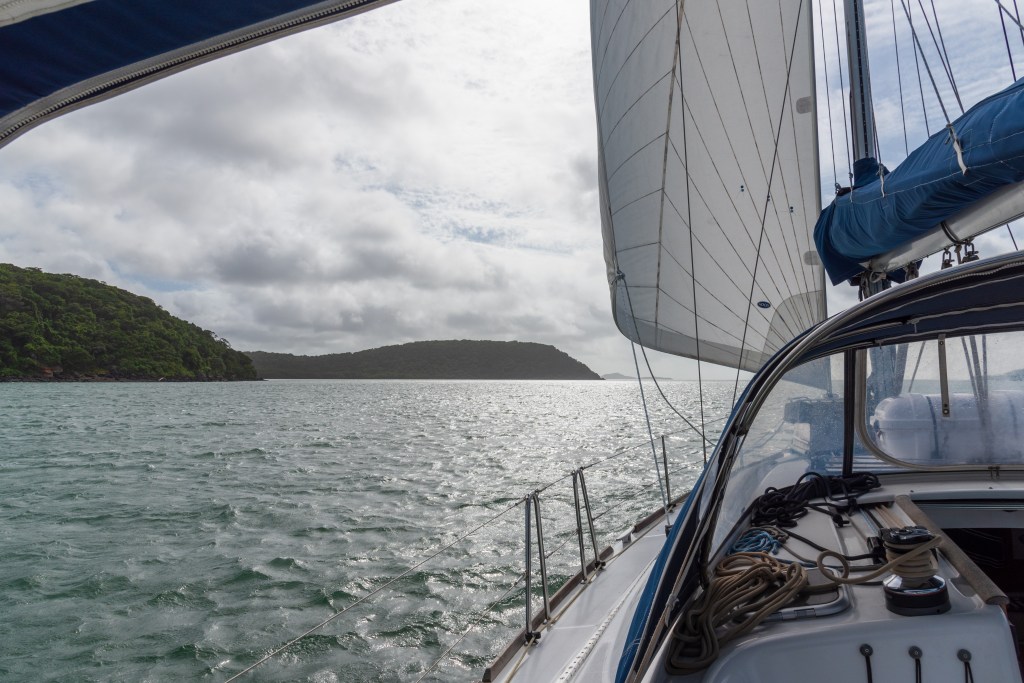
I emerged at 5.45am to find first light dawning, slowly creeping across the sky. About 15 minutes later, the glowing, shimmering red orb of the sun pushed its way through the soft pastels streaking across the bottom of the sky. It was a magical sight. Up in front of us we could see the towering cliffs of the Kimberley. Where all there had been was flat ocean for miles and miles, now we could see these impressive towers appearing to rise straight out of the sea. The sheer red cliffs, lit by the new light of the sun, had a glowing quality. It was truly striking, and was a very special and quite emotional experience for both of us. Here we were, finally, approaching the Kimberley at sunrise in our own boat, and it seems as if it will be just as spectacular as promised. A memory we will both hold forever.
Sunrise, Joseph Bonaparte Gulf
Our first glimpse of the Kimberley….
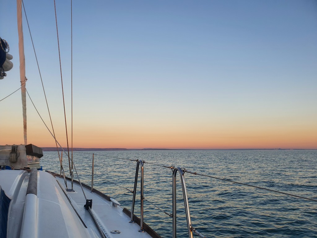
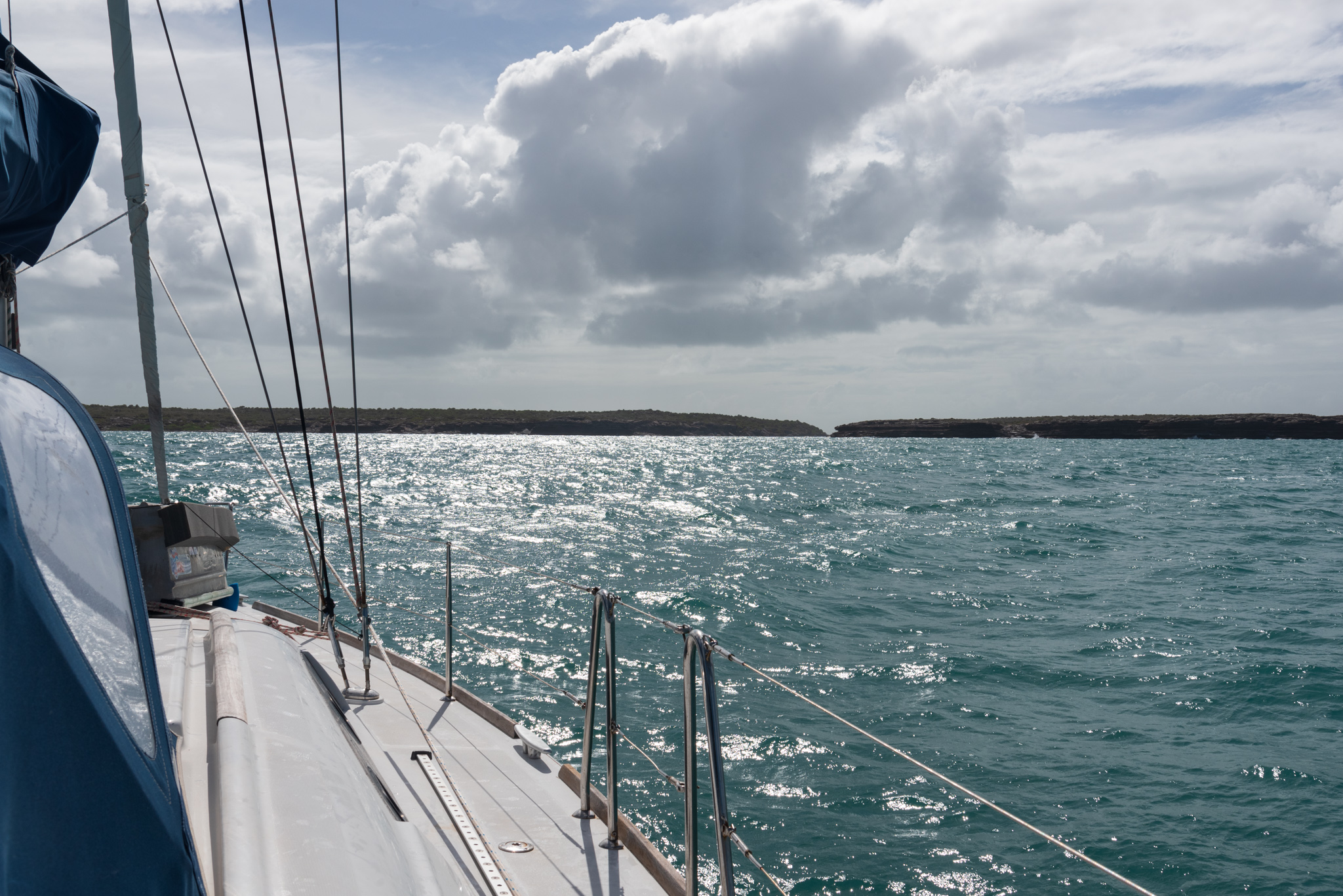
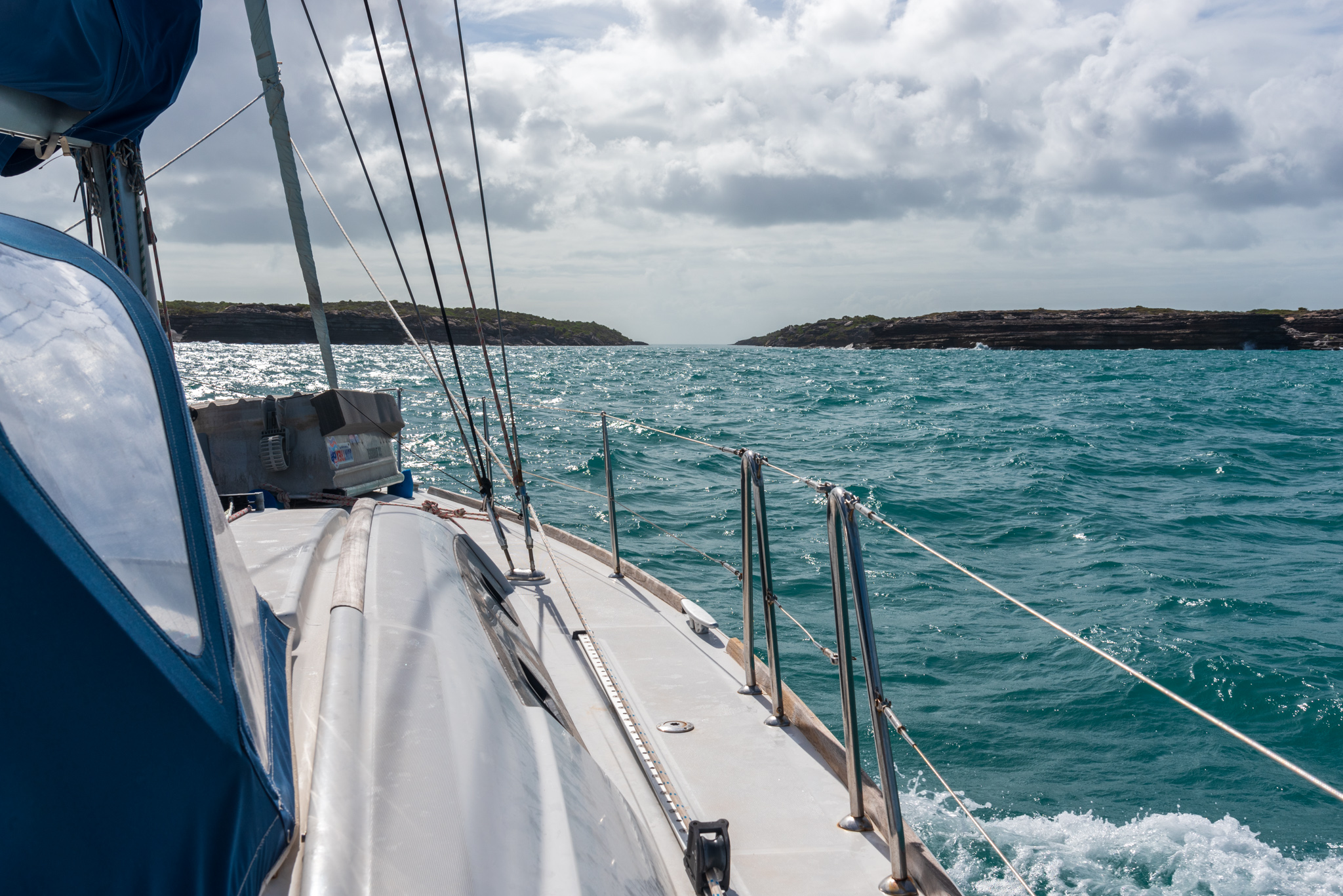
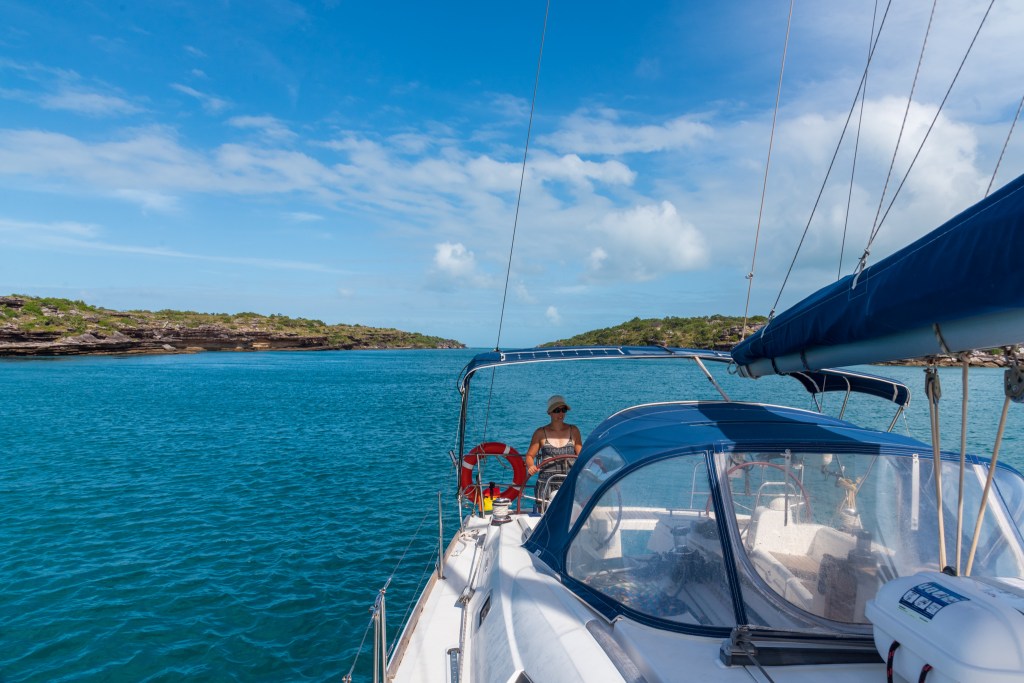
Soon though we needed to turn our attention to the task at hand – navigating the shallow entrance of the Berkeley River. We were both feeling a little apprehensive and nervous about the depths and the approach. Although we had entered waypoints from a guidebook and another yachtie into our chartplotter and planned to follow the path they created, there was no guarantee that we’d be on the right track and that we wouldn’t hit the bottom on the falling tide. The tide had turned about an hour before we started our crossing.
Matt steered us along the meandering route and I stood on the bow, ostensibly to be looking out for sandbars or other obstacles, but I couldn’t see anything in the murky water. Matt was expecting to have plenty of clearance under our keel. That’s not exactly what happened though!
Slowly, slowly, we edged our way along the track, and on several occasions the sounder showed less than a metre under us. This was not at all what we were expecting and we were tense with nerves. The charts showed that we were in a channel of around 1 to 1.5 metres depth at zero tide, so with the 3.6 metres of tide we should have had ample depth. This was early in the crossing. There was still the bit the charts showed as zero depth to navigate. What on earth would those depths be like?? We knew that there were several huge sandbars out there, but were we on the right route to avoid them? We couldn’t tell. It was a leap of faith, and we just had to go slowly slowly and feel our way in . We twisted and turned, following our waypoints and the crossing of the entrance took around 30 minutes.
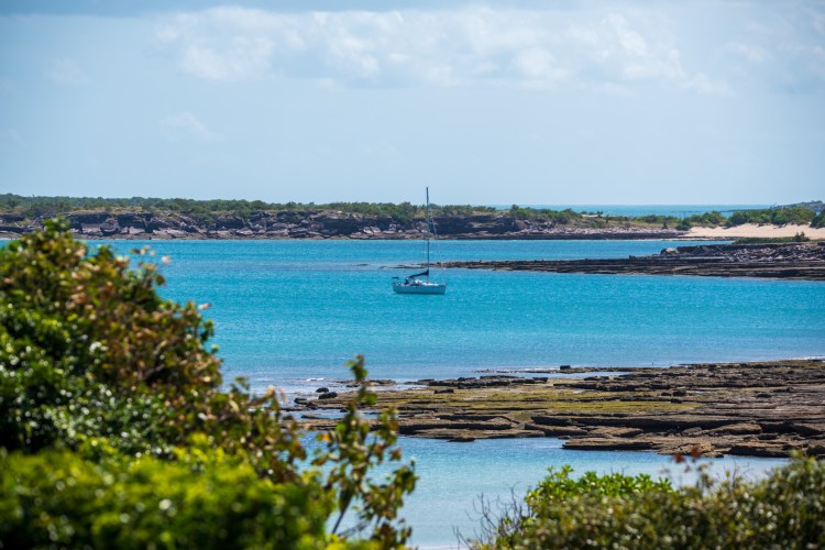
After slowly winding our way in, and coming perilously close to some rocks at one stage, we finally crossed into the river and found the deep water. We had arrived!! We were in the Berkeley River, in the Kimberley. Huge relief, along with extreme excitement and satisfaction washed over us. What a truly special and magical place we found ourselves in. We could not wait to soak it all in and explore further.
But first, coffee, breakfast and a nap were in order. We were in no rush. We were determined to slow right down and appreciate all that we could in this ancient and magnificent place. And we were to spend the next eight days doing exactly just that.
When you arise in the morning, think of what a precious privilege it is to be alive, to breathe, to think, to enjoy, to love.
We had booked into the marina at Cullen Bay in Darwin for two weeks. There were a few minor repairs and maintenance that needed doing on the yacht, as well as the massive task of provisioning for the Kimberley, and we also planned on doing some sightseeing around Darwin and its surrounds.
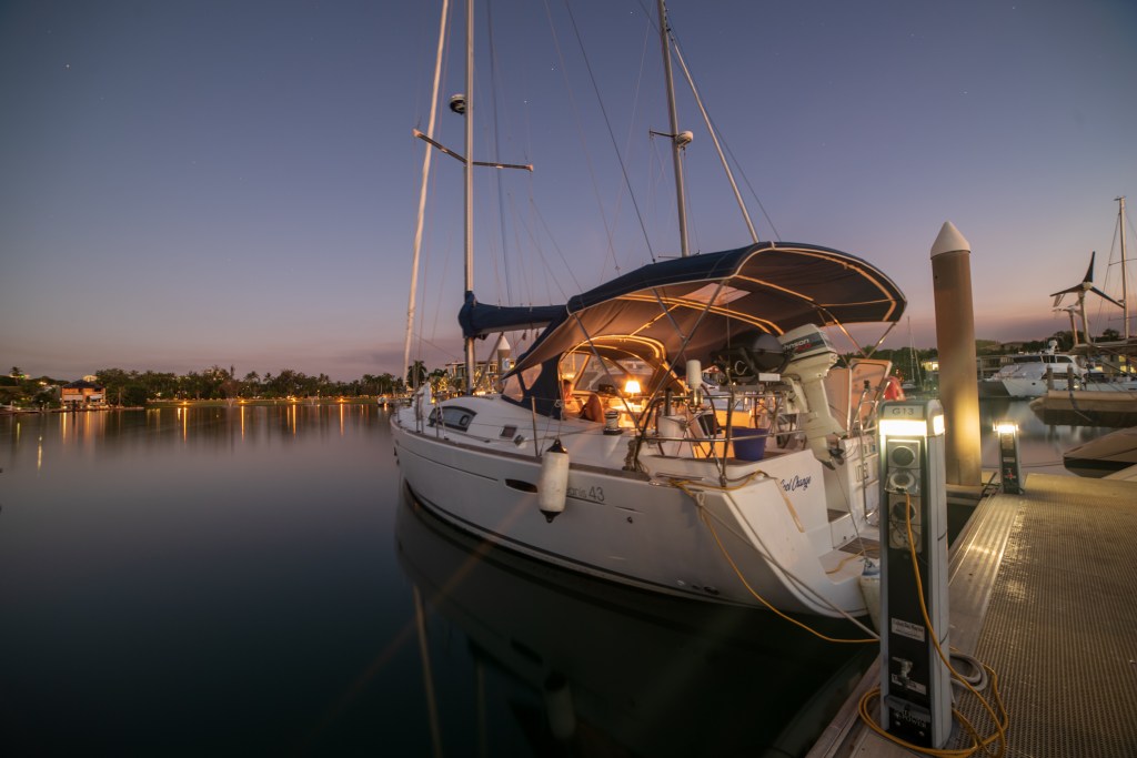
Cool Change in Cullen Bay marina, Darwin
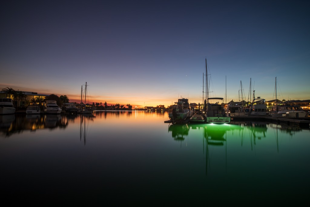
Cullen Bay marina, Darwin
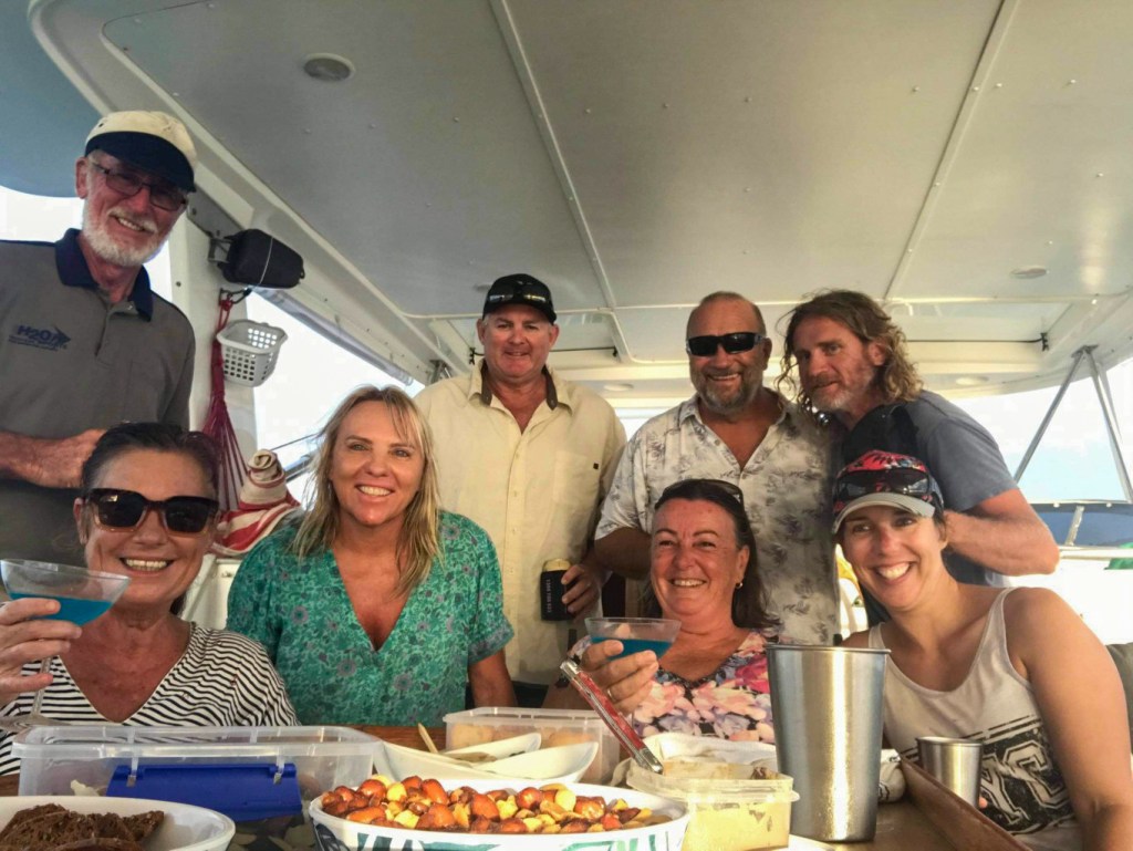
We spent the first few days attacking our jobs list, sourcing parts and ordering any we couldn’t find in local shops; a new battery for our handheld marine radio and an impella kit for the outboard. We had already ordered a new sensor for the anchor chain counter, and while we waited for it to arrive to a friend’s house in Darwin, we laid out our anchor chain on the deck, painting the links a bright yellow every five metres. This was just an extra precaution and when the sensor arrived, Matt installed it successfully so we have a working chain counter now. Matt rewired the battery charger for the bow thruster and stripped down the outboard motor. I did cleaning and laundry and started planning and writing lists for provisions. In between these jobs, we caught up with our friends Brian and Sandra from Sealeaf, Terry and Leonie from Sens de la Vie, and Al from Never Die Wondering.
We met Brian and Sandra at the Mindil Beach markets on one Thursday evening, and then met Terry and Leonie there the next. The Midil Beach markets are full of food trucks serving cuisines from all over the world, and are situated next to the beach where the crowd gathers to watch the sunset. Setting over the ocean, it is a truly spectacular sight, but we were a little taken aback when the crowd applauded the sun as it finally sank over the horizon. The Mindil markets was something I remembered fondly from when I lived in Darwin 14 years ago. But this time I found the crowds to be very overwhelming. While I’ve never been good in crowds, I think I am going to struggle even more after our often solitary lifestyle on the yacht. We especially realised how much we preferred to see these gorgeous sunsets from on our own boat, without being surrounded by hundreds of other people. Have we become very spoilt?!
Sealeaf was docked in Tipperary Waters marina, which was on the other side of town to us, and right next to the Dinah Beach Cruising Yacht Club. We’d heard about this interesting yacht club from some locals we met at a pub, and so we ventured out there several times to meet Brian for some drinks while Sandra was home in NSW for a while. Dinah Beach was a colourful place, full of interesting characters and old salts. Terry and Leonie also met us there with their friends Nick and Cass who’d recently moved to Darwin. Dave and Michelle from Luna Sea also came out one night too.
One Saturday evening Cass organised us all tickets to go to the Botanical Gardens to watch the Darwin Symphony Orchestra play with a band and some singers. The theme was Disco and I thoroughly enjoyed the evening sitting on our picnic rug and bopping away to the familiar tunes.
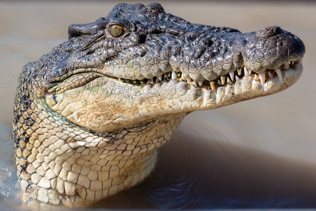
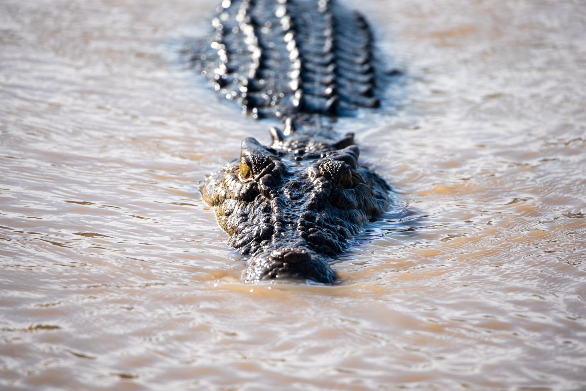
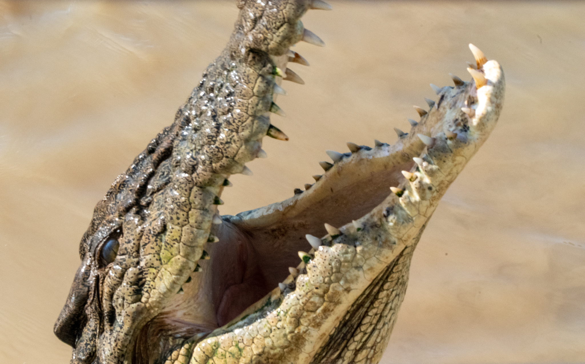
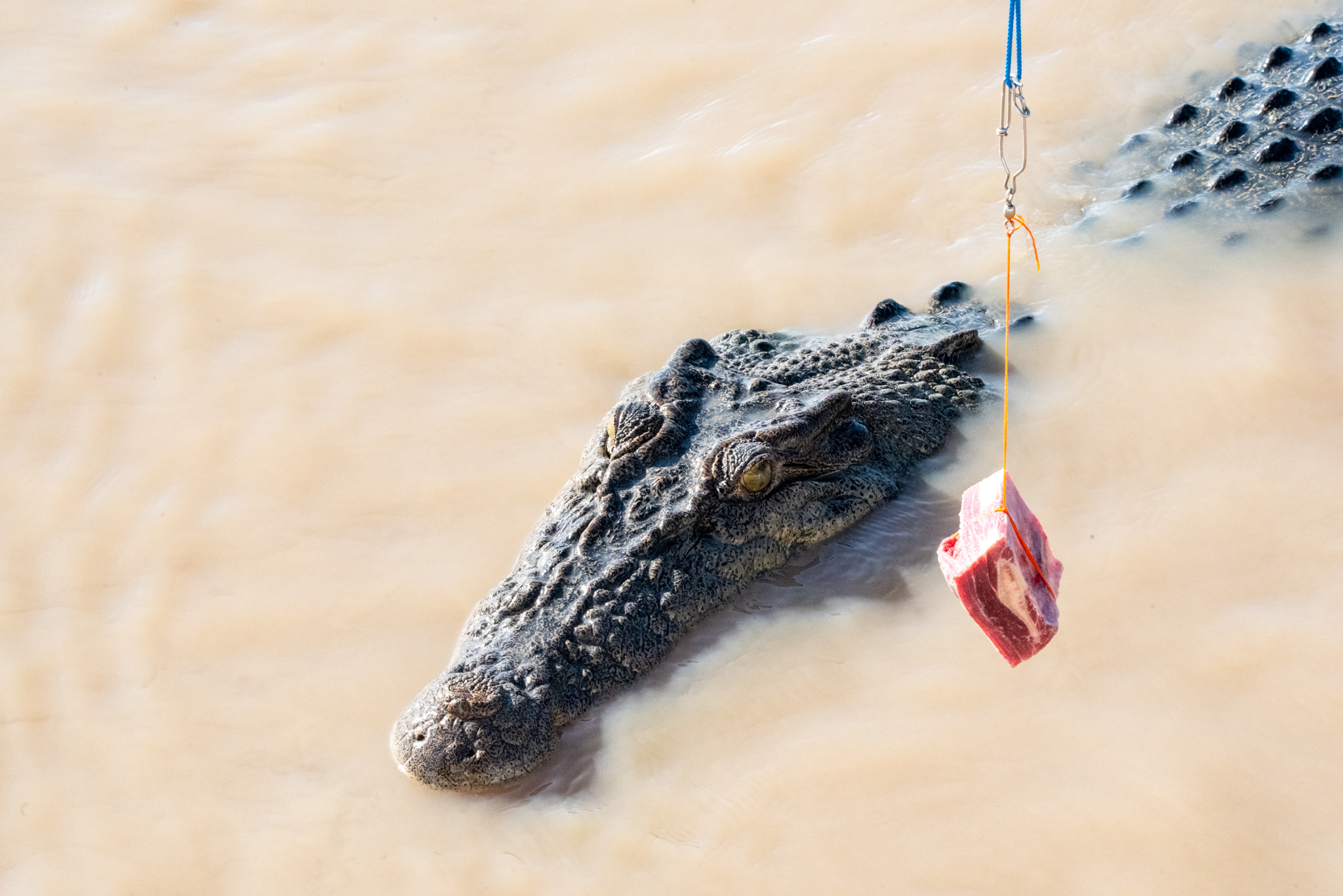
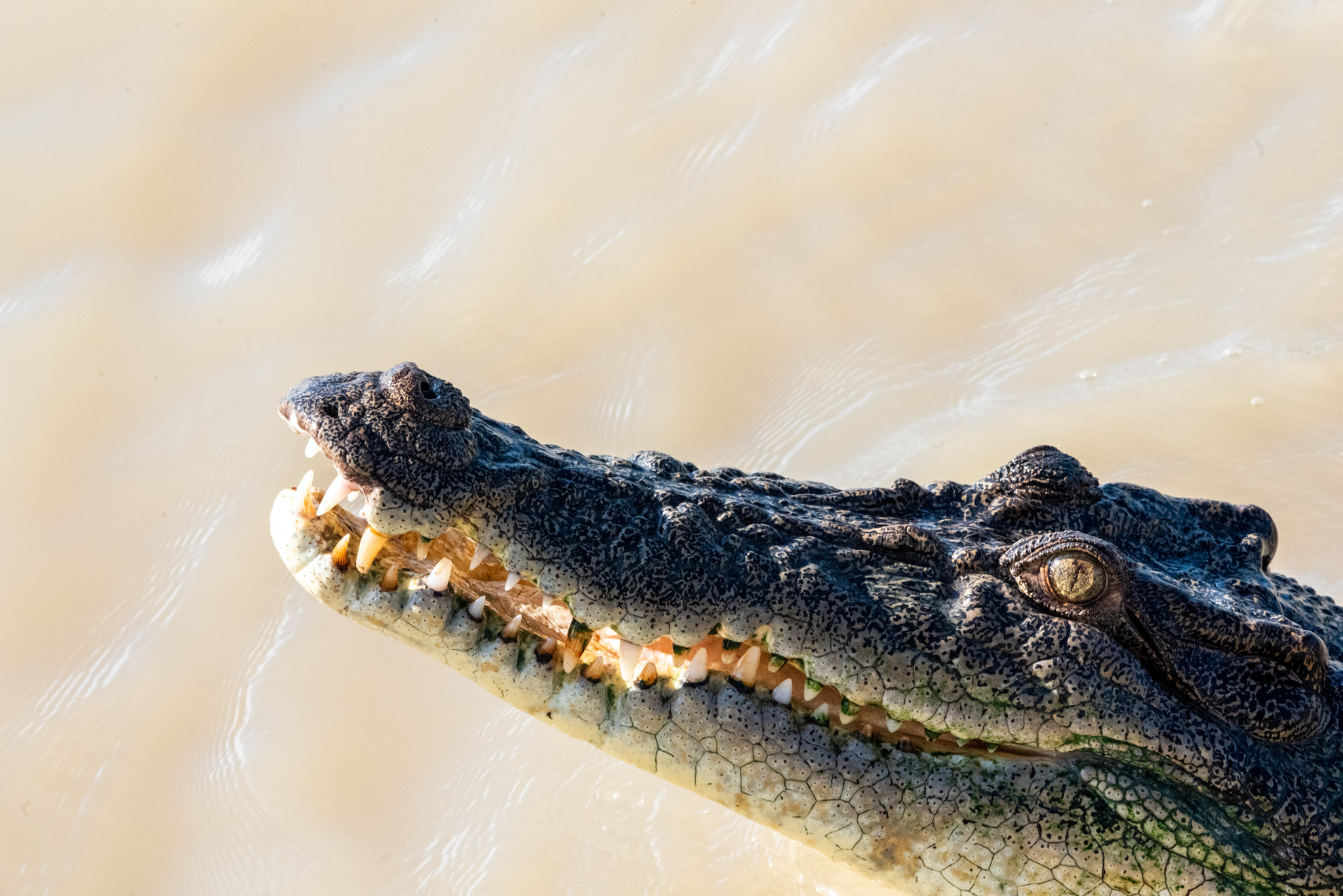
We ventured out to the Adelaide River for a jumping crocodile cruise. Matt’s family had given me a voucher for an experience for my birthday earlier this year, and we hadn’t used it in Cairns, so I decided this would be the perfect opportunity. The tour bus drove us an hour or so out of Darwin where we boarded a boat for a cruise up the Adelaide River. They promised jumping crocodiles, and that’s what we saw! We hadn’t really seen any crocodiles on our trip so far, apart from the one off in the distance at Port Essington. These ‘trained’ crocs came over to the boat when it approached and jumped out of the water to grab pieces of buffalo meat that were dangled over the side of the boat.
You could argue that there are questionable ethics about training crocodiles to view boats with humans in them as a source of food, but we also learnt some valuable facts about saltwater crocs and their habits. Crocodiles are opportunistic predators and given a chance, will definitely strike. They do lie in wait to observe and stalk, waiting for an opportunity, however they are after maximum gain for minimal effort, and tire quickly after very short bursts of energy. So if you follow some basic precautions and maintain a constant alertness and awareness, then you should be fine. They are definitely creatures to be respected.
Matt took some incredible photos, here are a few of his best:
We spent a day playing tourist on the Big Red Bus, just like the ‘hop on hop off’ buses that we so loved in Europe. First stop was Stokes Hill Wharf and the Royal Flying Doctor and World War II Museum. The interactive holographic exhibitions they have there are pretty cool. We continued the bus into the waterfront precinct and then wandered back into town via Bicentennial Park. After stopping at a pub for a drink, we missed the last round of the hop on hop off bus, so we walked back to the marina.
The public bus service in Darwin is pretty good and we were able to catch buses most places we needed to go. The marina was only a few kilometres from town and it was an easy walk in so we did that a lot too. One of the more popular ways to get around Darwin, however, was via the orange e-scooters and e-bikes that were littered all over the streets. I was hesitant to use the scooters at first, since they didn’t seem overly stable and I envisaged all sorts of accidents and injuries that might halt our trip. After seeing people of all ages, sizes and co-ordination levels managing to use them successfully, I was a bit more open to the idea though. One day on his way back to the marina, Matt discovered a bike that had its lights on and decided to see if it would work for him. We hadn’t downloaded the app that would allow us to hire the scooters, not thinking that we would use them. But the lights were on, so Matt jumped on and got it working and rode home in style. We’re not sure how the payment works, if it’s a time thing or a distance thing, so we don’t know if some unfortunate soul who forgot to log off was charged or not. I don’t think so though.
The night we were walking home from the concert in the Botanical Gardens we came across a scooter with the lights on. Matt looked at me, ‘Want to try it?’ By now, he’d had a bit of experience on them, so I nodded. We struggled to get on at first, but a couple passing by laughed at us and assured us that it could be done. Encouraged, we had another go and then we were on, gliding home, me standing at the front and Matt reaching over me to steer. I had to get off halfway up a steep incline, but we flew down the long hill to Cullen Bay, reaching a speed of just over 30 kms. I was glad I’d tried what seems to now be an iconic Darwin experience, but probably won’t be tempting fate again.
I started the big job of provisioning our boat for 6 to 8 weeks without the ability to resupply. I did several trips to the supermarket, lugging groceries back on the bus or in a taxi. Leonie and I had a girls day out, visiting several different shopping centres and picking up bits and pieces that we needed. Nick drove us on a culinary shopping tour of Darwin, visiting several different fresh food markets, delis, Asian grocers and a wholesale butcher. It was a huge help to be able to source everything that we needed in the comfort of a car. Many thanks Nick!
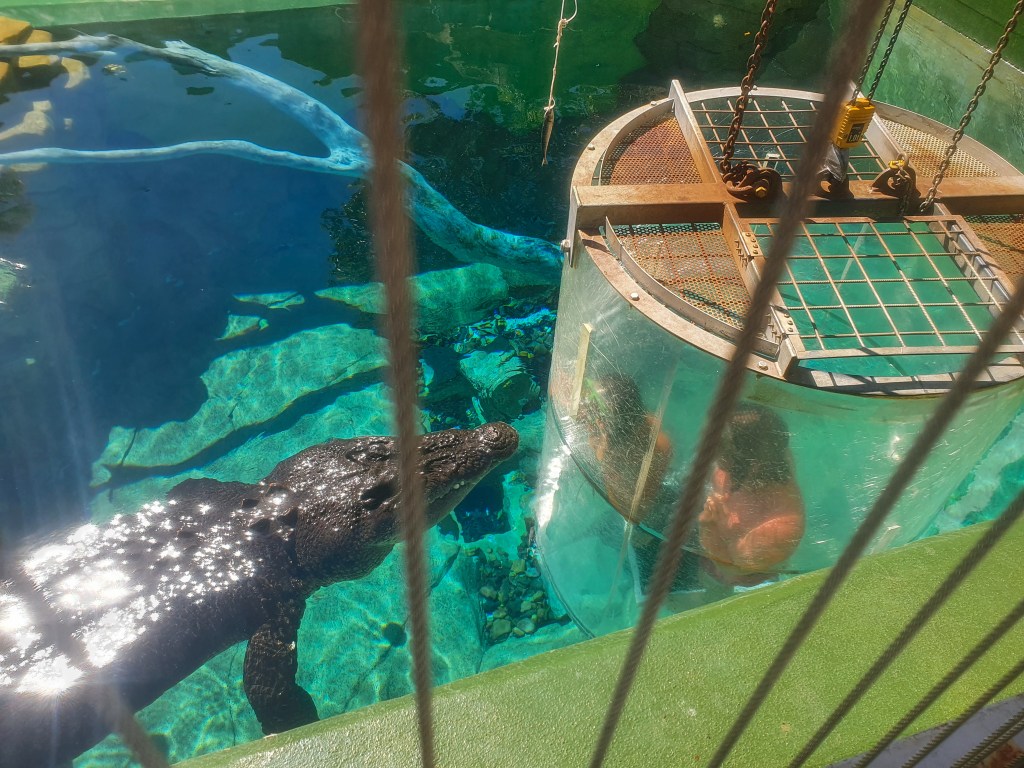
On a Sunday morning, Matt and I walked into town to visit the Crocosaurus Cove. It was one of the tourist attractions that was still on our list. The Croc Cove was home to several ginormous, five metre plus crocs, all in separate enclosures. Most of these crocs had been removed from places once they’d been designated ‘problem’ crocs, either for being aggressive towards humans or other crocs and so got to live out their days entertaining and horrifying tourists at the Cove. We watched some people get in the ‘Cage of Death’ immersion tank and be lowered into a croc enclosure. The staff then waved a chunk of meat around to entice the croc to come over to the tank. Over he came, and there he was, staring at the two punters in the tank, separated only by a piece of perspex. Hopefully a very strong piece!!
‘Cage of Death,’ Crocosaurus Cove, Darwin
As we walked around the reptile enclosure there, a woman looked up from her phone and said ‘We’re going into lockdown today.’ ‘No way,’ we told her, ‘we haven’t heard anything of the sort.’ A quick Google search on our phone confirmed her story, however. It was about 11.30am and lockdown was to begin at 1pm. For 72 hours. I couldn’t believe it. It all felt a bit surreal. I felt disappointed, frustrated and helpless.
We wandered dejectedly through the crocodile area for a bit and an announcement played over the loudspeaker about closing early due to lockdown. Matt looked at me, ‘Let’s go to the pub for a last drink.’ We crossed the street to Shenanigan’s, but they weren’t serving drinks anymore. The next pub down was though, the young girl seemingly reluctantly pouring Matt a beer. As we sat outside, we rang Brian and Sandra to see if they’d heard the news. They had and were currently on a bus into town. Pub sounds great, they said and ten minutes later were sitting with us, the boys drinking beer. The pub began to fill up, people talking loudly about the lockdown and masks and restrictions. It was the first time Darwin had had these sort of measures imposed, and the first time for us too. We’d managed to avoid lockdowns until now.
Since our Sunday afternoon plans had now been scuppered, we decided to go and hang out on Sealeaf. ‘We just have to stop by the bottle shop, though,’ Brian said, ‘we haven’t got anything to drink on the boat.’ Walking the short distance to Liquorland we found it all shut up, but the Coles was chockers, with a huge line already formed outside, winding down the street. A local noticed us looking at the closed bottle shop and told us that it’s always closed on Sundays. That it’s an NT thing, nothing to do with lockdowns or covid. Bummer!
We headed off down the street, hoping to grab a taxi, when we saw a guy with a carton of beer under his arm. ‘Hey mate, where’d you get that?’ ‘Down there,’ he gestured, ‘Vintage Cellars is open.’ Vintage Cellars was indeed open and it was crammed with people. A queue of people snaked through the drive-through and another wound all the way through the small store. There was barely room to move inside, but people laughed and joked as they manoeuvred their way to find what they needed and waited for their turn to pay. It was a long wait, but hey, what else have we got to do, everyone was saying. The store manager was a young woman who seemed bewildered by the onset of customers. ‘We aren’t closing,’ she kept saying, ‘we’ll be open tomorrow, there’s no need to panic buy.’
Lady, I thought, these people aren’t panic buying. They had planned on spending their Sunday afternoon in a restaurant or at a pub watching the rugby final, and now they have to go home. With less than two hours notice. Of course they want to buy some grog to take home. We lugged our purchases into a taxi and spent the afternoon and evening on Sealeaf, talking about what this meant for us now.
It was Sunday 27th June and we were meant to be leaving Cullen Bay marina on Thursday 1st July, motoring out to Fannie Bay to watch the NT Day fireworks and then sailing out of Darwin on the Friday. It had seemed a perfect plan!! We had a day tour to Litchfield National Park with Brian and Sandra booked on the Tuesday, plus I had also hoped to get to the Museum and Art Gallery before we left. But that was not to be. Our tour was rescheduled to the Thursday, but then the lockdown was extended for another two days, so it was cancelled.
Maybe we should just leave early, we thought, when it became clear that the lockdown was being extended. We can’t do any of the touristy things we wanted to do anyway, so maybe we should just shop and go. Get out of here. Well, that was easier said than done. It turned out that the marina management refused to let us out while the lockdown was on, unless we got permission from the government. We were literally locked in.
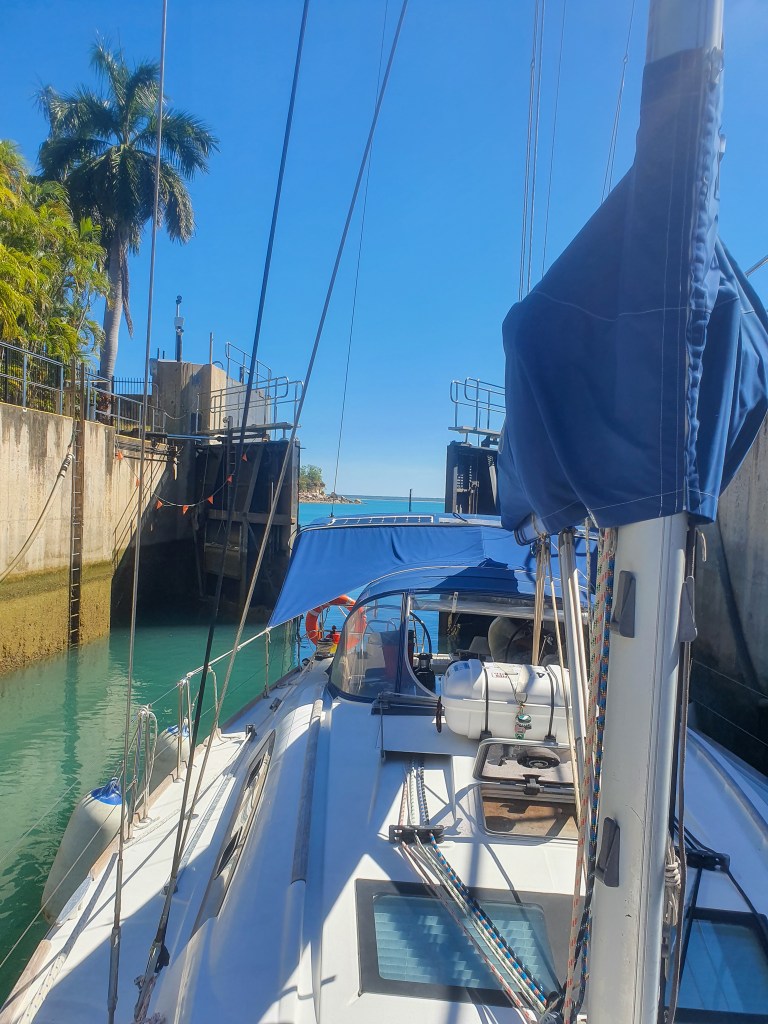
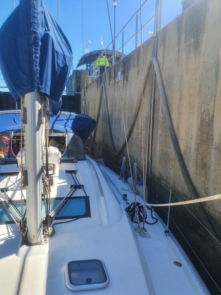
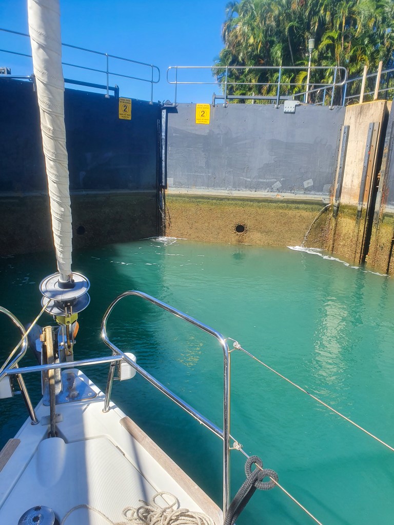
Let me explain that. The marinas in Darwin are all accessed via locks, due to the extreme tides. You motor your boat into the lock, tie up, the doors close and then the water in the lock either goes up or down to match the water on the other side where you are going; either into the marina or out into the bay. It obviously needed to be operated by staff from the marina. And they were not willing to do so. We called several different government and regulatory services and had several intensely frustrating conversations. No one seemed to really know, no one seemed able to make a decision and no one seemed to have any common sense. It was frustrating and infuriating.
We resigned ourselves to the fact that we were indeed locked in and there seemed to be nothing we could do about it. We spent the next four days on our boat in the marina. We spent the time doing our last few jobs so that we would be ready to go as soon as the lockdown was lifted. Matt and Terry borrowed Nick’s car and filled the gas bottles and petrol jerries. I cleaned, shopped and researched anchorages in the Kimberley. We had Terry and Leonie over for dinner and drinks on several nights, and their company and the laughs we had was just the distraction we all needed.
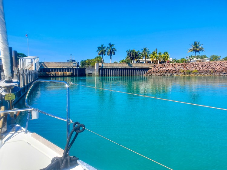
Since our holding tank (poo tank) was full, the marina staff agreed to let us out so that we could empty it. On the condition that we immediately return, of course! Here are some pics of the lock to show how it works. The boat is driven into the pen, loosely tied to the wall at the bow and stern, the lock doors then close and water begins to either pour in or out, in order to raise or lower the water level, depending on the tide at the time. We let out or pull in the lines as appropriate, and then the lock doors open, we remove our lines and motor out.
Cullen Bay marina lock
Cullen Bay marina lock
We used the opportunity to also fill up our diesel tank and jerries at the pump outside the marina. Now, apart from the last fresh food shop and laundry run, we were as ready as we could be. Our fingers were tightly crossed that the lockdown would finish on Friday as promised. It was a long and anxious wait that morning. When we got the word that the lockdown was finally lifted, at midday, it was all stations go. I rushed to the laundry to get a final load of washing done, had a last proper shower and then raced into town for the final fresh food shop. Matt had booked the lock for around 4pm and at 4.30pm we were outside the marina and motoring around to Fannie Bay. It felt ridiculously good to be free.
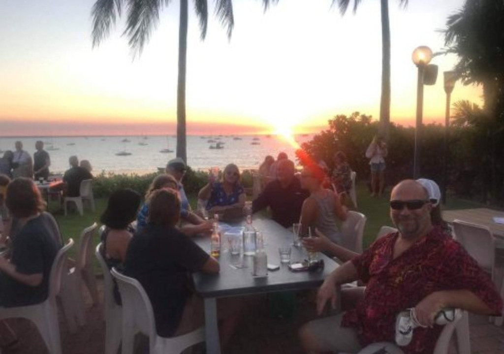
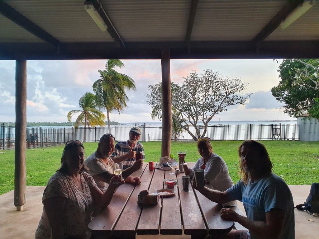
Once anchored in Fannie Bay, we quickly dropped the tender and headed ashore to the Darwin Sailing Club where Terry, Leonie, Brian, Sandra, Nick, Cass and Al and his friend Kylie were all waiting for us. There was a festive atmosphere in the club, as people celebrated being able to get back to their lives. We had a great night and it was lovely to be able to see everyone again and farewell them before we headed off. Brian and Sandra and Terry and Leonie were also heading to the Kimberley, but they had some delays so weren’t leaving Darwin just yet. It turned out we wouldn’t see them again for another 13 days, until they arrived in the Berkeley River.
The motley crew and a beautiful sunset, Fannie Bay, Darwin
As we went to bed that night, cherishing our freedom, we reflected on how lucky we are and how lucky we have been. The five days we had in lockdown, while frustrating and inconvenient, are nothing compared to the disruption that our family and friends, especially those in Melbourne and Victoria, have experienced. Personally, I don’t think lockdowns are a long term solution, and it is now abundantly clear that covid is going to be with us for the long term. Short sighted and narrow minded solutions, such as constant lockdowns and snap border closures are not only incredibly unsophisticated and lazy policy, but are also doing untold damage to our country and our people. We are a smart people and a smart country. We can do better and we should do better. We deserve better.
But for now, the two of us were able to put all those issues behind us. We were in the incredibly fortunate position of sailing off into the remote and isolated Kimberley for the next two months. We would rarely see any other people, we would have no phone or internet reception and hear no news of what was happening in the world. I couldn’t wait!!
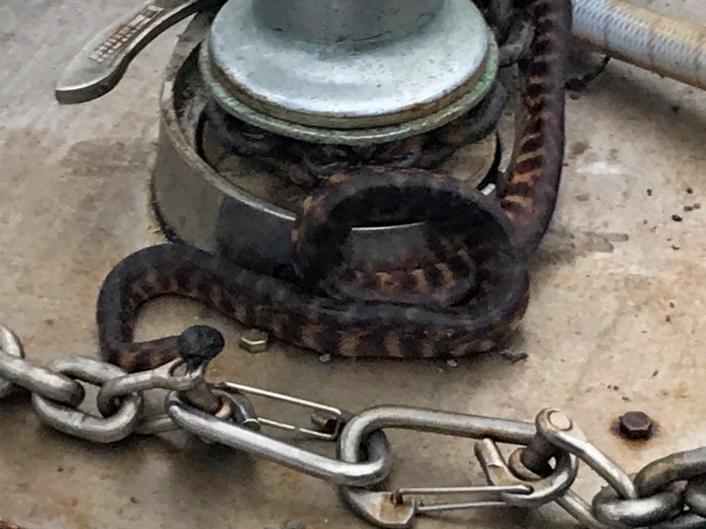
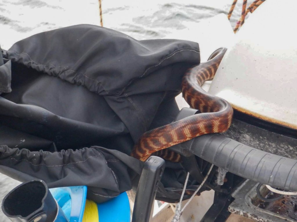
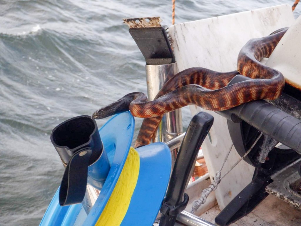
Don’t think there are no crocodiles because the water is calm.
We reluctantly farewelled the beauty and solitude of Marchinbar Island and resumed our journey again. Although we felt we could easily have spent several more days there, we were conscious of needing to move on, to reach Darwin and to prepare for the Kimberley. It’s a bit of a juggling act, spending enough time in each place but also covering the hundreds and hundreds of miles in a reasonable time.
The other consideration in this area is that unlike the Whitsundays, where you can go ashore pretty much anywhere, on any of the hundreds of islands, all of this land and these islands is Aboriginal land, and we aren’t supposed to go ashore without permits. Covid made getting permission and permits very difficult, so it seemed easier to skip over some of these places. We’d received permission to go to the Wessel Islands by the traditional owners, via a contact of Leonie’s, but not for any other areas of the NT coast. We therefore decided on a pattern of several pretty big sailing days then a rest day, stopping and exploring at places of interest where we could.
This next part of the trip would take us 13 days to reach Cullen Bay marina in Darwin. In that time, we rarely saw any other people or any other boats.
Leaving Jensen Bay, the sail back to Guruliya Bay was a fast one. With strong winds, and waves coming in from the front and side, it was quite uncomfortable but we flew along with just our headsail out. The next days sail was to Refuge Bay on Elcho Island, and thankfully this was much more comfortable. Terry and Leonie on Sens de la Vie were waiting for us here and they had us over for dinner. We gave them some of the big mackerel that we’d caught a few days earlier. By hoisting Matt’s phone up the mast, we were able to get some limited phone and internet reception here, bouncing off the Aboriginal community on Elcho Island. It was the first time we’d had reception since leaving Gove.
Cool Change had her full mainsail and headsail out as we had a great sail in 10 to 15 knots of breeze to Jigaimara Point, Howard Island. No waves and no swell, just how I like it! We made the most of the good reception when passing the community on Elcho Island, paying bills, making phone calls and sending messages. It was a little bit rolly in the anchorage at Howard Island, and there were lots of bugs, so it was early to bed.
The next day saw us up early at 5.30am for what turned out to be a frustrating day of sailing. As the batteries needed a charge, we motor sailed for the first few hours and then when we were ready to turn the engine off and sail, the wind shifted and died off, leaving us drifting along at only 3 to 4 knots. With lots of miles to cover we couldn’t keep this slow pace up or we would be arriving at the next anchorage in the dark. So on went the engine again. With no breeze, it was stiflingly hot on the boat. I was covered in sweat, I felt gross and I stank! Who said cruising was glamourous?!
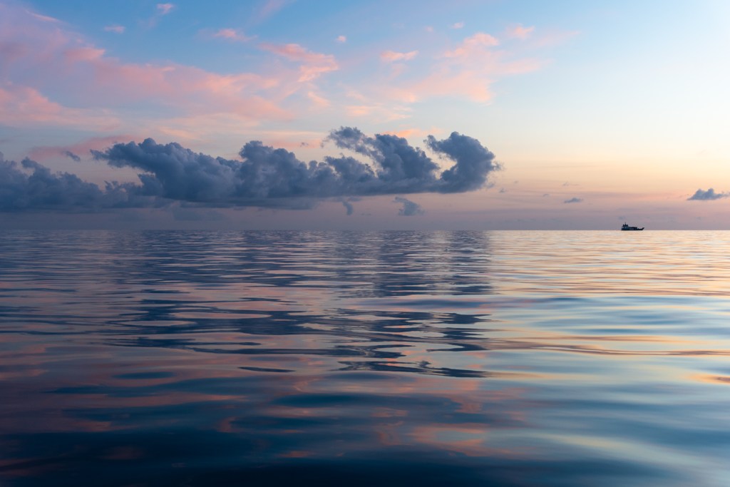
We arrived at Entrance Island, a very picturesque little spot, just before sunset and watched the incredibly red orb of the sun, coloured by the many fires in the area, sink into the horizon. We watched some Aboriginies cook a turtle in a fire on the beach. Something that I still find very confronting and quite distressing.
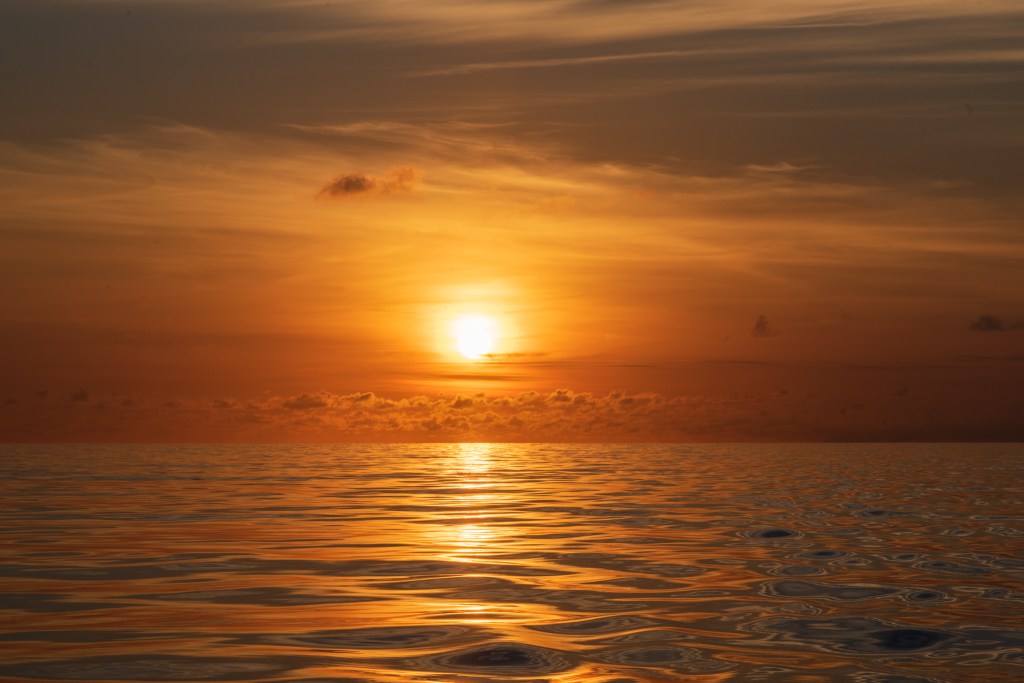
We were up at 5.30am again and motoring in the light winds that were less than 10 knots. An incredible sunrise was our reward for the early start. We don’t see all that many sunrises, so are especially grateful and awed when we do get the chance to witness a magnificent one.
Sunrise
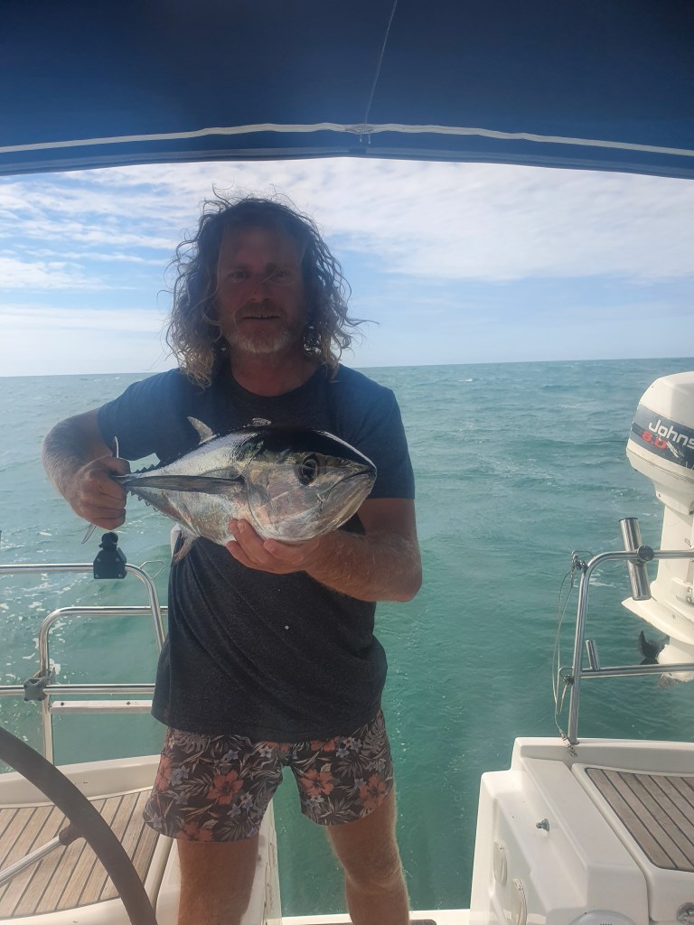
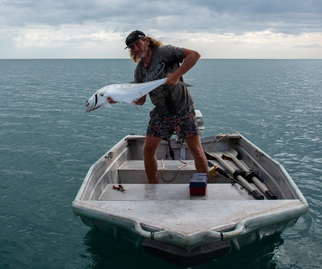
Thankfully the wind picked up and we were able to sail for most of the remainder of the passage to North Goulburn Island. Matt put the lure out and caught an undersize tuna and an undersize mackerel, both of which went back in. He did hook a monster fish of some sort, which took heaps of line, but unfortunately the monster got away. No fresh fish for us!
Matt with an undersize tuna
It was a relief to anchor in the calm waters of Mullet Bay, North Goulburn Island. We had a much needed rest day here, and with some internet reception I was able to work on some blogs while Matt made water to fill our tanks. In the afternoon we went to shore, stretching our legs for the first time in six days. We walked for hours, all the way up and down the long beach and inland to a deserted homestead. I searched for shells and found some of my largest shells yet, including an absolutely massive one, about the size of a large baby. I kid you not!
We saw several turtle tracks in the sand, leading up to where a nest was, although there were no eggs. A reef shark swam next to us in the shallows. The air had a hazy quality to it, as there were many small fires burning in the areas. It had been a good day, the rest and relaxation that we needed. We finished the day off with Leonie’s homemade pizzas cooked in our Weber.
Mullet Bay, North Goulburn Island
Mullet Bay, North Goulburn Island
Abandoned homestead, North Goulburn Island
Light winds turned our next passage to Oxley Island into a long day. In the end, we had to turn the engine on and motor for the last few hours. The charts and guidebook show a fringing reef, so we cautiously edged our way in to anchor. It was a bit rolly but I was sooo tired, so slept ok.
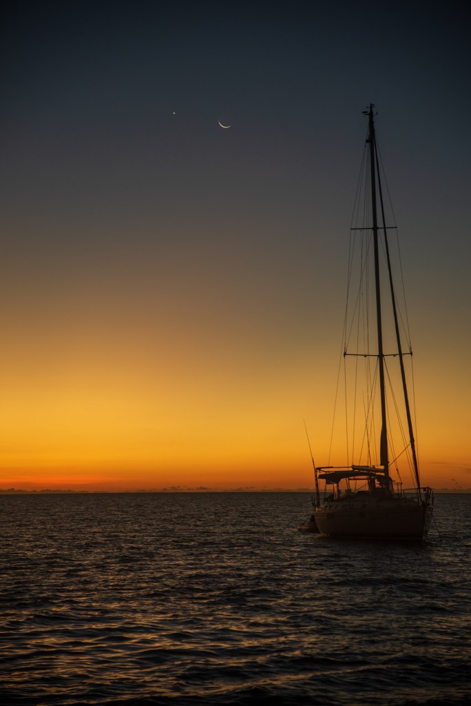
Big messy seas marked our sail to Port Essington at first, but then the seas calmed and the wind died to less than 10 knots, so we pottered along slowly. The sun was out and it was hot, and we had quite a nice sail in the end. Anchoring at Black Point, Port Essington, we were treated to a beautiful sunset and Matt took some photos of Sens de la Vie under the moon.
Sens de la Vie at sunset, Black Point, Port Essington
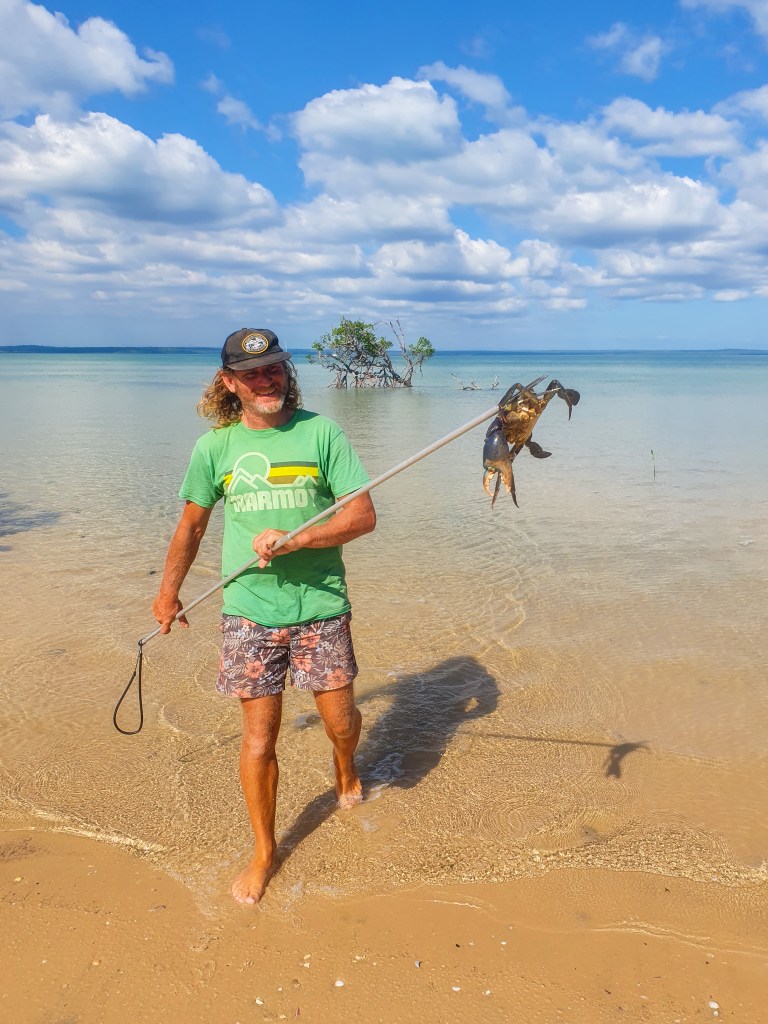
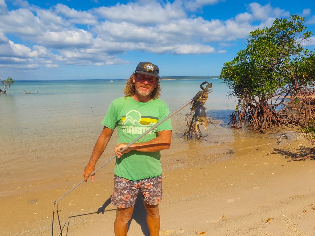
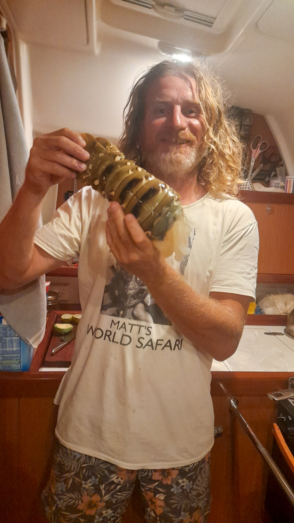
We spent two days in Port Essington which is on the Cobourg Peninsula and part of the Garig Gunak Barlu National Park. At Record Point we went ashore and the boys tried their hand at catching mud crabs. Matt managed to spear one with his Hawaiian swing. Our very first mud crab!! Leonie cooked it up for us, and that night we tasted mud crab for the first time. Very very delicious!!
Sens de la Vie and Cool Change anchored at Record Point, Barow Bay, Port Essington
Record Point, Port Essington
Matt hunting for mud crabs, Record Point, Port Essington
Matt the spear fisherman
Matt with his mud crab
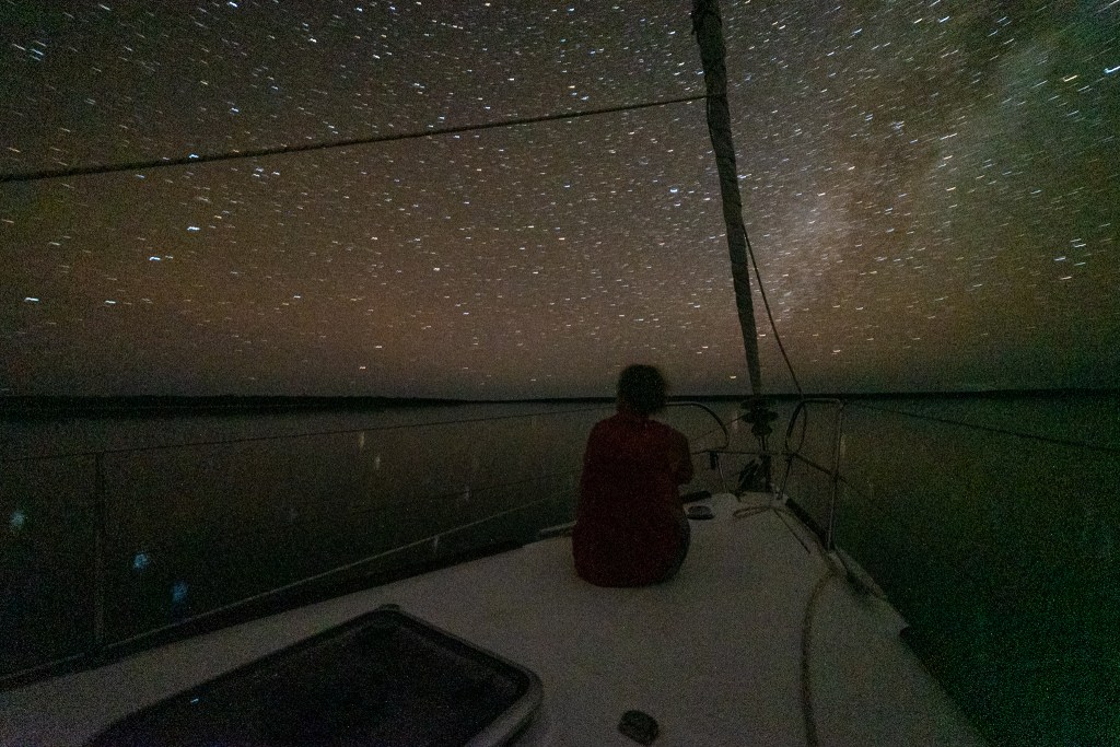
That night it was so dark and the water was so still that we could see the stars reflected in the water. The sky was bursting with bright stars and it was such a rare and special sight. After leaving Sens de la Vie and returning to Cool Change we had the lights on both yachts turned off, while Matt took some photos. Unfortunately, the full vision with the stars reflected in the water didn’t quite work out, but you can get a feeling for what we experienced.
Starry starry night, Port Essington
Starry starry night, Port Essington
Starry starry night, Port Essington
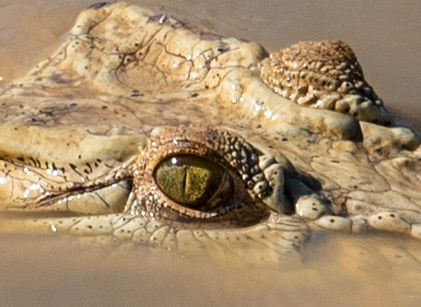
Enjoying a leisurely morning relaxing in the cockpit, Matt spotted a crocodile floating in the water near Record Point. Confirming his sighting with the binoculars, we jumped into the tender and motored over to get a closer look. As we approached, however, the croc sunk below the water. This was the first actual crocodile that we had seen in the wild, so we were quite disappointed that he disappeared, although maybe just a little relieved too. We headed back to the yacht, only to discover that he popped up again once we left.
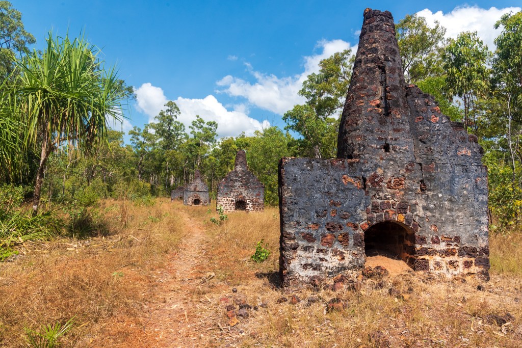
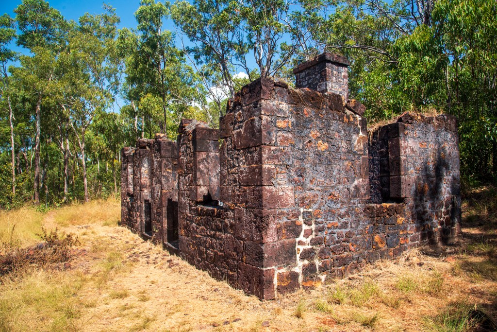
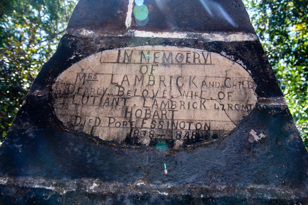
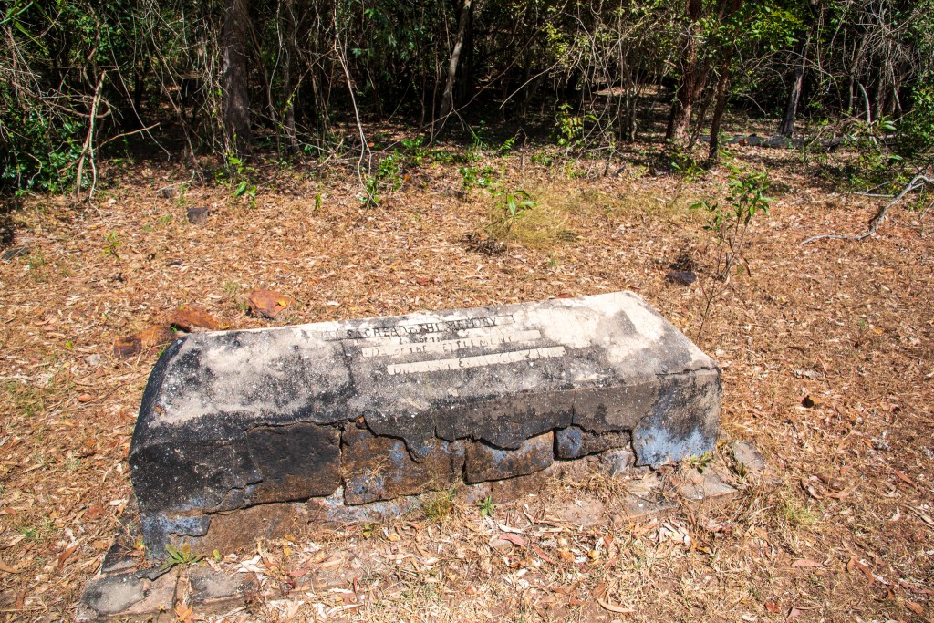
Motoring the short distance over to Minto Head, we anchored and went ashore to walk through the ruins of Victoria Settlement. The settlement was founded in 1838 as the third attempt by the British to settle on the northern coast of Australia. The pioneers spent 11 years trying to establish it before eventually giving in and abandoning it. By all accounts, life was incredibly tough here and at times most of the small community was in the hospital We wandered through the ruins of several buildings and around the little cemetery with its hand carved gravestones. A beautiful place, but so isolated and remote, a harsh landscape for those pioneers.
Minto Head, Port Essington
Minto Head, Port Essington
View from track, Victoria Settlement, Port Essington
Ruins, Victoria Settlement, Port Essington
Gravestones in cemetery, Victoria Settlement, Port Essington
We moved north to Kennedy Bay, hoping to find some caves there with micro-bats living in them. Although we didn’t find the caves, we found animal tracks of all sorts on the beach. We spied dingo tacks, goanna tracks and croc tracks, with the first two often leading to and from a turtle nest. The nests had obviously been raided, with the remnants of eggshells lying around. Poor little turtles!
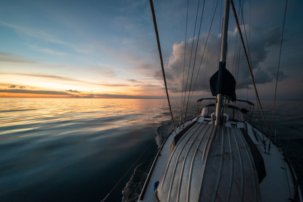
Another early start saw us motoring out of the anchorage in silky smooth, calm waters. We watched as first light appeared and then an incredible sunrise emerged, the brilliant golden orb rising through the clouds. With the water so still, Matt was able to take some great photos.
Silky smooth water at first light, leaving Port Essington
Silky smooth water at first light, leaving Port Essington
Silky smooth water at first light, leaving Port Essington
Sunrise, leaving Port Essington
Sunrise, leaving Port Essington
Sunrise, leaving Port Essington
Sunrise, leaving Port Essington
No wind and smooth seas….. no sailing today!
Our early start allowed us to catch the fast flowing current, and we were soon at our overnight stop in Alcaro Bay, Cape Don with the anchor down by 11am. Seeing as we had almost a whole day to explore, we went ashore with our hiking gear, hoping to walk the 5km up to the lighthouse on the point of Cape Don. However, the track was incredibly overgrown and we weren’t confident that we wouldn’t get lost, so back to the boat we went for a lazy afternoon lying in the sun.
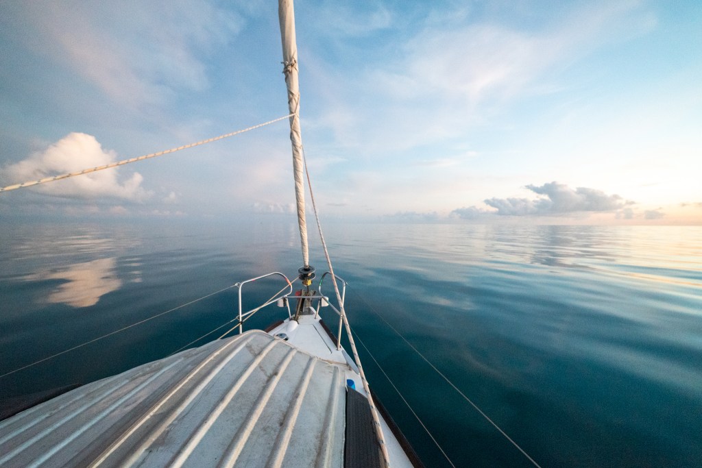
And then we were onto our final part of the journey; crossing Van Diemen’s Gulf to Darwin. Dundas Strait, at the top of the gulf, can be a treacherous stretch of water, with currents racing through and strong winds causing large waves. We timed our departure perfectly again and with the assistance of the tide, flew down the strait, averaging 8 to 9 knots. Once again, there was no wind to speak of, so we were motoring, but I didn’t care. The lack of wind meant that we had perfectly calm seas, and no waves at all. In fact, it was so calm and still that I was able to read a book.
We decided to anchor off Glyde Point in Adam Bay, rather than continue through the night. Surprisingly, as we were so close to Darwin, we still hadn’t got any phone reception, although once we put Matt’s phone up the mast here, we were able to make some phone calls by hot spotting to my phone below.
And then it was up early for the final leg, motoring through the South Channel below South West Vernon Island, the dark sky full of brilliant stars as I steered and Matt stood on the bow with a powerful torch, double checking for obstacles. Just a few hours later, we could see the buildings of Darwin and before we knew it, we’d entered the lock and tied up to a berth in Cullen Bay marina.
What an incredible couple of weeks we’d had sailing and exploring in the NT. We now couldn’t wait to experience all that Darwin had to offer, although it didn’t quite turn out exactly as we’d expected…..
Let’s go somewhere where the stars kiss the ocean.
After motoring through the Gulgari Rip, we turned south and anchored in Guruliya Bay on Raragala Island, one of the southern most islands of the Wessels. We had originally planned on anchoring in the first bay north of the Rip on Guluwuru Island, but Terry and Leonie on Sens de La Vie who were a bit ahead of us checked it out and reported that it was a bit rolly and unprotected. So we diverted to our plan B and headed `south.
A very pretty little bay, we enjoyed the evening here entertaining Terry and Leonie for dinner. Just as we had heard Border Force buzz Brian and Sandra when they were here the night before, so too did we get a call from the plane.
‘Yacht just overflown, yacht just overflown, yacht just overflown, this is Border Force, Border Force, Border Force. Over’
We had our AIS turned off, so they didn’t have our boat name, and they wanted to know who we were, and who the other boat was. We’ve had a number of calls from Border Force along the way. It’s good to know they’re out there.
Sens de la Vie in Guruliya Bay, Raragala Island
We were keen to explore the Wessel Islands further and decided to head to near the top of the northern island, Marchinbar Island, and anchor in Jensen Bay. I had read in one of the guidebooks that there was some Aboriginal rock art there that we thought we’d try to find.
And so the following morning we set off, motor sailing with the headsail in light winds and calm, aqua water. It was a fair distance to travel but we made good time, picking up the current towards the end of the passage.
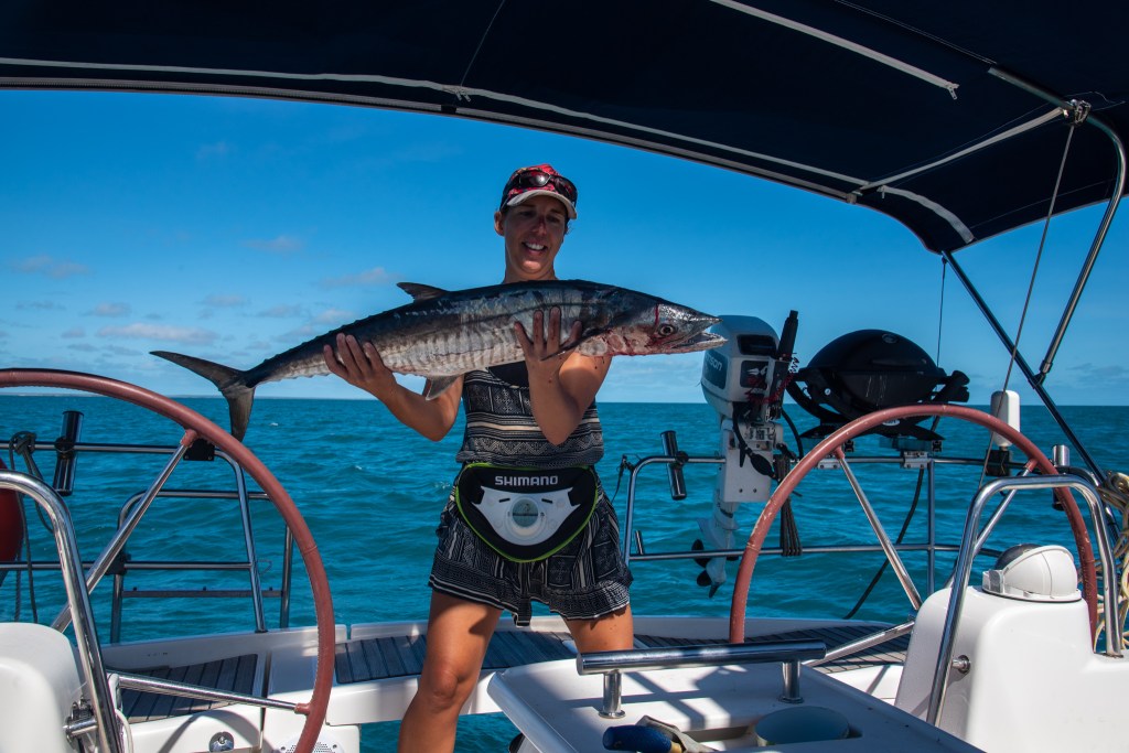
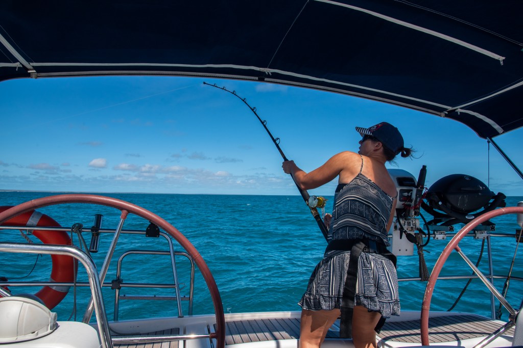
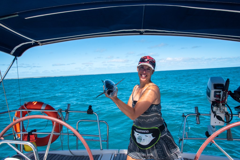
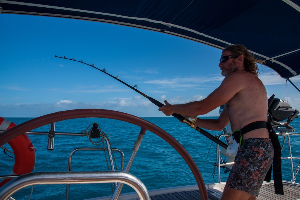
We were trolling the lure as we sailed, and the rod pinged not long after it was put out. Usually Matt brings the fish in, but I’d said I wanted to have a go this time. Holy moly, it was a big one. He didn’t fight all that much, but it was still hard work on my lower back. When we got him to the boat, we could see that it was a magnificent spanish mackerel, and he’d actually been foul hooked on the top of his head.
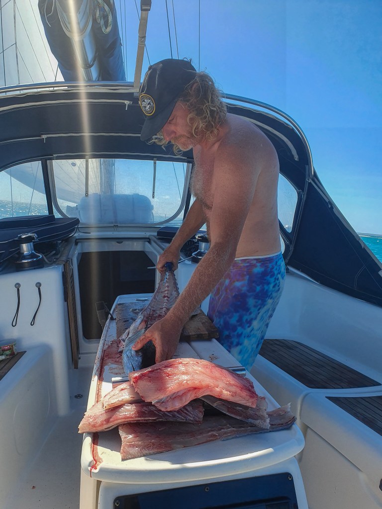
Getting him safely onto the boat, we measured him at 98 centimetres, our biggest mackerel to date. Matt set about filleting him before we reached the anchorage. Dinner for days!!
Me with the monster spanish mackerel
Matt filleting the mackerel
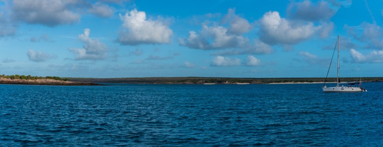
Arriving in Jensen Bay, we approached our chosen anchorage. The bay shoaled steeply, so, feeling like a catamaran, we slowly edged closer and closer to the rocks until we dropped anchor. Keen to explore and hopefully find the rock art, we immediately dropped our tender and went ashore about 4.30pm.
Cool Change, Jensen Bay, Marchinbar Island
Marchinbar Island is a truly spectacular place. It is up there with the prettiest scenery we’ve seen on this trip. We wandered all over the north part of the bay, searching for the art. All we had to go on was the fairly vague description in the guidebook: ‘Aboriginal rock art under overhanging outcrops depicting contact with the Macassan traders from across the Arafura Sea to the north.’
There were a lot of overhanging outcrops and we searched them all. Crawling on our tummies, and lying on our backs, we peered up at the rocks, hoping to discover the artwork. But although we searched and searched, it was to no avail. We didn’t find the mentioned artwork. I did come across some handprints, though.
Handprints, Jensen Bay, Marchinbar Island
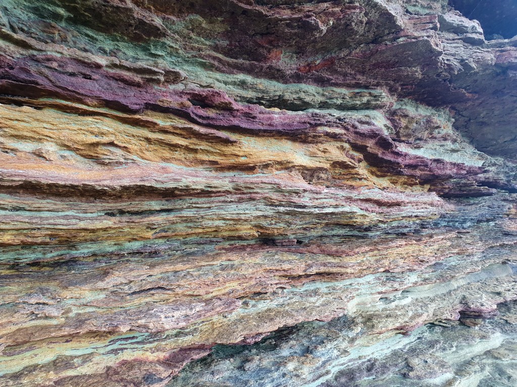
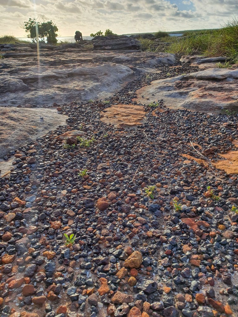
Although we didn’t see the rock art, we had an amazing afternoon exploring. The views were incredible everywhere we walked. The overhanging outcrops were made up of incredible stripey coloured rocks and inland there was tiny chunks of metal, bauxite I think, scattered over the ground.
Incredible colours, Jensen Bay, Marchinbar Island
Metal chunks, Jensen Bay, Marchinbar Island
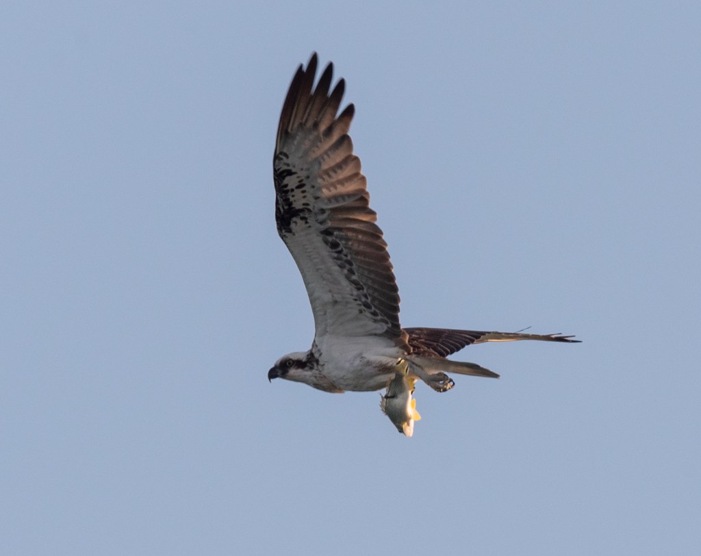
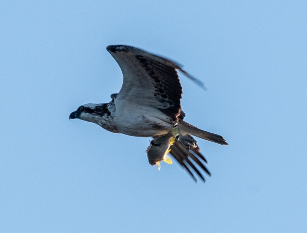
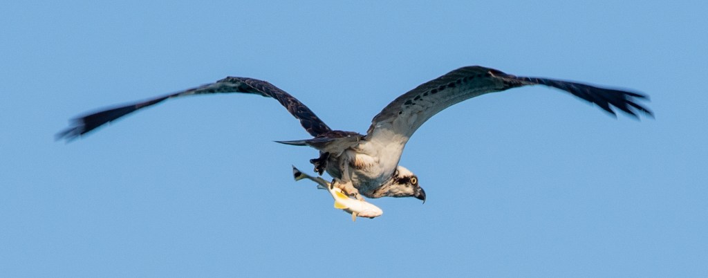
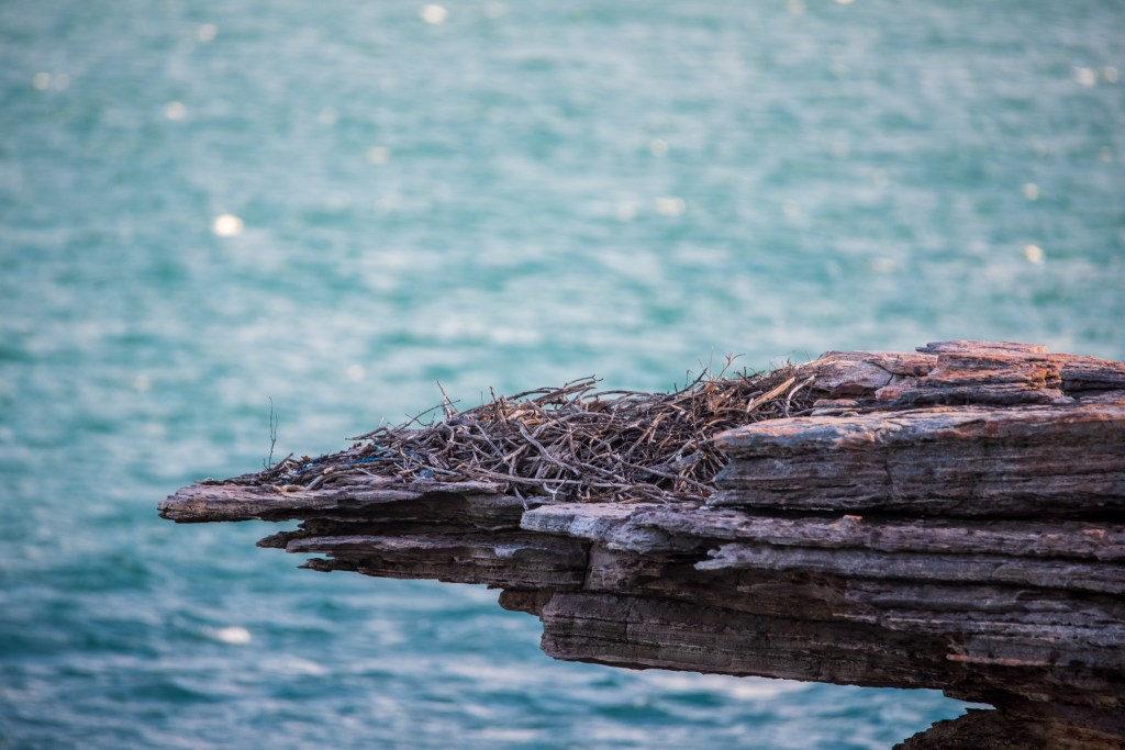
As we were walking along one section, we were suddenly startled by a huge osprey flying out of the rocks. Looking up, Matt exclaimed, ‘Oh look, there’s the nest’ and going up to investigate, he found a newly hatched chick and an egg in the nest. We only had a very brief look as we didn’t want to upset the parents who were flying circles around the nest high in the sky, squawking loudly at us.
Unfortunately Matt didn’t have his camera with him, so we decided we’d definitely come back the following day. It was nearing sunset and was one of those times when the light was absolutely perfect, ‘the magic hour,’ photographers call it. Matt was cursing not bringing his camera. I took some photos with my phone, and although they’re pretty good, they can’t compare with his proper camera.
As we reluctantly headed back to the yacht before it became too dark, we were treated to a spectacular sunset. The vibrant colours seemed to hang in the sky forever. It really had been an amazing day!
Sunset, Jensen Bay, Marchinbar Island
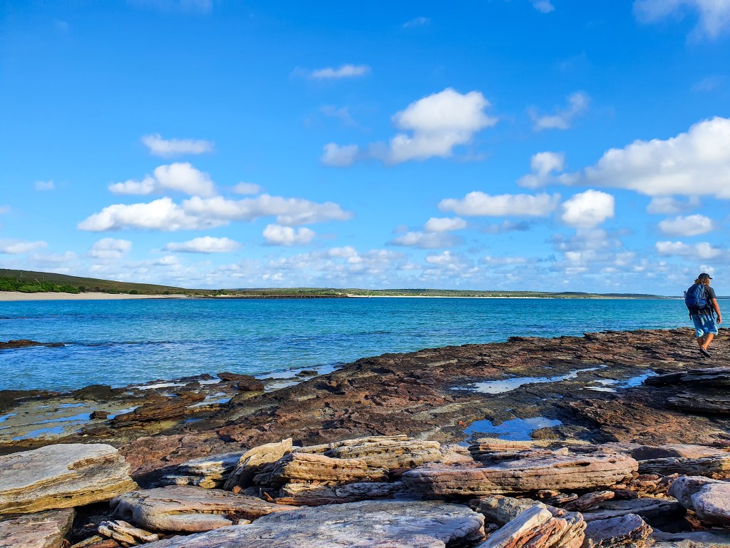
Although people did live here thousands of years ago, the Wessel Islands are currently uninhabited and we didn’t see a single other soul the entire time we were there. On our second day we explored right around Jensen Bay, walking down the length of the beach and venturing inland a little. It was a still and sunny morning, incredibly beautiful and the vibrant colours of the water, sand, sky, rocks and trees contrasting with each other were just amazing.
Jensen Bay, Marchinbar Island
Jensen Bay, Marchinbar Island
Jensen Bay, Marchinbar Island
Osprey nest in tree, Jensen Bay, Marchinbar Island
Walking inland towards the lagoon we found these unmistakeable croc tracks going up and down the beach. Comparing the size of our footprints with the croc’s footprint was pretty sobering. We didn’t see any crocs but it was a good reminder that they are definitely out there!
Crocodile tracks. Marchinbar Island
Crocodile tracks. Marchinbar Island
Crocodile footprint on the left, Matt’s footprint on the right.
Lagoon, Marchinbar Island
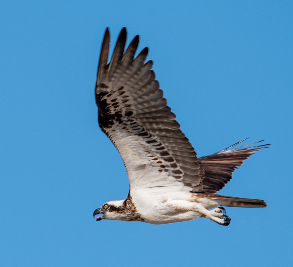
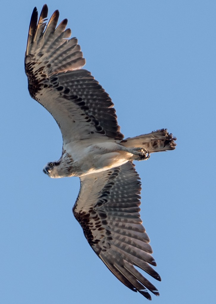
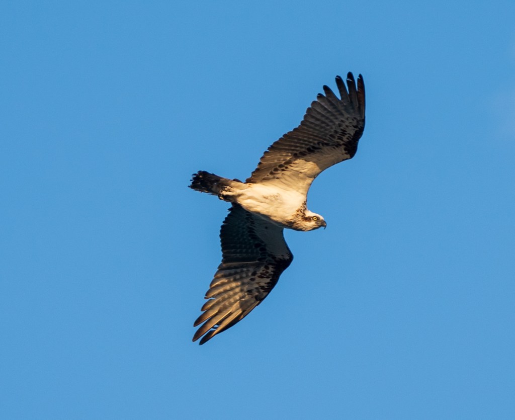
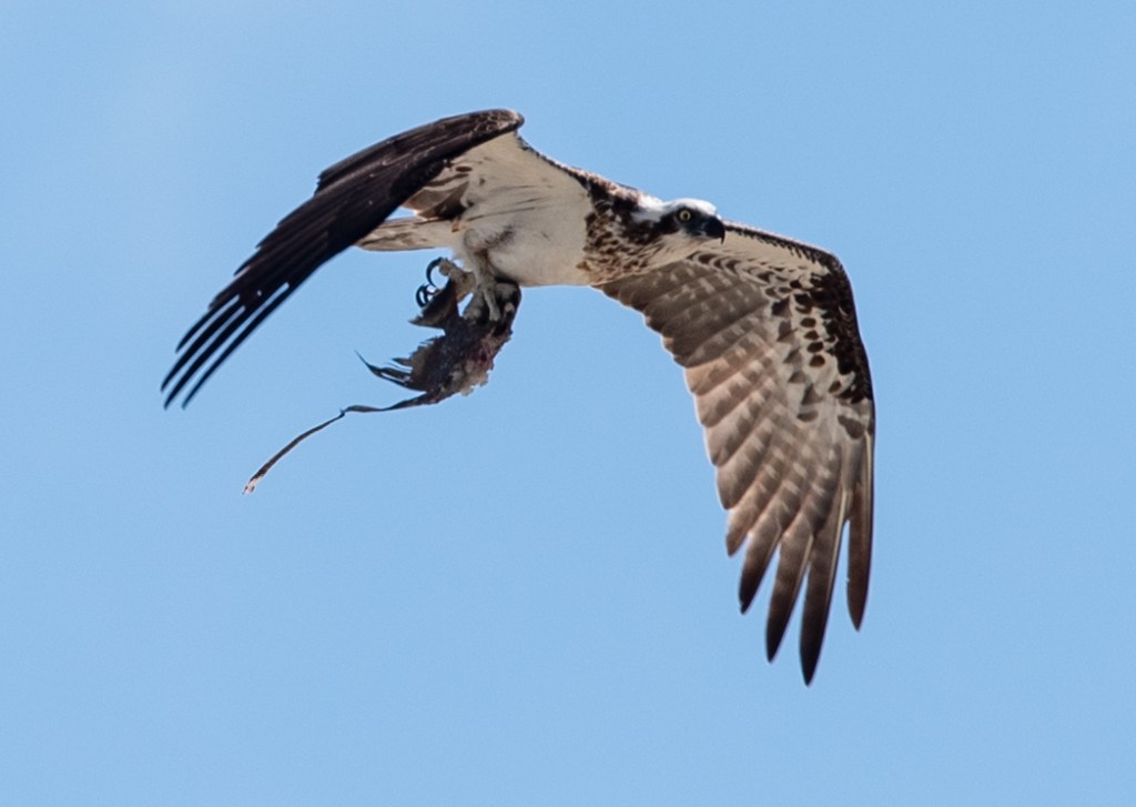
There was quite a lot of bird life and Matt took some brilliant photos. Here are some of his best. Check out the ospreys below; one has caught a fish and the other has a small native marsupial.
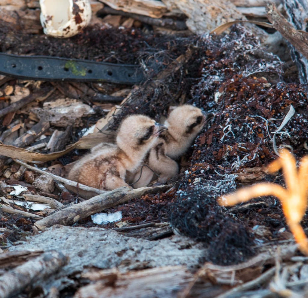
Late afternoon we headed back to the rocks to say hello to the ospreys again. Lo and behold, this time there were two chicks in the nest. Matt took a few quick snaps and we retreated.
Osprey nest, Jensen Bay, Marchinbar Island
Osprey nest, Jensen Bay, Marchinbar Island
Osprey nest, Jensen Bay, Marchinbar Island
Baby osprey chicks, Jensen Bay, Marchinbar Island
We continued searching for the rock art in several other locations, but unfortunately couldn’t find it. The wind had picked up, causing choppy water and waves in the bay and we both got soaking wet as we drove the tinny around. We still weren’t cold though!
Jensen Bay, Marchinbar Island
Jensen Bay, Marchinbar Island
The Wessel Islands, ‘the forgotten isles’ are truly a well kept secret, and one of the most beautiful places we’ve had the privilege of visiting. We couldn’t wait to see what other wonders the Northern Territory coast was hiding.
So here we are in the Northern Territory, our fourth state/territory of the circumnavigation. We are pretty much at the opposite end of the country to Melbourne, so I think that makes us about halfway through our trip. Only halfway! It has been many, many years since I was last in the NT, and Matt has never been so we are particularly excited to be here.
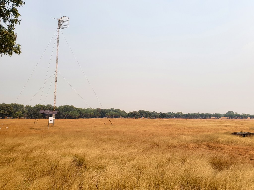
We spent five days in Gove and the neighbouring inland town of Nhulunbuy. Situated in Arnhem Land, the Gove Peninsula is barely touched by western development, with the exceptions of Nhulunbuy and the bauxite mine and alumina refinery. There are vast tracts of unspoilt land, beaches and ocean. Nhulunbuy is a purpose built town developed in conjunction with the bauxite mine and the now closed alumina refinery. The town is built on a Special Purpose Lease on Aboriginal land and is now the largest town in East Arnhem Land and the fourth largest town in the NT.
Anchored in the calm waters of Gove Harbour, we spent several days just relaxing and catching up with family and friends as we had good phone reception. We joined up as temporary members of Gove Boat Club and used their showers and laundry facilities. Evenings saw us hanging out with Brian, Sandra, Terry and Leonie. We had a potluck dinner at the BBQ shelter and evenings on both Sealeaf and Sens de la Vie. Our friend Matt, who happened to be working in Gove at the mine, came out for drinks one afternoon and it was great to get his local perspective on the town.
Gove Harbour
Gove Harbour
Gove Boat Club
Sunset, Gove Boat Club
Sunset, Gove Boat Club
Sandra, Brian, Terry, Leonie and Matt, Potluck Dinner, Gove Boat Club
Cool Change, Gove Harbour
Terry and Leonie had a contact in Nhulunbuy, a friend of a friend who had very kindly offered to drive them around and give them a bit of a tour. We jumped at the chance to tag along. Ivor and his wife Linda have been living in Nhulunbuy for over 30 years so he was a fount of knowledge about the area. He drove us around the town, pointing out buildings of interest and also took us up the Roy Marika Lookout and out to some local beaches.
It was fairly quiet around the town, quieter than normal, Ivor told us, because there was a large amount of unrest amongst the local Aboriginal people at the moment. The Aboriginal people here are called the Yolngu, which is the word that Aboriginal people from East Arnhem Land use to refer to themselves, rather than the name of any clan or family group. There are five main clan groups in the area and there is a lot of rivalry amongst the tribes. According to Ivor, this rivalry goes back a long way, but unfortunately it often leads to violence. There had recently been a stabbing of a young man, and so the town was on edge, wary of more violence, as the inevitable payback was dished out.
This tribal rivalry, for no more reason than the fact that they have always been rivals, is absolutely ridiculous. Violence for absolutely no reason. In today’s world, surely these ancient rivalries are no longer necessary and can be let go. Why can’t people just get along, or at least just ignore each other and live peacefully . It drives me nuts and I have no patience for it. Rant over.
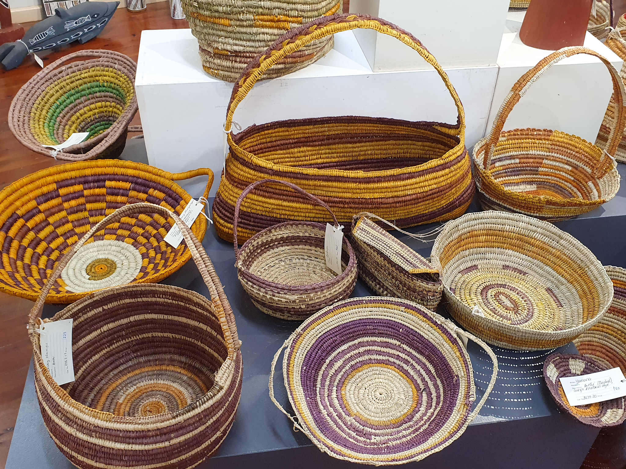
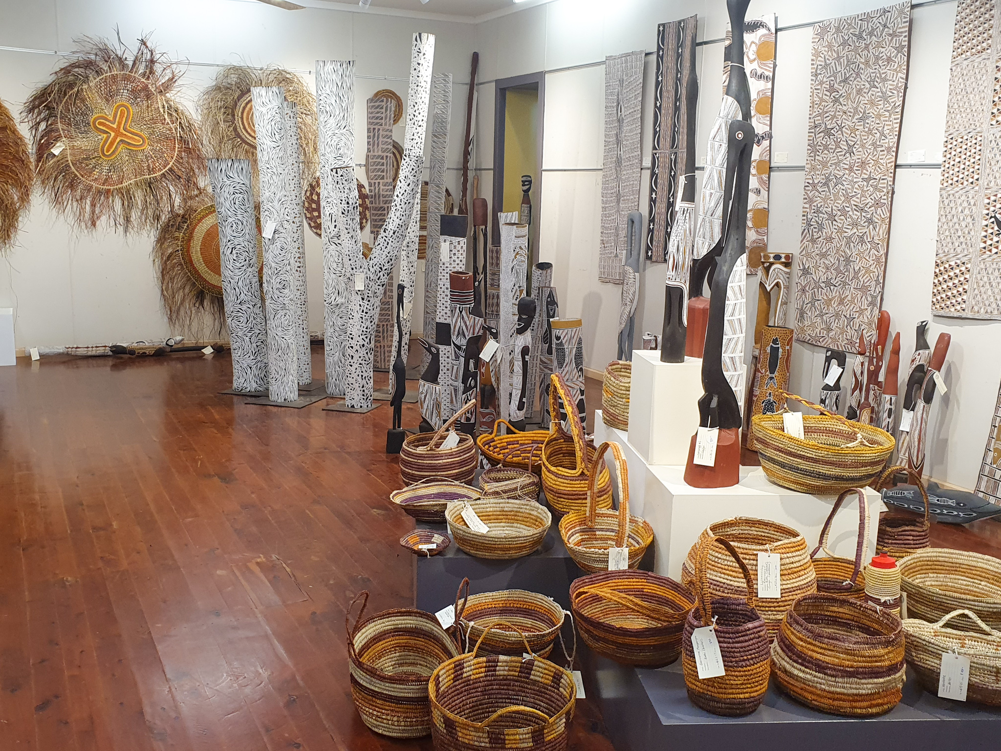
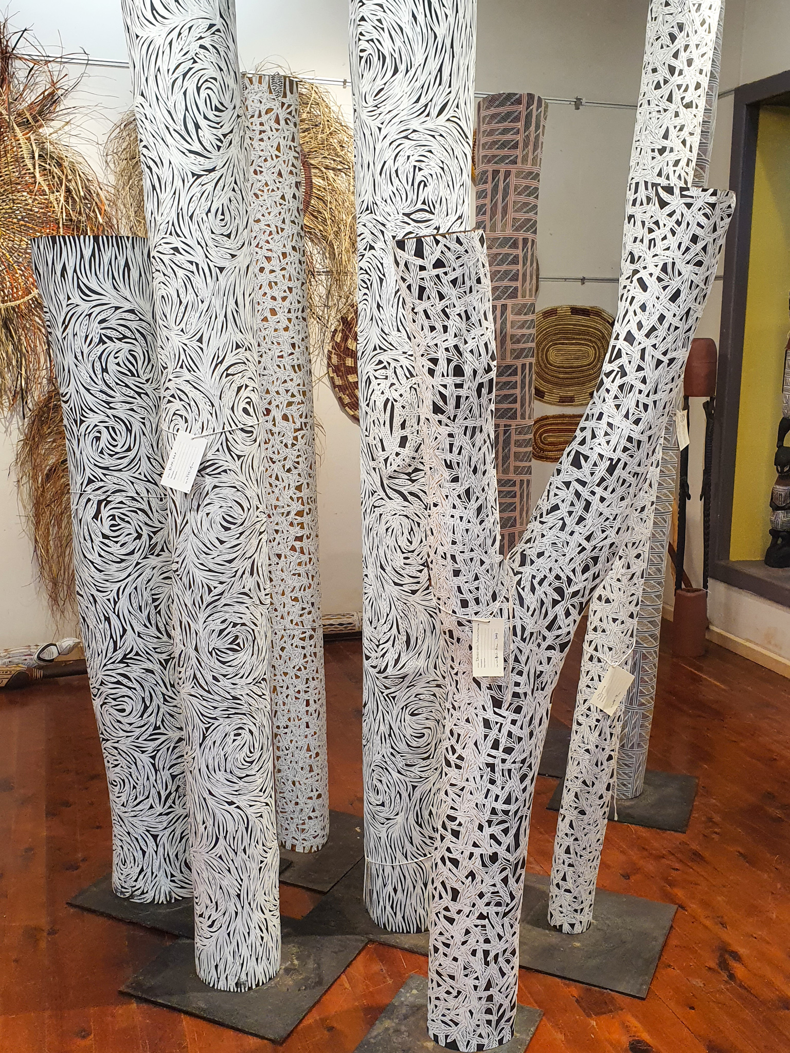
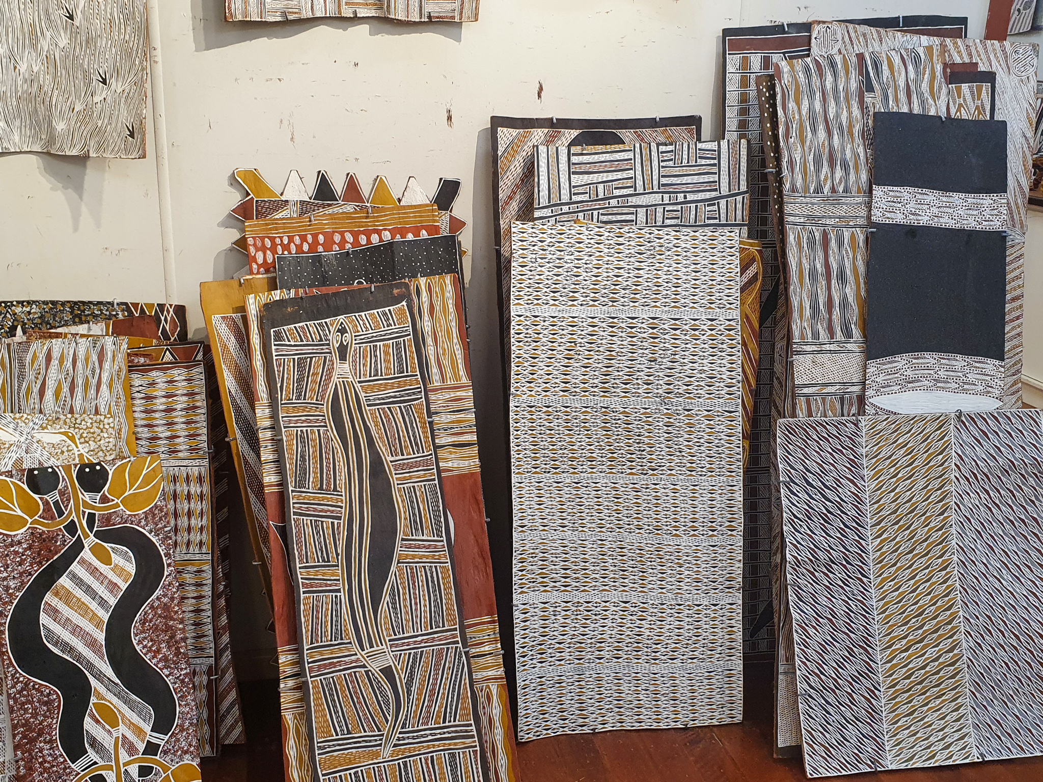
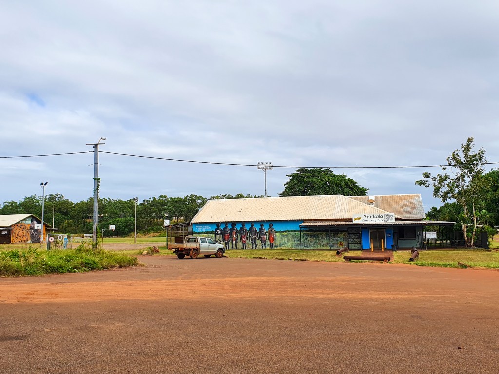
Ivor also took us to the little community of Yirrkala, where the Buku-Larrnggay Mulka Centre is. The Buku Art Centre is a gallery showcasing a range of indigenous artwork, including paintings, weavings, jewellery, sculptures and memorial poles. The artwork is sold and distributed to buyers all over the world. We admired many of the intricate pieces, but with prices reaching thousands of dollars, even the cheapest pieces were beyond our means.
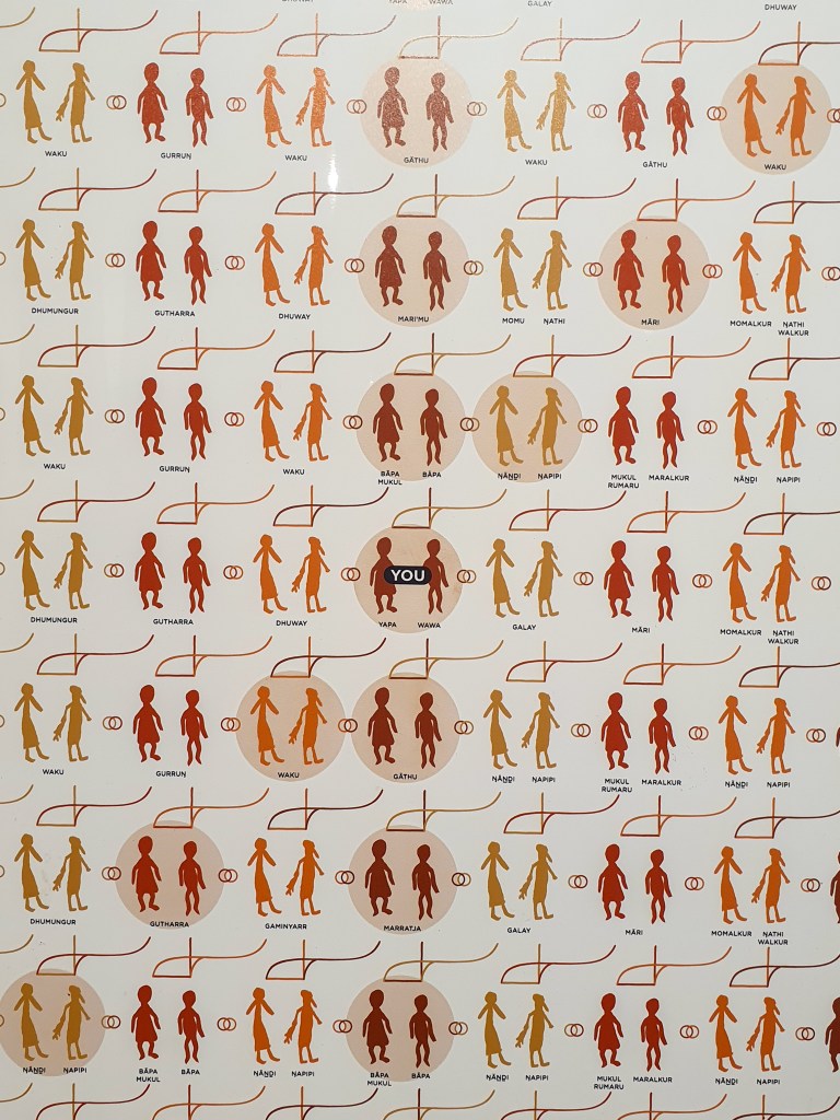
The intricate rules of who you can and can’t marry for the Yolngu.
Yirrkala, East Arnhem Land
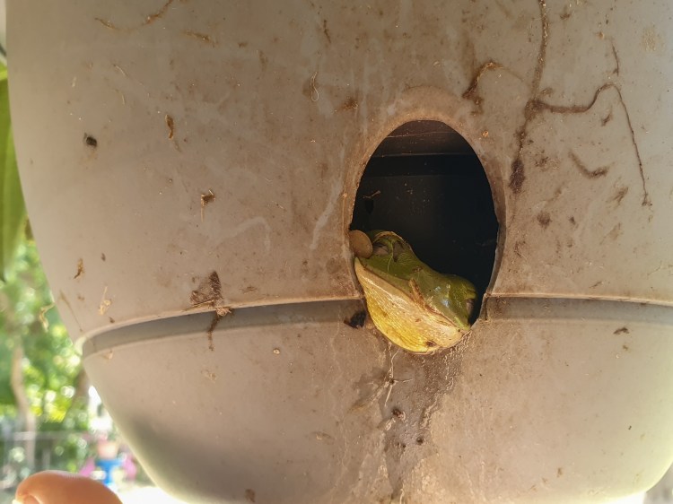
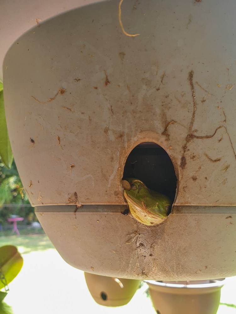
Ivor also took us back to his house to meet his wife Linda, and their pet green tree frogs who live in some hanging baskets. How cute are these guys?!! Many thanks to Ivor and Linda for their hospitality.
After our time in Gove we were well rested, the boat was nice and clean and the fridges and freezer were stocked full. It was time to move on. The next couple of weeks would see us sail along the Northern Territory coast until we reached Darwin. This would be some of the most isolated and remote waters that we had sailed so far. Although we would be able to get off the boat to stretch our legs on some beaches, there were no towns or ports where we would be able to buy any supplies, and we would have very limited internet and phone reception. We had to be completely self sufficient for the next couple of weeks. I was looking forward to it!
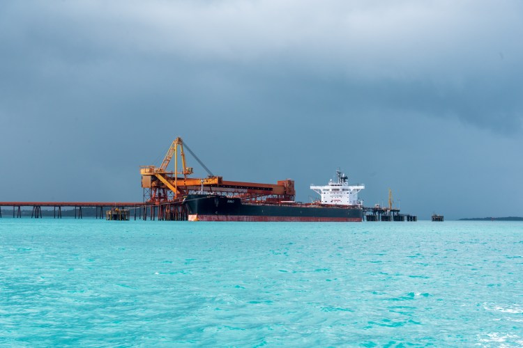
We farewelled Gove, motoring out of the harbour under grey skies, but still in incredible aqua coloured water. Once past the huge tanker being filled with material from the mine, we hoisted our sails and set off for the English Company Islands.
Ship being loaded with bauxite
We decided to anchor at Wigram Island for the night and tucked ourself into the little bay. Although we could see some buildings near the shore, the island seemed deserted. We spent the following morning on the boat, making water to to fill our tanks and Matt also pressure washed off all the red dust that had accumulated on our deck.
We were in no hurry because our next passage included the famous Gulgari’s Rip, otherwise known as the ‘Hole in The Wall.’ The Gulgari Rip is a narrow passage, about 50 metres wide between two islands, and currents can rip through there at 9 to 12 knots. Consequently the ideal time to transit is at slack water, unless you feel like a rollercoaster ride. Seeing as we were not up for quite that much excitement, we read the guidebooks and tried to calculate the time of slack water. One said two and a half hours after Darwin high tide, another said one and a half hours after Gove high tide. We spoke to Brian and Sandra who’d motored through the day before and they had had a good passage at 2pm. We settled on aiming to enter sometime between 2pm and 3pm.
So around midday we set sail into pretty calm water that was the most beautiful aqua colour. It was a lovely sail and we could just spot Sens de la Vie out in front of us, who’d come from Elizabeth Bay where they’d anchored for the night. It was almost impossible to see the entrance to the Rip until we were right upon it. We furled our headsail and started the motor. I steered us into the Rip while Matt got out his camera. We had timed it well and had just a very slight current pushing us.
The Rip was just beautiful, with layers of rocks stacked upon each other lining the sides. We pulled the motor right back, and cruised through slowly, trying to take it all in. A spectacular place and a very cool experience.
Cool Change approaching the Rip:
Gulgari Rip, Wessel Islands
Gulgari Rip, Wessel Islands
Gulgari Rip, Wessel Islands
Gulgari Rip, Wessel Islands
Gulgari Rip, Wessel Islands
What a beautiful place!! The Gulgari Rip is part of the Wessel Islands, an archipelago stretching 120 kilometres in length. We couldn’t wait to explore them!
The core of mans’ spirit comes from new experiences.
While we had really enjoyed our time in the Torres Straits and around Seisia and Bamaga, our next challenge loomed large, ever present in our thoughts and our conversations with other yachties.
The Gulf of Carpanteria. 350 nautical miles. Two to three days of non stop sailing.
Up to this point our longest passage had been 25 hours, so we were looking at more than doubling that time.
There were many things to take into consideration. Should we leave directly from Seisia? Or should we sail further south to Weipa and cross from there? We’d heard from other yachts who’d headed south that they’d had an uncomfortable time bashing into wind and waves, and some rolly anchorages on the way down. It was a shorter distance as the crow flows from Weipa to Gove than from Seisia to Gove, but which route would put us on the best angle to the waves and the swell? Was the forecast wind too strong? Would it get stronger or weaker over the next few days? We heard from a few yachts who described their crossing as a ‘washing machine’ – how similar were the current forecasts to those conditions?
In the end, after much umming and aahing, the decision was made. We would leave on Tuesday 25th May. I was a bundle of nerves the night before, still questioning whether we should go, if the weather and seas would be ok? I didn’t have a great sleep that night, but in the end decided that a leap of faith was needed, and that we were indeed ready for this. Terry and Leonie from Sens de la Vie were heading across as well. It was comforting to know we’d have some friends out there with us.
After a final weather check, and conference between Matt and Terry, the final decision was made, and we set about readying the boat. Objects that could go flying were stowed away, pot restraints were screwed on, food items were taken out of the pantry for easy access, jacklines were tied onto the deck, and torches, life jackets and warm clothes gathered.
We left Seisia at the very civilised hour of 9.30am. Why leave at the crack of dawn when we’d be sailing for two to three days? We’d estimated that leaving early to mid morning should have us arriving in Gove Harbour in daylight hours two days later. As we motored out of the channel we received a text from Brian and Sandra who’d departed Seisia on Sunday and were almost at Gove, ‘We’ll see you in two days after the washing machine!’ Not the most comforting message ever received!
Nonetheless, we continued on, manoeuvering through the numerous shoals of Endeavour Strait for an hour before shutting off our engine, unfurling our headsail and setting our course towards Gove. We were on our way!! Matt was really pumped and excited, looking forward to the trip. I was too, but also felt a little apprehensive and a bit nervous. Still, I had total confidence in both our abilities and our boat. We could do this!
We settled into the sail and with winds about 20 to 25 knots from behind, we were flying along. At first the conditions weren’t too bad, but as we progressed further out into the Gulf, we began to encounter big, sloppy, confused seas. Waves were coming at us from the side, rocking the boat uncomfortably. The ‘washing machine’ description turned out to be a fairly apt one!
Day One – Gulf of Carpentaria. Sens de la Vie in the distance, in the relatively calm conditions at the beginning of the sail.
Day One – Gulf of Carpentaria Sens de la Vie in the distance, in the relatively calm conditions at the beginning of the sail.
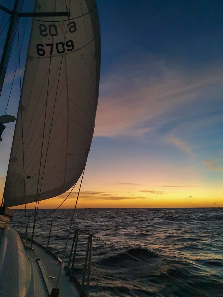
After dinner we started our shifts. I was taking 6 to 12 and Matt was on from 12 to 6. Give or take half an hour. By utter chance, it turned out that we would be sailing across the Gulf under a full moon, and not only that, but on the second night there was going to be a full supermoon lunar eclipse. I couldn’t believe our luck! The full moon meant that there was plenty of light and we wouldn’t need to use torches at all. Although we still turned on the radar at night, we could see all around the boat very well, which was much more comforting than being in the pitch black, the case if there was no moon.
As I began my first evening shift, I watched the sun set directly in front of the boat and the full moon rise directly behind it. It was pretty magical!
Sunset, Day One, Gulf of Carpentaria
Sunset, Day One, Gulf of Carpentaria
Sunset, Day One, Gulf of Carpentaria
Sunset, Day One, Gulf of Carpentaria
Full moon rising, Gulf of Carpentaria
The wind was still blowing strongly and I had my life jacket and tether on, as per our usual precautions during night watches. After a few hours of sitting at the helm, holding on tightly and riding up and down the three metre waves, the wind picked up. Suddenly our 7ish knots of speed had rocketed up to over 9 knots with the wind strength shooting up to over 30 knots. Wowsa!
With the boat heeled over, I knew I had to de-power us, so I set about furling the headsail in a little bit. A challenging manoueuver in the strong winds on my own. Matt had only been dozing and he’d felt the sudden acceleration and leaning of the boat, so he jumped up to help. I had it mostly under control, but was grateful for his helping pair of hands. With the boat stabilised, Matt returned back to bed, and I completed the rest of my shift, hanging on tightly as Cool Change rode up and down the big seas. I’d taken sea sickness tablets so I didn’t feel sick and I tried to enjoy the experience. Terry called in on the radio to see how we were doing, ‘What a wild ride!’ I told him. Their boat had been knocked around and Leonie had hit her head, so Terry slowed his boat right down. I hoped Leonie was ok.
I gratefully swapped places with Matt when he came up for his night watch. Although it was hard to actually sleep with the rocking and jerking motion of the boat, it felt amazing to just be able to lie down and close my eyes. I dozed a bit, my body becoming accustomed to the movement. As our cabin lies across the stern of the boat, we sort of slide up and down the bed as the boat rocks back and forth.
About 3am, I felt a huge jerk as my body was suddenly thrust along the bed. I heard a big whoosh and properly woke with a start. ‘MATT!’ I yelled, scrambling to get up, my heart thudding. ‘I’m ok, I’m ok,’ he yelled down, ‘it was just a massive wave. It flooded the cockpit.’ Matt emerged down into the cabin, completely drenched. A huge wave had broken right in the cockpit dumping water everywhere and completely saturating him. I jumped up and grabbed him some dry clothes as he towelled off and got changed.
Luckily, since we were about as far away from Melbourne as you can get, and still be in Australia, the night was as warm as the water. Water temperature was in the high 20s and the maximum air temperature was around 28 degrees. Matt reckons it only dipped down to a ‘chilly’ 27 at night. He’s exaggerating, of course, and although he only needed to add a light long sleeved top for night watches, I would wear 3/4 pants, a hoodie and a head scarf.
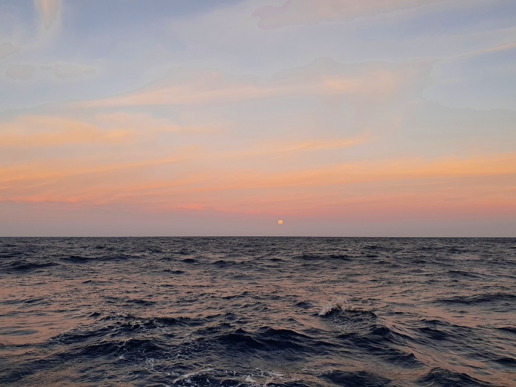
Thankfully that was the last of the excitement and we swapped watches just before sunrise. By that time both the wind and the seas had died down a fair bit, and I sat fairly contentedly holding my mug of hot coffee, and watching the full moon that was now in front of the boat. I could see ‘the man on the moon’ very clearly, but to me it was most definitely a lady and she was peering down at me with a bemused expression, as if to say ‘what are you doing out there?’ It’s amazing what thoughts a tired brain conjures up.
Full moon lighting up the sky, Gulf of Carpentaria
I sat and watched the sun rise in the east behind the boat; first a faint tinge of colour colouring the sky, before the fiery ball emerged from the horizon and up into the clouds. Always a special experience and a time to be grateful.
Sunrise, Day Two, Gulf of Carpentaria
Sunrise, Day Two, Gulf of Carpentaria
Sunrise, Day Two, Gulf of Carpentaria
Sunrise, Day Two, Gulf of Carpentaria
The slightly better sea conditions continued into that day and we mostly abandoned our shift times, just napping in short stints and swapping over constantly. By this time, the fatigue was really starting to kick in. The lack of sleep was a killer and I felt utterly exhausted. In addition to the normal tiredness, the seasickness pills I took made me really drowsy and I found myself battling to keep awake during my watches.
I tried a number of tactics to combat this. I started snacking constantly, because I figured surely I couldn’t fall asleep if I was eating. So I ate; mandarins, fruit cake, chips, crackers, cold sausages, banana pancakes, toasted sandwiches, brownies and icy poles. There was plenty of ready to grab food as I’d prepared heaps and heaps in preparation for the passage. I ate so much that after a while I couldn’t stomach the thought of any more. I took to singing out loud to the songs on our playlist. Or tapping myself on the face, willing myself to stay awake. The lack of sleep plus the effect of the pills and the consequent exhaustion and tiredness was one of the most challenging parts of the passage; I’ve never coped well without enough sleep. Thankfully, we both seemed to sleep a bit better during the second night and actually felt like we got some proper sleep instead of just dozing.
On that second day, we didn’t see a single other soul, just a wide expanse of water and waves. By this time we were on a slightly different tack to Sens de la Vie and a bit ahead of them so we couldn’t even see them on the chartplotter. We were totally on our own. Nothing to see and nothing to hit. I did spy a few flying fish however. Did you know that flying fish actually have wings and actually fly up and out and across the water? I always thought it was just a term for the fish that leap out and skim across the water. But these little fish actually flew, their tiny wings beating furiously. Very, very cool! Consider my mind blown!
At some stage of the journey we were joined by a little bird. He flew onto our deck and proceeded to ride with us for about 24 hours. Sometimes he’d be blown off by a big gust of wind, but he’d find his way back and settle back down again. At one stage, he edged up right alongside where I was sitting, it was nice to have the company.
Our little hitchhiker
Once again the sunset and rising of the moon fell in my evening watch. The sunset was absolutely spectacular, bright streaks of orange and yellow stretching across the sky.
Sunset, Day Two, Gulf of Carpentaria
Sunset, Day Two, Gulf of Carpentaria
Sunset, Day Two, Gulf of Carpentaria
Full moon rising, Gulf of Carpentaria
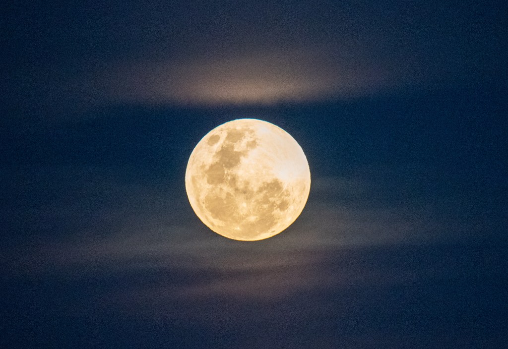
That second night there was also a ‘super blood moon,’ which is a total lunar eclipse coinciding with a supermoon. A supermoon takes place when the full moon occurs near the closest point in its orbit to Earth and a lunar eclipse occurs when the Earth passes between the sun and the moon. Apparently supermoons coincide with total lunar eclipses only once every four to five years. How incredible that we would be able to view this amazing sight in the middle of the Gulf of Carpentaria.
We had heard that the eclipse was due to start at about 9 pm, and I’d promised to wake Matt up then so that he could watch too. As I glanced up at the moon I could see what I thought was a big cloud passing in front of it. It was still a fair bit earlier than we expected the eclipse so I just dismissed it as a cloud. But the cloud didn’t pass across, and I started to wonder – maybe this was actually the eclipse? I radioed Sens de la Vie, and Leonie confirmed my suspicions, the eclipse had indeed begun. I raced to wake up Matt.
We sat completely entranced for the next hour or so, as the moon was very slowly covered up and then turned a deep orange red colour. It was as if a blanket was very slowly pulled over the moon, and as the bright light emanating from the full moon was covered up, the sky darkened and stars began appearing. As there was absolutely no light pollution around, other than that from our boat, the stars were incredibly bright. It was magical!
Thankfully, the seas had calmed significantly so we were able to sit pretty comfortably and marvel at such an incredible sight. ‘Did you ever imagine we’d be watching a lunar eclipse in the middle of the Gulf of Carpentaria, on our own boat?’ I said to Matt in awe. ‘And in the nude!’ he replied. Well, Matt was in the nude as he’d come up from his sleep but I was wearing a hoodie and a head wrap; as I always got a bit chilly during the night watches. Matt tried taking some photos and he managed a couple, but the boat was still rocking too much, so he gave up and we just sat and absorbed the sight.
Full moon, before the super moon lunar eclipse, Gulf of Carpentaria
After a while, Matt retired back to bed and I was on my own again. The blanket was peeled back off the moon and as the bright light reappeared, the thousands of stars faded away, completely hidden from sight. It really was like magic.
Full moon, Gulf of Carpentaria
When I came back out for my morning watch there were some interesting cloud formations across the sky. I’m not sure if they were the famous ‘Morning Glory’ clouds that the Gulf is famous for, but they were cool nonetheless. The sun rose from behind them.
Day Three, Gulf of Carpentaria
Sunrise, Day Three, Gulf of Carpentaria
Sunrise, Day Three, Gulf of Carpentaria
It was almost midday when we finally sighted the coastline. Land ahoy! There were some big waves building and the wind was no longer favourable for sailing so we switched on our engine. The last part of a trip always seems to take forever, but this really was a long way in and over and around to Gove Harbour, taking us four hours to motor in. Once we had passed Bremer Island, the seas dropped and it was lovely and calm.
Finally, bang on 55 hours after we left Seisia, we dropped anchor in Gove Harbour, waving madly at Brian and Sandra who came out onto the deck of Sealeaf to welcome us. We had arrived! Excitement and relief combined to give us both a second wind of energy and after a quick shower we dropped our tender and headed over to the Gove Boat Club for dinner and drinks with Brian, Sandra, Dave and Michelle. Our little tribe was missing Terry and Leonie who had dropped anchor near Bremer Island and would motor into Gove the next day.
Falling into bed that night, we felt happily exhausted and very pleased and proud of ourselves. We were looking forward to the next leg of our journey; discovering the unique and isolated coastline and islands of the Northern Territory.
Always remember we are under the same sky, looking at the same moon
Described as ‘impossibly beautiful and virtually untouched’ the Torres Strait Islands lay north of Cape York and consist of 274 tiny islands. Only 14 of the islands are inhabited and only a few of these permit visitors. The Torres Strait Islander peoples, being predominantly Melanesian, are ethnically, culturally and linguistically different from Aboriginal Australians.
Matt and I were keen to visit this intriguing and unique area so we set off for Horn Island where there was a safe anchorage. Motoring through the lumpy seas in order to charge our batteries, it took only three and a half hours to arrive at Horn Island. The ‘impossibly beautiful’ moniker was spot on the money. Incredible turquoise water surrounded us and we spotted several huge turtles peeking their heads up out of the water.
At Horn Island we joined Brian and Sandra to visit the Torres Strait Heritage Museum which was filled with fascinating information and artefacts about the island’s role in World War II. It was especially significant for Brian whose Dad had been stationed here in the war. After a couple of hours of wandering the exhibits, which also included information about the local culture, we retired to the bar at the nearby motel and chatted the afternoon away.
Horn Island
Brian and Sandra’s Sealeaf at the Horn Island anchorage
Horn Island Boat Ramp
The following day saw us boarding the tiny ferry across to Thursday Island, which is the administrative centre for the Torres Strait. The ferry fare included a bus ride as well, and after dropping the other passengers off, including a boy at the high school, the incredibly friendly and obliging bus driver offered to drive us up to Green Hill Fort to save us the walk. On the way he gave us an impromptu tour of the tiny island, which is only about three square kilometres in size. We wandered through the old fort, marvelling at the spectacular views of the surrounding islands and the breathtaking aqua and turquoise waters.
Green Hill Fort, Thursday Island
Green Hill Fort, Thursday Island
Brian and Sandra, Green Hill Fort, Thursday Island
Strolling back into town, we explored the two streets that make up the tiny town and chatted with some locals. We found everyone to be incredibly friendly and the island to be a very welcoming, clean and tidy place. We were all very impressed. Lunch was at the Torres Hotel, nicknamed ‘Australia’s Top Pub’ as it is quite literally the northernmost pub in Australia. Bafflingly there was no seafood available so we had chicken parmies, some of the hugest meals I’ve ever seen. After we’d digested lunch we continued on to try to visit the award-winning Gab Titui Cultural Centre, but it was unfortunately closed until the end of the month.
Thursday Island
Jumping into a cab to get us back to the ferry on time, we arrived with minutes to spare only to find no one there and then almost an hour wait when we did board the boat. I’m sure we read that timetable correctly, I think we just experienced a dose of ‘island time!’ We had all been keen to buy a painted craytail, but on finding that the price had doubled overnight to $90 a kilo we declined. Later, Brian struck up a conversation with a local fisherman and he bought two tails off him for a price closer to $40 a kilo. Matt and I cooked up our very first crayfish tail the next night. It was yum!
After our adventures in the Torres Strait it was time to head back to the mainland, to the little port of Seisia where we would do jobs and prepare for our passage across the Gulf. We spent four days anchored in the calm waters off Seisia, and I did laundry and grocery shopping while Matt filled up jerries of diesel at the nearby servo and refilled a gas bottle.
Seisia is a tiny little town, with the slightly bigger town of Bamaga about 6km inland. The famous red dust of the outback was here and we were soon covered in it. We saw lots of piles of what we at first assumed to be camel dung, but discovered was actually from horses. There were dozens of wild, semi-tame horses roaming the streets and apparently the local kids would tempt them with a piece of bread and then ride them bareback to school before releasing them. Not something I’ve ever seen anywhere else!
Sandra and I discovered a lovely lady called Valerie who had a mobile remedial massage business operating out of her caravan. Her husband Mike took the guys into the Pub in Bamaga while Sandra and I had massages. Win- win! On the Sunday, Leonie and I hitched into Bamaga to go to the larger supermarket there. I have to say I was so impressed with the supermarkets in all these remote towns. They pretty much had everything we wanted, and I even found the small sand anchor that we needed for our tender, as well as gluten free bread at the supermarket in Bamaga. While prices were slightly higher, as to be expected, they definitely weren’t excessive.
Seisia
Sunset, Seisia
Sunset, Seisia
Bamaga
Matt and I took our tender around to the Loyalty Beach Campground for fish and chips on the Sunday night. We had a delightful evening chatting to Cliff and Kerry, a couple about our age that we met who were touring the area by road. The sunset there was absolutely magical and we soaked up the atmosphere.
Sunset, Loyalty Beach Campground, Seisia
Sunset, Loyalty Beach Campground, Seisia
Although we had sailed past ‘The Tip’ we were pretty keen to actually stand there if we could, so we looked into hiring a car as Cape York was only a 45 minute drive from Seisia. After much effort, Leonie finally managed to get us a car, albeit for a half day, and at the price of a full day, but we didn’t care, we were excited to be going.
It was worth it! The Cape was absolutely spectacular and we loved exploring the striking area. Matt took some incredible photos, as well as the obligatory pictures at the sign.
Cape York – ‘The Tip’
Cape York – ‘The Tip’
Cape York – ‘The Tip’
Cape York – ‘The Tip’
Cape York – ‘The Tip’
Rock formations, Cape York
Cape York – ‘The Tip’
Cape York
Standing at the very tip of mainland Australia
Obligatory photos at the sign
All too soon it was time to return the car. But it had been a very special afternoon and a wonderful way to finish off our time in Queensland. The next day we were setting sail for the Northern Territory, a multi day passage across the Gulf of Carpentaria.
The world is a book, and those who do not travel read only one page.
The second leg of our circumnavigation has been quite different in many ways to the first part. In January 2020 we sailed from Melbourne up the East Coast, arriving in Cairns at the start of December. The sailing caper was still pretty new to us then, and we were constantly learning new skills, discovering new things about our yacht and refining our techniques and procedures. As our experience and confidence grew, so too did our faith in our own abilities. Our comfort zone has expanded considerably and conditions that would have terrified me in the past are now par for the course.
This second leg, from Cairns to Darwin, is turning out to be quite a different experience. Last year we day hopped up to Cairns, pulling into pretty much every little town we could, and staying in marinas every so often. We’d spend at least a few days in each new place, seeing all that we could, occasionally eating out at restaurants and provisioning at supermarkets and bottle shops.
The pace of our trip in this leg is very different. In the two weeks since we’ve left Cairns, we’ve only stayed at two anchorages for more than one night. We’ve covered approximately 600 nautical miles in sixteen days and we haven’t spent a penny in any shops. The two cafes we’d hoped we might be able to stop at were both closed, so we haven’t eaten out either.
It is very remote and isolated up here, with very few towns and few, if any, places to provision. There aren’t many other people about, nor many other boats. After leaving Lizard Island, apart from chatting to Alistair from Never Die Wondering on the VHF radio, we didn’t see or speak to any other boats for four more days.
But we have been having a blast! The trade winds have most assuredly kicked in, bringing consistently strong winds from the south east. With the wind from behind, usually just off our back corner, and following seas (waves heading in the same direction as the yacht), we have been sailing along very comfortably. Champagne sailing, you could call it! The strong winds have often seen us averaging 7 to 8 knots over a passage, so we’re covering some good distances each day.
Although the conditions are perfect for sailing, they aren’t great for being out in unprotected areas, such as reefs and coral cays. Consequently we have had to abandon our hopes of being able to explore the outer and more remote reefs of the Great Barrier Reef, such as the Ribbon Reefs. You just can’t have everything!
After leaving Lizard Island we had a long day sailing back over to the mainland near Cape Melville. As we came around the cape, the winds accelerated to 30 knots and we absolutely flew with two reefs in the main. Hanging on for dear life, I watched a speed of 10.4 knots flash up. Holy moly!!! We pulled into Bathurst Bay and dropped anchor where the wind continued to howl all night. It was a bit rocky on the boat, but we slept ok.
Our next anchorage was Stokes Bay on Stanley Island, just a short hop away in the Flinders Group of islands. Arriving in the blessedly calm bay around midday allowed us to put our tender in the water and head to the beach for a walk. It was also calm enough to get the drone out. Much less nerve wracking operating it from land and not from the bow of the yacht!!
Drone pic of Cool Change in Stokes Bay, Stanley Island
Stokes Bay, Stanley Island
Cool Change in Stokes Bay, Stanley Island
Stanley Island
We had a leisurely afternoon relaxing in the cockpit and enjoying the scenery. Since the tinny was still floating off the back of the boat, Matt decided to go for a spin and troll a lure. Well, lo and behold, I glanced up from my book to see a huge fish jumping in and out of the water not far from Matt in the tinny. I started to point and shout out before it clicked, he’d actually hooked the monster fish and was reeling it in. It was quite a sight and I raced down to get Matt’s good camera to see if I could get a shot. The camera was on some weird manual setting so I missed the shot, but picture this…..
Beautiful still silvery water, fluffy clouds in the sky that are starting to pinken with the setting sun, a silver tinny silhouetted against the horizon with a massive fish leaping out of the water behind it. It would have been a magical shot…..
Anyway, Matt managed to land the huge queenfish into the tinny and motor back to the yacht. Matt was proud as punch and I took some photos before he released the queenie back into the bay.
Matt with his Queenfish, Stokes Bay, Stanley Island
Big game tinny fishing, Stokes Bay, Stanley Island
Tinny fishing, Stokes Bay, Stanley Island
On our way to Morris Island the following day, the wind died off completely and so on went our engine. Without any breeze it was oppressively hot on the boat. With not a single other boat in sight all day, I stripped down to my undies to try to get some relief. We were however, buzzed by the Australian Border Force plane, who came down low, before calling us on the radio to ask their routine questions.
We were also trolling a lure and after landing an undersized mackerel, plus completely losing one lure, Matt pulled in this little shark. He put up quite a fight and scratched up our flooring. Not exactly what you’d call a successful day of fishing!
Matt reeling in the shark
Arriving at Morris Island only an hour or so before sunset, we immediately set to lowering our tender so we could go ashore to explore. A tiny, very pretty little island, it apparently housed a grave for an unknown sailor as well as a resident crocodile. We found the grave, marked by the palm trees standing tall over it, and we found the croc. Well, we found his tracks, anyway!!
We walked right around the circumference of the island, keeping a good lookout all around us and I found some beautiful shells to add to my collection. On high alert, we pushed the tinny off the beach and quickly climbed in. I rowed us back to the yacht with Matt keeping a lookout but we never did see the croc.
Morris Island
Morris Island Morris Island
Morris Island
Morris Island
Morris Island
Unknown Sailor’s Grave, Morris Island
Matt doing his thing…. Morris Island
Crocodile tracks, Morris Island
Leaving Morris Island, lightish winds of 10-15 knots saw us sailing slowly up the coast at about 4.5 knots. Enjoying the leisurely sail, we trolled a lure and after catching a few undersized fish, we finally landed a good sized mackarel. This one was a keeper and he became our dinner. We passed Chapman Island which was disappointingly quite non-descript and wholly unremarkable. Anchoring just off Lloyd Island in Lloyd Bay, Matt’s phone finally got some reception and we made a few phone calls.
Matt and his mackarel
Portland Roads was our next stop, a mere 20 nautical miles up the coast. I was hoping the little café here might be open but we had no such luck. Still, it was a very picturesque little place and we enjoyed wandering around the lush tropical gardens. That afternoon Sens de la Vie and Sealeaf arrived into the anchorage, as well as Dave and Michelle on Luna Sea who we hadn’t met yet. Sandra and Brian invited us all for sundowners on the big veranda of their gorgeous motor yacht and it was lovely to catch up and chat after almost five days on our own.
Portland Roads
Terry and Leonie (Sens de la Vie), Dave and Michelle (Luna Sea), Brian and Sandra (Sealeaf), and Matt and I on Sealeaf‘s veranda.
The next day we all set off in procession for Margaret Bay, Cape Grenville, where we spent two nights. With a forecast predicting some strong winds coming, we all decided a rest day was in order. After a bit of a sleep in we had a morning of housekeeping. Matt ran the watermaker to fill our tanks, and good samaritan that he is, filled the tanks of another boat Bullenschaukel who was running low on fresh water and planning to cross the Gulf without much fresh water. I did my least favourite job, hand washing, uuugh!!
Terry and Leonie kindly picked us up in their tender and took us to shore, to save us having to get our tinny off in the strong winds. We wandered around for a while and fossicked for oysters and coconuts. Along with the two spotted cod that Dave had caught and given us we returned to our yachts with quite a haul! A chilled out afternoon and evening on Sens de la Vie followed. Leonie made Bloody Mary oyster shooters and served us some delicious sushi. After a couple of bottles of red as well, Terry dropped us back home. Lucky we weren’t driving!
Anchorage at Margaret Bay, Cape Grenvile Margaret Bay, Cape Grenvile
Oysters and coconuts!!!
The procession of boats headed off again, this time just after first light as it was a long 75 mile sail up to our next anchorage at Escape River. It was overcast and grey for much of the day and I wore a light jumper. We sailed with our headsail only, averaging 7 to 8 knots in the 25 knot winds. Although we had some big waves at times and I occasionally felt queasy, we were very happy with our sailing.
Matt rocking the pirate look
It was a relief to finally enter the protection of Escape River, drop anchor and finally relax. Then we heard Brian and Sandra calling us all on the radio, they’d found a sea snake in Sealeaf’s windlass when hauling anchor at Margaret Bay, and just now had found another sea snake in their BBQ, who must have travelled the entire 75 miles with them. What the!! Crazy, huh?! Sandra wanted us all to check our lockers and any nooks and crannies. Matt had a bit of a poke around, but thankfully no other sea snakes emerged anywhere.
Sea snakes on Sealeaf (Photo courtesy of Brian and Sandra Dorling)
We had a quiet morning on the boat, waiting for midday to come around. This was the time we had calculated that we needed to leave in order to reach the Albany Passage when the tide would be in our favour to push us through. Shortly after that we would reach ‘The Tip.’ It was an exciting thought and a big milestone of our trip; rounding the northernmost point of the mainland and finally heading west.
So, we were both a bit restless as we waited, and when Terry and Leonie radioed to tell us that they’d just passed through and that there was hardly any current, we jumped up immediately. They had left early that morning planning on going around Albany Island, instead of through the passage, but on arrival had found very little flow so went through instead.
I was on the helm as we motored out of the calm shelter of Escape River. We were met with strong winds coming from around the point and big seas rolling through the river entrance. On went our life jackets, and then with the boat pointed directly into the waves, we crashed our way through. Up and down went Cool Change, the big seas slapping her bow back down heavily on the water. There was nothing to do but hold her steady and wait until we had pushed through. Both completely drenched, we cleared the bar, turned to the north and let out our headsail. Now we had the wind and seas from behind and it was a nice, fast sail up to Cape York.
We looked at each other as we approached the entrance to the passage. In the past, we had pretty much always motored through any channels or passages, just to be safe. But with our newfound confidence, and the conditions ok, we decided to sail through. ‘Let’s do this!’ After some slight confusion, we jibed right before the entrance and set ourselves up perfectly. Through we glided into the calm waters of Albany Passage.
It was incredibly beautiful and although the boat had picked up speed, and was now actually speeding along at 8 knots, it felt really smooth. With another jibe in the middle of the passage to remain on course, we were jumping around pinching ourselves, soaking it all in and taking photos and videos. We were in awe of where we were and what we were doing. We were really proud of ourselves and how far we had come, both geographically and in terms of our sailing ability. It was very special!
Approaching Albany Passage
Sailing through Albany Passage
Sailing through Albany Passage
Sailing through Albany Passage
From here we sailed out and around Cape York, the northernmost point on the Australian mainland. The conditions were pretty rough out there, so we couldn’t get very close and had to just look from afar. We had all planned on anchoring just off Cape York and having a ‘Tip’ party, however, the anchorage was extremely rough and unsafe so we continued on to the calmer waters near Possession Island. Although we were a little disappointed that we didn’t actually get to stand on the very tip, we were still pretty pumped and celebrated with a bottle of bubbles that evening. As we had finally gotten some phone reception after weeks with none, we rang our Mums to let them know where we were.
‘The Tip’ – Cape York on the left, York Island on the right.
‘The Tip’ – Cape York on the left, York Island on the right.
And so now, the next big challenge before us is the Gulf of Carpentaria. Crossing the Gulf will take several days and we will be far from anyone and anything. We plan to spend the next few days exploring the Torres Strait while we wait for a weather window to cross. The adventure continues!!