Our First Taste of the Great Barrier Reef

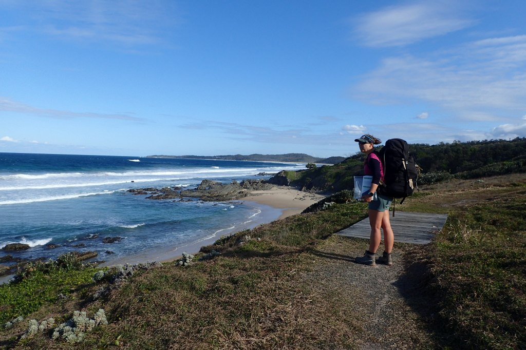
Lady Musgrave Island is the second island in the Great Barrier Reef chain of islands. The southernmost island is Lady Elliot, however it houses a tourist resort and is supposedly unwelcoming to yachties, so Lady Musgrave is where our exploration of the Great Barrier Reef was to begin.

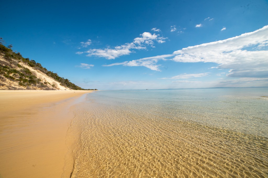
Lady Musgrave is a coral cay; a small, low-elevation, sandy island on the surface of a coral reef. The cay, which is only a couple of kilometres in circumference, sits on the edge of a coral reef enclosing a large lagoon.

We had heard so many incredible stories about Lady Musgrave, but would it live up to the hype? We were excited to find out!

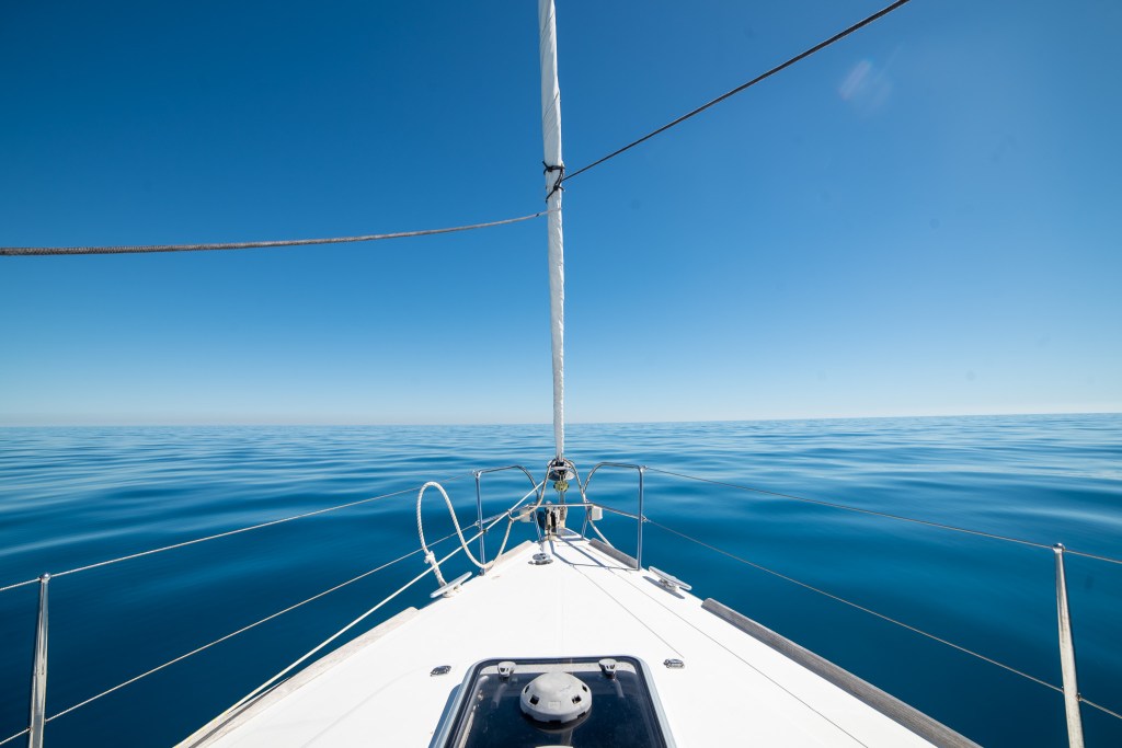
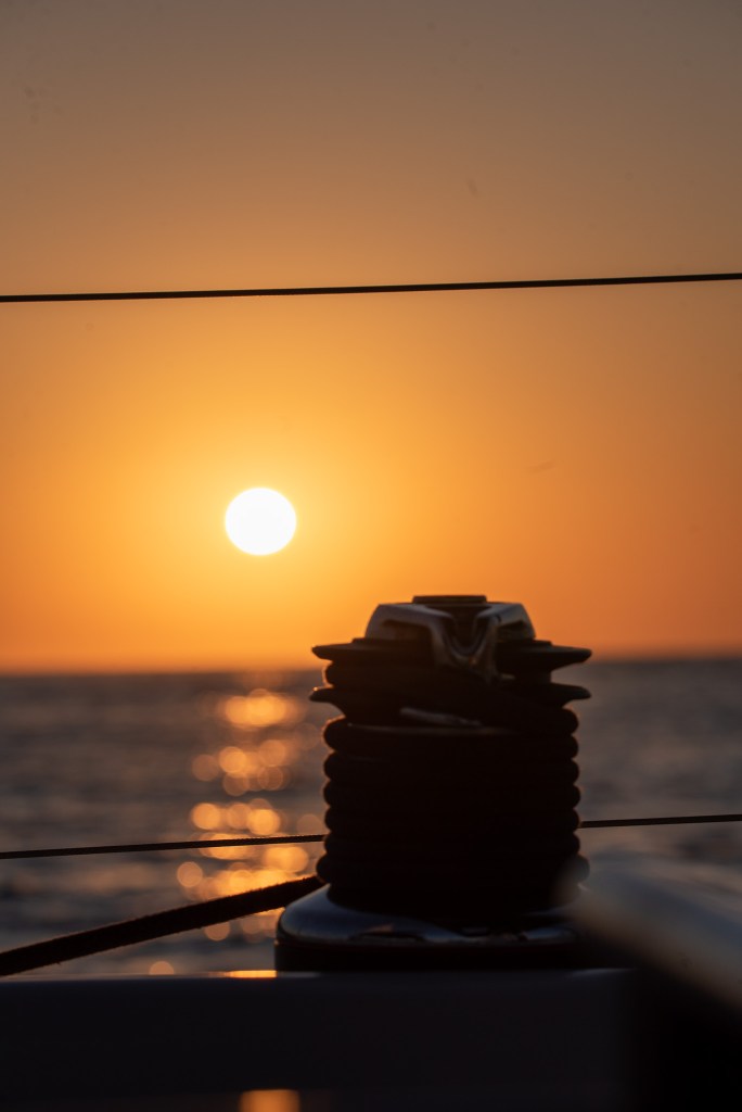
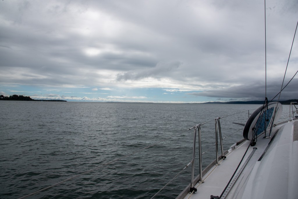
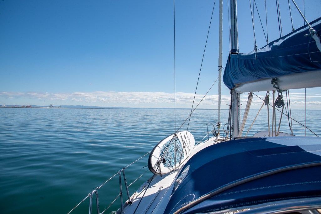
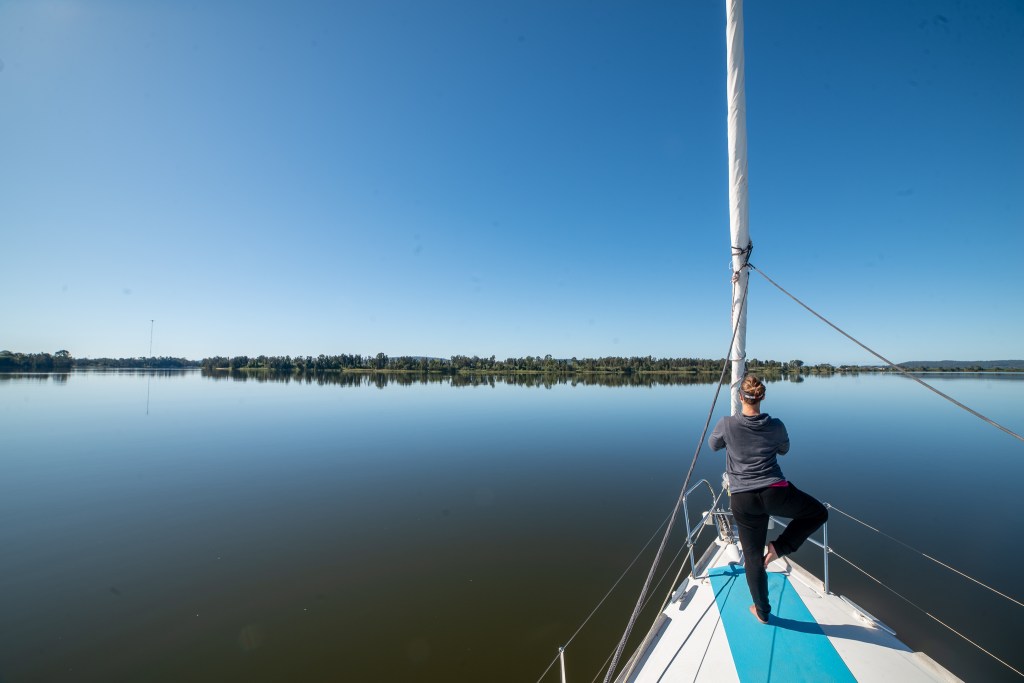
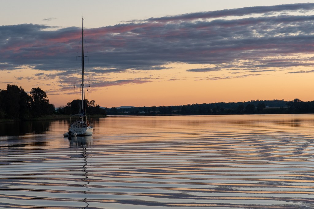
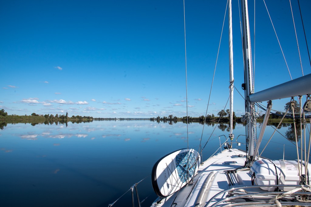
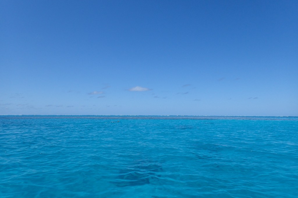
The ideal time to arrive into a lagoon is around midday, when the sun is high in the sky. Why, you ask? It’s because that gives you the ideal lighting conditions to spot the ‘bommies’ that you need to avoid hitting. Bommies are large pieces of coral or rock that are scattered throughout the lagoon, some just below the surface while others are quite deep. Cool Change has a keel that is 2 metres below the water and running into a bommie could damage the boat.

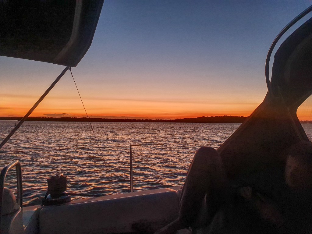
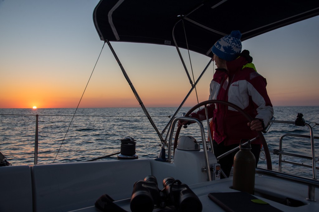
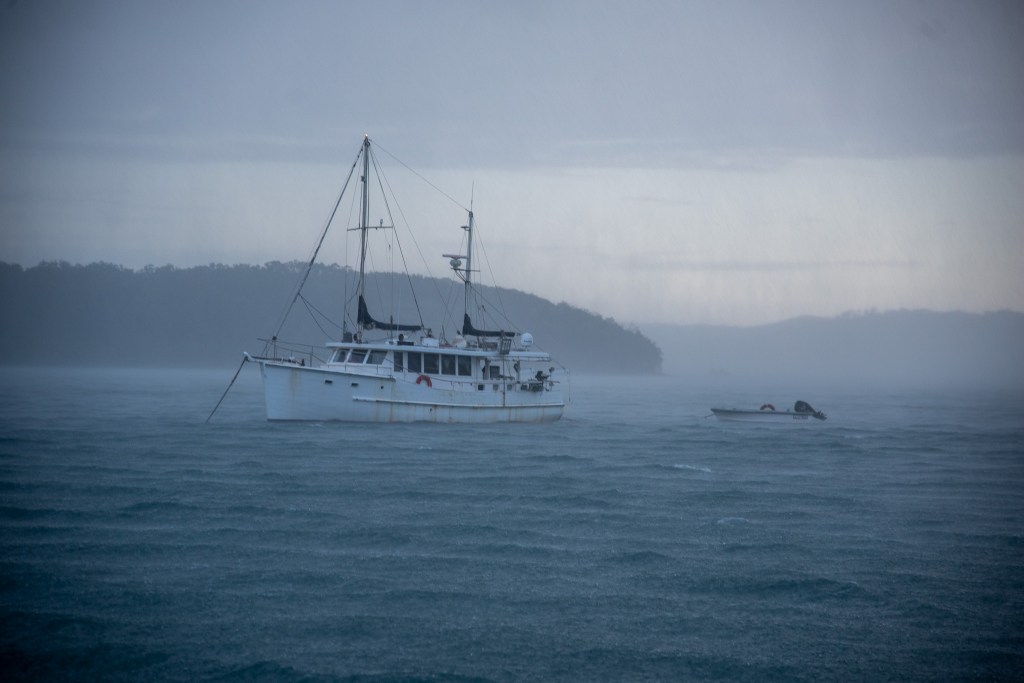
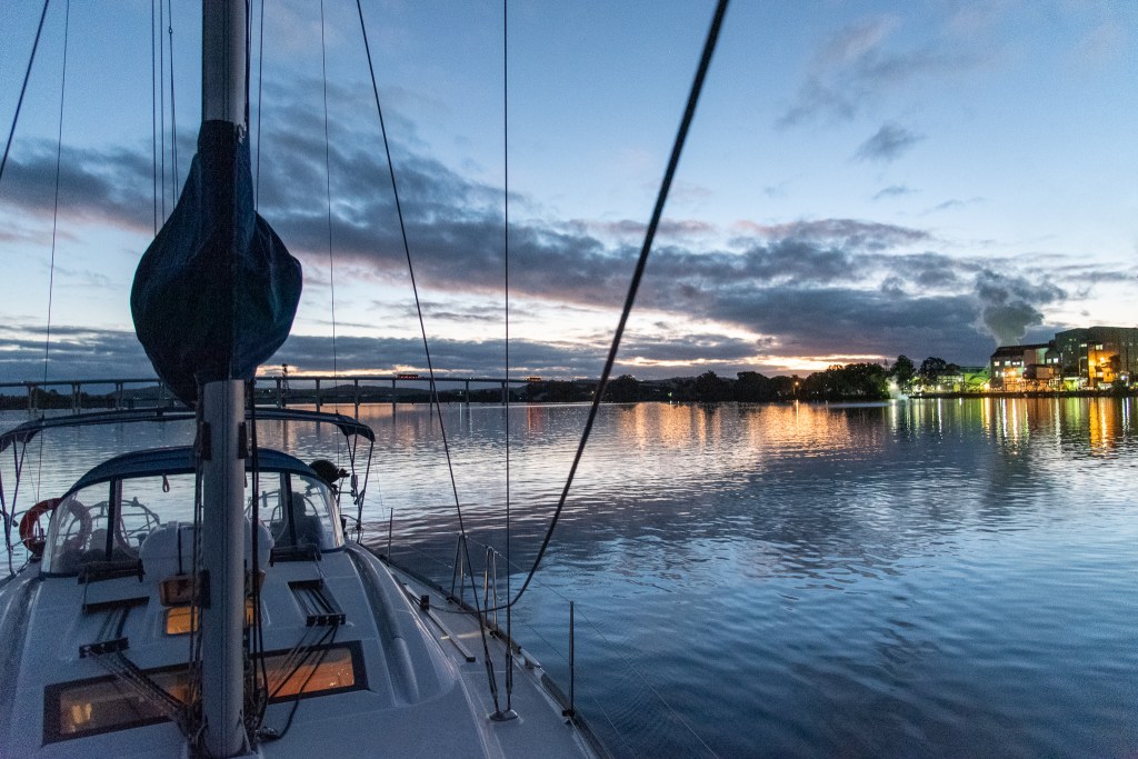
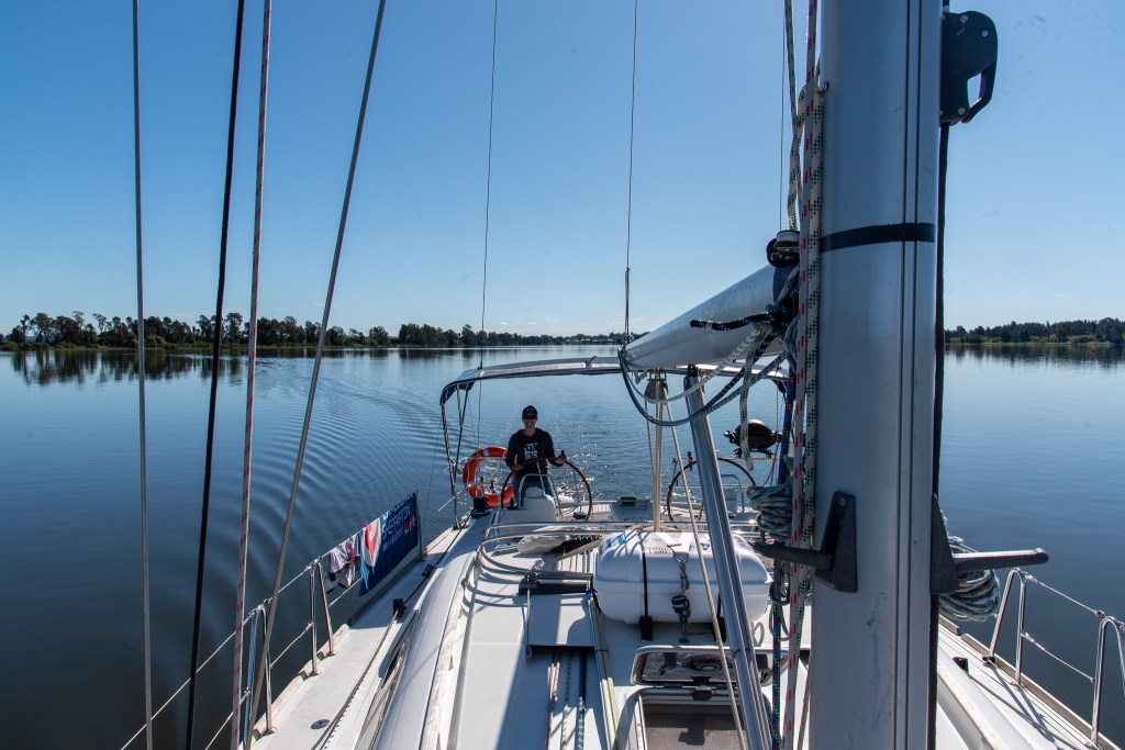
So once again we prepared for an overnight passage, with an early dinner and a few hours sleep before rising at 11.30 pm and departing Hervey Bay at 11.45 pm. There was a full moon shining so it was quite bright, with light winds and calm water. We took shifts this time, with Matt heading back to bed at 1 am until 5 am and then I slept until 8 am. I awoke to a beautiful sunny day and lovely calm waters, and we were perfectly on track for a midday arrival.

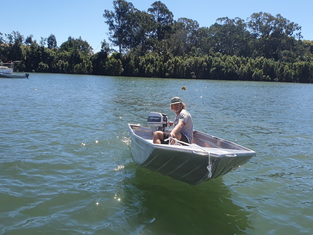
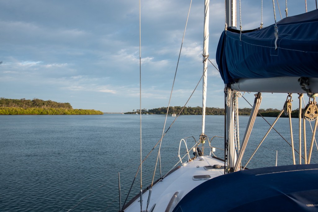
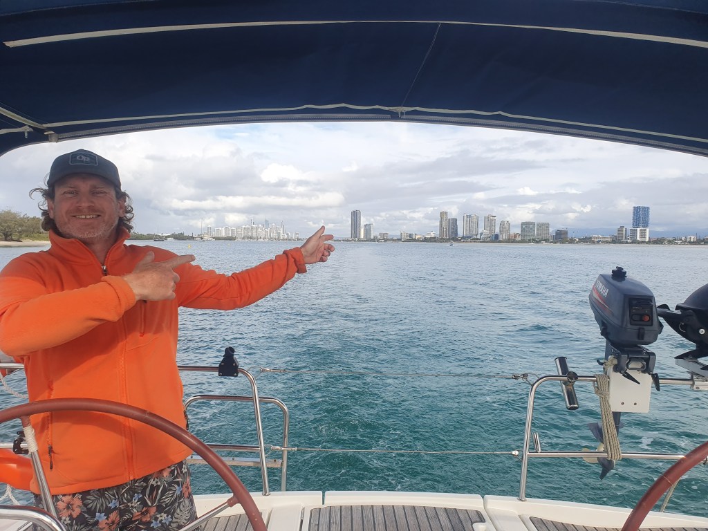
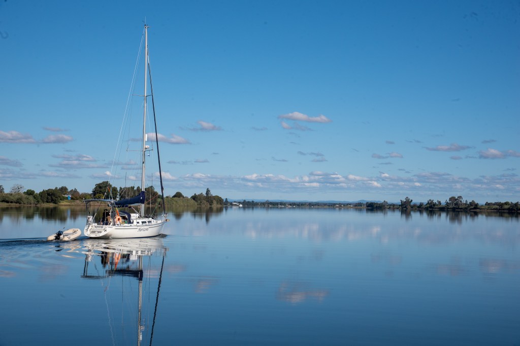
Matt steered us through the entrance and into the lagoon, while I stood up on the bow, on the lookout for bommies. They were very easy to spot; dark shapes in the incredibly clear turquoise water. I shouted directions and used hand gestures to let Matt know which way to go. Seemed crystal clear to me, but apparently Matt didn’t understand what some of my gestures meant. We probably should have worked out a system beforehand!

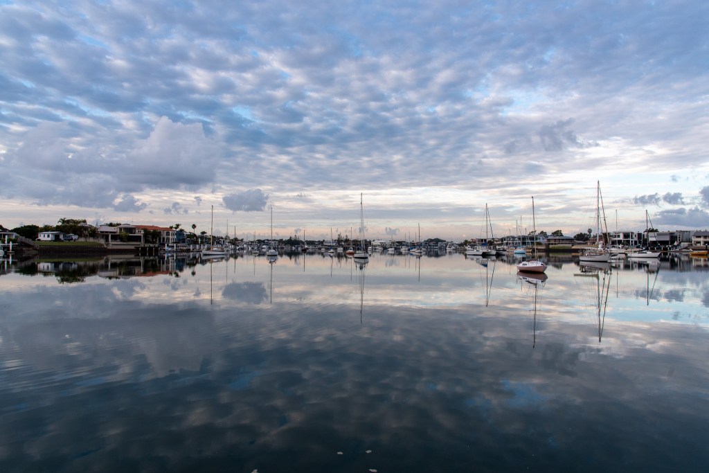
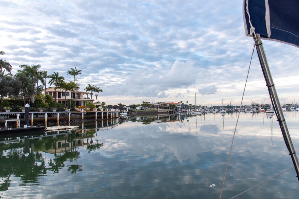
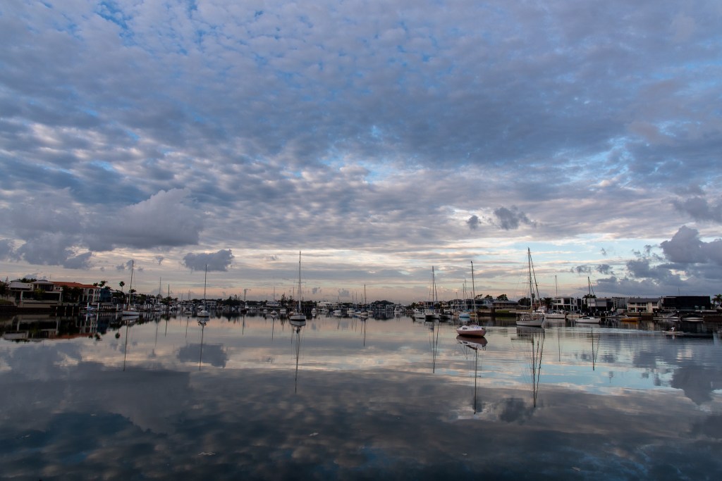
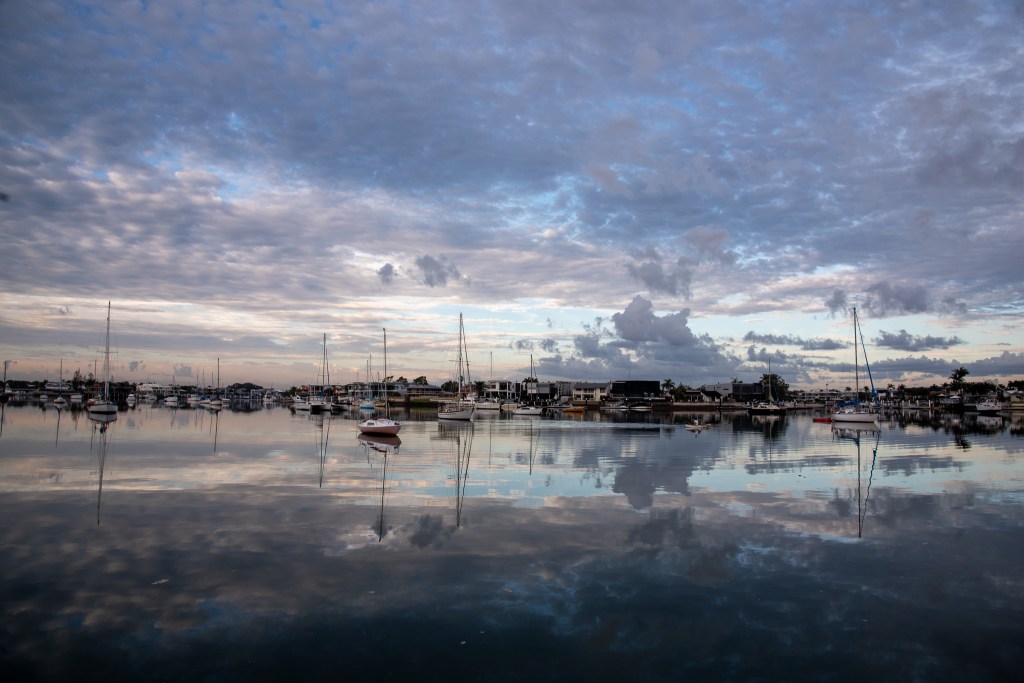
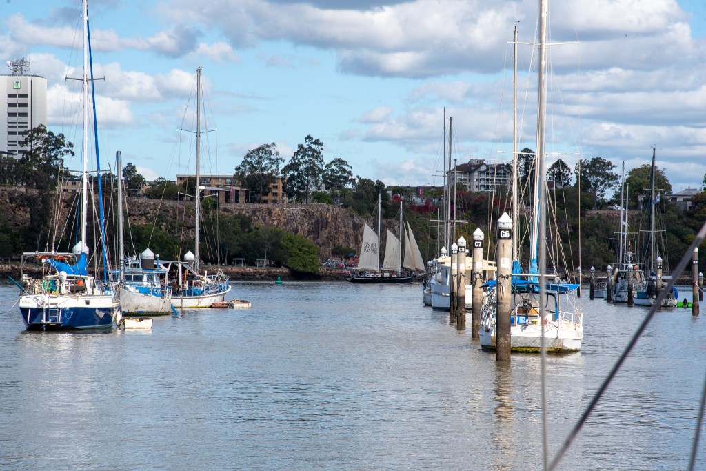
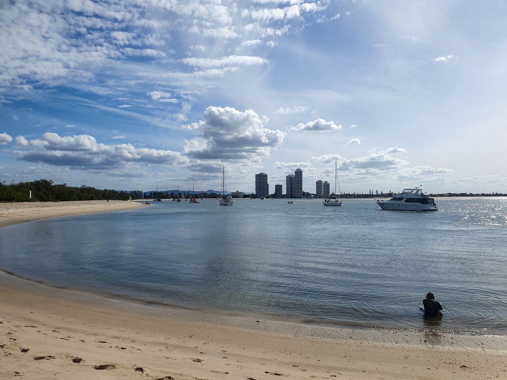
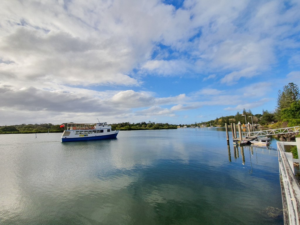
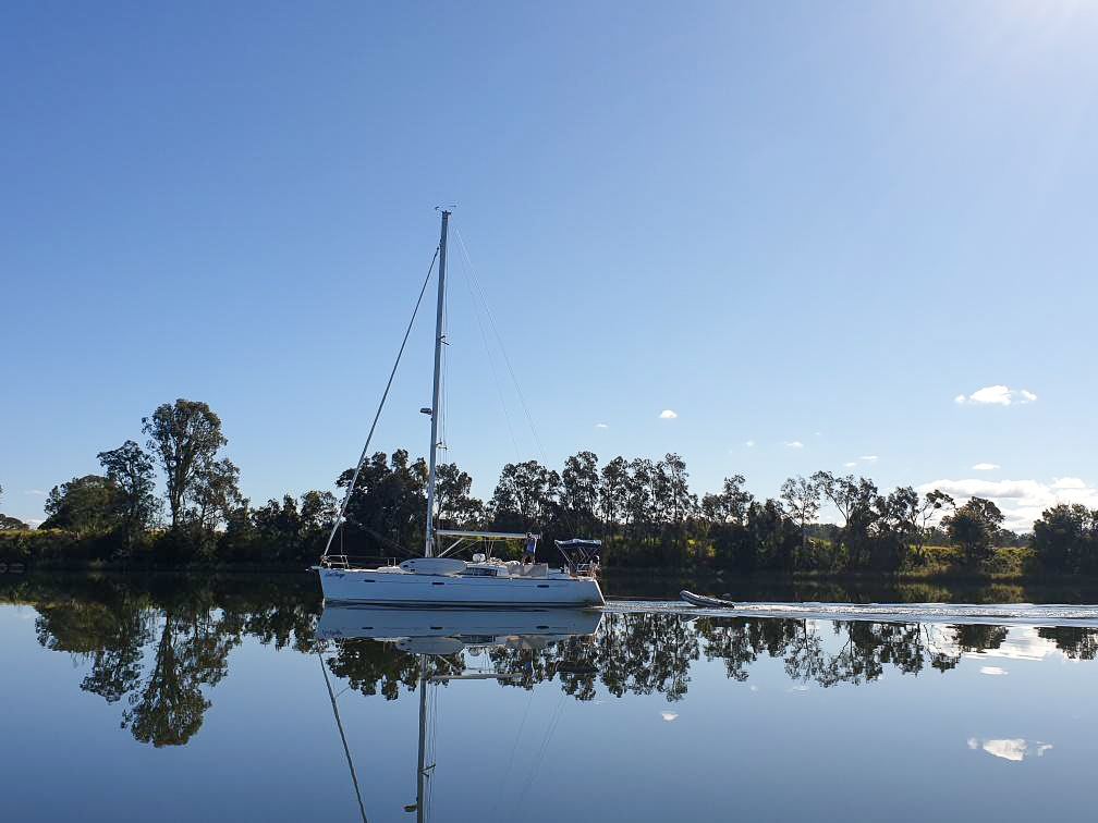
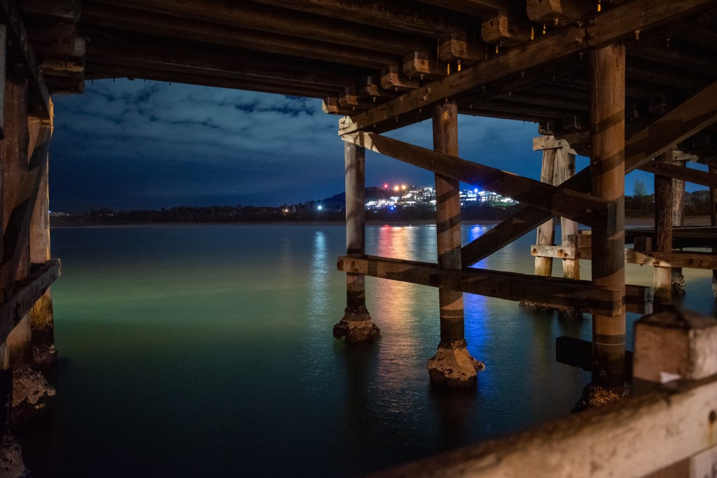
But we entered safely, and negotiated our way to a bommie free patch of water where we dropped anchor. We had heard that there were seven public moorings available in the lagoon, and had been reasonably hopeful that we could grab one, but as we approached and started counting masts, we could see that we were out of luck. There were heaps of boats in the lagoon! On that first day, I counted over twenty.

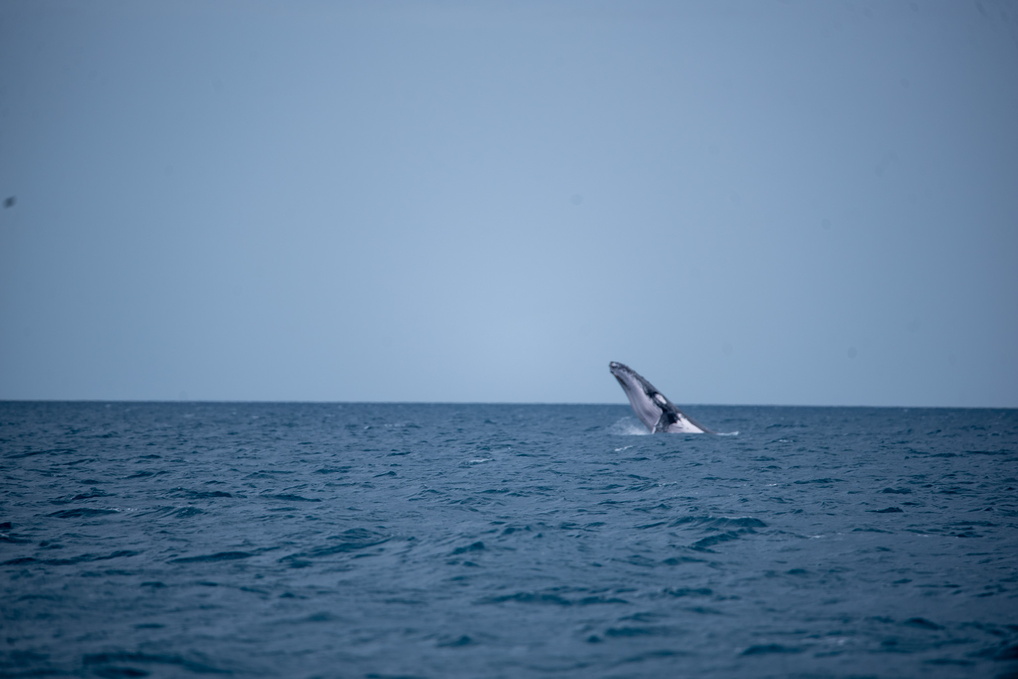
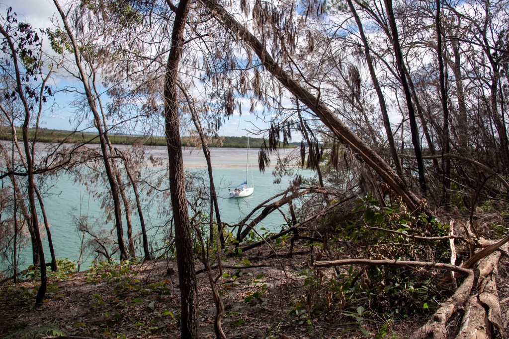
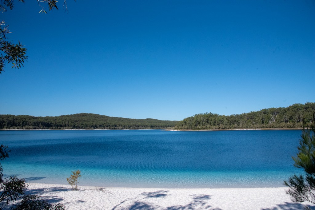
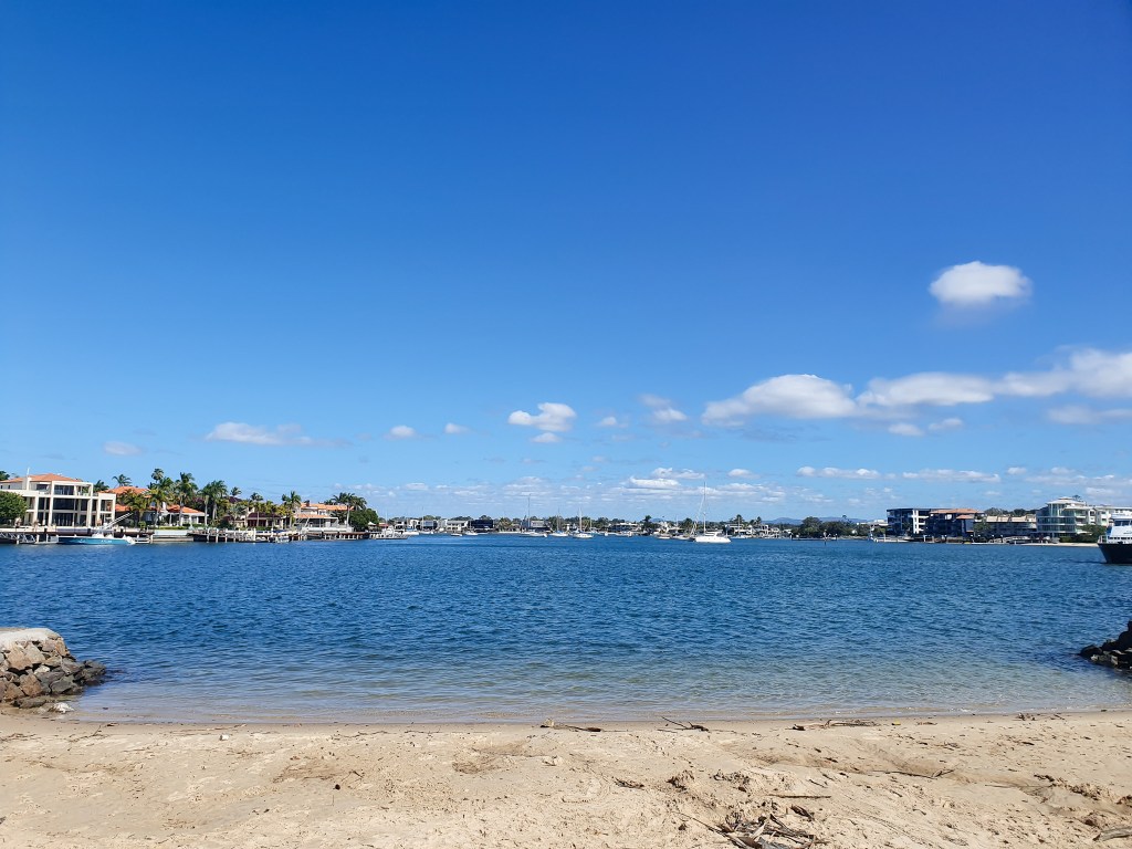
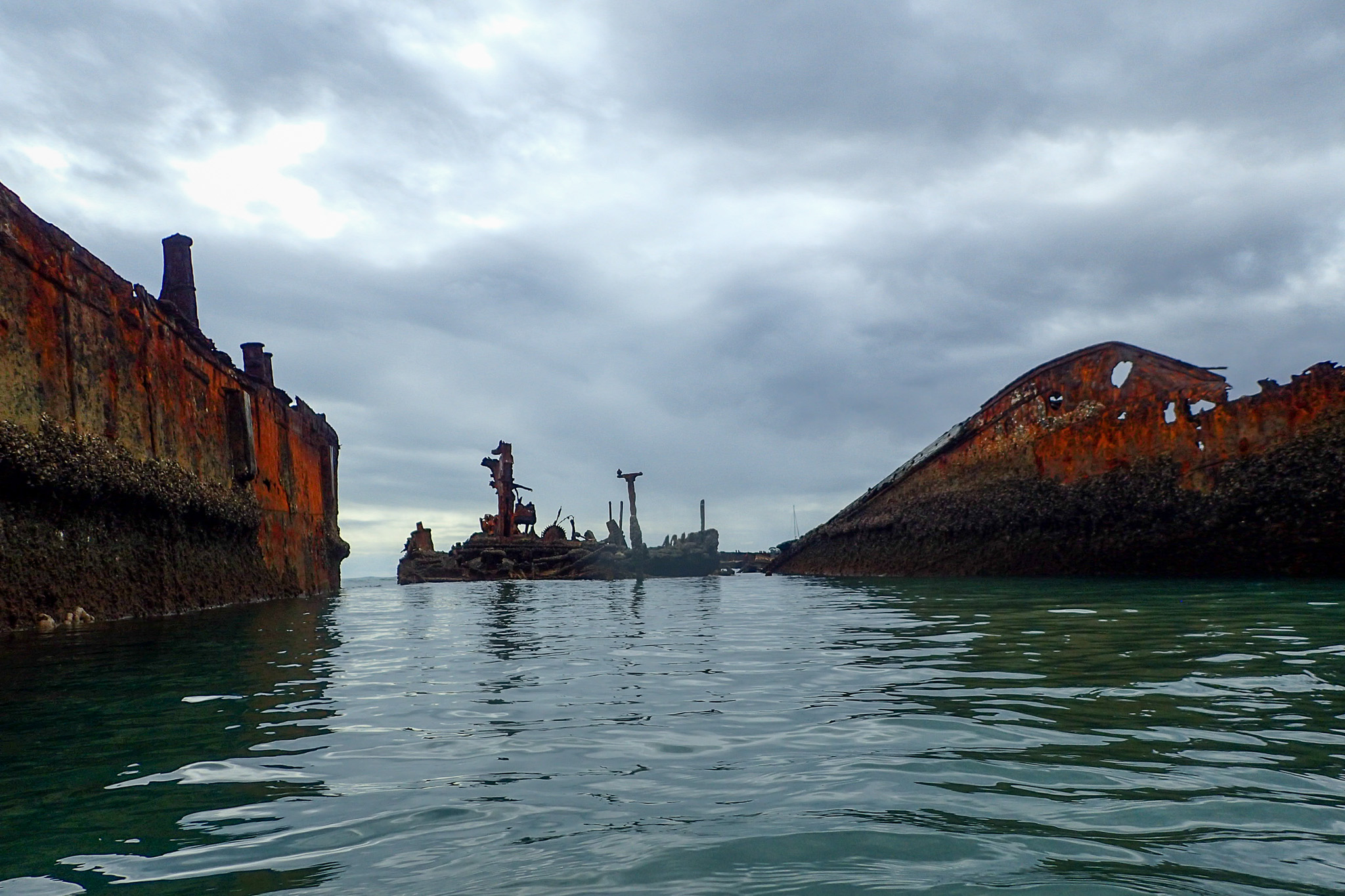
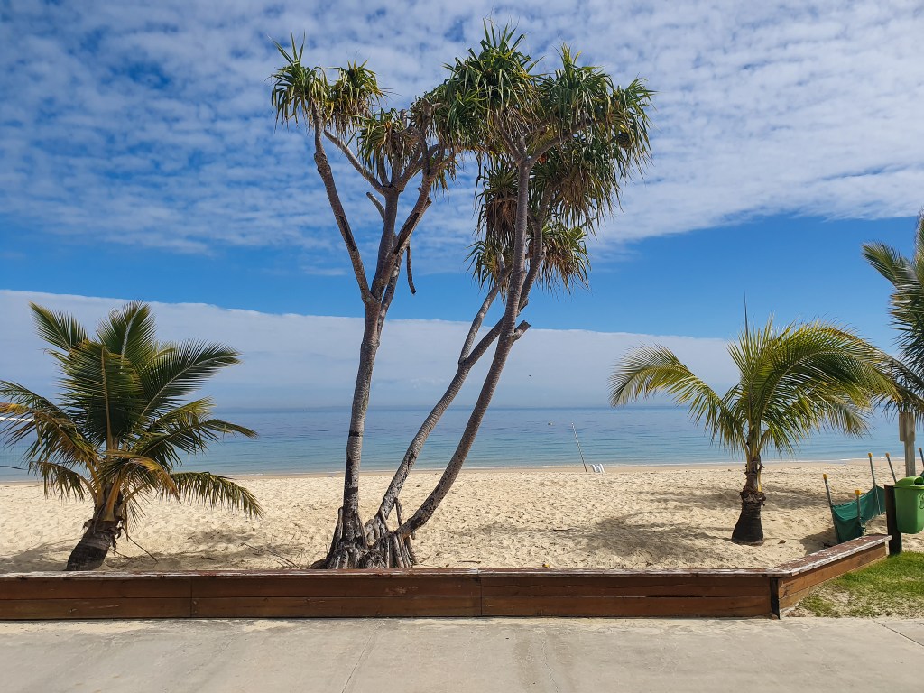
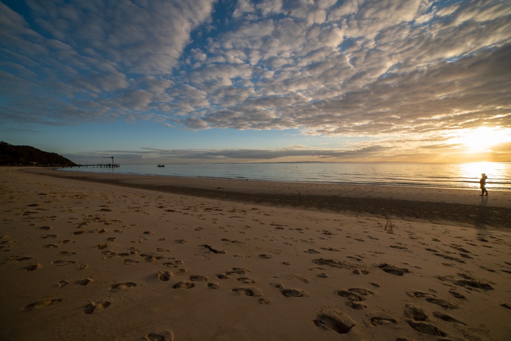
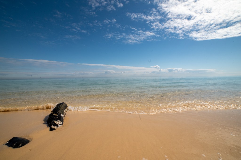
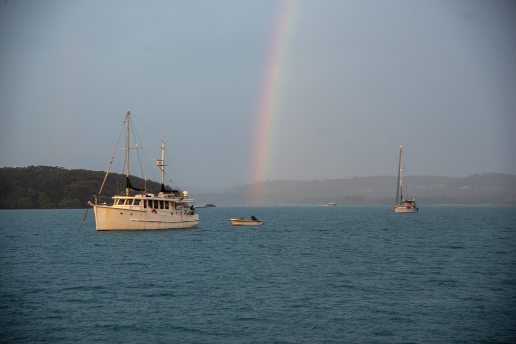
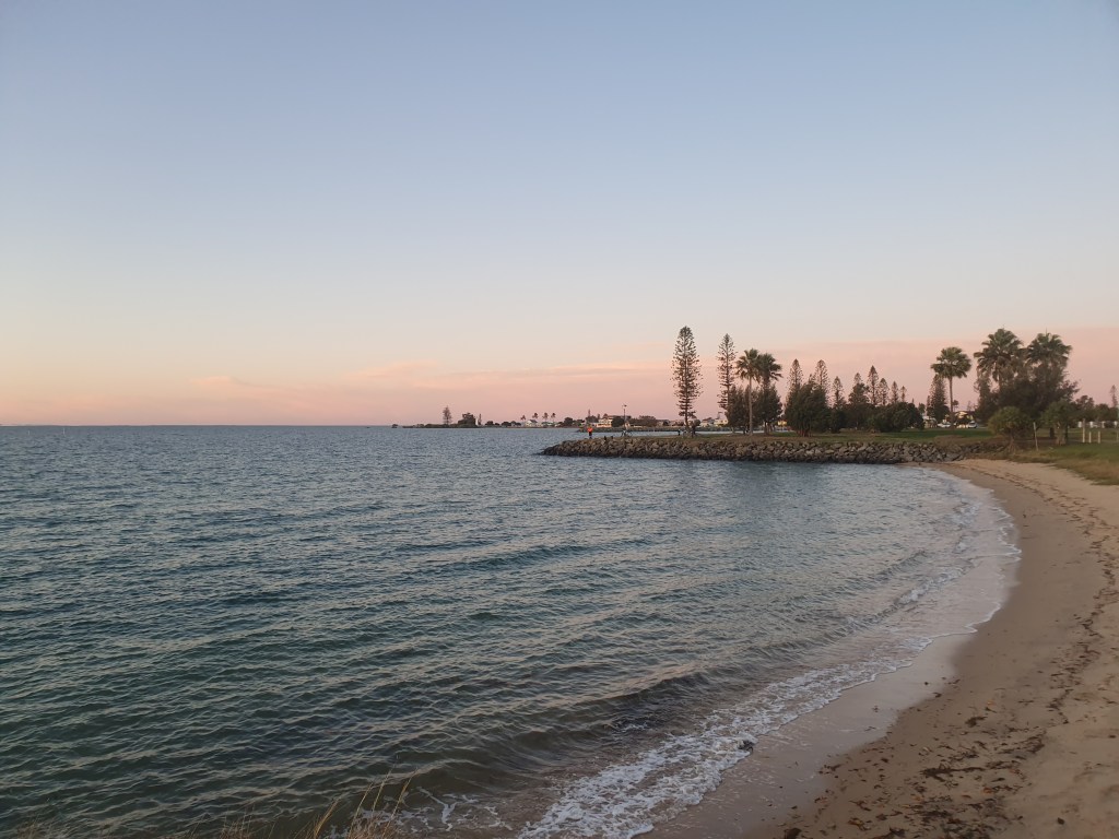
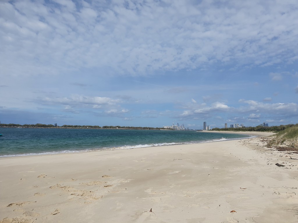
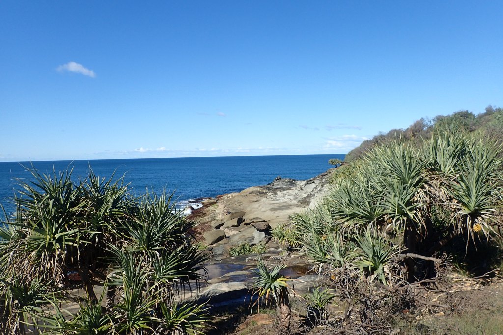
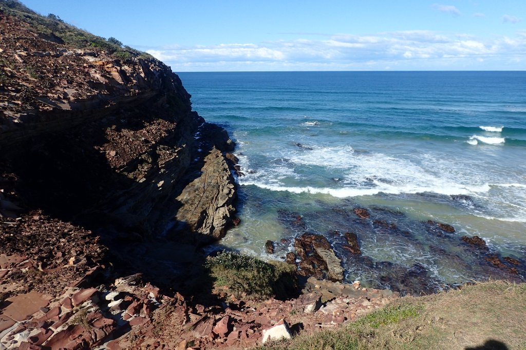
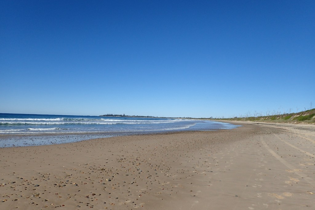
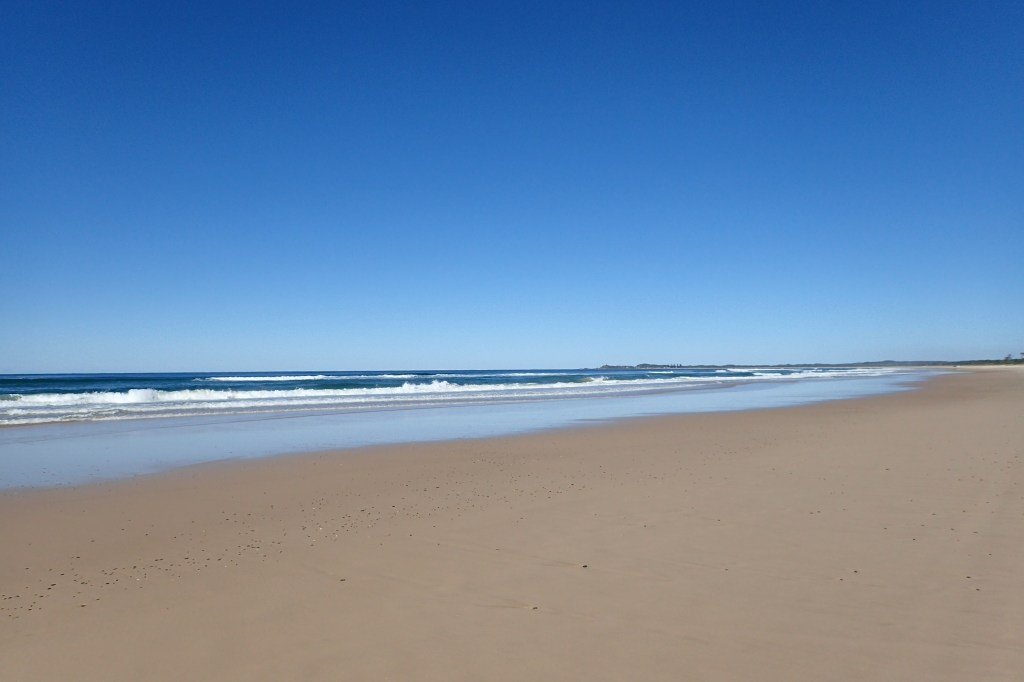
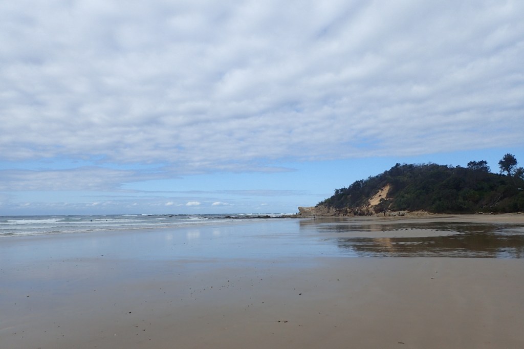
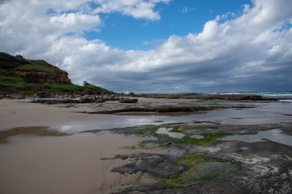
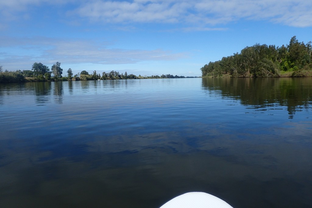
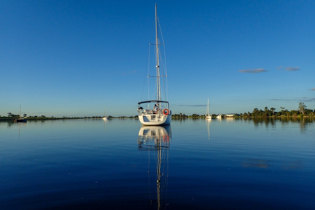
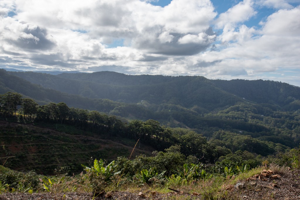
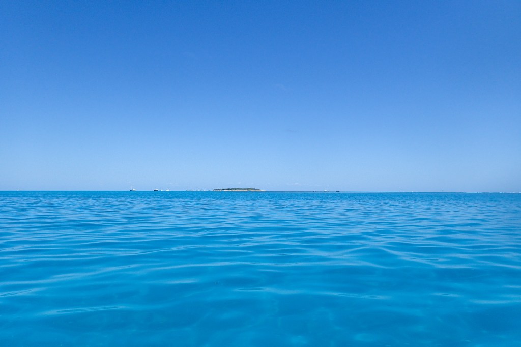
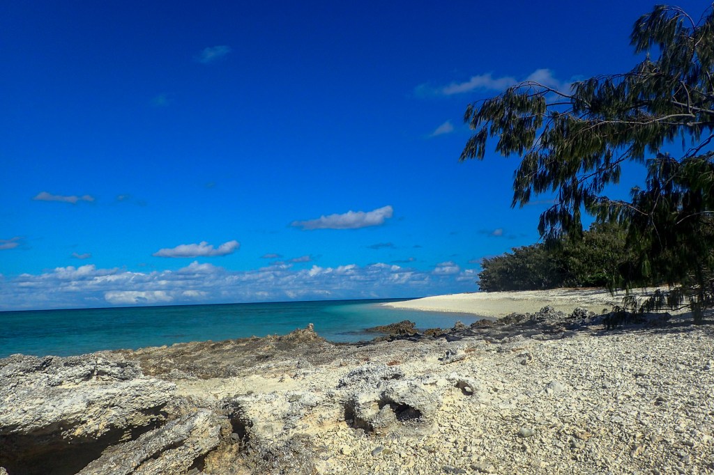
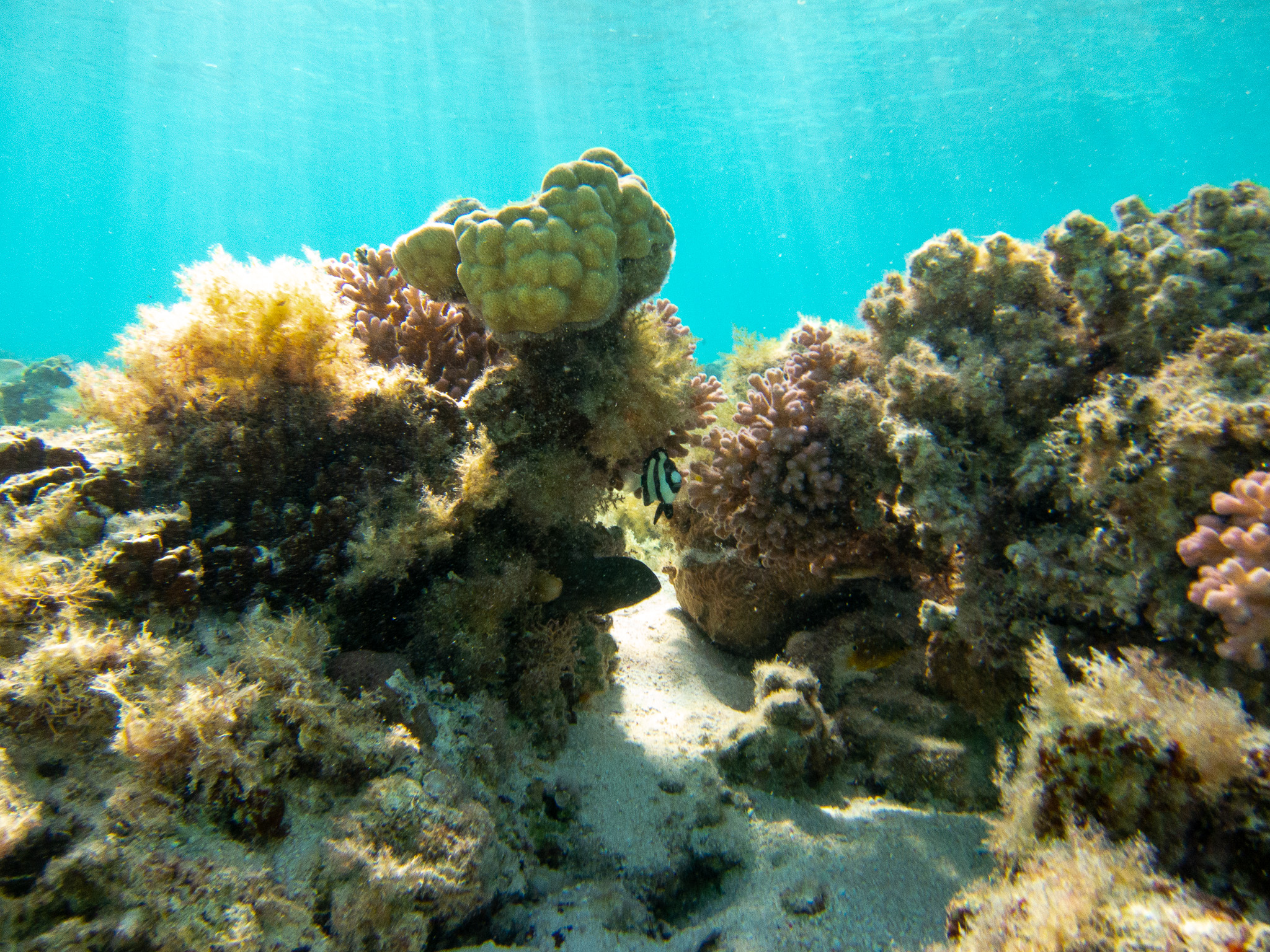
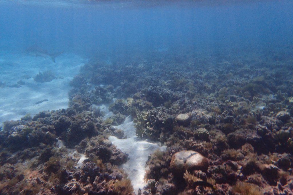
Now we could see what all the fuss was about. Lady Musgrave was absolutely breath taking. Just amazing!! The lagoon was a crystal clear turquoise, surrounded by a reef that you could see at low tide, but that disappeared at high tide so that all you could see was blue water for miles. The tiny island was a thick patch of green, surrounded by a ring of yellow sand.

It was truly spectacular. Like nothing either of us had ever seen before. In this case, reality definitely lived up to our expectations. And if above the water was pretty, then the underwater world was stunning. We felt we were somewhere truly special.

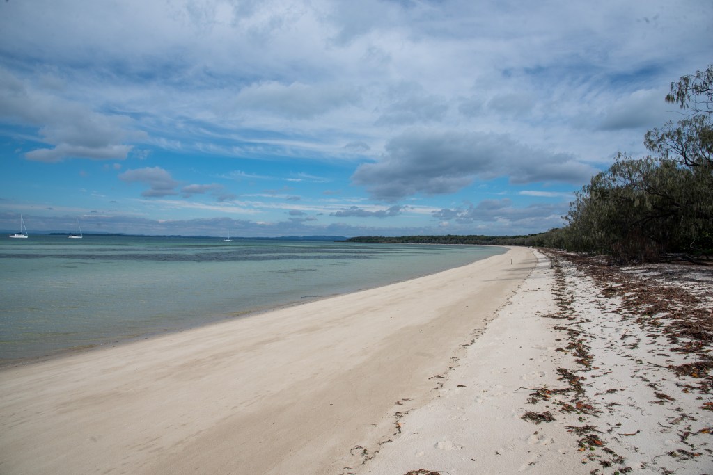
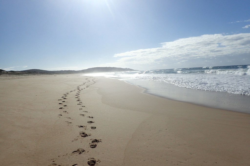
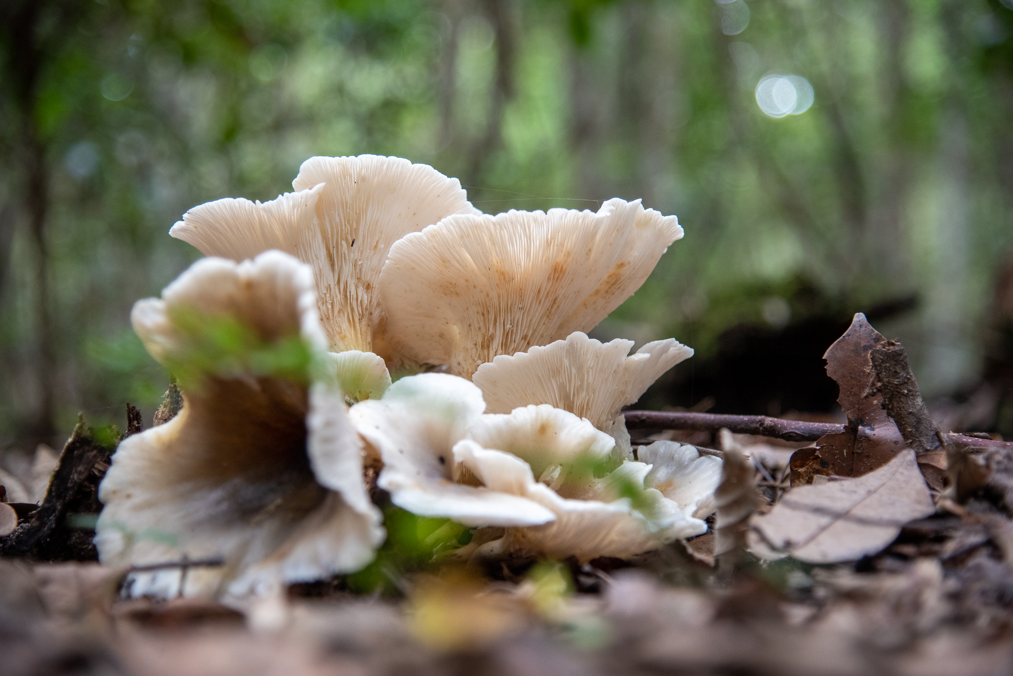
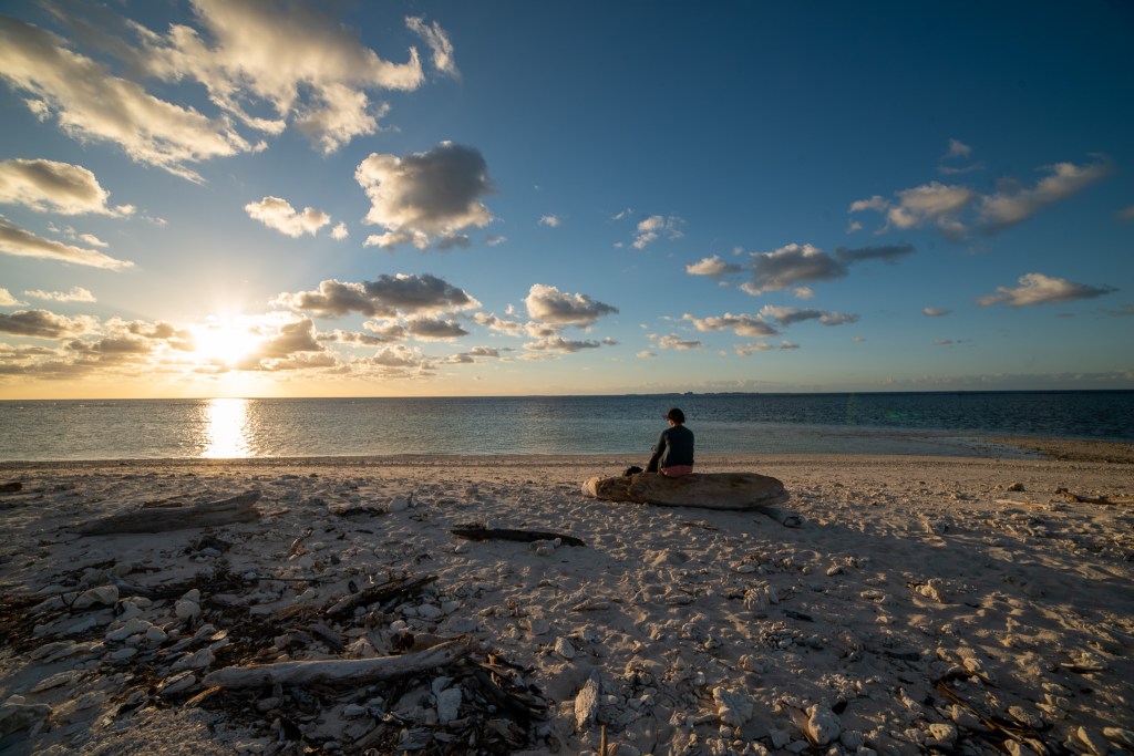
We stayed at Lady Musgrave for four nights, soaking it all in. Our days were pretty relaxed, and we got into a bit of a routine. Waking up early and enjoying a coffee gazing out over the lagoon, before heading for a snorkel, back to the boat for a bacon and egg brekkie, chilling on the boat during the day, before another snorkel or a walk on the island in the afternoon. It was a pretty great existence!

Lady Musgrave Lagoon
Matt snorkelling on the reef
Lady Musgrave Island

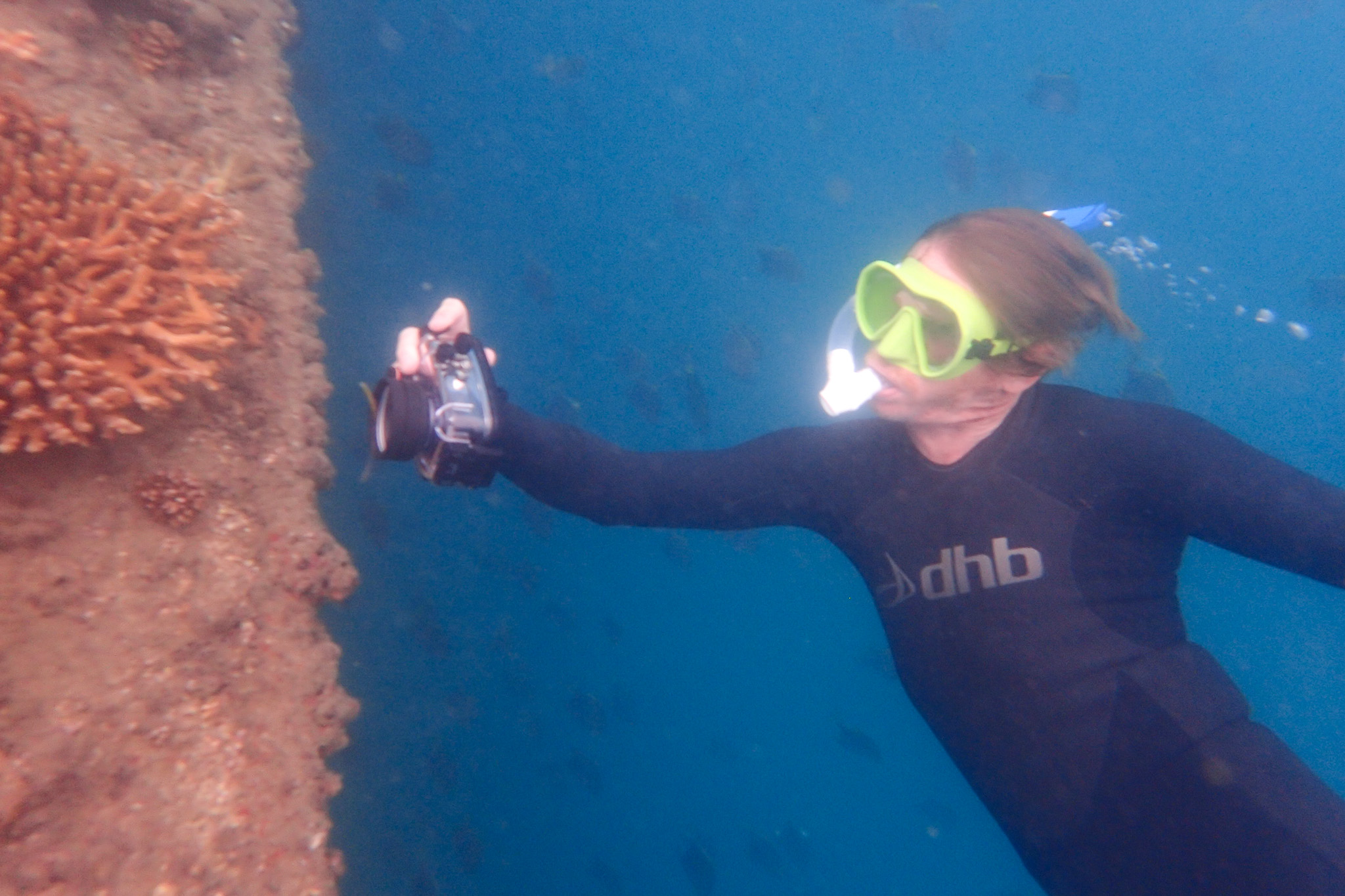
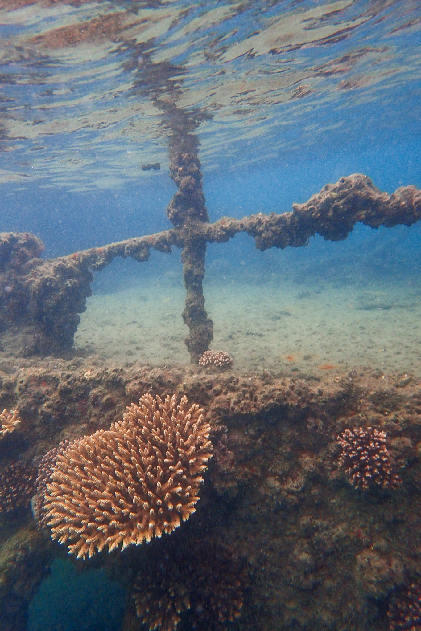
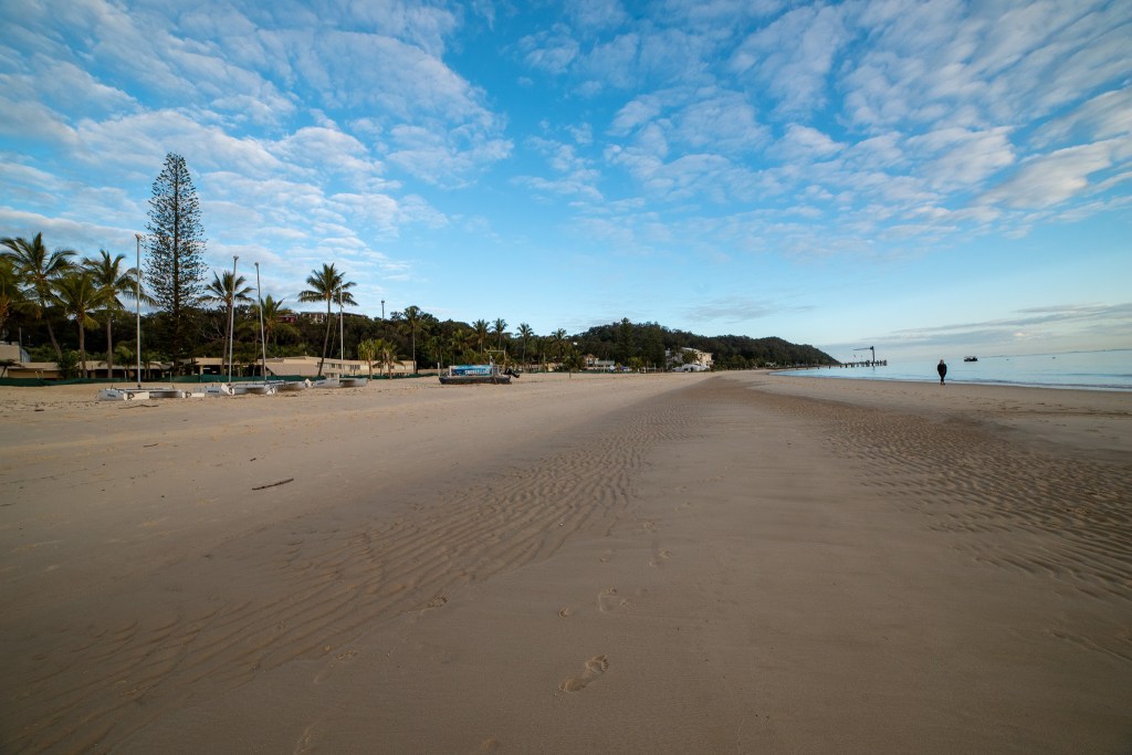
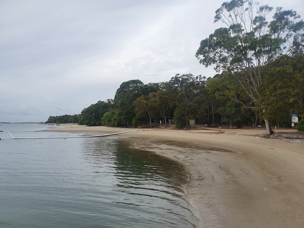
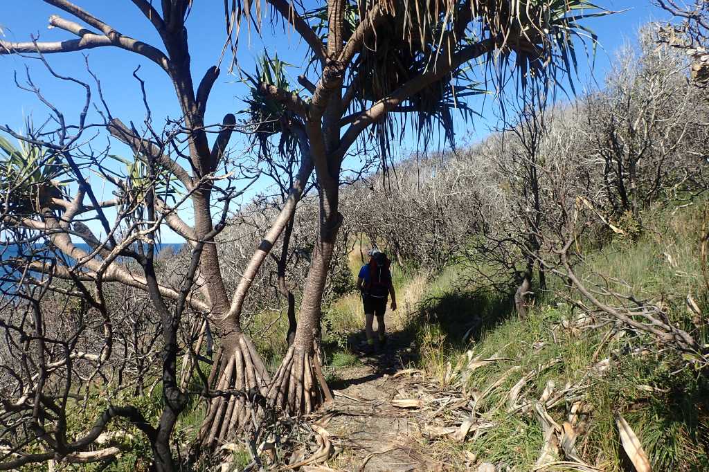
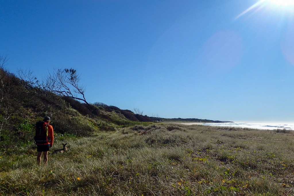
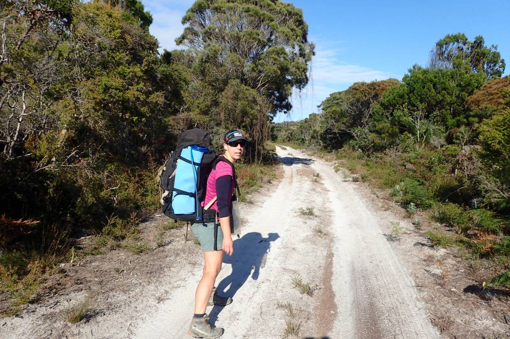
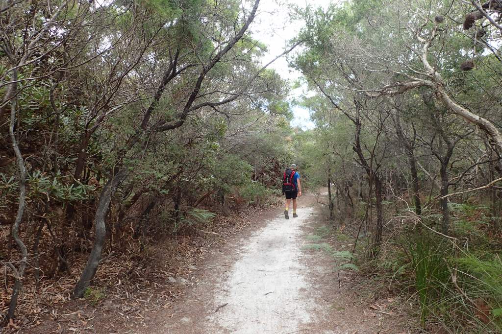
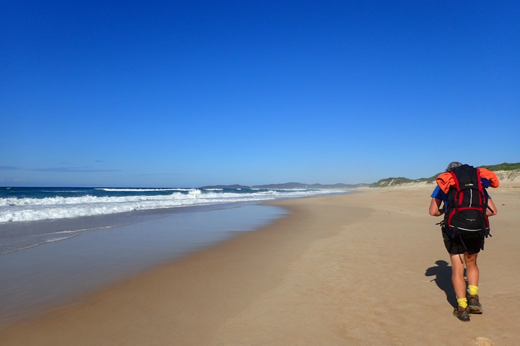
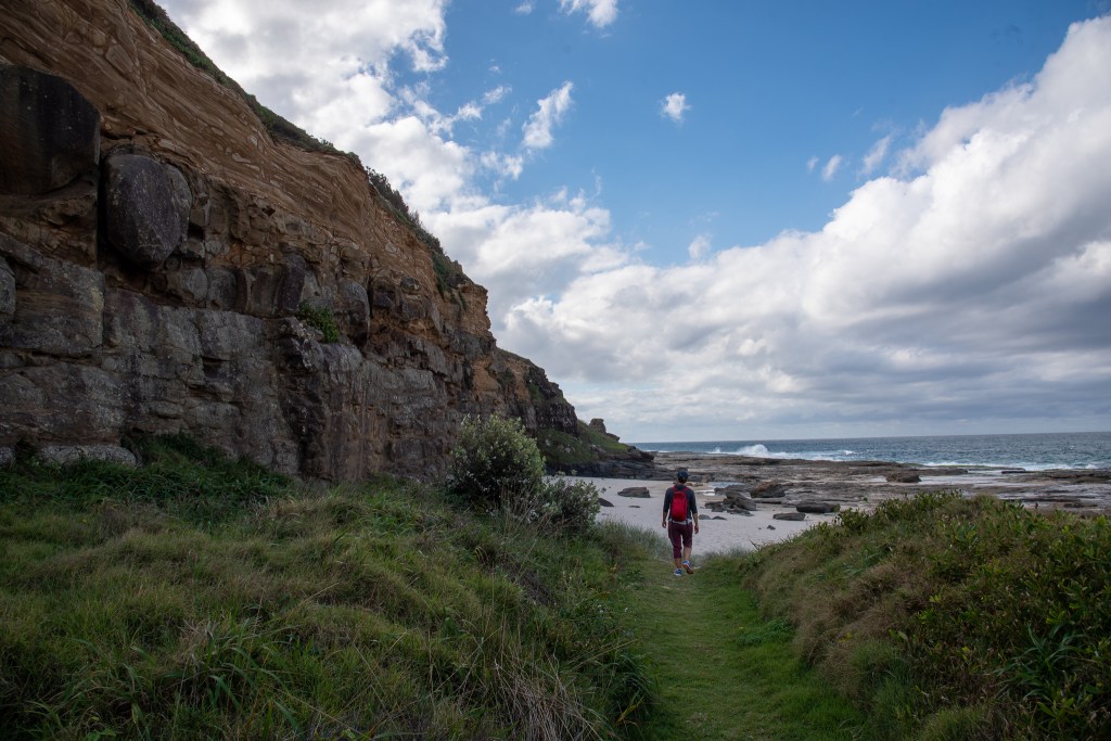
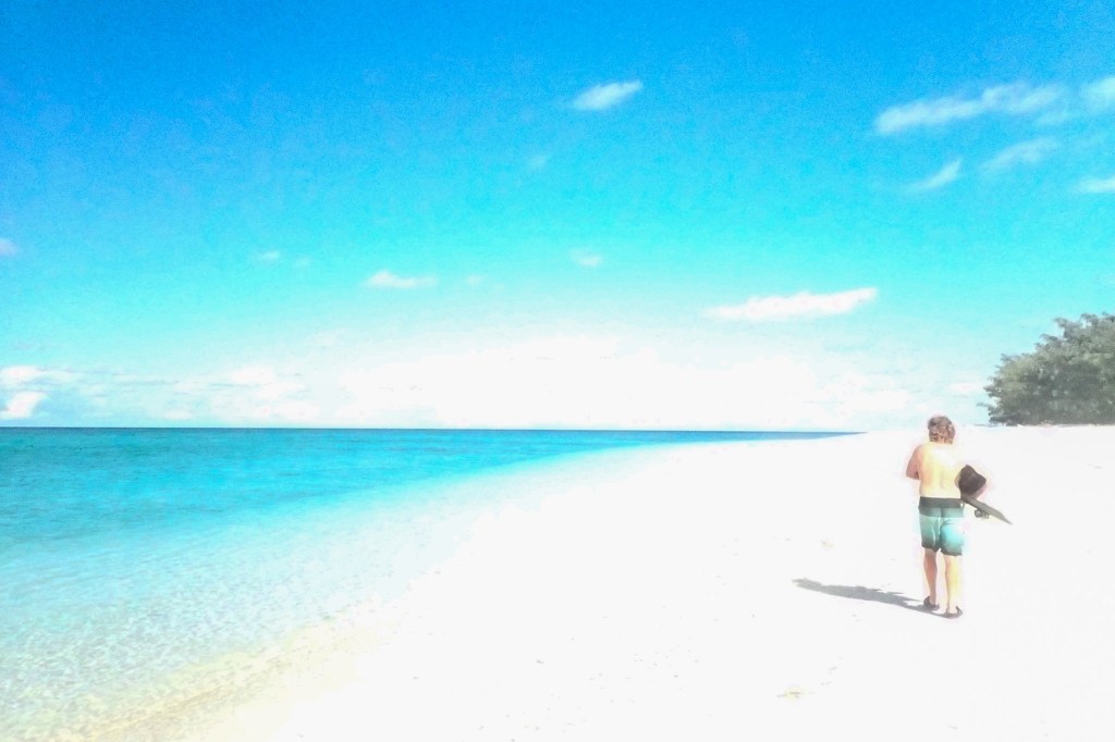
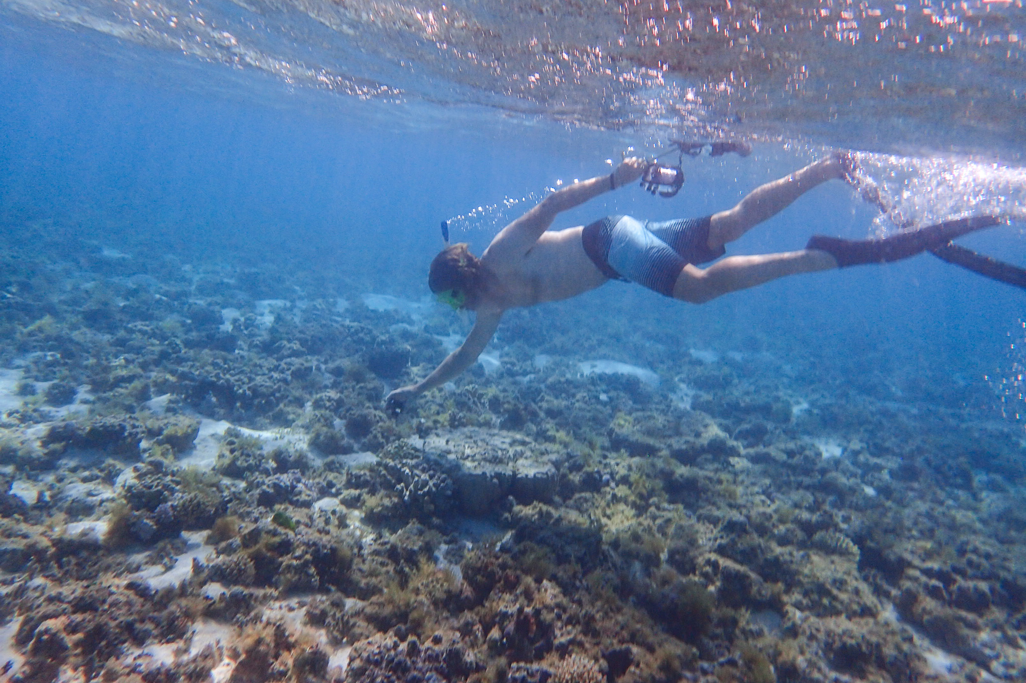
On several mornings we snorkelled over the reef just off the south side of the island. We would drop our towels and clothes on the beach and then keep walking to our entry point, swimming back to where we’d left our stuff.

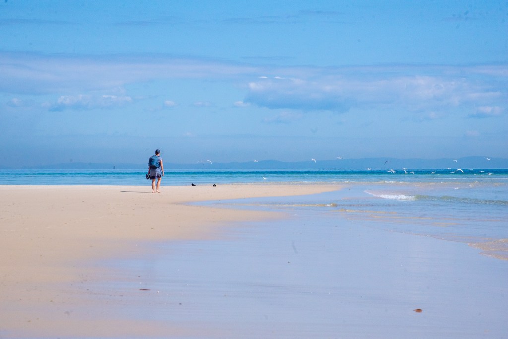
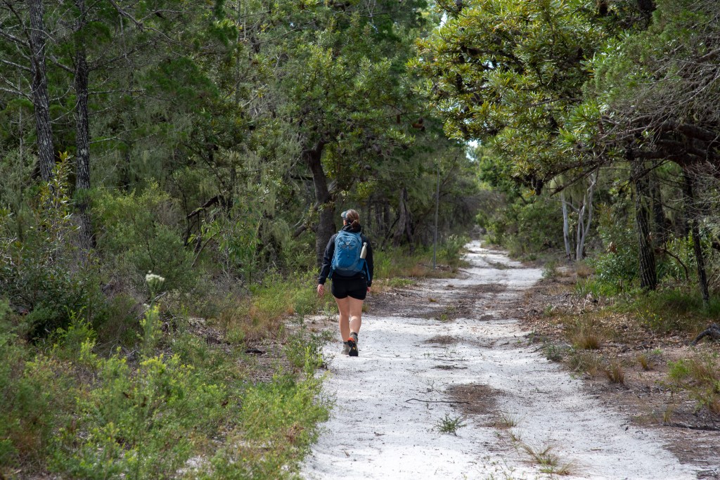
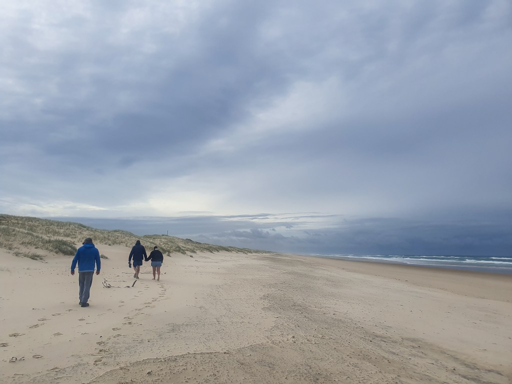
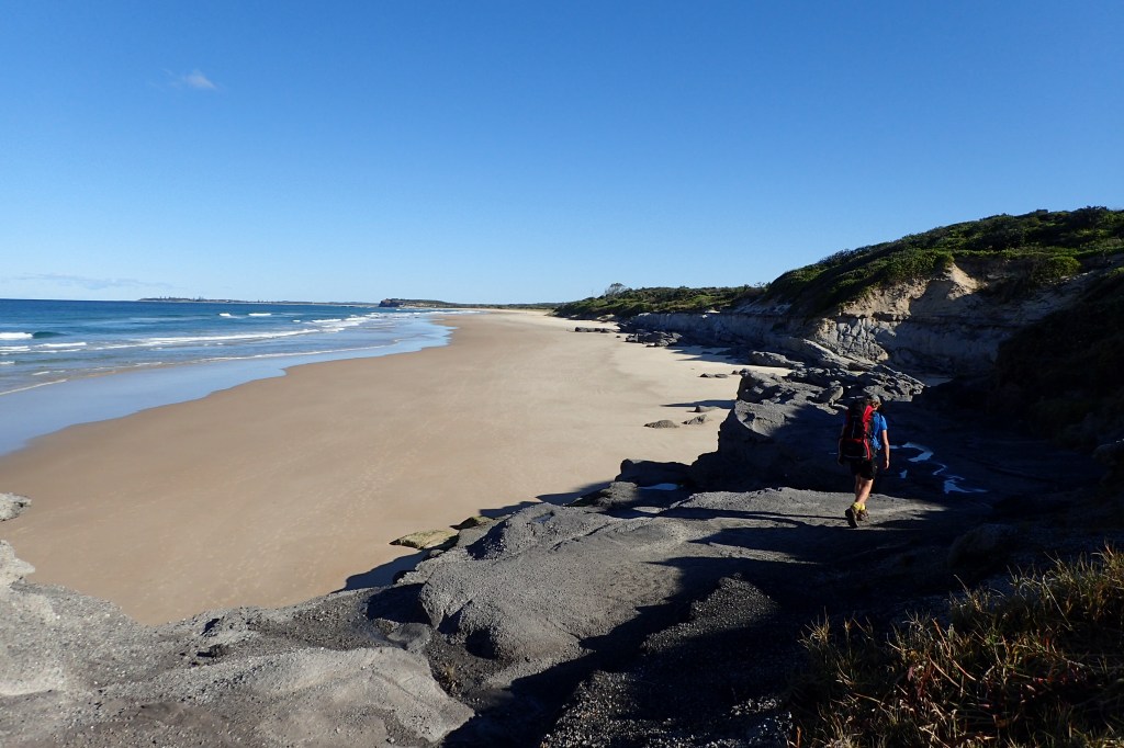
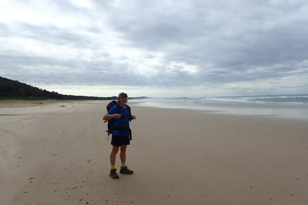
Here’s Matt walking along the beach. The photo was accidentally over exposed but I think it’s a cool effect, sort of looks like a painting!

Lady Musgrave Island

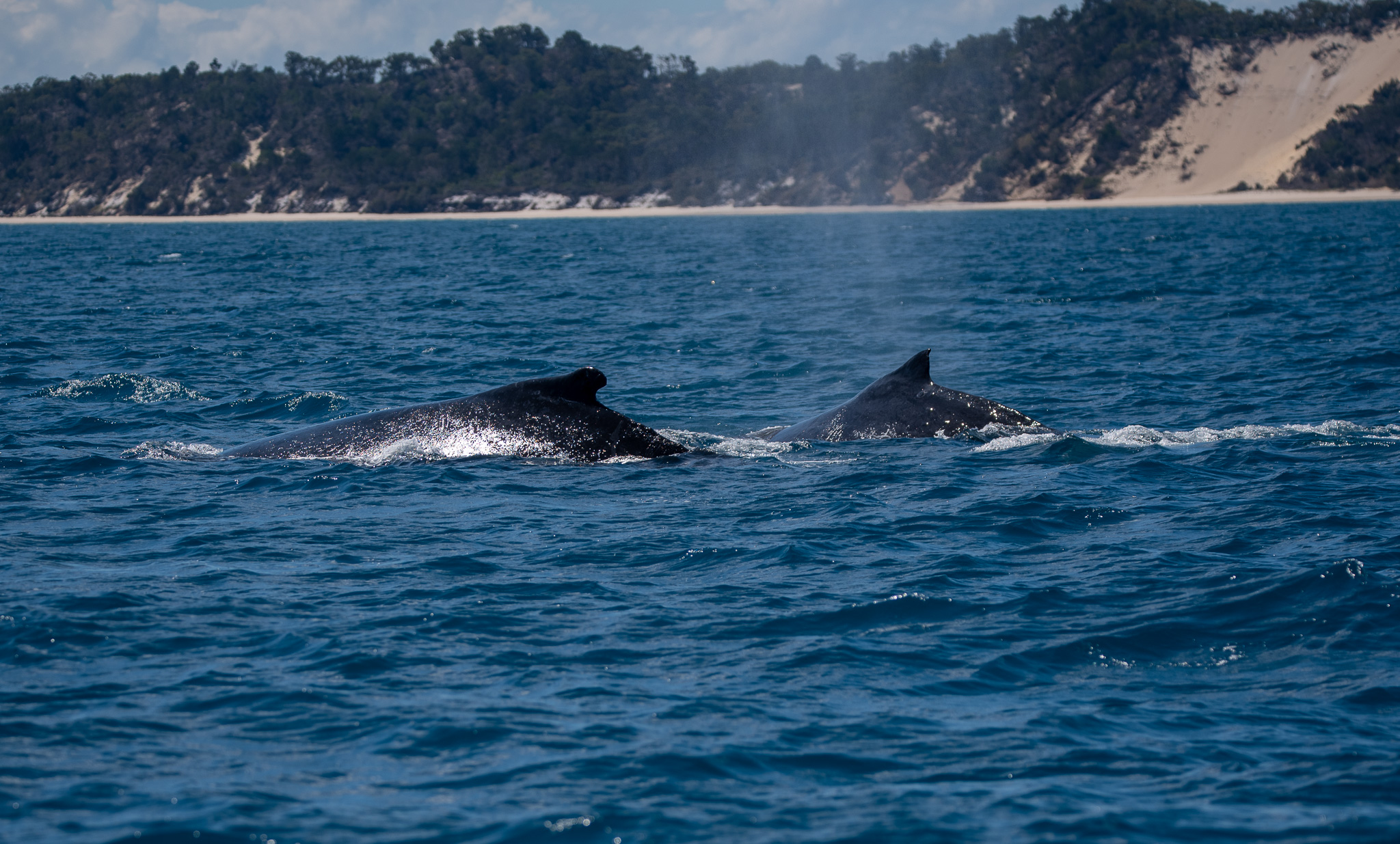
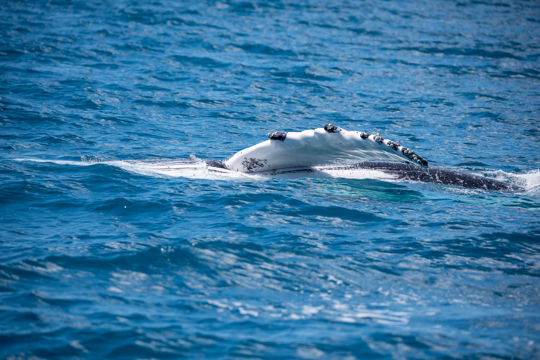
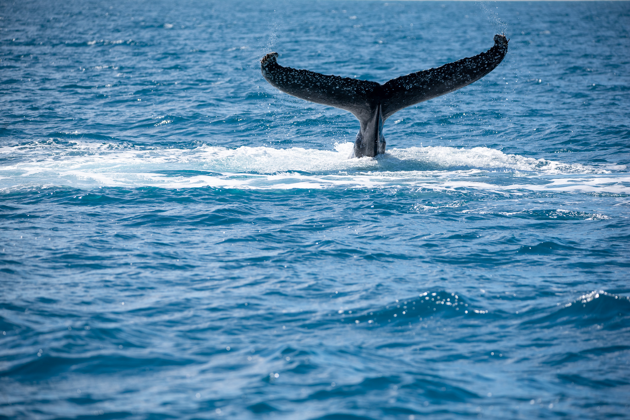
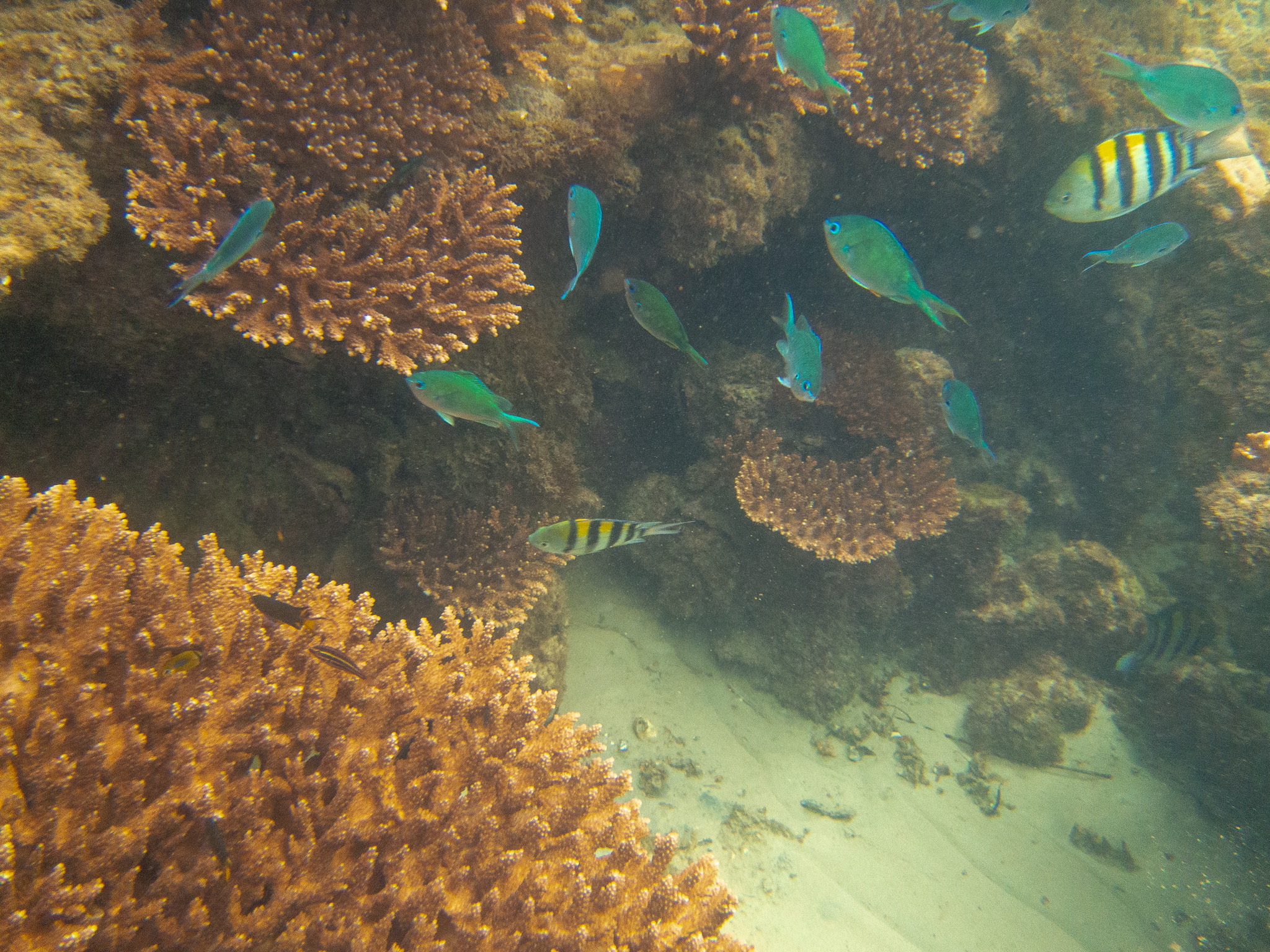
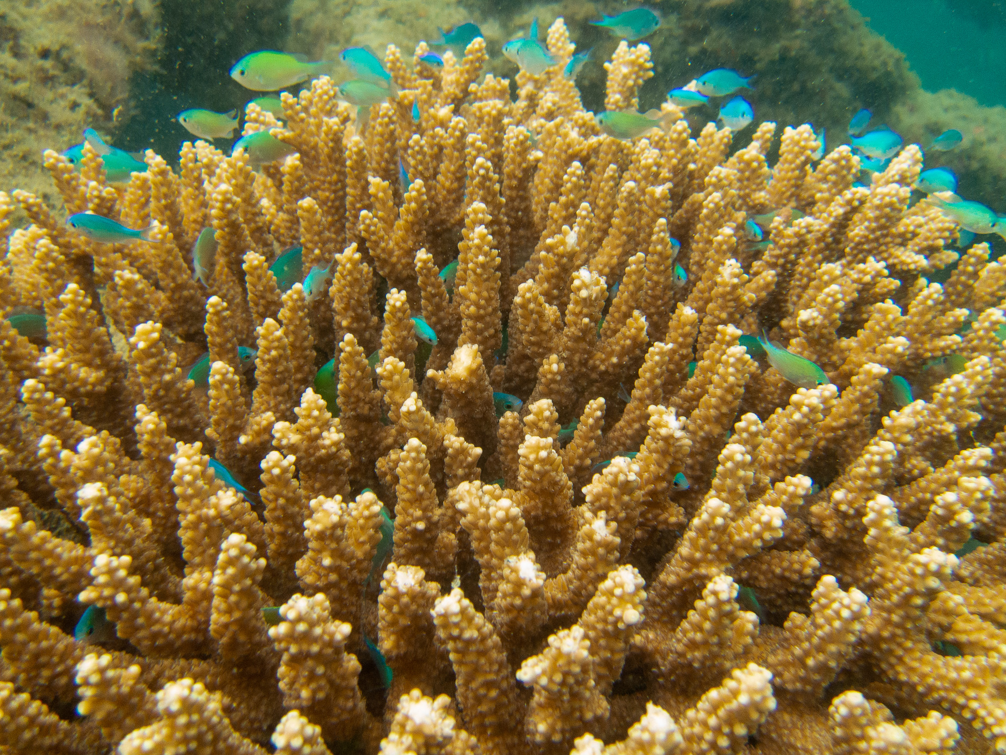
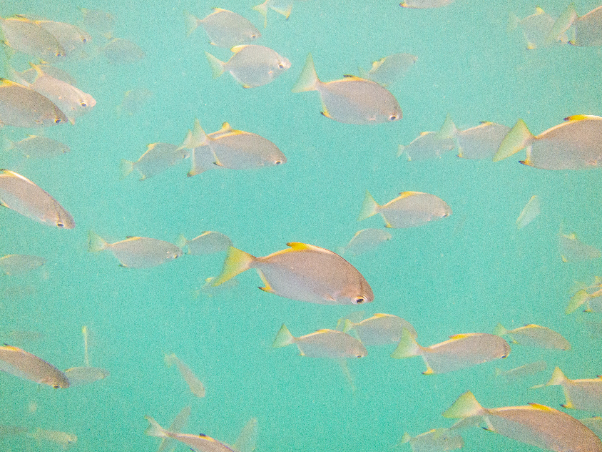
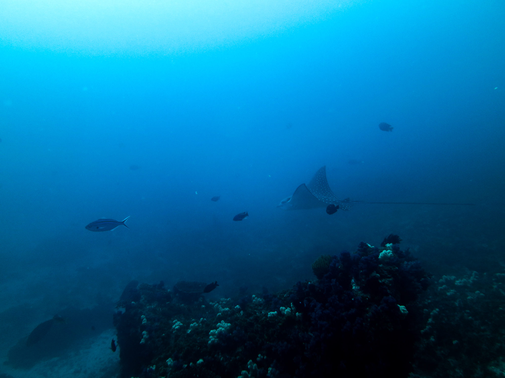
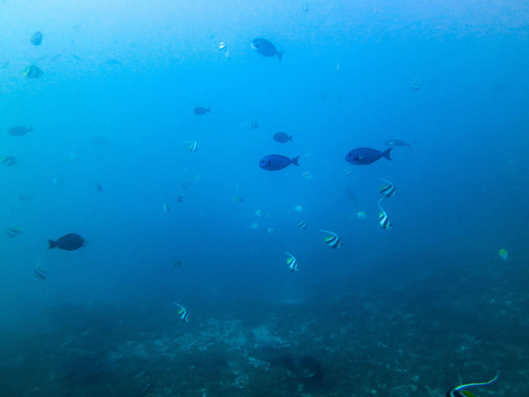
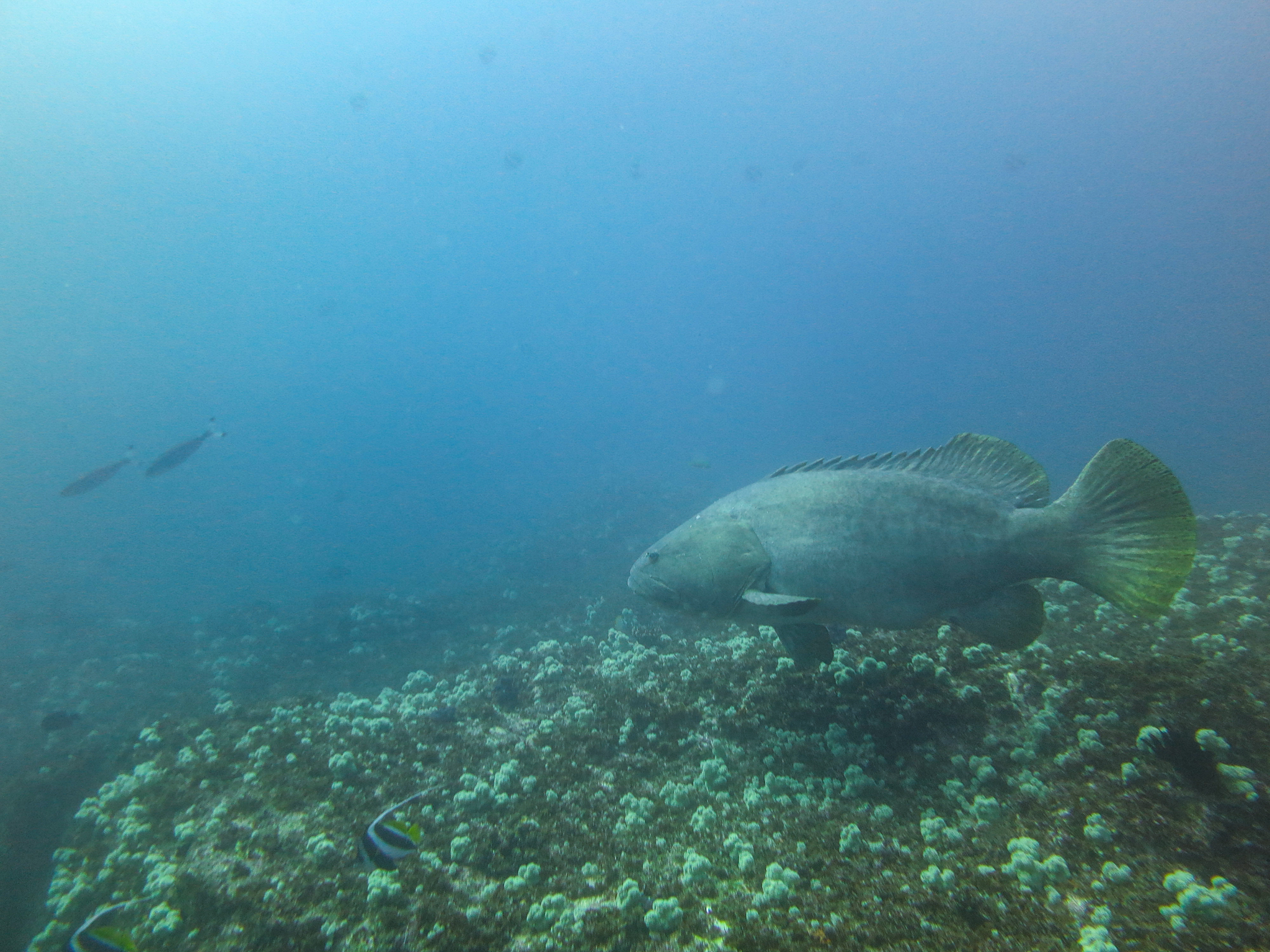
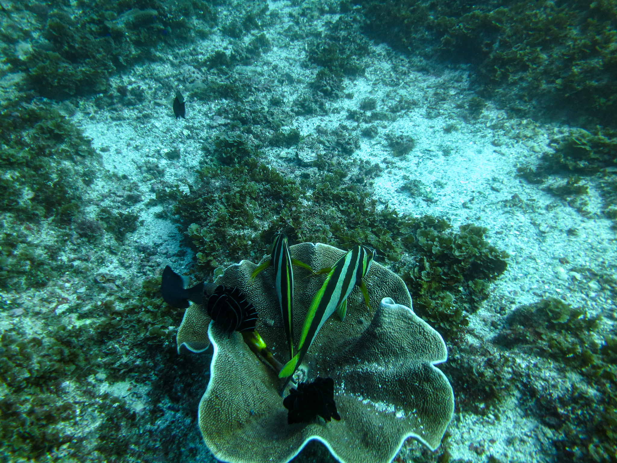
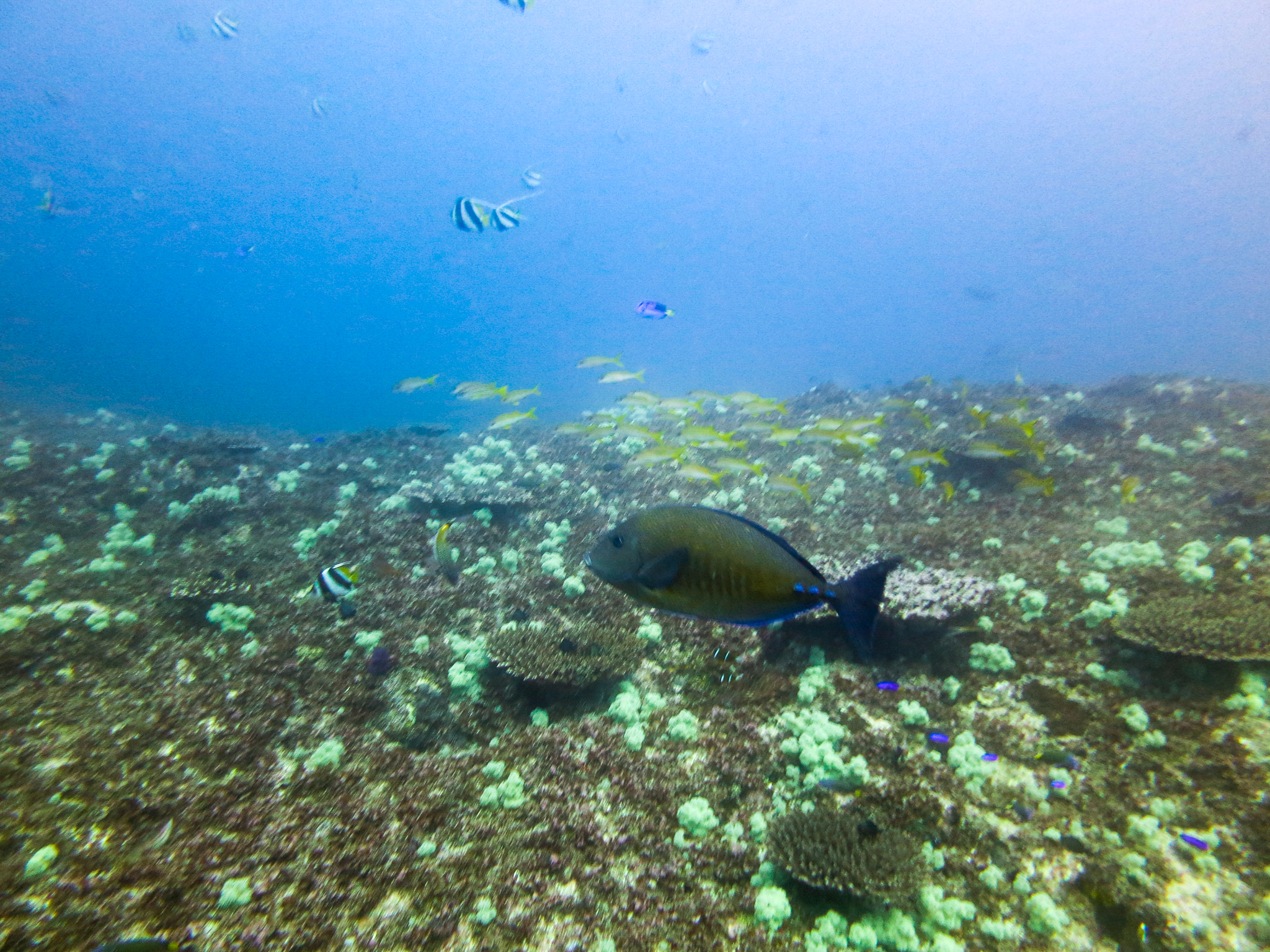
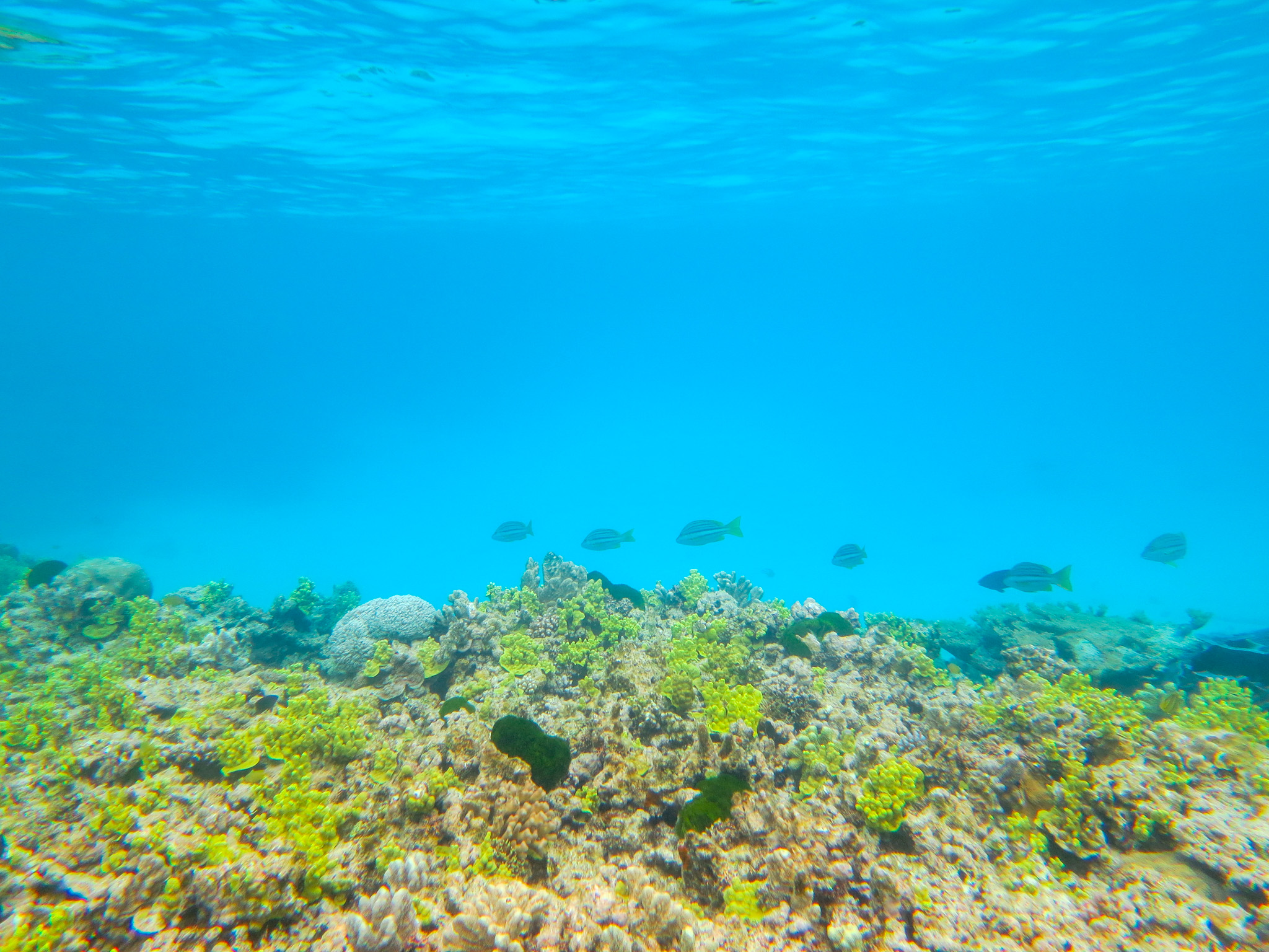
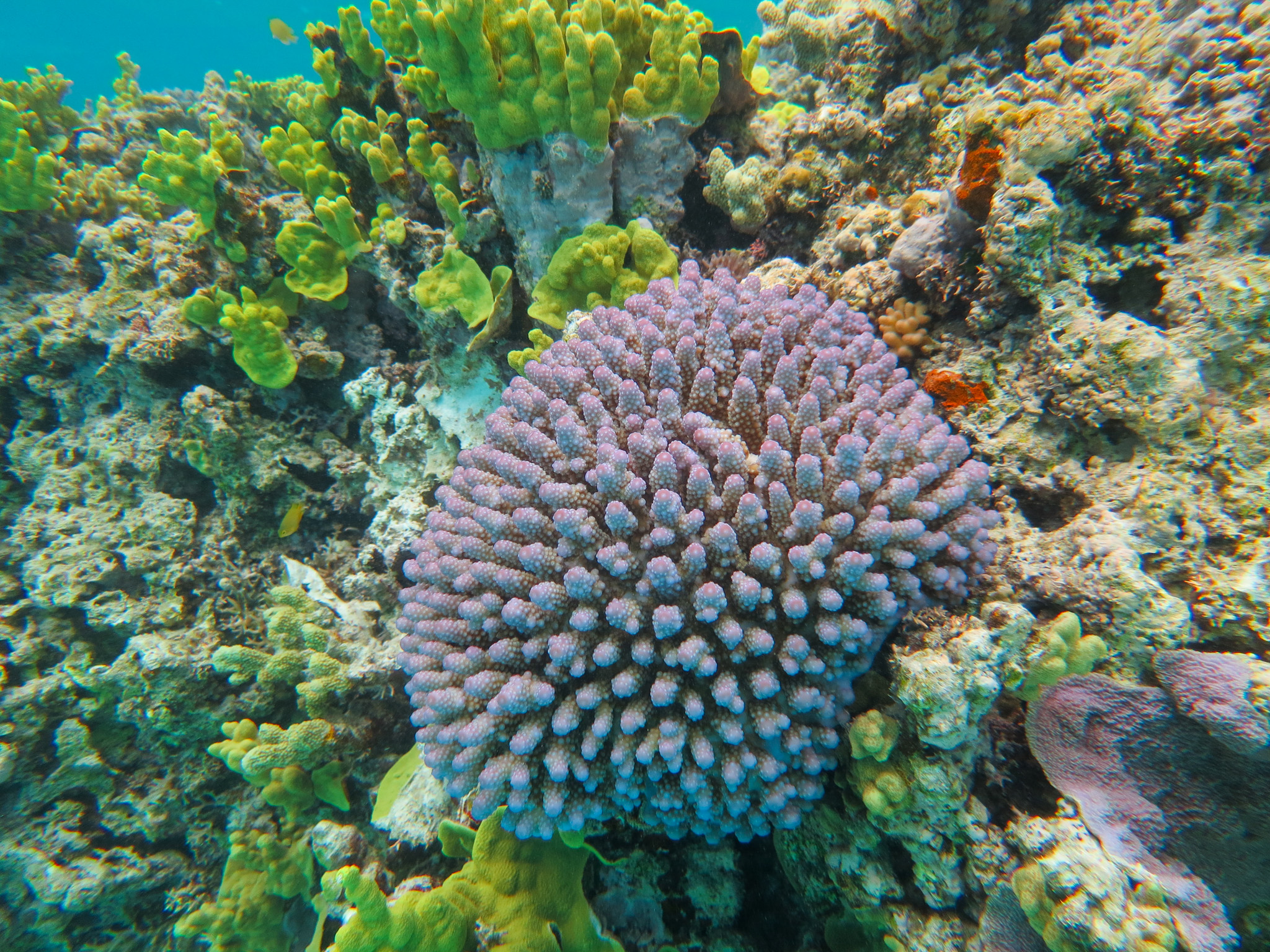
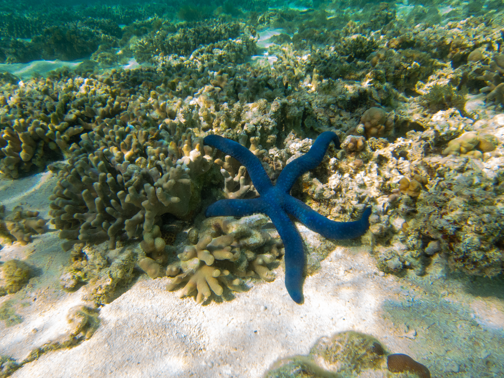
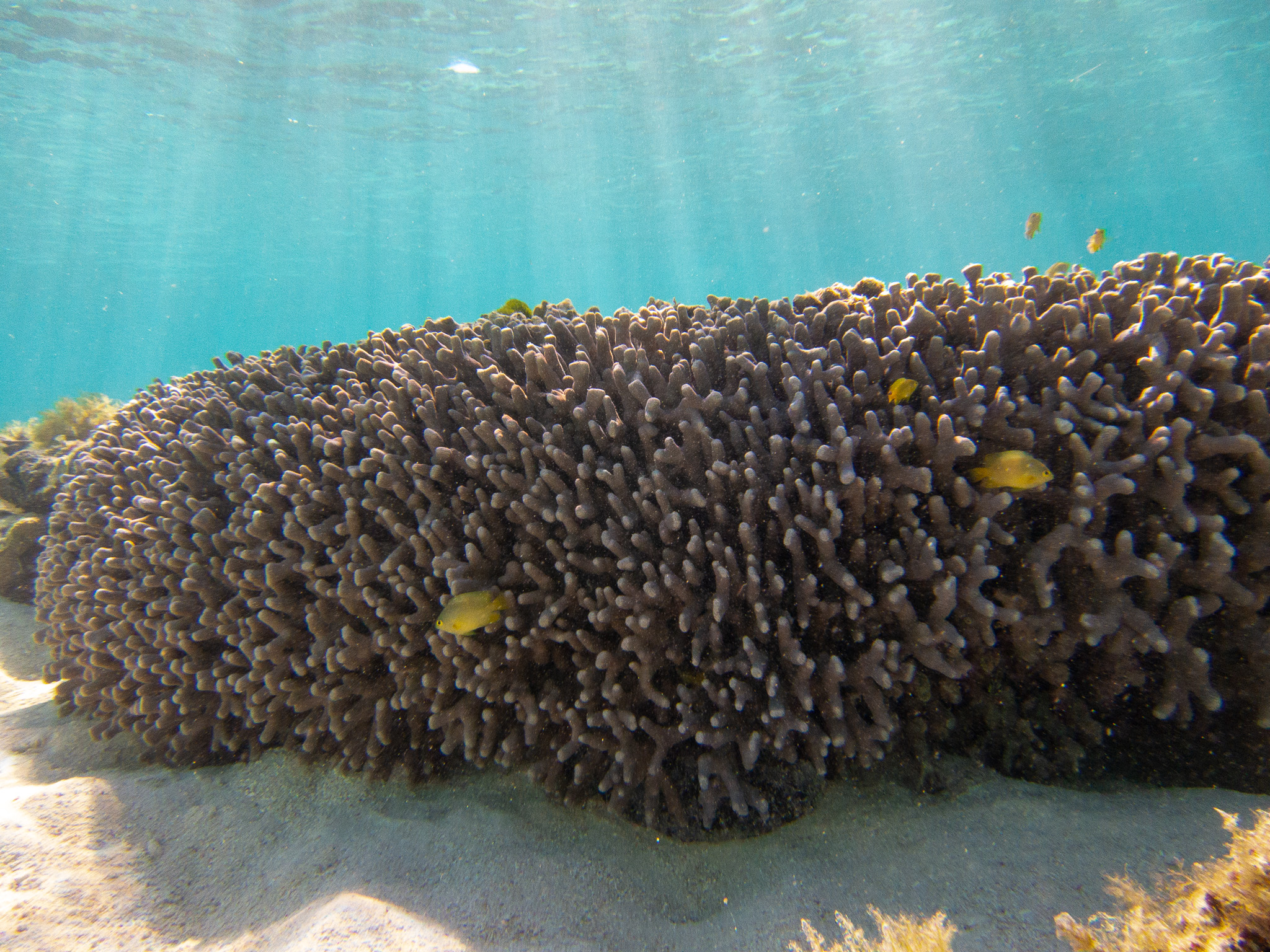
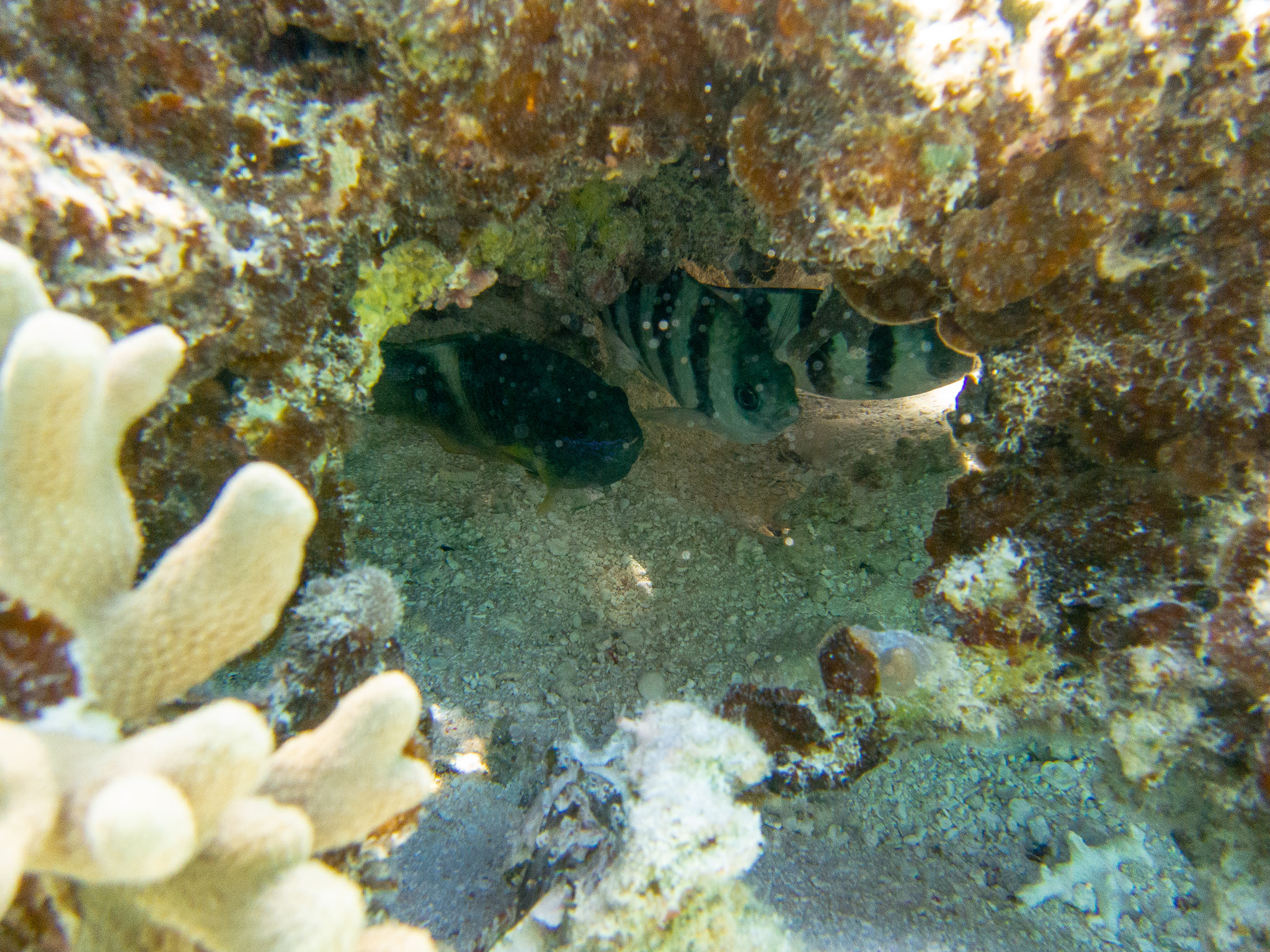
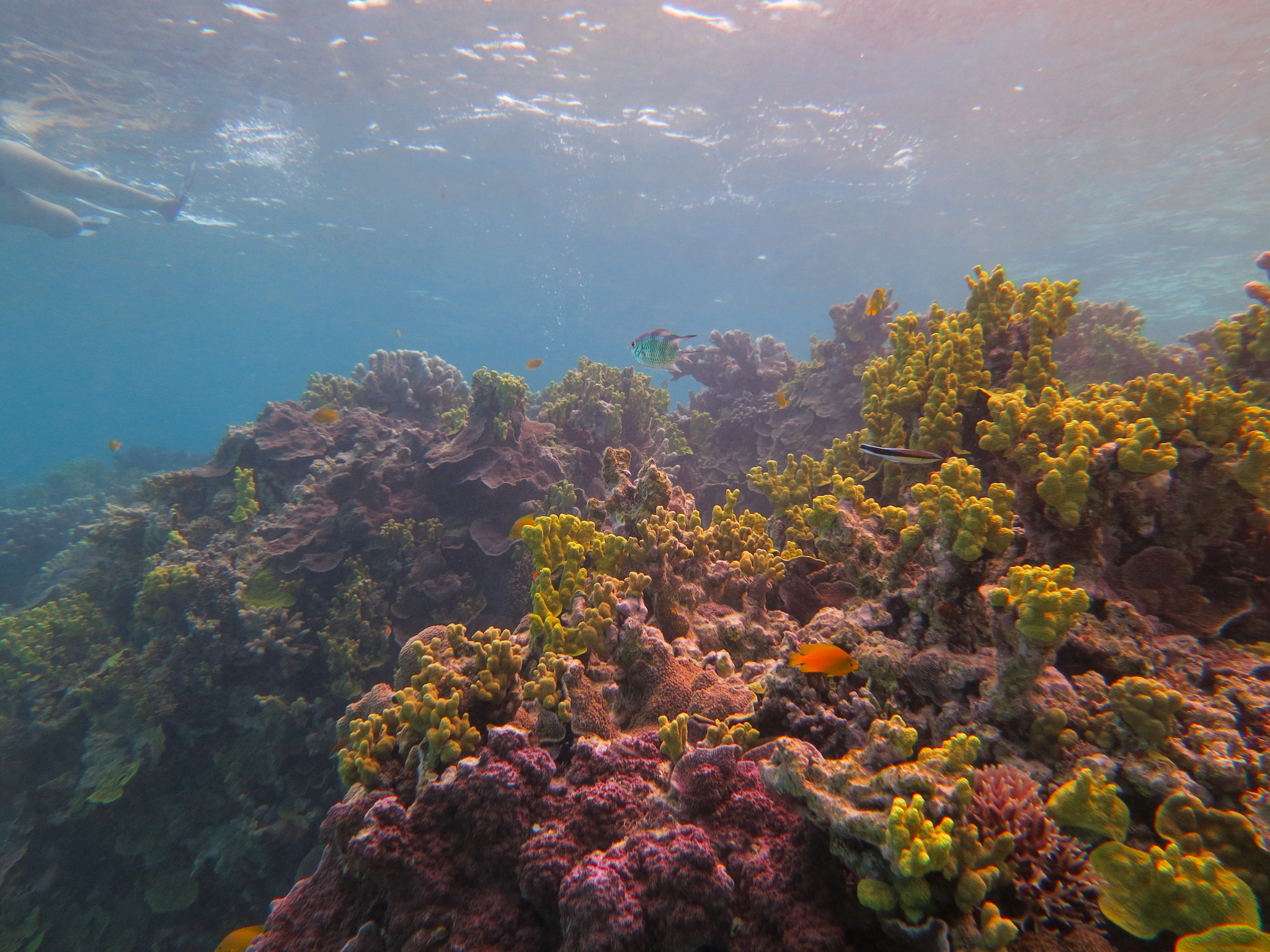
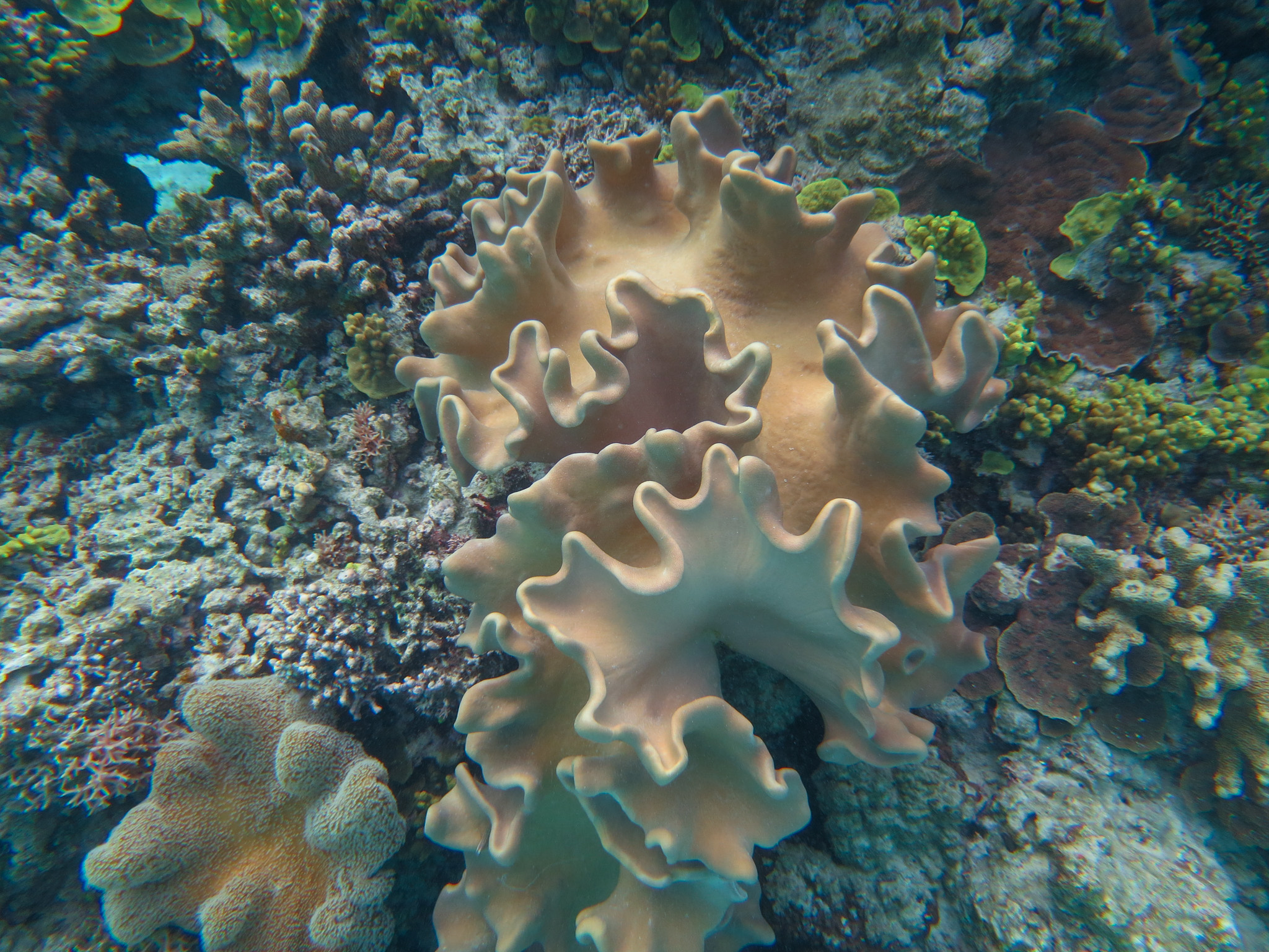
There was so much life under the water. Coral of all shapes and sizes and colours and fish galore; big, small, spotty, striped. It wasn’t too deep either, so I could just snorkel along at the surface and drink it all in.

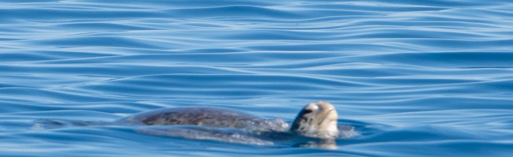
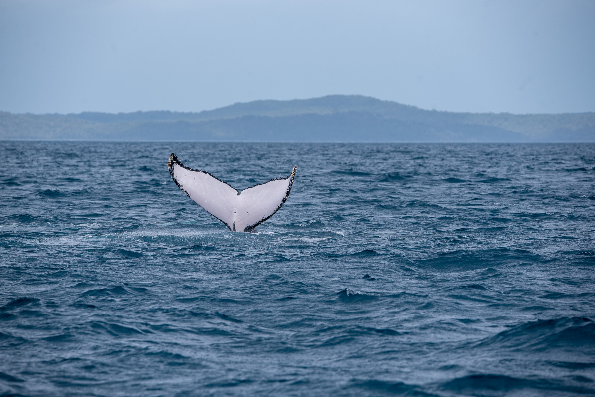
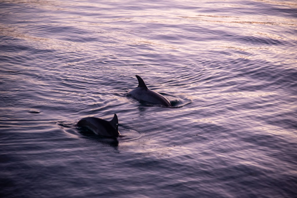
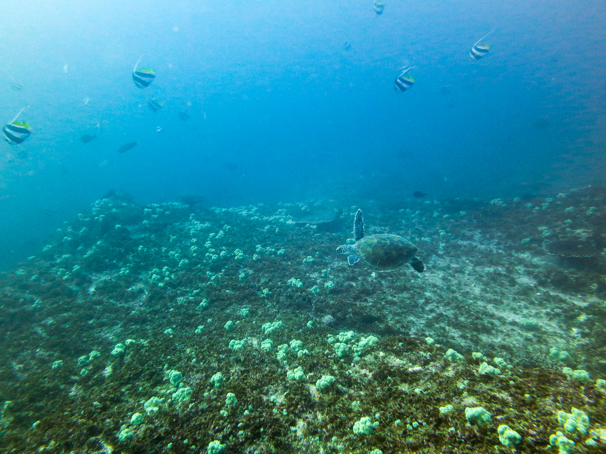
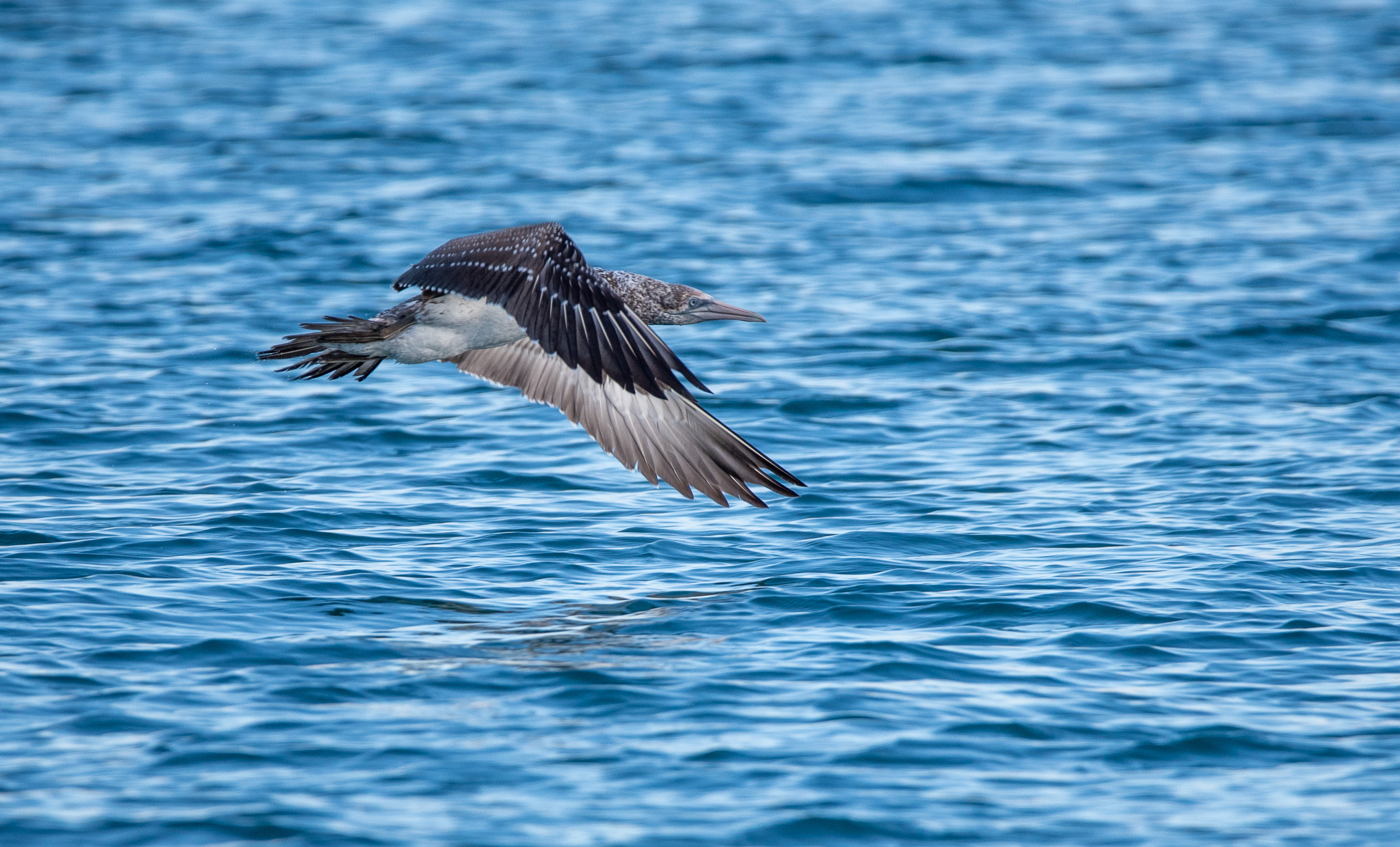
Seeing a turtle up close was very high on my bucket list, and I thought we might have a good chance at Lady Musgrave. The island is an important nesting ground for both green and loggerhead turtles. Whilst it wasn’t nesting season (that’s mainly from November to January), we hoped to still see some turtles swimming in the waters. We certainly did see turtles, pretty much every day, but this is about the only good photo we have. These green sea turtles are very shy and as soon as they realise that you are there, bang, they’re off, and they’re fast! They are incredibly graceful and fluid in the water. We’d also often spot them from the beach or from the tender, when they would pop up their head for a breath and a quick look around. With their wrinkled neck and wise old eyes, they are truly an amazing creature and I felt very privileged to see them in their natural environment, even if only briefly.

Turtle, Lady Musgrave Lagoon

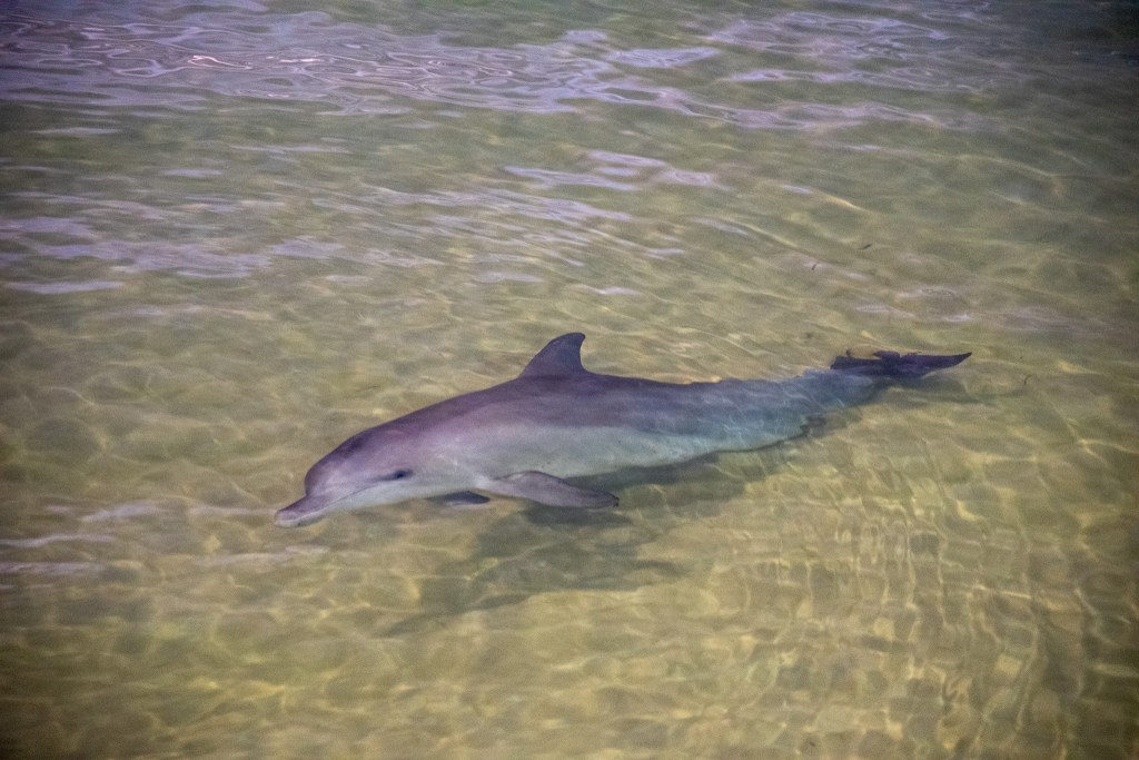
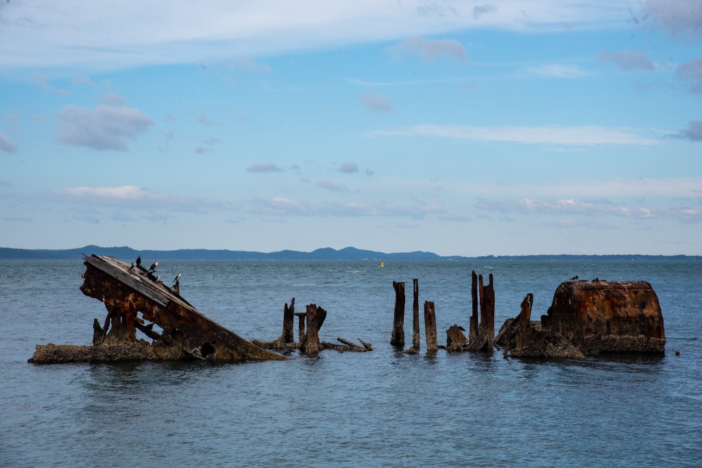
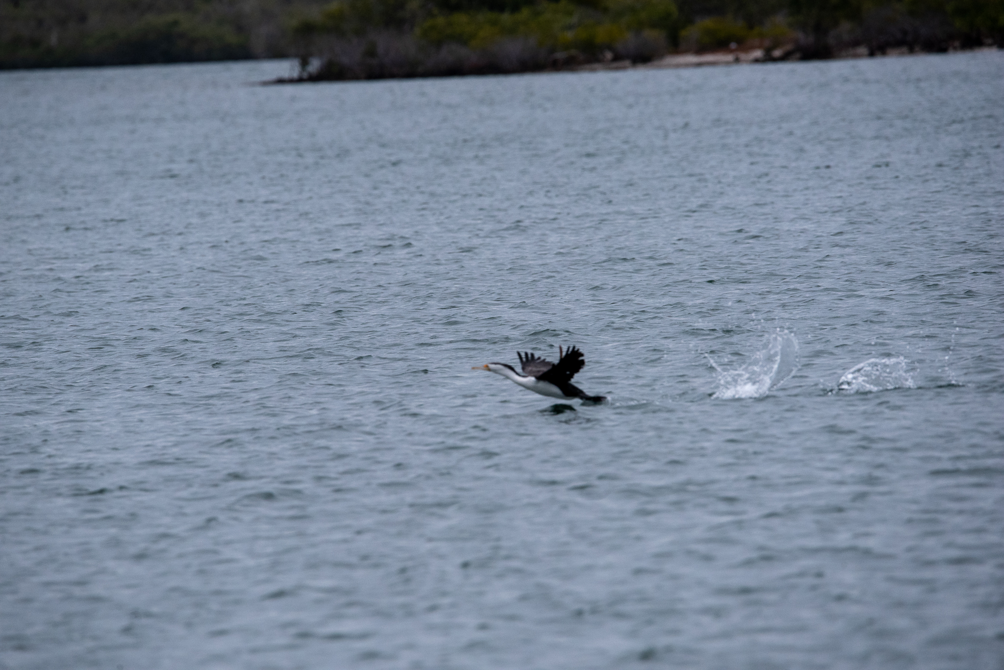
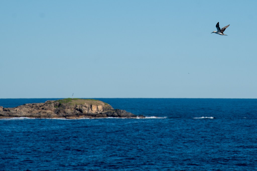
Another ocean animal we encountered was a shark. On our first day, we were walking in the shallows at low tide when we spotted two fins jutting out of the water, coming right at us. Although I could see that they were small and probably wouldn’t harm us, especially as we were only in knee deep water, you still get a bit of a shiver. There’s that innate fear of that fin! Several days later, right at the end of our swim, I saw one in the water with me. It was a reef shark. I froze for a split second, then I quickly tried to fire off a few shots with my camera. A couple of seconds is all I had, because as soon as he registered my presence, he was out of there. Phew! You can just make out the faint outline of the shark in the photo below. I kinda hope that’s the most exciting shark encounter that I have.

Reef shark. You can just make him out in the upper left hand corner of the photo.

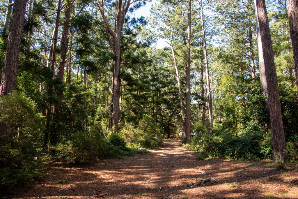
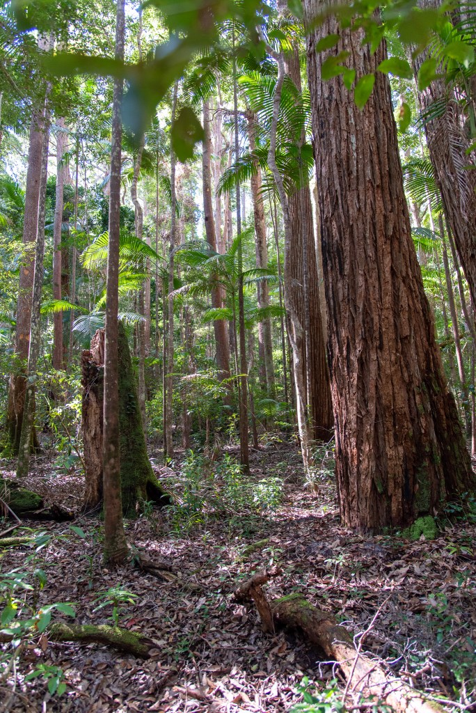
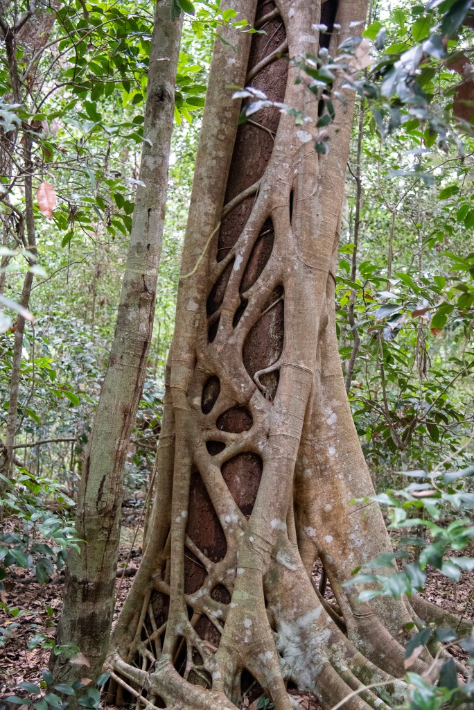
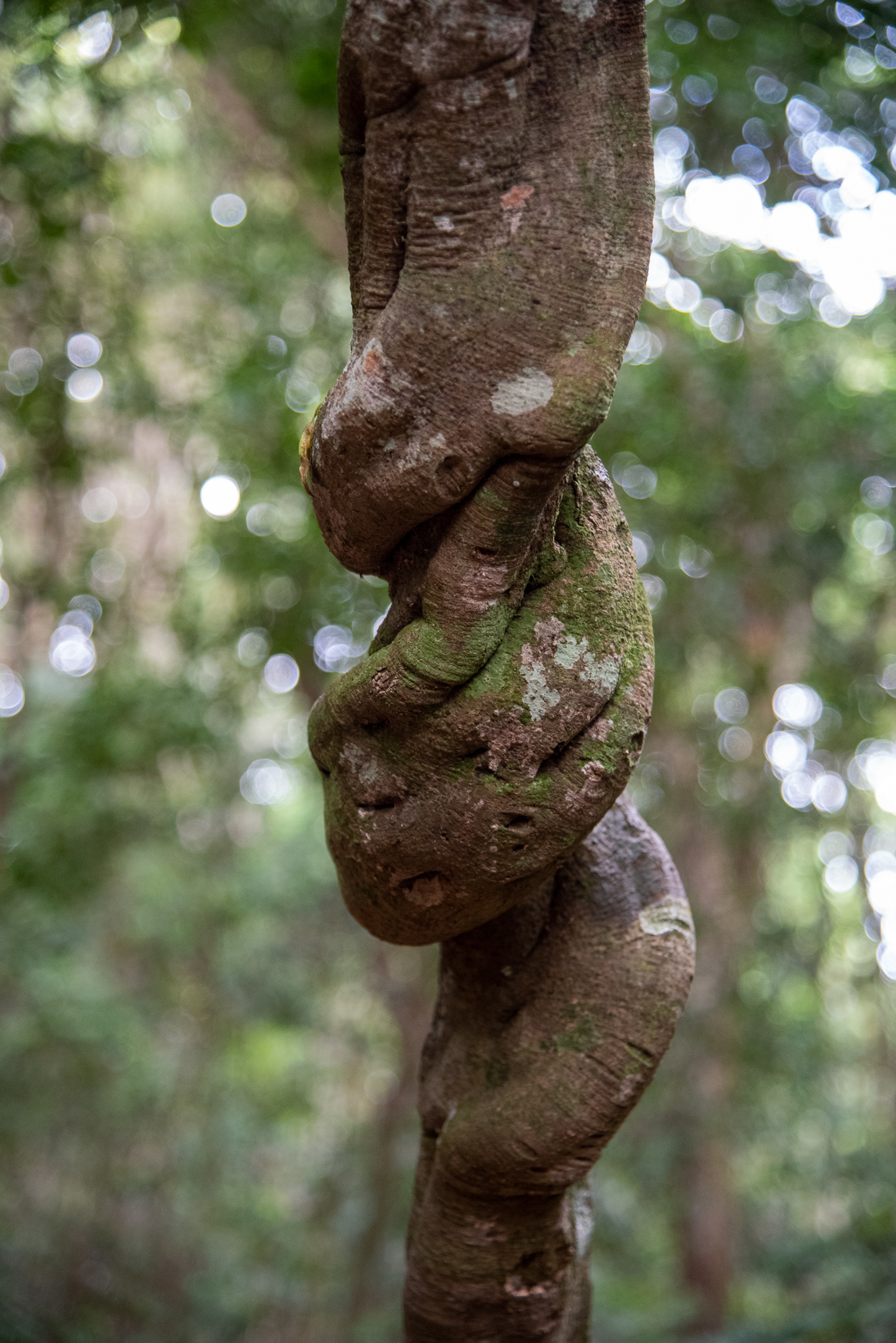
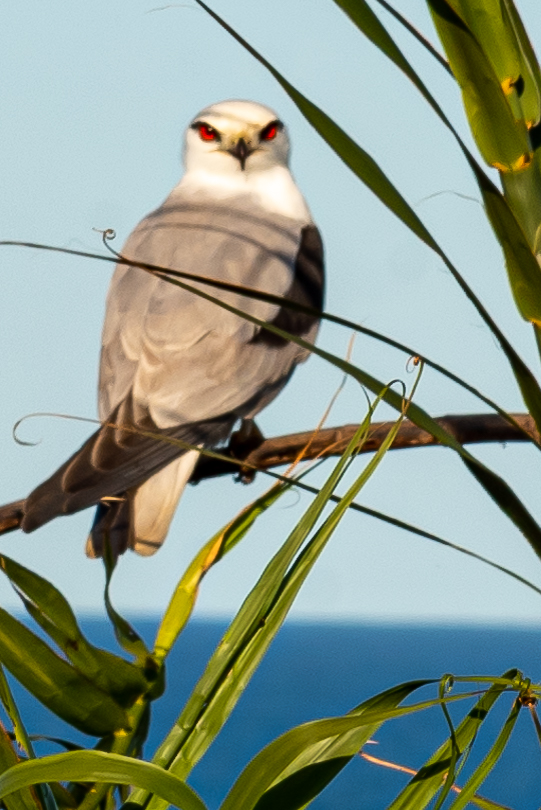
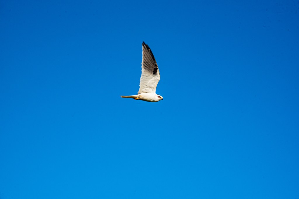
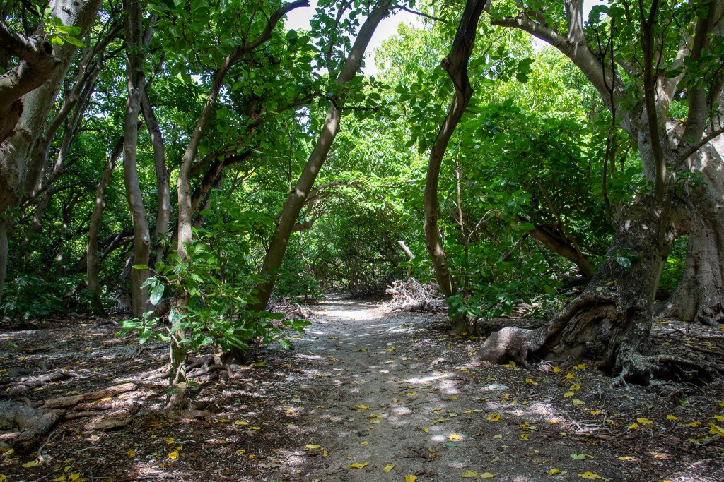
The island hosts a small forest of Pisonia trees. Pisonia are a fascinating type of tree found in tropical habitats, mainly coral islands in the Caribbean and Indo-Pacific. It has been given the nickname of ‘the bird-catcher tree.’ Yep, this particular tree catches and kills birds. I know, what the?!

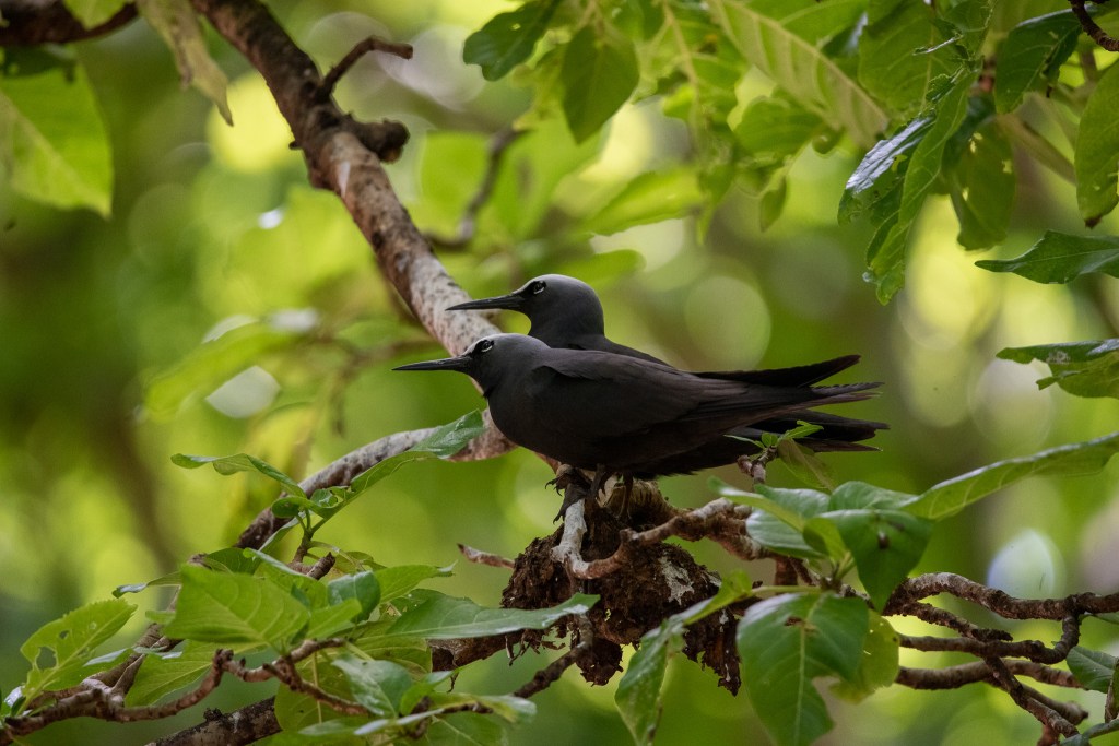
A bird called the ‘black noddy’ lives in this forest. They build very flimsy nests in the Pisonia trees, glued together with bird droppings. It did smell a bit! The Pisonia tree produces a seed which is coated with a thick mucus and small hooks. These seeds stick to the noddies and can trap them in the trees, where they ultimately die. One theory is that the decomposing birds are used as a fertiliser for the trees, however some researchers argue that the guano produced by the noddies would be a far richer source of nutrients, meaning the noddies would be worth more to the trees alive than dead. So they don’t really know why this occurs. Isn’t nature strange??

Pisonia forest on Lady Musgrave Island
Black noddies

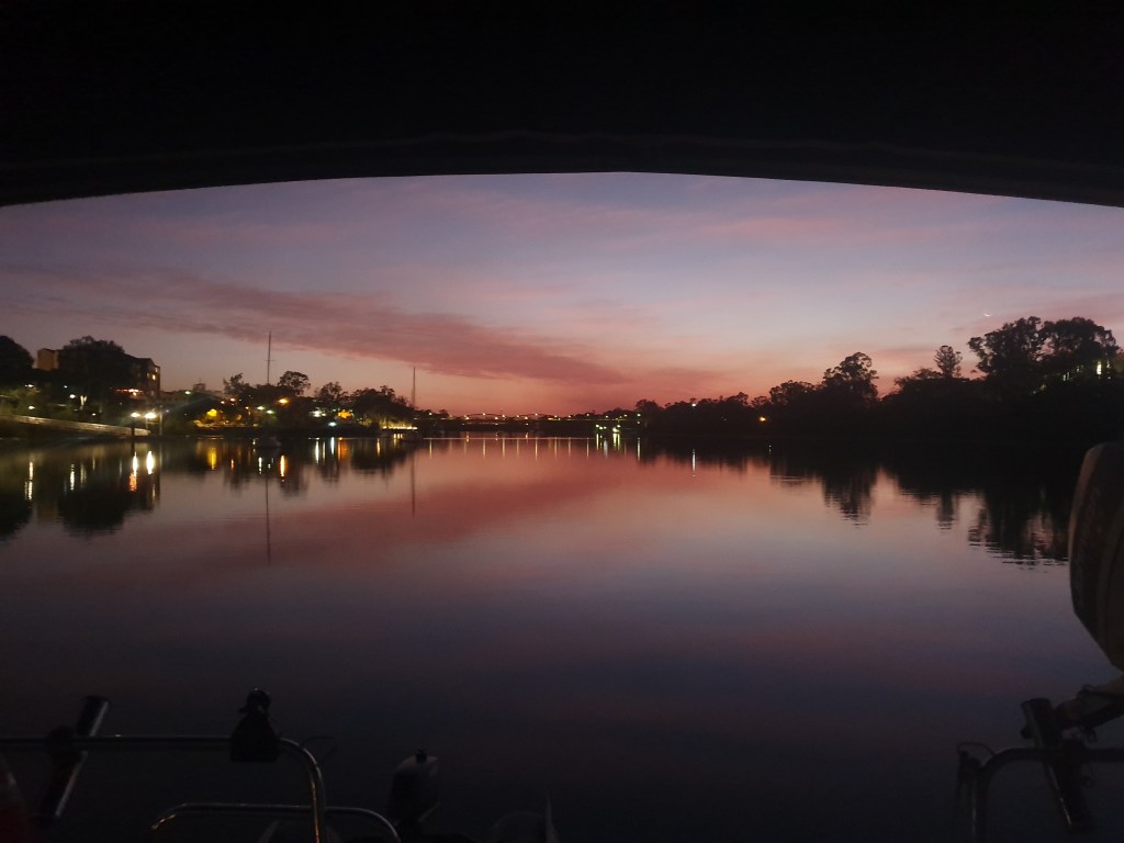
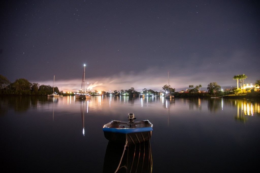
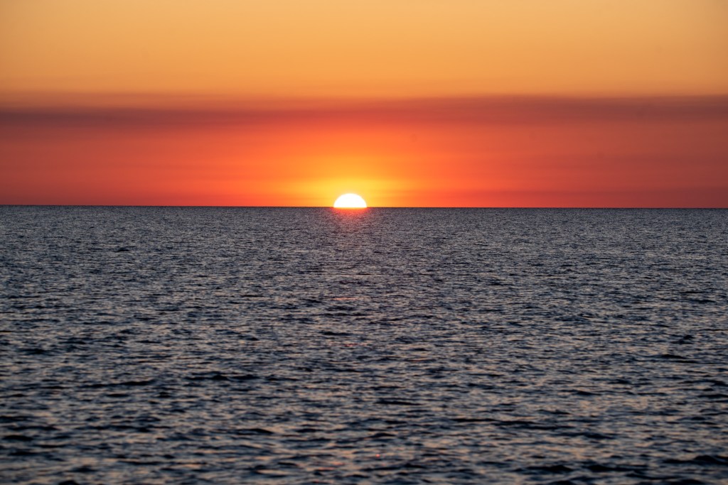
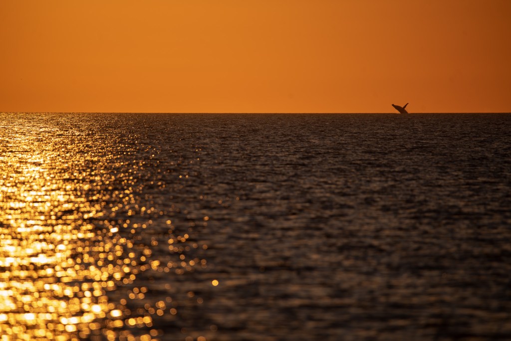
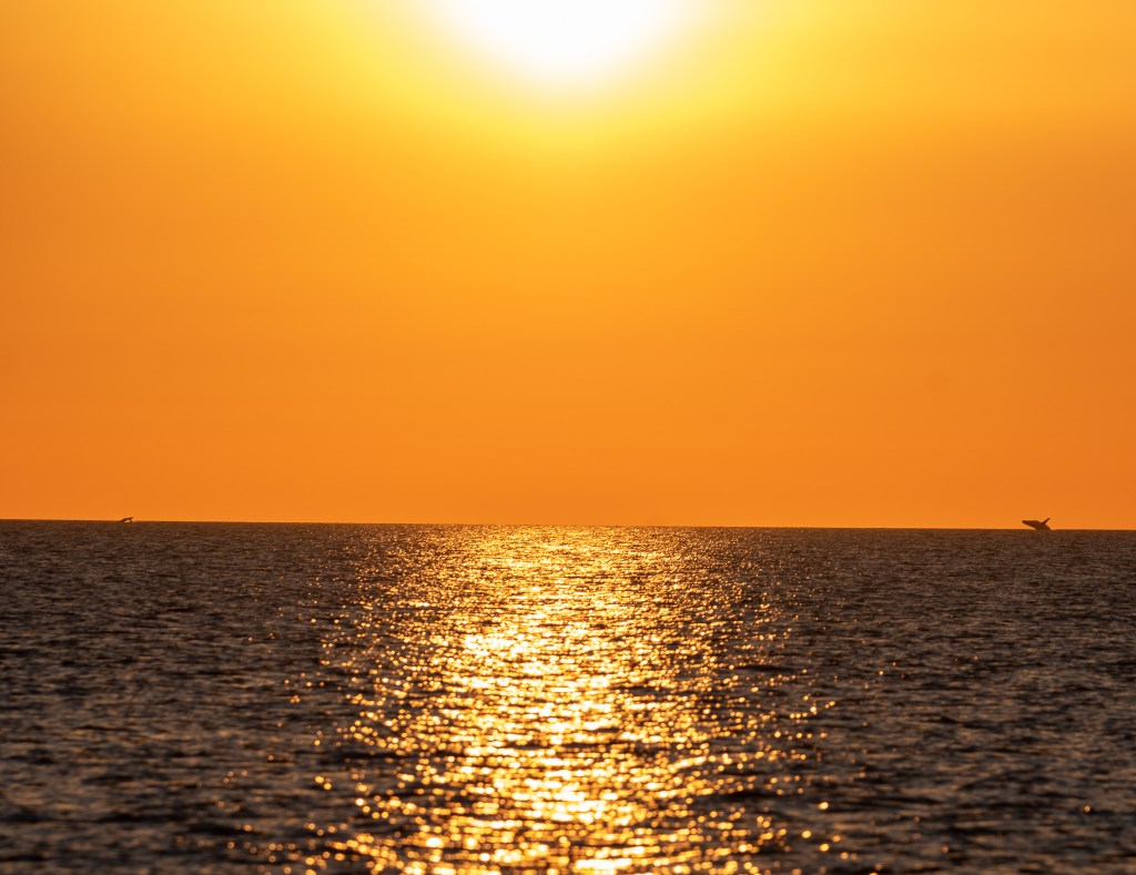
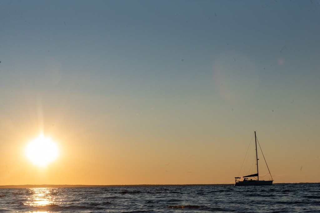
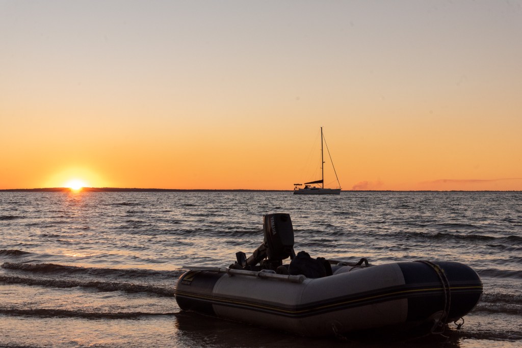
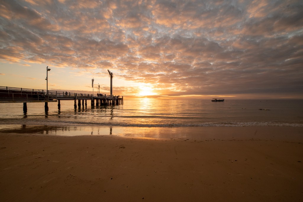
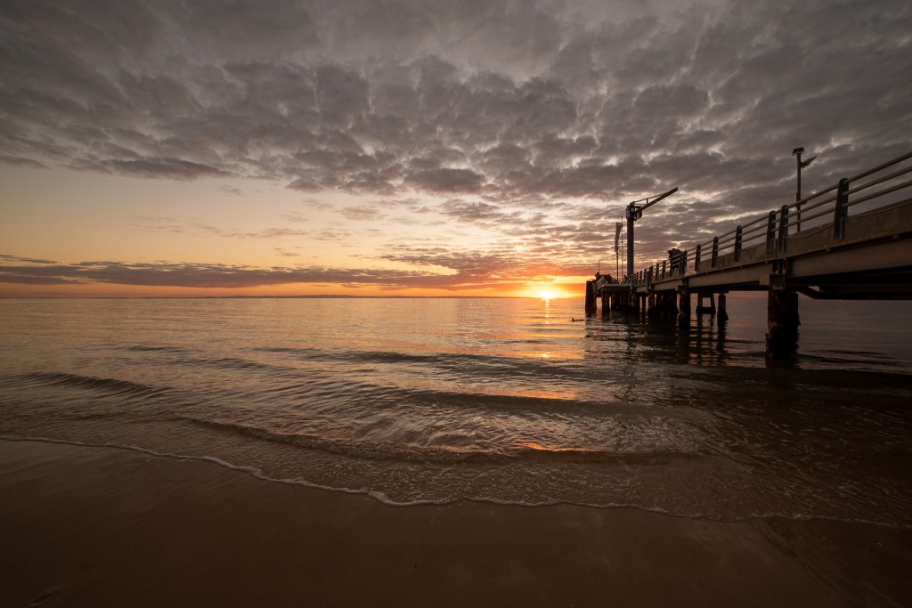
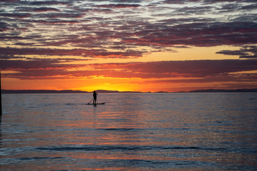
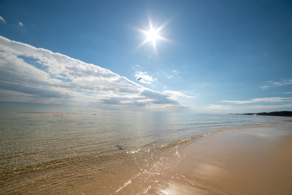
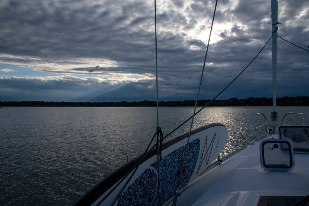
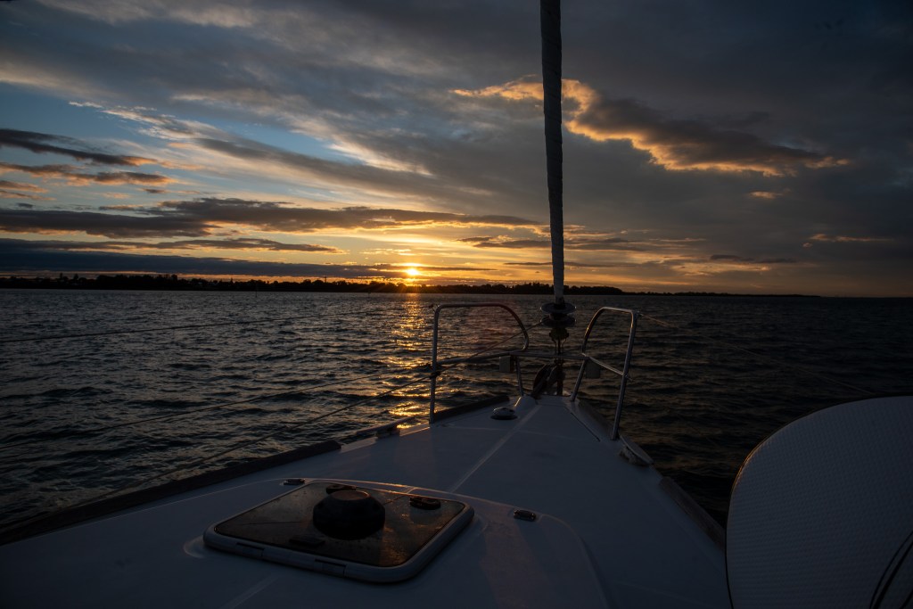
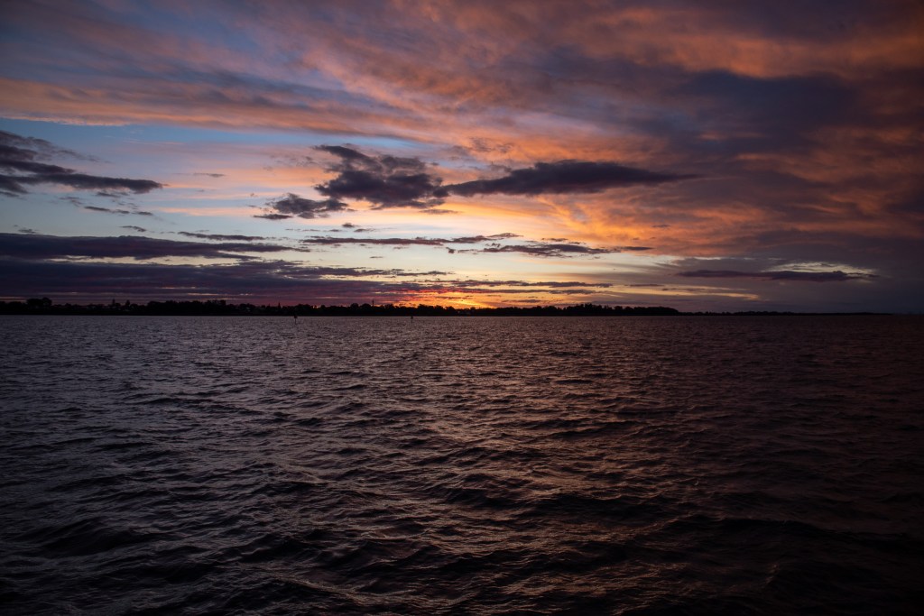
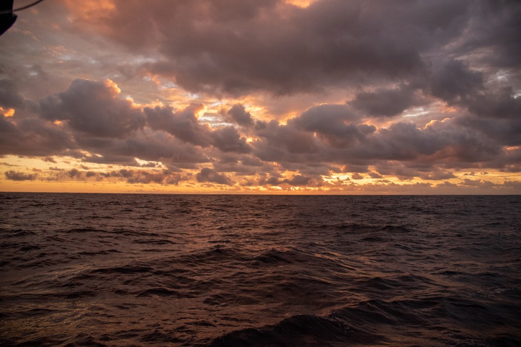
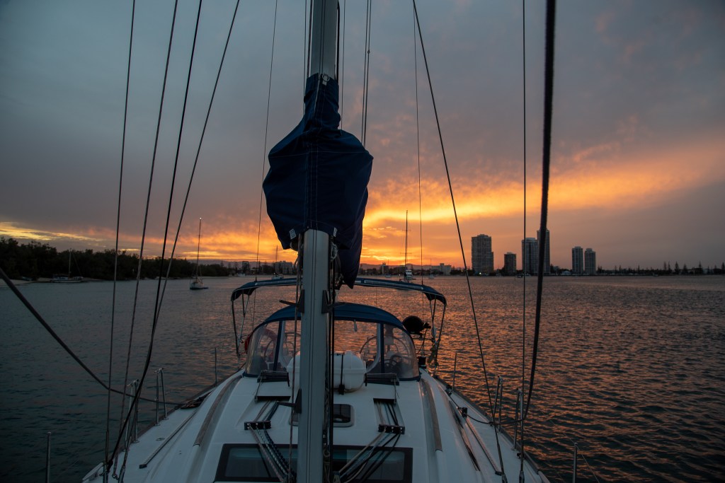
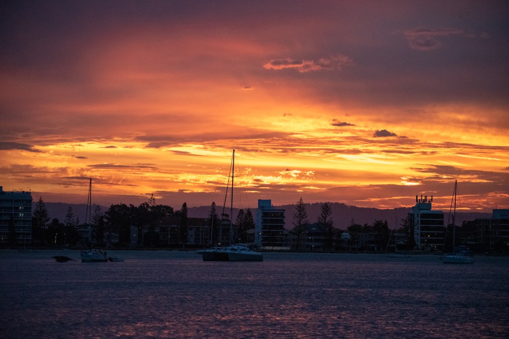
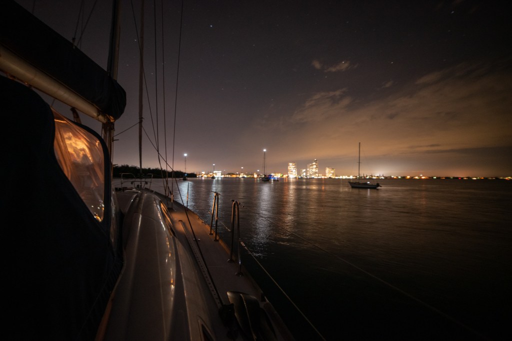
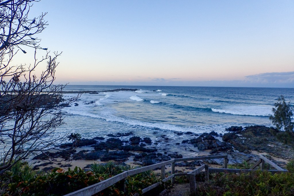
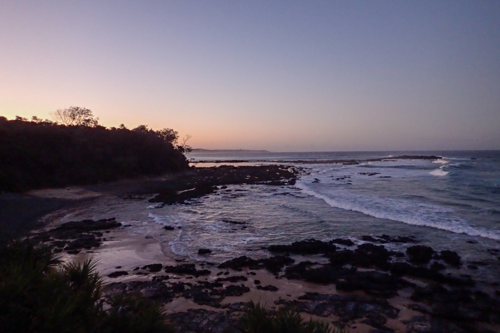
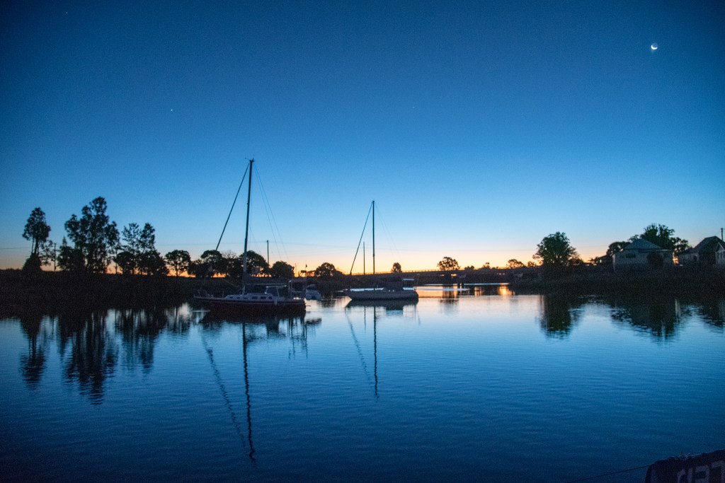
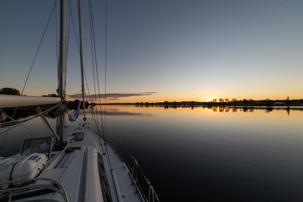
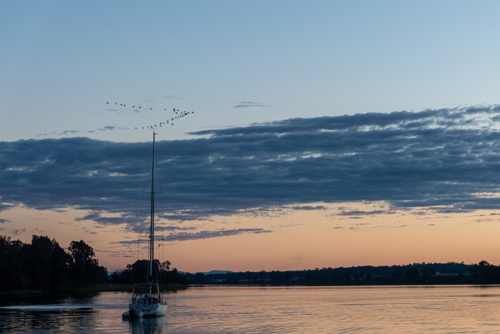
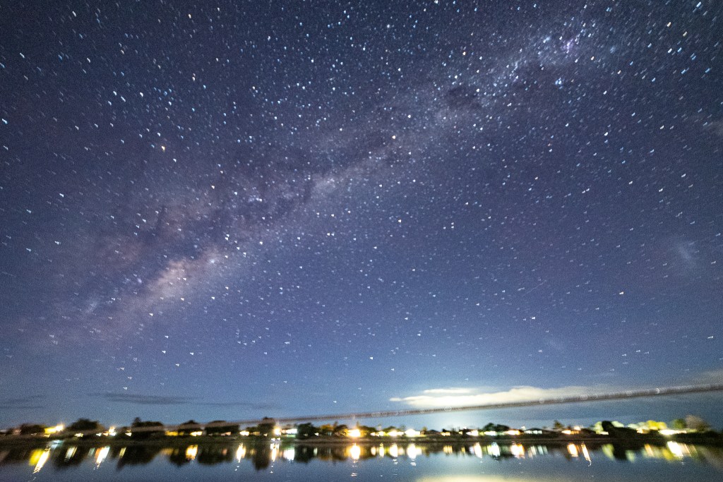
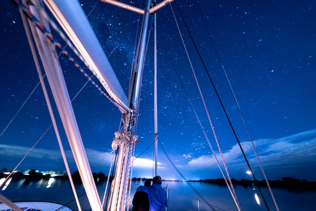
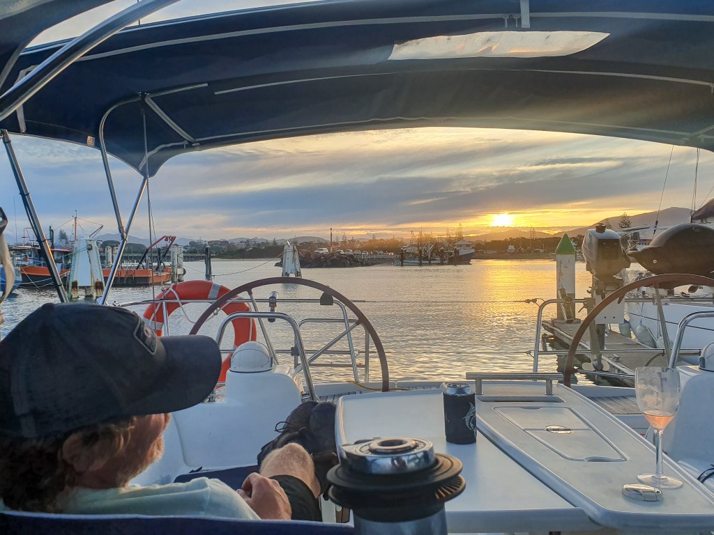
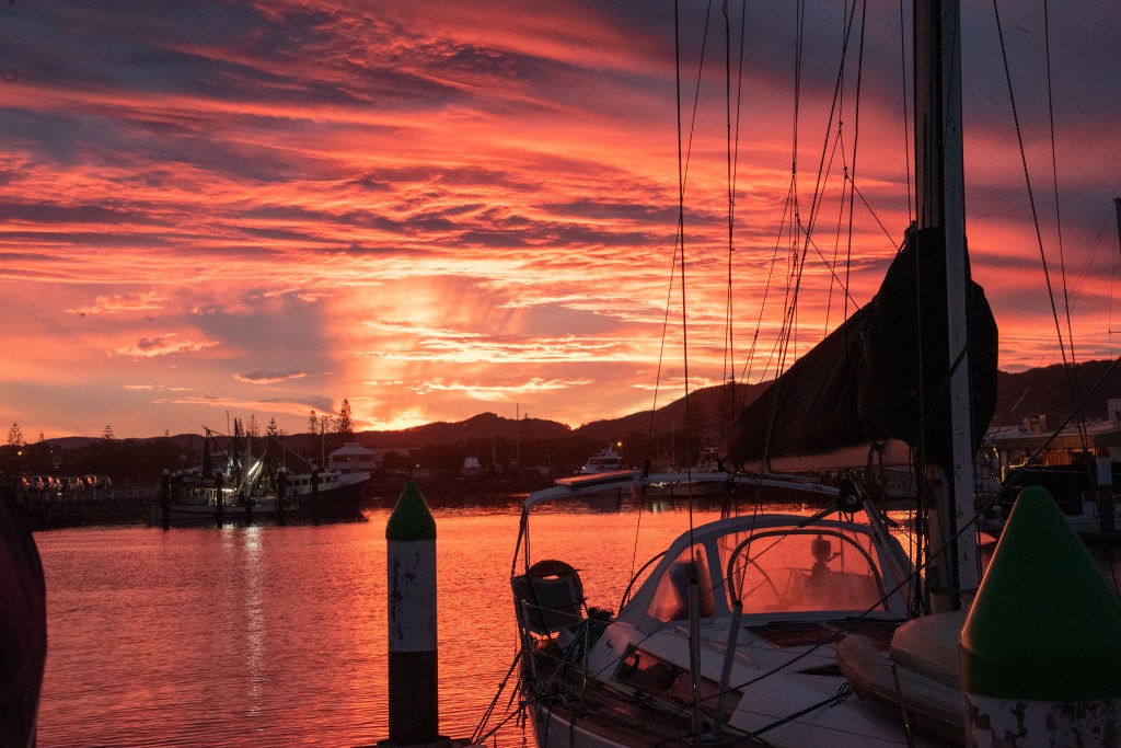
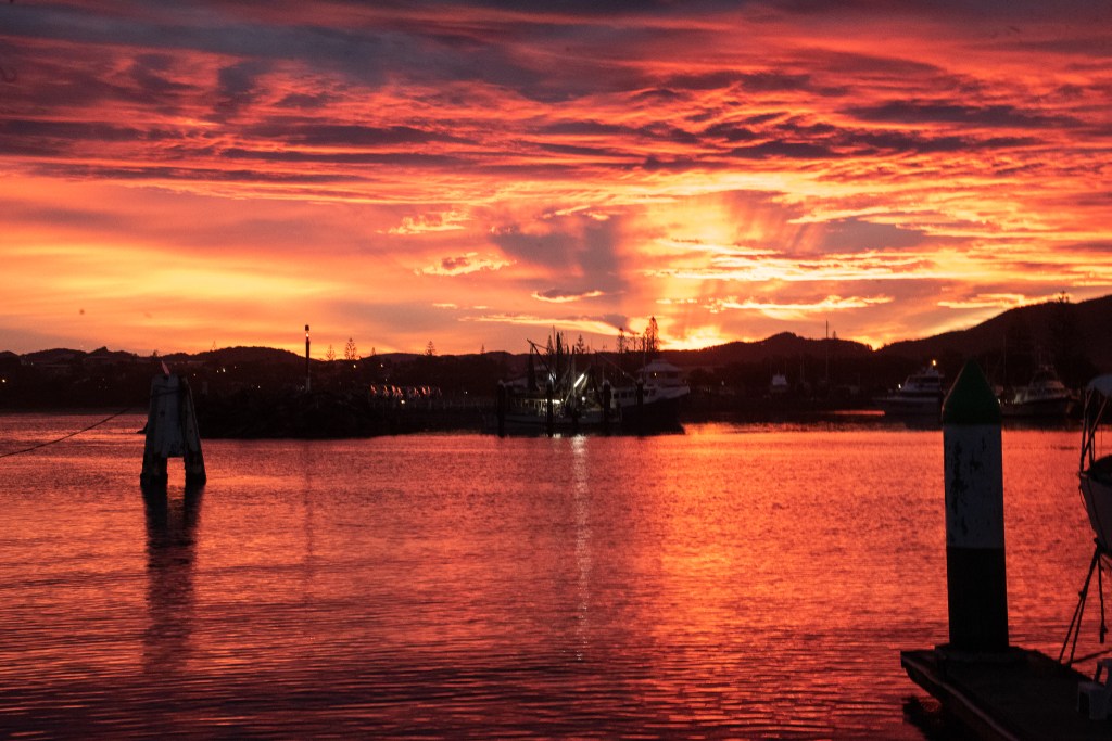
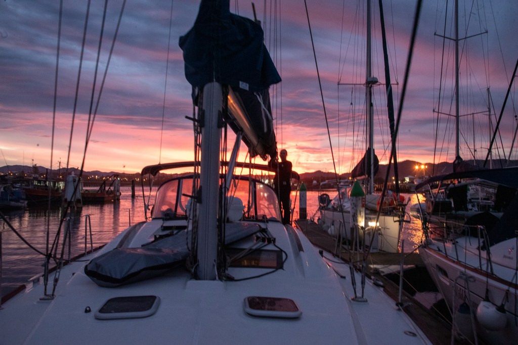
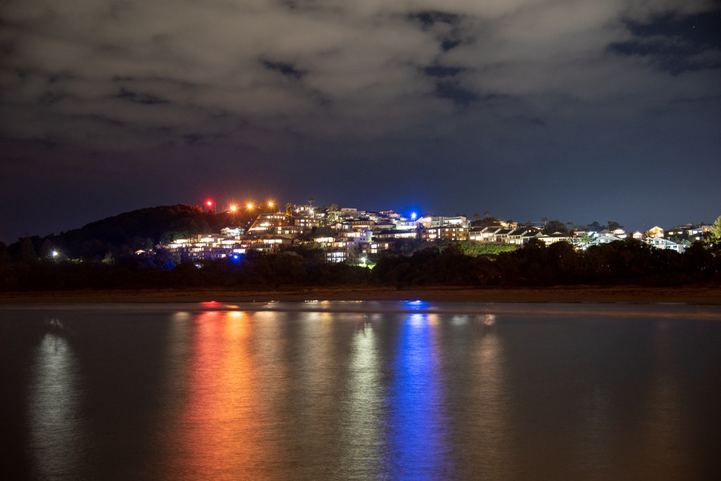
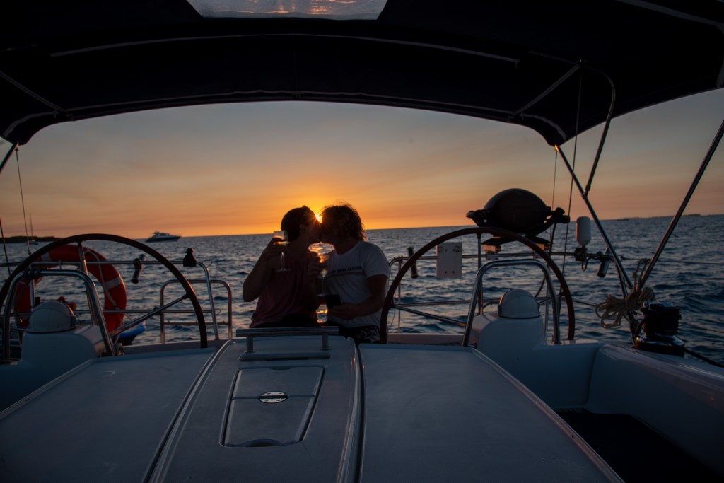
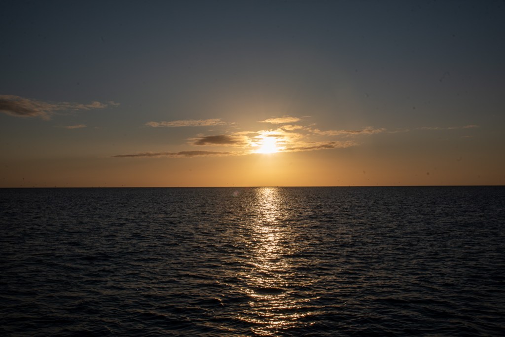
We saw some beautiful sunsets, both from on our boat in the lagoon and also from the island, with the sun setting out over the endless sea.

How romantic!
Sunset, Lady Musgrave Island

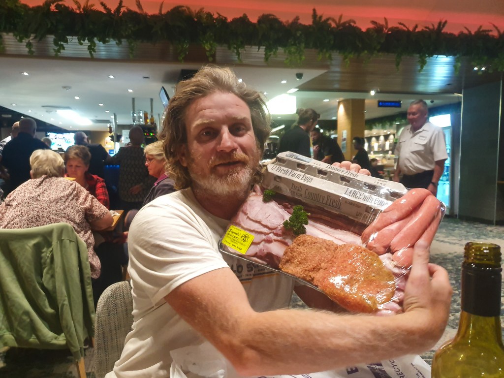
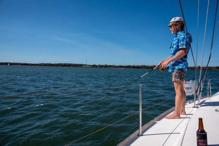
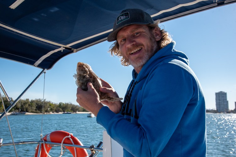
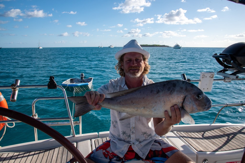
Matt caught this big guy off the boat, with a bit of leftover chicken. After much research and debate, he has decided it is a Silver Perch. Let us know if you agree. Whatever he was, he definitely wasn’t a protected species, and he was definitely big, and he was definitely delicious!

Matt with the silver perch ……..?

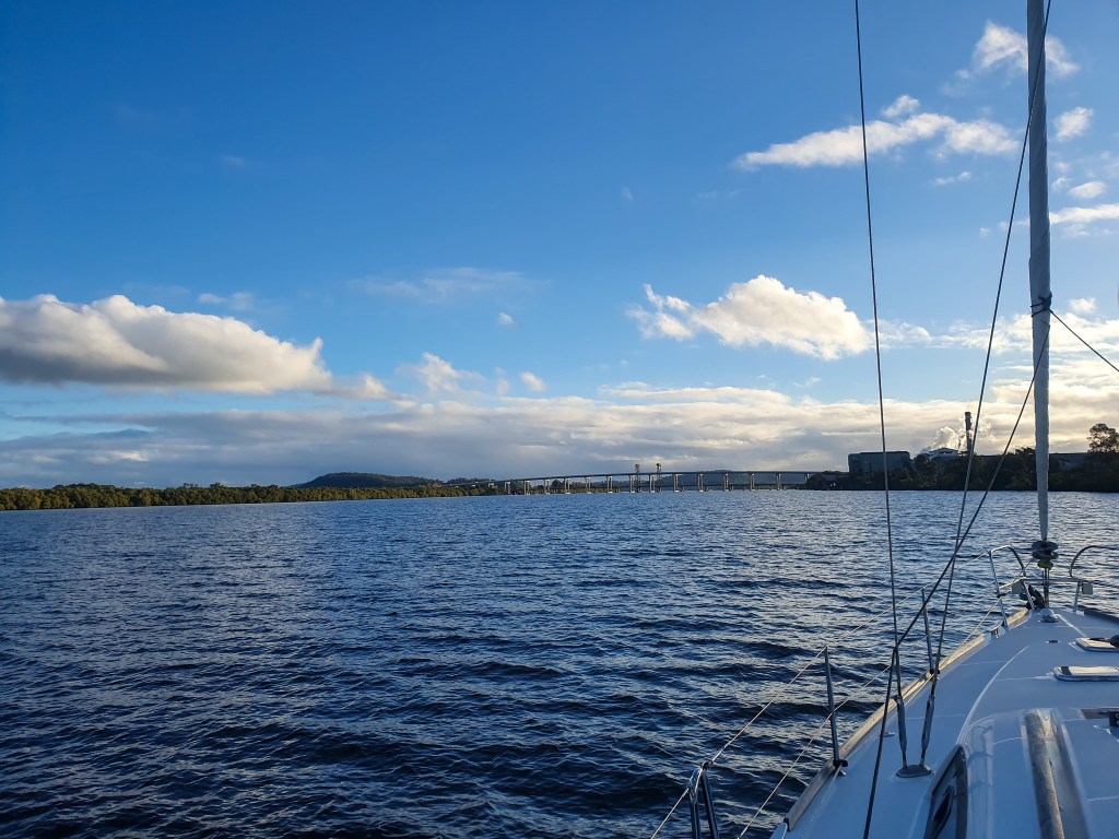
After four nights at Lady Musgrave, we moved to another lagoon called Fitzroy Reef. We left at 7 am, and in that early morning light the bommies were almost impossible to spot, so thankfully we could just follow the track on our chartplotter that we’d used to come in. Great conditions had us sailing all the way, flying along at six to seven knots.

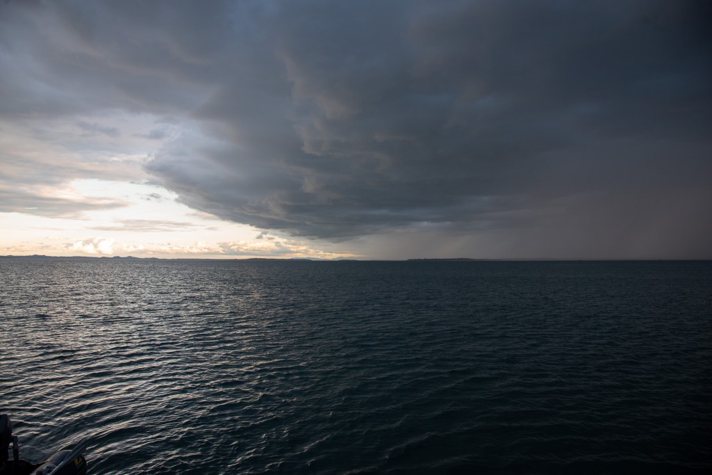
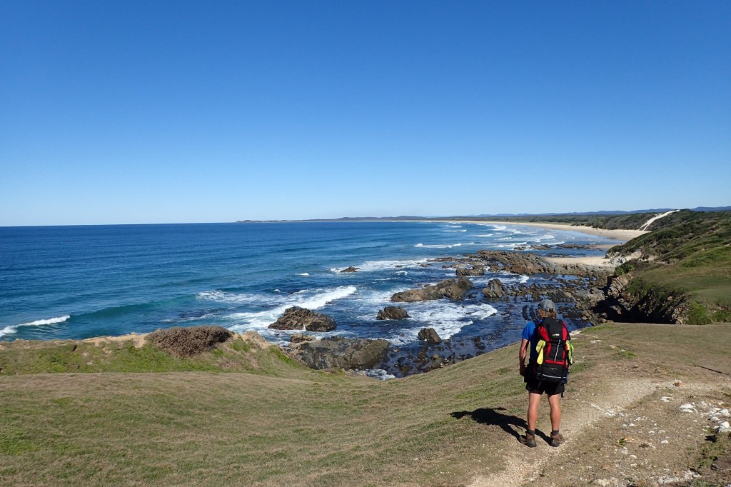
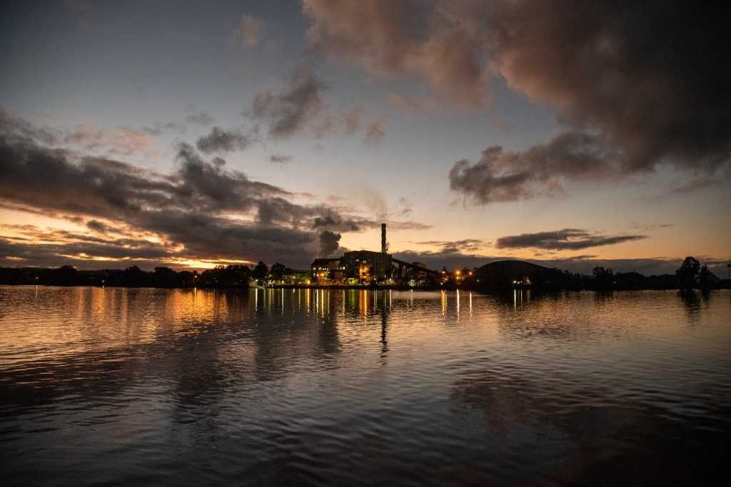
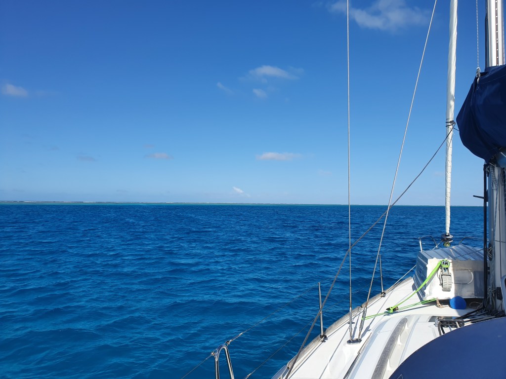
There was some big swell in the entrance but we got in ok and manoeuvred our way to a clear patch of water to drop anchor. Fitzroy Reef has no island, it is just a coral reef forming a lagoon with a narrow entrance. At high tide the reef is completely covered. All that you can see is blue ocean stretching away into the distance. Not a speck of land, as far as the eye can see! At low tide, the reef becomes visible around the edges of the lagoon. Low tide is more comfortable as the waters of the lagoon are calm and still, but at high tide, when the swell washes over the reef, it can get a bit rocky on the boat.

Looking out at this stark, yet beautiful landscape, we reflected again on how far we have come. To be this far out in the ocean, with no land in sight, would most likely have worried or alarmed us in the early days, yet here we were feeling perfectly at ease and perfectly safe.

Fitzroy Reef

We went snorkelling several times during our two days here, taking the tinny over to the reef and anchoring it, and then jumping over the side. That bit was easy, it was heaving myself up and back into the tinny from the water that was the challenge! The underwater world was spectacular and filled with life. Matt speared a fish, similar to the one he’d caught at Lady Musgrave, just a bit smaller.

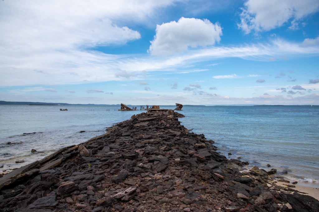
Fitzroy Reef was much smaller than the lagoon at Lady Musgrave and there were a lot less boats, so it was very quiet and peaceful. It’s a pretty strange feeling knowing that you can’t get off the boat and go for a walk though. We had thoroughly enjoyed our very first taste of the Great Barrier Reef and now it was time to head back towards the mainland to Keppel Bay.

We stopped at North West Island to break up the trip, gratefully jumping onto a mooring buoy for the night instead of anchoring. There were some colourful squid swimming right next to the boat and Matt tried to catch them with lures, but without success. It was also here that I saw the mythical ‘green flash’ at sunset. The green flash is a phenomenon that I’d heard about, but I didn’t know if it was fact or fiction. I’ve certainty seen a lot of sunsets and never seen this green flash that is supposed to occur right as the sun dips below the horizon. Well, I can categorically tell you that it is a thing. It’s real! I saw it with my own eyes. I was super excited! Matt just looked at me like I had two heads.

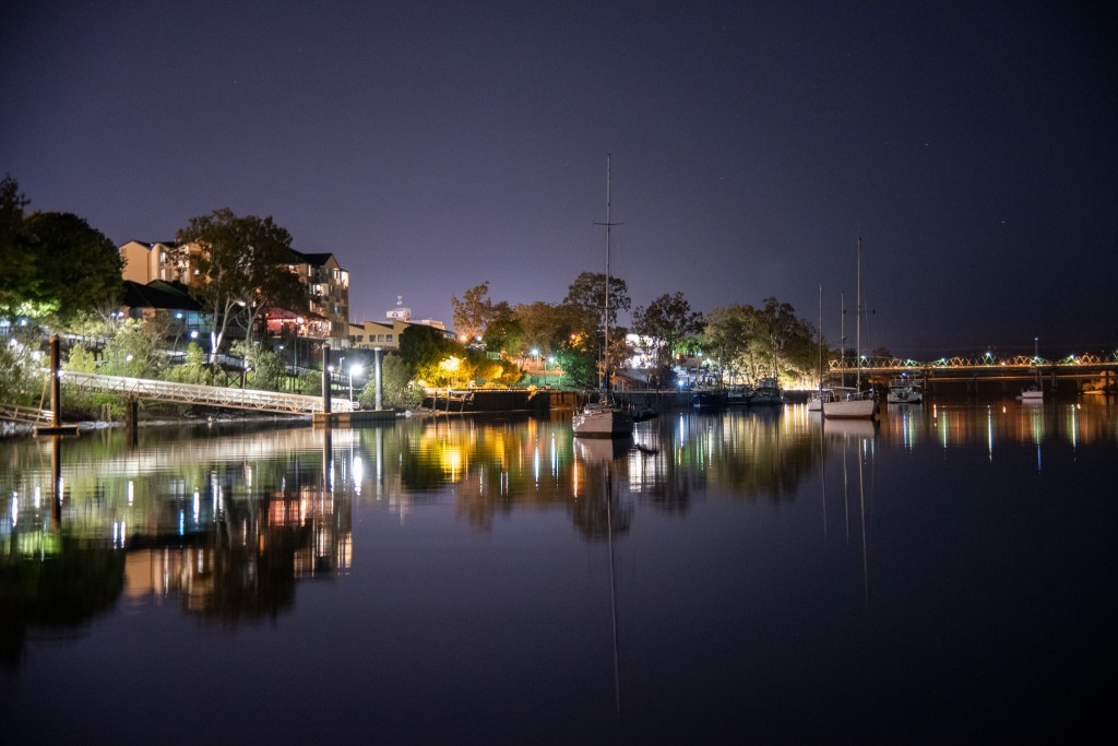
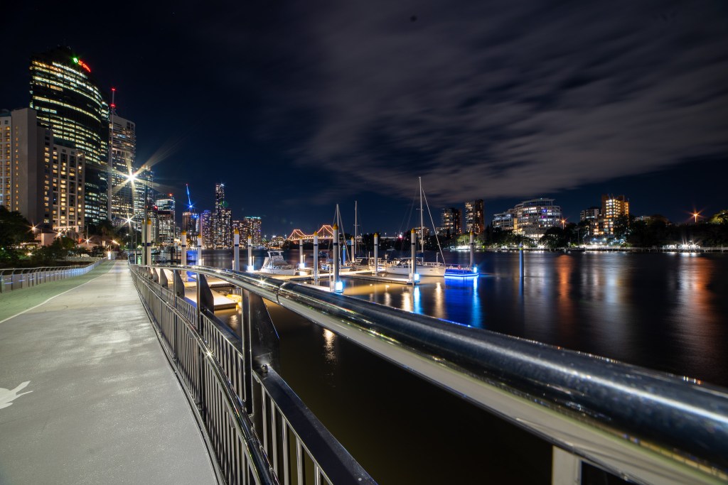
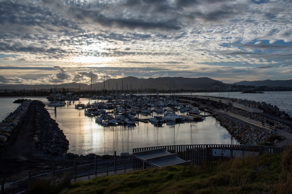
Unfortunately, it was pretty rolly off North West Island, so we had quite an uncomfortable night and I didn’t sleep much. I was very eager to move off the next day, and with the wind picking up even more, we flew along, sailing at a speed of six to eight knots. The seas also picked up as the day wore on and soon we were in choppy water filled with white caps. The choppy water and increased winds made anchoring at Great Keppel Island an unappealing prospect, so we booked a berth at Rosslyn Bay Marina. Arriving into the marina right on sunset, I felt so relieved to be tied up safely and securely. A hot shower, dinner at a restaurant and a good night’s sleep went down a treat!

How inappropriate to call this planet Earth when it is clearly Ocean.

Arthur C. Clarke

Bundaberg and Hervey Bay

The day we left Fraser Island and headed up into Hervey Bay was one of those surreal sort of days where it is so, so calm and so, so still that it doesn’t feel real. Not a cloud in the sky nor a ripple in the water and no breeze whatsoever. Just a sheet of deep blue satin stretching out in front of us, merging into a matching backdrop of blue.

Surely we will see whales today in these conditions, we thought, visibility was at its best. Hervey Bay is famous for the thousands of whales that visit each year between July and November. Dubbed the whale watching capital of the world, the whales in Hervey Bay are known to be unusually curious, often approaching boats for a uniquely intimate encounter. We’d seen some amazing videos of whales swimming right up to boats, and we wanted to see if we could experience that for ourselves.

So we set off, full of high hopes, with our eyes peeled and Matt’s camera ready to go. How many whales do you think we saw? Nada, zilch, not a one. Not a single whale. Not even a spout.

The only wildlife we saw in those eerily calm and smooth waters was a lone turtle, about two hundred metres from our boat. We very slowly turned around to try and see him a bit better, but as soon as he clocked us he was off. Matt managed to get a couple of photos, although a bit blurry. Still, we’d finally seen something, a turtle, pretty cool.

It was a long way from our anchorage at Kingfisher Bay across Hervey Bay and into Bundaberg, about 50 nautical miles. In our eagerness to see some whales, we detoured slightly in towards Platypus Bay, where mothers and calves are commonly seen. But with the long distance to cover, the distinct lack of whales and a forecast predicting a weather change, we soon gave up and headed straight for Bundaberg. Conditions deteriorated over the last few hours as a front approached and we had a pretty choppy and swelly last part of the passage. It was with a huge sense of relief that we dropped anchor in the relative calm and safety of the Burnett River. We were both exhausted. It had been a long ten hours.

The winds continued overnight, and when the tide changed at 1am we were up, and resetting our anchor, as we’d been pushed over towards the river bank instead of out into the river, as Matt had expected. The stern of the boat was a bit too close for comfort, and in the dark it was hard to tell just how far from the bank the back of the yacht and the all important rudder was to grounding itself. Better to be safe than sorry. As we were moving our boat and resetting our anchor, one of the cats near us was doing the same.

The following day saw the wind still blowing strongly, so we decided to sit tight where we were, instead of venturing further upstream into the main town of Bundaberg. We did hop off the boat and walk in to the Port Bundaberg Marina to buy some oil and oil filters for the yacht engine. The strong winds meant it was a wet ride in the tender, with waves splashing over the bow and all over me. Never mind, it was so lovely and warm that I dried off pretty quickly. It was a long walk in the heat of the day, but we were loving it, finally some sunshine and some warmth!!

Arriving back at the tender, we discovered that the tide had gone out and we had to walk across thick mud, sinking in right up to our knees at times. It was very hard to step out of. And so with both of us and the tender thoroughly coated in thick grey sludge we made it back to the yacht. Who said yachting was glamorous? Matt then changed the oil in the engine and that also turned out to to be a very messy job, there was engine oil everywhere!

The next day we filled up our diesel and water tanks and moved upstream. There were a few shallow patches to negotiate and we were pushing a bit of current, but it wasn’t a long trip. The Town Reach area where we anchored, right next to the main part of Bundaberg, was lovely. There were lots of other boats there, but plenty of swinging room. We watched a beautiful sunset and had a great sleep in the lovely, still river water.

Sunset, Burnett River, Town Reach, Bundaberg

We spent six nights here and during the days we walked all over Bundaberg, ticking errands off our list. Most days we clocked up over ten kilometres on foot. New tinny, mooring line, anchor and anchor rope for the tinny, zoning maps for QLD marine parks, new reef shoes for both of us, bolts for the mast, padding for tender, plastic tub, oil, glue, laundry, groceries, replacing gas bottle, filling our fresh water tanks, petrol, ratchet straps, part for spear gun. The only item we couldn’t get were the ratchet straps.

One of the jobs that needed doing was replacing all the bolts in the mast. Over the last few months, during regular maintenance checks, Matt had been tightening the bolts in the mast as they can work their way loose. On finding a few bolts with rounded heads, he decided to replace them and when he put the new bolts in, he found that they fit much more securely. So he decided to replace all the bolts in the mast, all 180 of them.

Actually getting a hold of the right bolts took a while, but in Bundaberg we hit jackpot with the appropriately named The Bolt Place. We’d also been waiting until we were in a nice, calm anchorage because it involved Matt going up the mast for quite some time. In this way, Bundaberg was perfect too. So we were up relatively early to make the most of the calm morning, before the winds picked up, as seemed to be the weather pattern at the time.

Matt prepared himself to be hoisted up the mast, and I went to turn on the engine so that I could use the electric winch. Nothing happened. I turned the key again. Nothing. Ok, turn it on, Matt yelled to me. I’m trying!! Still nothing. Uh-oh!

So that was the beginning of a morning spent trying to figure out what was wrong. By Matt, of course. This is solely his department. My knowledge of engines and mechanical things is pretty much non-existent. His first thought was that it was a fault with the starter motor, so he removed it and took it to a nearby mechanic shop to be checked out. The click of the solenoid on the starter could be heard but it was not turning the engine. Nope, no problem there, it was tested and given the all clear. After trying a few more things and narrowing it down to likely being an electrical fault, he discovered that the master battery switch had come loose. Having already checked the battery terminals on the battery, it was a relief to find the issue was so simple. The master switches are located in the main bedroom at the back of the boat. Turning the lever on the switch ended up with the lever on the floor. Once tightened, the engine fired up, good as gold. Phew! What a clever boy!

By then though, the winds had picked up a bit, so we postponed that job until a few days later. Once again, we were up early and Matt was successfully hoisted to the top of the mast. After replacing a few bolts, however, he dropped the Allen key into the water. His back-up Allen key didn’t really work, so down he came and off he trotted to get two brand new Allen keys. Might as well buy a spare! Thankfully ‘third time’s the charm’ and he set to replacing the bolts, with me lowering him down a bit every so often. 180 is a lot of bolts, so we did it over several days, when it was really calm in the early mornings, stopping when the wind picked up too much.

On Friday night we went out for dinner at the Bundy RSL. On producing my Victorian Driver’s licence when asked for ID, we were given the tenth degree about how long we’d been in Queensland. They were very polite but also very insistent at seeing some proof. Since our permits were on Matt’s phone which he didn’t have on him, we settled for showing them my online banking app. Success, we were allowed in! It was the first time that being a Victorian in this weird coronavirus world had been an issue for us. A strange feeling.

The RSL was busy and we had a nice meal. Always happy to support a good cause, we bought some tickets to the meat tray raffle. We joked about the odds of winning. There were approximately 2700 entries, 10 trays to be won, and we had 20 entries. We couldn’t be bothered to figure out the actual odds, but they seemed pretty high! Not a chance! Still, Matt declared that he was going up to choose if we won. What confidence! Well, it must have worked, because about halfway through the draw, 2657 was called. Holy sh££, Matt, that’s us! We were winners! Matt went up to choose his tray, as promised, but bless him, came back with the eggs and bacon tray, the one I’d liked.

Winner, Winner! Meat Tray Dinner!

One of the most important reasons for going in to Bundaberg was to pick up the new aluminium tender we had ordered. Cool Change came with a small inflatable dinghy, which had been fine up until now, but we’d always known that we’d have to get something a bit stronger and tougher as we progressed north. Why??Crocodiles!!

Matt did the research and settled on a 3.2 metre punt style aluminium tinny. He wanted it to sit on the bow of Cool Change, and this was the biggest we could fit there. He’d already sourced two second hand motors and serviced them, so now we were good to go. Thankfully, the boat shop offered to deliver the tinny to the river for us, saving us a 5 km walk through the streets of Bundaberg, pulling the tender behind us. That would have been quite the adventure!

We are very pleased with our new little tender; it certainly feels a lot more secure, and it definitely goes a lot faster!!

Here’s Matt in our new tinny:

New boat day!

We did a little bit of touristing and walked over to the Bundaberg Rum Distillery. Unfortunately, the distillery tours were still not being run (another casualty of the coronavirus) so there wasn’t a lot to see. They didn’t even have the bar open so you could sample the specialties. It was pretty much just a shop. Feeling quite disappointed, we left and stopped in at a nearby cider house, the Ohana Cider House and Tropical Winery. Served by the very friendly owners, we shared two tasting paddles and sampled their entire range of ciders, wines and liqueurs. Yum yum!! We walked out with a bottle of delicious Limecello.

Matt and a very big bottle of rum!

We also hiked over the bridge to the Hinkler Aviation Museum. It was a fascinating museum all about Bert Hinker, a Bundaberg local, who was a pioneer in the aviation industry in the 1920’s and 1930’s. The museum had plenty of interactive displays, including a flight simulator. Turns out I am completely rubbish at flying! Who would have thought!

Hinkler Hall of Aviation

Our anchorage at Town Reach was beautiful at night. Here’s a couple of photos:

After our week in Bundaberg we headed back out into Hervey Bay and over to Platypus Bay. We were determined to see some whales, god dammit!

It was a yucky day sailing across the bay to Rooney Point. The waves were big, there was some swell and I felt pretty seasick the whole trip. Also, no whales. Again. Actually, we did see one whale, after sunset, just after darkness descended. We could just make out his dark body against the dark water. So, they are out here, we told ourselves. We had three days to spend in Platypus Bay. Surely the whales would come and say Hello.

Over the next few days, we sailed and motored around Platypus Bay, constantly searching for the tell tale puff of water and air spraying up. We put our marine radio onto the same channel as the whale watching charter boats, and tried to figure out where they were. According to the one of the many, many skippers out there, it was ‘whale soup.’ Well, not quite sure about that, but we did manage to spot quite a number of pods cruising around. We saw lots of whales at the surface, a few tail dives and pec slaps. A couple of times we saw breaching in the distance, but unfortunately never very close to us. Still, it was pretty exciting, the water was flat and the sun was out. Life is good!

One evening, sitting on our boat at Lagoon Anchorage, we watched an incredible sunset. Then we noticed that far out in the distance, right on the horizon, were two whales breaching. They breached and breached, frolicking against the setting sun for over twenty minutes. Matt managed to get a few photos with his long camera lens, the whales silhouetted against the brilliant orange backdrop. It was a pretty special moment.

Sunset, Lagoon Anchorage, Platypus Bay, Hervey Bay
Whale breaching. Lagoon Anchorage, Platypus Bay, Hervey Bay
Whales breaching. Lagoon Anchorage, Platypus Bay, Hervey Bay

Our time in Hervey Bay was over, as the conditions we had been waiting for had finally arrived. It was finally time for our overnight passage to Lady Musgrave Island. We were both super excited to be heading out for our first taste of a coral lagoon, at the bottom of the Great Barrier Reef.

The pessimist complains about the wind; the optimist expects it to change; the realist adjusts the sails.

William Arthur Ward

Braving the Wide Bay Bar and Exploring Fraser Island

Ok. So. The Wide Bay Bar. Sounds harmless enough, right? Just another bar crossing. But every time we spoke to someone about it, descriptions like terrifying, treacherous, gnarly, whitewater, big breakers, five metre waves, surfing massive swell, and ‘getting smashed’ were used. Hmmm. It’s also known as ‘The Mad Mile.’ Hmmm. Googling images of Wide Bay Bar brings up pictures like this:

Double hmmm!

Tin Can Bay Coastguard says “Coastal bars are dynamic in nature, and the Wide Bay Bar has a reputation for being one of the most dangerous on the Queensland coast because of the length of the crossing (over 3 nautical miles), its distance offshore, the length of time it takes for our rescue crews to reach the bar (up to 1 hour depending on conditions) and the effects weather conditions have on the seas thereabouts.”

So you can understand that I was feeling just a tad bit nervous and apprehensive at the prospect of this particular bar crossing. But, I reminded myself, lots and lots of yachts successfully cross every year with no problems. It’s just a matter of picking the right conditions and the right timing.

These include a day with light winds and low swell. Entering on a rising tide, around two hours before high tide, and crossing around the middle of the day, not in the late afternoon when the sun will be in your eyes.

So we crossed our fingers that all these factors would fall into place for us, and lo and behold, on the Wednesday, the forecast predicted a day with very light winds, lowish swell and a high tide time of 3.26 pm. Perfect! Most likely we would have to motor for the nine to ten hour passage instead of sailing, however we didn’t mind if that meant adhering to our ‘better safe than sorry’ motto.

And so it was that we were up early again, motoring safely out of Mooloolaba before 4.30 am. Thankfully there was some moon and it was very still so we had no problems departing in the darkness, following our previous track marked on the chartplotter. There was very little wind as predicted, only 6 to 7 knots, and seas were calm, although a little swelly, but I felt ok. Reaching Wide Bay Bar right on time, we could see at least ten other boats crossing in front of us, and several behind. It was quite the procession, so clearly lots of people had the same thought processes as us!

I steered us towards the waypoints that Matt had received from Marine Rescue Tin Can Bay and entered into our chartplotter. These waypoints are crucial and ensure that you are passing through the deepest water. The many sandbanks in the area continually shift, so it is vital to have the most up to date information.

Even in such calm conditions, it was still unnerving passing through this channel, ‘the mad mile,’ with breaking waves on either side. I can only imagine how terrifying it would be in wilder weather and big seas. Thanking our lucky stars, we breathed a big sigh of relief when we were finally through and into the sanctuary of the calm waters of the Great Sandy Strait.

Cool Change approaching Wide Bay Bar – ‘The Mad Mile’
Wide Bay Bar

The Great Sandy Strait is a 70 kilometre long stretch of water, separating Fraser Island from mainland Queensland and opening into Hervey Bay in the north. It is a complex network of wetlands, sand flats, and salt pans, with channels of varying depths and widths. Some of these channels would be completely impassable at low tide, and we’d heard of many yachts touching the bottom here, so accurately working the tides north was going to be very important.

We motored south to the intruiging sounding town of Tin Can Bay where we dropped anchor in Tin Can Inlet. The winds dropped and it was a still night, as we both caught up on much needed sleep. The following morning, we awoke to low tide and a stretch of land poking out of the water not too far from our boat. A timely warning on the perils of low tide! Just before midday, in time with the high tide, we motored north, back past the Wide Bay Bar and up into Garry’s Anchorage.

I spent the first part of the passage on a Zoom call helping my nephew Lucas with some home schooling, while Matt steered the boat. The technology that we have today is really so incredible. As well as keeping us safe by allowing us ready access to accurate weather, tide and navigational information, it also allows us to connect with family and friends back home. There I am, on a boat in Queensland, helping my nephew in Victoria with school work or tutoring my students in Korea. Amazing!

Anyway, we successfully negotiated the shallow patches and anchored at Garry’s, enjoying a lovely sunset. The following morning we took the tender over to Fraser Island and stretched our legs along a disused 4WD track. We met some other yachties on the beach and enjoyed a chat with some like minded folk.

Sunset, Garry’s Anchorage, Fraser Island
Garry’s Anchorage, Fraser Island

The following morning we were up early and leaving by 6.30 am to use the high tide to work our way north. A couple of patches had us holding our breath, but we had timed it well and glided through easily. The wind picked up after lunch and we had a rolly afternoon on the boat at our anchorage in Kingfisher Bay.

The next day was nicer and we ventured off the boat, exploring Kingfisher Bay Resort on Fraser Island. I’d been hoping that the showers that are available for visiting yachties would be open, but they were still closed due to coronavirus. Craziness! Another ridiculous overreaction. So we made the most of the sunny day and enjoyed some time apart; Matt going for a walk along some tracks to several lookouts, while I soaked up the sunshine, lying on the beach with my book.

Kingfisher Bay, Fraser Island

We’d both been looking forward to exploring some of the sights on Fraser Island. Fraser Island is the world’s largest sand island, with the second, third and fourth largest being Stradbroke, Moreton and Bribie Islands, that we’d passed on the way up. In 1992, Fraser Island was listed as a UNESCO World Heritage destination due to its rare and unique flora and fauna.

The Island is made of up to 240 metre tall sand dunes that are still changing and evolving after 700,000 years. These sand dunes house an incredible array of diverse habitats including over 100 freshwater lakes, 40 of which are perched dune lakes, (which is 50% of the world’s total). It is the only place on the planet where tall rainforests grow in sand. There are also eucalyptus woodlands, wallum and peat swamps and mangrove forests.

A significant number of Australian fauna also call Fraser Island home, including the dingo. These dingoes are the last pure examples of their species. There are also around 35 species of other mammals, 350 or so species of birds, more than 70 species of reptiles and amphibians including acid frogs, various snakes, goannas, geckos and turtles and much more. The surrounding waters are also full of life, with humpback whales, dolphins, dugongs and tiger sharks regularly being spotted.

With the island stretching over 120 kilometres, and mostly being sand, we decided it probably wasn’t the right place to tour on our bikes. Having no one to split the costs of a hire car with, we decided to join a tour group to see the main sights of the island instead. So on Monday we found ourselves boarding a 4WD bus, jacked up on massive tyres, the kind Mad Max would drive the kids to school in, for a tour of Fraser Island’s ‘Beauty Spots.’

Over the course of the day, our guide drove us and 24 other passengers to the highlights of the island; the Maheno shipwreck, Eli Creek, 75 Mile Beach, the Pinnacles Coloured Sands, Central Station, Wanggoobla Creek and Lake McKenzie. He was very knowledgeable about the history of the island and especially the many different flora growing there. It was especially fascinating to learn about the ancient forests, with some of the hardwood satinay trees more than 1000 years old and growing up to four metres in diameter around their trunk.

Ancient forest, Fraser Island
Maheno shipwreck, Fraser Island
The Pinnacles coloured sands, Fraser Island
Our 4WD bus

The island was incredibly busy, in fact the resort was fully booked out, and we learnt that this was because there was a public holiday in Brisbane. People in 4WDs were everywhere, hooning up and down the beaches and campsites were dotted all along the coast. There was so much to see, and we only saw a snippet of it. We both agreed we’d love to come back in a 4WD with camping gear and spend some proper time exploring it at our own pace. My favourite stops were the forests of incredibly old and tall trees and, of course, Lake McKenzie. We both went into the crystal clear water of the beautiful lake for a swim and gave ourselves a homemade spa treatment, rubbing the white sand all over our bodies, exfoliating our skin. I can’t remember my skin ever feeling so soft, it was just divine!

Stunning Lake McKenzie

We sat at the Sunset Bar for a drink to toast the day, before heading down to the beach to take photos of Cool Change against the setting sun. Running out of petrol on the way back to the yacht, Matt started rowing, but the strong current had other ideas and soon we weren’t making much progress. Luckily, a yachtie on a nearby boat spotted us and kindly offered us a tow. We gratefully accepted and drifted back to his boat, grabbing onto the side. Upon hearing that we’d just run out of petrol, he instead offered to top up our fuel, and away we went, safely back to our own boat. Thanks Foxy Lady III, hopefully we run into them again somewhere and can buy them a beer!

Sunset, Kingfisher Bay, Fraser Island

I’d thoroughly enjoyed Fraser Island and the Great Sandy Strait, and was especially pleased that it was starting to warm up, enough for us to ditch our second doona and not be wrapped in blankets each night. I was, however, covered in little sandfly/midgie bites. And Matt? Not a single bite. No complaints from me though, it was worth it.

Time to head up into Hervey Bay, try and spot some whales and then head to Bundaberg to pick up our new tinny.

In a forest of a hundred thousand trees, no two leaves are alike. And no two journeys along the same path are alike.

Paulo Coelho

Mooloolaba and the Sunshine Coast

We farewelled Brisbane on a gloriously sunny day, motoring downstream along glassy, flat water. A quick pit stop at Riverside Marina filled our diesel tank, and then we were out in the bay, hoisting our sails and choofing along at five knots in the ten knot breeze. Lovely! It was late afternoon when we arrived at our anchorage on the west coat of Bribie Island near Bongaree, a beautiful little spot.

Bongaree, Bribie Island

After an early dinner and watching the sun set into a gorgeous watercolour over the adjacent land, we were both early to bed, as we planned to get up at 3am for our passage to Moolooolaba. Whilst not far from Bribie Island, only about 30 nautical miles, Mooloolaba is another tricky bar entrance, with some shoaling right in the entrance, so we wanted to enter right on high tide in daylight to be safe. On this day, that was around 9am, hence our night departure.

We awoke at 3am to a full moon, absolutely no wind and very calm seas. Great conditions! Of course, we had to motor, but it was an easy passage. We watched a lovely sunrise, even if it was a bit hazy. As soon as it was light, Matt had his new camera lens ready to go. This was the first time we’d been out in the ocean since he’d received it, almost a month earlier, and so we were both keen as mustard to see some whales doing their thing. And do you think we did? Nope, not a one. We didn’t sight a single whale, not even a blow. Murphy’s Law!

Watching the sun rise on the way to Mooloolaba
Sunrise on the way to Mooloolaba

Nevertheless, it was hard to feel disappointed on such a lovely day. We entered the Mooloolah River with no dramas and made our way to the very crowded anchorage. After a few attempts, we found a position we were happy with and sat back to relax. Mooloolaba is a gorgeous little harbour and we spent the rest of the day just chilling on the boat and celebrating with a few drinks in the afternoon.

Mooloolah River, Mooloolaba

The following morning I woke up to incredibly flat and still water, with clear reflections. It was like a mirror! It was amazing! Since Matt was still in bed, I grabbed his camera and had a go, and the photos came out pretty well, if I do say so myself.

Mooloolah River, Mooloolaba

The rain came later that day, but it wasn’t cold, so out came our raincoats and off we went. We walked into neighbouring Maroochydore to meet Naomi, a friend Matt used to work with. It was lovely to hear about her new life on the Sunshine Coast as we chatted over coffee, and then toured her studio/shop and apartment. Naomi is a very talented artist and has started a gorgeous art studio featuring beautiful prints inspired by the ocean. We were particularly taken with her drawings of a whale and a turtle, two of our favourite ocean animals. Check out ‘Ocean Art Naomi’ to see her work.

Draining the water out of the tender on a wet, wet afternoon.

Naomi very generously offered us the use of a car whilst we were in town, which we gratefully accepted. It’s such a treat to have wheels and meant we could explore a little further afield, as well as being able to do a nice big grocery shop.

We spent a day touring inland, driving out to Kondalilla National Park, where we walked the five kilometre circuit to a waterfall and rockpools. It was beautiful green forest, and felt lovely to be in such a different environment. Stopping in the quaint village of Montville, we had coffee with a view, looking out over an expanse of lush green vegetation towards the ocean. We also made the most of the car, driving to some shops a bit further out from town and picking up parts for the new tender motor.

Kondalilla National Park
Waterfall, Kondalilla National Park
Matt taking photos, Kondalilla National Park

On Sunday we took Naomi and her daughter Bree out for a sail. It was a perfect day to be out on the sea, good winds and pretty flat water, although there was a bit of swell. We zoomed along the coast, reaching speeds of 7 to 8 knots at times, with Naomi and Bree pointing out landmarks on the shore. It was just lovely to have company on board and I’m glad they both had a good time, even if Bree did feel a little seasick.

Matt, Bree and Naomi

We thoroughly enjoyed our six days exploring Mooloolaba and the Sunshine Coast, and could definitely have stayed longer, there’s so much to see and do, a really beautiful area. But the notorious Wide Bay Bar was up next, and we had the perfect weather and tide window, so it was time to move on.

On our last night, Naomi, Bree and Bella took us out for an absolutely scrumptious dinner at Rice Boi on the edge of the harbour. Bree ordered all their favourite dishes and we ate delicious dish after dish as the food kept arriving, until I was totally stuffed. I highly recommend the amazing eggplant crisps there! It was a lovely evening with lots of laughs and a fitting farewell to our time in Mooloolaba. Naomi gifted us our two favourite prints, the whale and the turtle, and they now hang very proudly in our cabin. Thank you so much for your hospitality ladies, and I hope you come visit us somewhere up north.

Dinner at Rice Boi, Mooloolaba

The beautiful turtle and whale prints, thank you so much Naomi, we love them!!

When you arise in the morning think of what a privilege it is to be alive, to think, to enjoy, to love.    

Marcus Aurelius

Tangalooma Island Resort, Moreton Island

I’ll just put this photo here.

Yep, that is us, hand feeding fish to a wild dolphin.

Pretty cool, huh?!

Well, it was definitely the highlight of my day, that’s for sure.

Let me tell you how it came to be.

Moreton Island is a large island on the east of Moreton Bay, just above North Stradbroke Island. We’d heard of the famous Tangalooma wrecks off the coast of the island, and were both very keen to go snorkelling amongst them. In order to anchor Cool Change off the island however, we would need some very settled and still weather, as there didn’t appear to be many protected anchorages there.

The weather hadn’t been too kind to us recently, and I was conscious of keeping on moving north, to warmer weather. I discovered that there were ferries from Brisbane to the island, and also plenty of accommodation options on the island. When researching further, I found that guests staying at Tangalooma Resort were able to participate in ‘dolphin feeding,’ instead of just ‘dolphin viewing.’ Well, we were both sold. Decision made.

We booked one night’s accommodation, ferry transfers and the dolphin feeding. We also booked a snorkelling tour. This turned out to be rookie error, but I’ll explain more about that later.

Leaving Cool Change berthed at the public pontoons in the Brisbane River, and with Kirsten, Shane and Wayne agreeing to keep an eye on her for us (thanks guys!), we headed off, catching a taxi to the ferry terminal. It was a gorgeous, sunny day as we disembarked from the ferry onto Moreton Island, checked into our room and went to register for the snorkel tour. It turned out that we were the only people booked on the tour, and after half-heartedly trying to get me to switch to a glass bottomed boat tour instead, the manager agreed to run the tour just for the two of us.

We rocked up to the beach at the appointed time with our own wetsuits, snorkels and masks. The guy at the beach wasn’t expecting us and knew nothing about our tour. Huh. From the water sports area on the beach we could see the wrecks, only about a kilometre down the sand. They were also pretty close to the shore, a short swim out. We looked at each other. Why exactly have we booked a tour, when we could easily walk down and swim out there ourselves?

We offered to do just this and get a refund on the tour. After some back and forwards between the poor guy and his manager, we were told definitively that their current policy meant they were unable to give refunds. He did offer for us to instead use a small tinny or stand-up paddle boards. Not much of a novelty for us! We also dismissed the idea of a segway tour; thanks, but not my cup of tea!

Well, then, we’ll just do the tour, we decided. And so, we sat on the beach and waited. It seems that communication and organisation are not strong points of the Tangalooma Resort tour operators. Our boat arrived, with the previous tour participants disembarking, well over an hour after the time we were told to be there. Matt was pretty annoyed by this stage. I just shrugged, ‘island time.’

The dive boat took us on the short trip over to the wrecks and we jumped in. The wrecks were fantastic, really fascinating. There are 17 wrecks, vessels which were deliberately sunk to not only form a breakwall for small boats, but also to create a unique dive and snorkel site. We saw a heap of different fish and some interesting corals. As it was nearing low tide, it was quite shallow, and in some areas you could stand up or even kneel. We had to be careful not to touch the wrecks with our hands to avoid being cut.

We leisurely floated our way through all the wrecks to the end of the line, with the dive boat trailing us. It was really great, and we both enjoyed it. I was, however, very glad to be on the boat speeding back to the beach, as after an hour in the water I was beginning to get a bit cold and my hands were numb. We raced back to our room and I jumped in the shower, having a wonderfully long hot soak until I was nice and warm again.

Later, we wandered along the beach as the sun set, watching the dolphins begin to come in, ready for their dinner. Shane and Kirsten had recommended going down to the jetty early, as the dolphins come in to the shallows to play while they are waiting. This was a great tip, as we watched the dolphins frolicking in the water for about an hour, before it became dark and it was time to feed them.

I was a little bit worried about how ‘touristy’ or ‘commercial’ the dolphin feeding would be. Lucky for us, the island was pretty much empty as the majority of their tourists usually come from overseas or Victoria. So there weren’t too many people, and no really large crowds.

We lined up and waited for our turn. We were instructed to first wash our hands in the bucket of disinfectant, grab three fish each, wade out into knee deep water, and holding onto the tail of a fish, put our arm into the water up to our elbows and offer the fish to the dolphin. It delicately took the fish from my hand, without even touching me. Our dolphin was called Tinkerbell and she was huge. She was about 30 years of age and had had 6 calves. She normally fed with another dolphin, a male called Rani, but he wasn’t there that night.

There were ten dolphins, all from the same family group, and all descended from the same wild dolphin, Beauty, who first began accepting food from humans on the island in the 1990s. The staff know all the dolphin’s names and personalities and have some strict rules in place to protect the dolphins. While it was so tempting to pat them, this was a very strict no-no. There is a fascinating account of how it all came to be, written by Brian Osborne, the owner of the resort, on the Tangalooma Island Resort website.

It was an absolutely incredible experience and we both felt so lucky to have the opportunity to get up so close and to interact with one of these beautiful animals. We were lucky enough to have a second turn at feeding Tinkerbell, with the staff member on our line inviting us to grab some more fish, because there were so few people, and so many fish still to be given! After that, we reluctantly said goodbye to Tinkerbell and headed back to our room to change out of our wet clothes. What a night!

The following day we spent a leisurely morning in the hotel room, enjoying the novelty of watching TV in bed (There’s no TV on Cool Change.) Then we wandered south along the beach to see some more of the island. It was a perfect day, idyllic island weather. Sunny and warm, not a quiver of wind and glassy still water. I even wore a dress! I was hoping to see a dugong, who apparently come into the shallows to eat the sea grasses, but no such luck. We didn’t see a single sea animal. There was a moment of excitement when Matt thought he saw a turtle in the water. While he raced to get his camera out, I began wading in only to find that our turtle was just a big rock. Excitement over!

The crystal clear water was incredibly inviting, and for once I felt warm enough to swim. The beach was deserted so Matt stripped off and went for a nudie swim. After a moment’s hesitation, I joined him. The water was very shallow for a long way out, so it was a quick albeit refreshing dip.

Making our way back to the resort, we shared a bottle of rosé while we waited for the ferry. Yes, we could definitely have brought our own boat over here, we reflected, and it would have been lovely, but feeding the dolphins was awesome and we were so grateful for the experience we had. What a trip!

There’s no question dolphins are smarter than humans as they play more.

Albert Einstein

Around Moreton Bay and up the Brisbane River

The rain that had been threatening while we were in the Broadwater finally arrived. It began to rain during the night that we were anchored at Millionaire’s Row and it pretty much didn’t stop for a few days. We donned all our wet weather gear for the trip through the channels up to the bottom of Moreton Bay. There are some very shallow patches in this area, so we had to time our departure to coincide with the high tide. The heavy rain made the navigation markers quite hard to see, but we managed to successfully negotiate all the shoals. There was also a set of powerlines to pass under that had us holding our breath a bit, but we were fine. (That’s a joke peeps, of course we researched it thoroughly!)

Anchoring in between Karragarra Island and Macleay Island for some shelter, we resigned ourselves to a few uneventful days on the boat. Luckily it wasn’t too windy, nor too cold, just very very wet! On the Saturday, a rainfall of 125mL was recorded! We did manage to take advantage of a short break in the weather and motor the tender over to Macleay Island for a walk and a coffee. It sure feels great to be onshore stretching the legs when you’ve been confined to the boat for a while!

Anchorage between Karragarra and Macleay Islands, Moreton Bay
Birds nest, Moreton Bay. You can just see the little chick being fed!

On the Sunday afternoon we moved north through the bay to Horseshoe Bay at Peel Island. We’d consistently heard about this incredible anchorage at Peel Island from many different people and it seemed to be a ‘must visit.’ In fact, Matt had been looking forward to visiting Moreton Bay for years, and even before he had a yacht, when he was still just dreaming, he had joined a Moreton Bay Facebook group. So, it was with some pretty high expectations that we arrived into Moreton Bay and to Peel Island. The problem with high expectations is that sometimes they just aren’t realised.

The water was calm, and the sun even peeped out a few times, for the first time in days. We saw a couple of turtles swimming in the water which was pretty cool. It was eerily calm and quiet as we anchored in Horseshoe Bay, the calm before the storm, as it turns out. As we sat in the cockpit, we watched a spectacular line of storm clouds approach. The squall blew right over us, bringing heavy rains and strong winds of 20 to 30 knots. It lasted for twenty to thirty minutes, and then the skies cleared and a beautiful rainbow appeared. It was pretty amazing. I have always loved watching storms. As kids, we’d be tucked up snugly in bed watching a thunderstorm through our floor to ceiling windows, marvelling about the power of Mother Nature. I still find it an incredible, awe-inspiring experience, and probably even more so when viewed from a boat.

Storm clouds approaching, Horseshoe Bay, Peel Island, Moreton Bay
Storm passing over, Horseshoe Bay, Peel Island, Moreton Bay
Rainbow, Horseshoe Bay, Peel Island, Moreton Bay

The next morning dawned calm and somewhat clearer, so we took the tender to shore to check out the island. During the mid 19th century, Peel Island was used as a quarantine station for ships arriving into Brisbane, and then from 1907 to 1959 it became a leper colony, where people with leprosy were housed and treated. There are several buildings from that time, called lazarets, still on the island, but a permit or a guide was required in order to visit them. Having neither, we just went for a walk along the track to the shipwreck ‘Platypus’ at the east end of the island. Matt decided not to snorkel here and it was way too cold for me to even contemplate getting in the water, so we made our way back to the boat and prepared to leave. The winds were due to pick up again, and we wanted to make our way over to Raby Bay on the mainland.

Horseshoe Bay, Peel Island, Moreton Bay
Wreck of the ‘Platypus’, Peel Island, Moreton Bay
Peel Island, Moreton Bay

We set off, heading west, on the relatively short trip to Raby Bay. The winds did indeed pick up, and soon we were beating into a 30 knot headwind. Not the most comfortable passage, it was with relief that we pulled into Raby Bay and dropped the anchor. We watched a beautiful sunset and waited impatiently for the wind to die down as forecast. Thankfully it did, but it was still a very rolly night in the bay, and we didn’t sleep very well.

We were up early the next morning though and heading for shore, as Matt had a dive booked out on North Stradbroke Island. I was going to spend the day on the mainland catching up with a friend I used to work with. After seeing Matt off on the ferry over to North Stradbroke Island, I caught a few buses and then walked to my friend Nat’s house in Redlands Bay. Lucky for me, Nat was home from work because, unlucky for her, she had a broken leg. It was so lovely to see Nat and we had a great catch-up, it being several years since I’d last visited her after she’d moved to Queensland. She fed me lunch and made me have a hot shower; absolute heaven.

Nat and Jason dropped me back in Cleveland where I had several hours to kill before meeting up with Matt again. On impulse, I popped into a hairdresser to see if I could have a last minute haircut. The first answer was no, as I half expected, but the second hairdresser had just had a cancellation and agreed to squeeze me in. I haven’t had a cut or colour since last November, so you could say it was just a tad overdue. The hairdresser was absolutely lovely and we chatted away as she transformed my unkempt locks. I should have taken a before and after photo, as she worked absolute wonders and I left feeling like a new woman. I never got her name, but if you need a great hairdresser in Cleveland, go to Hair @ Hot Vanilla.

Sunset, Raby Bay
Sunset, Raby Bay
Me and Nat!
Sunset, Raby Bay, Cleveland

While I was out socialising and being pampered, Matt was on North Stradbroke Island scuba diving with Manta Lodge Scuba Centre. Here’s Matt’s account, in his own words:

After arriving at the resort and gearing up, the dive group walked to the beach and waited for the dive boat and tractor. The boat was launched off the beach straight into the surf and we were off. A short boat ride at full throttle saw us arrive at the dive site in about 20 minutes. The crew tied up to the mooring and we dropped off into the deep to get up close and hopefully not too personal with a few sharks. Only after dropping off the boat did I realise that I had left my camera on the boat. Nerves or excitement, I’m not sure.

Following the guide we dropped down to about 20 metres and into a ridge where we saw the sharks. Big buggers, over 2 metres and with sharp teeth. They are wide, wider than expected. They were only just longer than a tall person but were at least 2 people wide. These weren’t Wobbygongs or Port Jackson sharks which are sharks in name only. These were shark sharks. Grey Nurse sharks. Mouths full of sharp teeth and a presence that leaves no doubt as to who is in charge. I was thankful to be in a wetsuit provided by the dive tour as there was a quivering or puckering down south that I vaguely remember from the last time I had a beef vindaloo at an Indian joint pre-covid. Fortunately the moment passed quickly and without incident.

After a few moments on the bottom and realising that there was so many fish around that these sharks obviously weren’t hungry, I relaxed and took in the experience. We swam around and took in the sights. After about 40 minutes my air was running low so after letting the guide know, two of us ascended to the surface to wait for the rest of the group.

Back on the boat I had a chat to the skipper and he said there were a few whales off in the distance. Relaxing on the boat watching the humpbacks off in the distance was a good way to wait until the others surfaced and the next dive.

In between dives we had some lunch and then we moved on to the next dive. It was only about 500 metres from the first dive, but this time we weren’t going as deep and the scenery was totally different. Fortunately I remembered my camera and Go-Pro for this one. No sharks but lots and lots of fish, plus a few rays and turtles. The big potato cod, bottom left below, was huge; must’ve been over 2 metres long and over 100 kilos. Almost as big as the Murray Cod I caught that time but my camera was flat so I didn’t get a picture. Seeing my first turtle was pretty special too.

While we were in Moreton Bay, not having seen any whales or dolphins to photograph, Matt practised using his new camera lens on the many different sea birds that we saw. My favourite are the birds who dive bomb, hurtling straight down into the water with a sudden splash, and often emerging with a fish in their beak.

From Raby Bay we were headed to Brisbane and up the Brisbane River. We had a spectacular day for it; gorgeously sunny and warm with calm, flat water. As we motored along, we unfurled both the mainsail and the headsail to air them out a bit after all the heavy rains. Reaching the channel entrance, we could hear on the radio that there was a large amount of commercial traffic going in and out. There seemed to be a particularly large ship making its way downstream to the bay, so we decided to wait for it rather than risk encountering it in the river. We ended up floating about in the bay for just over two hours, waiting. At least it was an exceptionally lovely day, so it wasn’t too taxing just lazing in the sun and bobbing in the calm water.

When we finally made our way into the river, we realised we probably would have been just fine to enter hours earlier. Oh well, better to be safe than sorry. That’s our motto! We motored all the way up the river, right into the city, anchoring just on dark outside the Botanical Gardens, with the pretty lights of the city as our backdrop.

The following morning we had intended to jump onto one of the pile moorings provided by the council, but instead, we could see a very new looking public pontoon, with lots of empty berths, right next to the moorings. We decided to pull into one of these berths while we assessed our options for getting onto a pile mooring. Pile moorings are tall poles driven into the bottom of the river and spaced out so that there is room for a boat in between. Boats tie up to two piles, with the bow tied to one in front, and the stern tied to one behind the boat. Looks simple enough, but with the strong current flowing through the river, I figured there was probably a great deal of skill and precision required. Hence, the attractiveness of the berth in the public pontoon.

As it were, since we hadn’t thought to wait for slack tide, it was quite a challenge to park the boat in the berth, fighting the strong current flowing down the river. Another yachtie came over to give us a hand, which we accepted gratefully. We ended up staying in the two hour berth for six nights, while we spent four full days exploring Brisbane and two days and a night out at Moreton Island (I’ll write another post about our visit to Tangalooma on Moreton Island).

Also berthed at the public pontoons, we met Wayne, and Shane and Kirsten who live full time on their boats on the river, usually on a pile mooring. They assured us that it would be fine to stay on the pontoon, and that it was probably unlikely that we’d be kicked off. They themselves were on the pontoon temporarily, after filling up their water tanks, just ‘waiting for slack tide’ to move back onto a pile mooring. How long they would wait there each time just depended on how long it would take for someone to come and shoo them off! We all agreed that the two hour limit was highly impractical and it was such a waste to see all the empty berths just sitting there, so we might as well make use of the practically brand new facility! We spent a couple of nights having drinks with these guys, exchanging boat stories and touring each other’s yachts. It was lovely to meet like-minded folk our age, and hopefully we might catch up with them again somewhere up north.

Having toured the main sights of Brisbane two years ago when we ended up in the city on a Mystery Flight that Matt bought for my birthday, we were content just to explore near the boat, through the Botanical Gardens and over to Southbank. The highlight of visiting Brisbane for me was always going to be catching up with my friend, Jess. I’ve known Jess and Liam for almost twenty years now, and we usually manage to catch up in person every few years or so. I spent a lovely day and night with Jess and Liam, and their gorgeous girls, Primmy and Mae. We just hung out and chatted, and did normal life stuff like school pick-up. Normal life stuff that is now a novelty to me; being in a house, watching TV, sleeping in a bed, using a proper shower and a real washing machine without coins!

Jess, Liam, Prim and Mae came out to tour the boat and the girls enjoyed finding all the ‘secret’ hidey holes and ‘hidden’ storage areas. Matt also borrowed their car to pick up a motor for our new tinny from the outskirts of Brisbane, which saved him spending several hours on a train. Thanks so much guys!

Calm water and sunny skies on our way to Brisbane
Motoring up the Brisbane River
Cool Change at Garden’s Point ‘River Hub’ pontoons, Brisbane River, Brisbane
Pile moorings, Brisbane River, Brisbane
Brisbane River, Brisbane
‘Bin chicken’ They were everywhere!

Brisbane is such a beautiful city at night. We were so lucky to be staying right in the middle of the city and with lovely mild evenings, we wandered along the river and over to Southbank on several occasions. Here are some of Matt’s best photos of the lights of Brisbane.

Cool Change anchored in Brisbane River
Garden’s Point ‘River Hub’ pontoons, Brisbane River
Brisbane City at night
Brisbane City lights from the Goodwill Bridge
Brisbane City lights
Brisbane City lights and the Story Bridge. It was a different colour each night.

Matt has been working on a new Spotify playlist which has become the soundtrack of our last few weeks. Check it out – ‘Changes in Latitudes,’ you won’t be disappointed.

Pour me something tall and strong…… It’s only half past twelve, but I don’t care. It’s 5 o’clock somewhere!

Alan Jackson and Jimmy Buffett

And across the border we go…… Hello Queensland!!

It was finally time for our long awaited passage into Queensland. It was 9th July 2020, we had been on the ‘road’ for almost 25 weeks and we were about to cross into our third state. The Gold Coast Seaway is 100 nautical miles from Iluka, a journey we estimated would take approximately 20 hours. The border was due to open at 12 midday on 10th July, so we would likely be a little early, but no one seemed too worried.

We spent the morning on the boat, prepping for the passage. I prepared a dinner to be heated up later that night, while Matt contacted Maritime Queensland to organise our paperwork. The lady there was very helpful, knowledgeable and efficient and it was all sorted out with a minimum of fuss. Matt emailed off photos of our driver’s licenses, she checked our AIS history and could see that we had indeed been in NSW for several months, and so we had permission to enter without needing to quarantine. (AIS, Automatic Identification System, is a tracking system that uses transceivers on boats to chart their locations. Similar to how air traffic controllers track aeroplanes, marine authorities and coastguards use AIS to monitor vessels at sea. It also allows us to view the location of other vessels nearby on our chart plotter and allows them to see us!! Especially useful when navigating in the dark!) The online border passes weren’t available yet, so Matt downloaded those and filled them out while we were at sea. It was a surprisingly easy and hassle free process (for a Government requirement!).

At 12.30pm we left Iluka, following Horizons and Ducksridge out through the bar. The entrance was ok, and we made it through easily and safely, but it was quite swelly out in the open water, and I didn’t feel too great for a lot of the trip. Think I must have lost my sea legs after three weeks spent in the river!

The winds were ok, and we were able to sail off and on, for about one third of the passage. We were not the only ones out there, taking advantage of the first opportunity to head across the border. There were about five other boats in our general vicinity, but Mum sent a screenshot from the Marine Traffic app later, showing a huge contingent all heading up the coast behind us. We were quite concerned about how long the border might remain open for, and since there was a weather front on the way, the time to go was now!! Obviously, lots of other yachties all had the same idea!

We saw lots of whales, but they were all very passive, just cruising along. Matt heated up the dinner I’d prepared earlier and then we took shifts overnight. I was up first and manned the helm from 8.30pm until 1.15am, while Matt went to bed. I actually felt ok in this shift, maybe the darkness helped. I listened to music and sang aloud to keep myself awake. As there was no one around, I could sing as loudly as I liked, to my tone deaf, heart’s content!

Matt took over and I went downstairs. Although I didn’t sleep properly, waking up often, it felt good just to be lying down. The swell had increased quite a bit overnight, so when Matt said he was all good up there, I delayed getting up as the rocking of the boat was quite an uncomfortable feeling. Matt doesn’t get seasick at all, so he enjoyed the sunrise, lighting up the sky.

We motored through the Seaway at 10am and were notified by the Coastguard that we would need to head south into the Gold Coast, into the quarantine area until the border officially opened at 12pm. We enquired if we could go straight to the marina berth we had booked instead and remain on the boat there until 12pm. Unfortunately, we were told it would ‘be better’ to go to the quarantine area until midday. Rules are rules! And so we dropped anchor next to Horizons and Ducksridge, had a quick nap and then a coffee, before heading north through the Gold Coast up to Runaway Bay Marina.

A hot shower at the marina felt amazing, as did yummy fish and chips for lunch. Chris and Anne came over that evening with a bottle of champagne and so we celebrated with bubbles and nibbles; all of us super tired, but very happy, relieved and excited to finally be in Queensland!

Sunrise, Gold Coast
Heading North!
Happy to be in Queensland!!

We stayed at Runaway Bay Marina for 10 nights. During this time we explored the area, ran errands and did some maintenance on the boat. I attended some yoga classes and a workshop in Broadbeach. Matt travelled back over the border to Tweed Heads on two occasions; to pick up his new camera lens and then again to pick up a cover for it. We started researching aluminium tinnies and motors for further up the coast; something ‘croc proof’ to replace our blow up tender.

Gold Coast locals, Deb and Andy, who we’d met on the Yuraygir Trail, drove up to the marina to meet us. We gave them a tour of the boat and then they took us out for lunch to a beautiful seafood restaurant in Labrador. It was so lovely to see them again, and hopefully we can catch up again somewhere else in Queensland!

We trekked out to the David Flahey Wildlife Park where Matt experimented with using his new camera lens. There were lots of Australian animals, including cassowaries, which I’d never seen so close up, and a huge old crocodile who gave me the chills, even without all of his teeth!

We did a lot of walking and caught a lot of public transport to get around the Gold Coast. The light rail was very reliable, but we found the buses to be very hit and miss. At the marina, there were some incredibly large and fancy yachts, worth staggering amounts of money. Cool Change was dwarfed by most of the other boats here. The affluence at the marina was in direct contrast to the people we saw when out and about on public transport. Deb and Andy told us that the Gold Coast is actually quite a poor area and we could see that. Catching public transport really gives you a very different perspective.

Cool Change in Runaway Bay Marina, Gold Coast
Sunset, Runaway Bay Marina
The new camera lens

David Flahey Wildlife Park:

After ten nights we were ready to move on, so once we had filled up with diesel and pumped out our very full holding tank, we left Runaway Bay and headed out into the Broadwater. We spent two nights anchored off Wave Break Island, right near the Gold Coast Seaway entrance. It was lovely to be back out on the water again. Matt did a spot of fishing, and even caught something! We took our SUPs over to the island where we wandered over the sand flats at low tide. There were thousands of soldier crabs swarming all over the sand, making it look like the beach was rippling and making a really strange fizzing sort of sound.

Captain Crook
Fishing and beer on the Gold Coast!
He got one!
Wave Break Island, Gold Coast
Sunset, Wave Break Island, Gold Coast
Lights of the Gold Coast

After this we motored further up into the Broadwater, staying a night each at Tippler’s Passage and Millionaire’s Row, off South Stradbroke Island. Chris and Anne joined us at Tippler’s Passage and we all went across in their tender to South Stradbroke Island for a walk along the deserted beach. The weather during these days was overcast and cloudy; a bit gloomy. I was quite underwhelmed by this area but I wonder how much of that was due to the dreary weather?

Ocean Beach, South Stradbroke Island
Tippler’s Passage, South Stradbroke Island

Birds of the Broadwater:

From here, we move on up to Moreton Bay and into the Brisbane River, which I’ll write about in the next post. We feel so incredibly lucky to be up here in Queensland, enjoying a pretty normal and restriction free life. Our thoughts are again with family and friends in Victoria, especially Melbourne, who are enduring a second lockdown. Stay strong and look after yourselves. You got this!

I don’t think of all the misery, but of the beauty that still remains.

Anne Frank

Hiking the Yuraygir Coastal Trail

While we were hanging out in the Clarence Valley, waiting for Queensland to hurry up and let us in, we decided to spend a few days hiking the Yuraygir Coastal Trail. The four day, 65 kilometre walk traverses Yuraygir National Park, the longest stretch of protected coastline in NSW. The trail begins in Angourie and extends along the coast to Red Rocks.

We chose a four day period in which the winds were predicted to be very light and no rain was forecast. Chris and Anne offered to keep an eye on Cool Change, as they were also anchored in Iluka Bay with us. Considering how good the holding was last time we were anchored in Iluka, and with only light winds forecast, we were pretty confident about leaving Cool Change for a few days, but it was very reassuring knowing that Chris and Anne were there keeping a watch.

When researching the hike I came across several difficulties and challenges that we had to solve. The first problem was that the initial section of track, from Angourie to Lake Arragan, was listed as closed on the National Parks website due to bushfire damage from last year. Fine, I thought, we’ll just start the walk from Lake Arragan instead. However, that was not so easy, as without a car there was no way we could get to Lake Arragan. Having spoken to the guys in a local camping store about the hike, they had assured me that lots of people actually were walking the trail. Ok, we thought, we’ll give it a go and plead ignorance if challenged. As it turned out, there were plenty of people along this section of track, but more about that later.

The second issue involved river crossings. The Yuraygir Coastal Trail involves three different river crossings, at Sandon, Wooli and Red Rocks. At each crossing there is a local contact who transports hikers across the water. However, there is no longer anyone running the Red Rocks crossing, so there was going to be no guarantee that we would be able to cross safely there. Hmm, couldn’t figure out how to overcome this one, so we decided to finish our hike at Wooli instead, cutting 15 kilometres off the walk, and negating the need for two of the river crossings. 50 kilometres would still be a decent hike, we reasoned!

The third challenge was the lack of any form of public transport to get us back from Wooli. Apparently on a school day we could have organised to hitch a lift on the school bus, but of course, this was school holidays. We decided to leave this one up to the Universe and trust that an answer would present itself. That, or it would be a $300 taxi fare back to Iluka.

And so, early on Saturday morning we ventured off, with our hiking packs feeling pretty full and heavy. We caught the ferry to Yamba, then a bus to Angourie, found the beginning of the walk and we were off.

Day One – Angourie to Lake Arragan, 13 km

It was a gorgeous sunny day, perfect for bushwalking and although we could see the fire damage to the area, the track wasn’t too hard to follow and there were lots of people walking it. No one else carrying full hiking packs though! At a crossroads in the trail, we met a lovely couple, Deb and Andy, who were doing a day walk and we chatted with them as we walked for a while.

At Shelley Beach Headland we decided to walk around the rocks instead of taking the track over the top. Too late, we realised the tide was coming in, and coming in fast. We had to do a little bit of dodgy and dangerous rock jumping and carefully traverse some rock ledges. Ten minutes later and our situation would have been much more precarious. A silly mistake, I should have known better. As it was, we only ended up with wet socks and boots.

After this we caught up with Deb and Andy again, who’d taken the same route over the rocks as we had. The trail died out here and the four of us bush bashed our way through the next section. We would find a section of the track, only to have it peter out after a while. Using good old Google Maps on my phone, Matt would navigate us in the general direction of where the track was supposed to be, while we searched for a way through the bush. There were quite a few red herrings and dead ends though! I was beginning to understand why the National Parks website listed the trail as closed!

Finally, we made our way onto the beach leading to our campground at Lake Arragan. We farewelled Deb and Andy here, as they had to retrace their steps all the way back to Angourie before it got dark. We swapped phone numbers and promised to catch up with them when we reached the Gold Coast later in the trip.

I was incredibly relieved to reach the campsite at the Lake Arragan Camping Area. Although we’d only walked for four hours, it had been a long day with the ferry and bus journeys in the morning, and I was exhausted and sore. I’m not as young as I once was, when I used to carry a heavy hiking pack for a living!

We gratefully shed our packs, kicked off our shoes and collapsed on the grass. The girls at the campsite next to ours offered Matt a beer which went down a treat. We were the only hikers, everyone else having driven cars and 4WDs in. I had planned on being able to access drinking water here to fill up our bladders, but the water was actually located several kilometres away at the entry to the campground. A few extra kilometres I was not at all keen to walk! Very generously, the girls, as well as another family camped near us, offered us fresh drinking water. We gratefully accepted, seeing that they had plenty of water in large containers. The difference between car camping and hiking!!

The girls had built an extra campfire on our site to cook their fish for dinner, so we kept it going when they’d finished and enjoyed sitting around the flames as it got dark and cold. Still, we were in bed by 7pm and stayed there in our warm and cosy sleeping bags until it was light at 7.30am.

Angourie Back Beach
Yuraygir Coastal Trail
Rock ledge at Shelley Beach Headland
Shelley Beach
Our campsite, Lake Arragan
Shoes and socks drying by the fire

Day Two – Lake Arragan to Sandon River, 13 km

Day Two began with us winding our way through the Lake Arragan and Red Cliff Camping grounds onto the beach. The sites were all very busy, we hadn’t realised how many people were here, but it was the first weekend of the NSW school holidays. After saying Hello to a kangaroo lazing in the grass, we began our trek along the beach. Almost of the walk was to be along the sand today. Hello calf muscles!

The little township of Brooms Head marked approximately halfway. Unfortunately the shop at the caravan park was closed, so it was muesli bars and scroggin for us. We sat in the sun and watched the surfers playing in the waves, it was a gorgeous day. Filling up our water bladders partway, we carried on to Sandon River. On this section of beach we were passed by lots of 4WDs, hooning along the sand. It’s not the greatest feeling in the world to be hiking along with a heavy pack, while vehicles zoom past you. I definitely prefer to hike in more remote areas.

In fact, we realised that whilst we were in an incredibly beautiful setting with stunning coastal views and lookouts, we were not as awed as we should have been. For six months, the ocean and beaches, coastal walkways and dramatic headlands have been our constant backdrop. I’m not saying that we have become immune to the beauty of the coast, for it is a setting I will never tire of, and one that I am grateful for every day. I think that our sense of awe was less than it would have been if we’d come on the hike when the suburbs of Melbourne was our normal. We agreed that our next hike would be inland somewhere, maybe into the Hinterlands through forest. And somewhere where we wouldn’t be overtaken by a procession of 4WDs.

At the Sandon River campground we found a very small and very full campground; people, caravans and vehicles everywhere. After putting a call through to the management we were directed to the ‘Hiker’s site,’ a small patch of grass where we pitched our little tent. The trail notes had said that drinking water was available at the campground here, however there was only non-potable water. I filled a bladder to use for cleaning dishes and rationed the rest of our water to last us until we could re-fill the next day. I was kicking myself for not filling all the bladders up completely at Brooms Head earlier.

With not much atmosphere in the crowded campground, we ate our rehydrated camping meal and retired to bed. Once again we were in our sleeping bags from 7pm to 7am!

Saying hello to a kangaroo, Red Cliff Beach
Brooms Head in the distance
Main Beach, Brooms Head
Yuraygir Coastal Trail

Day Three – Sandon River to Boorkoom Camping Area, 17.5 km

The morning began with crossing the Sandon River. We’d organised with Lance, the local contact, to take us across at 9am. Lance backed his tinny into the river, motored us the short distance across, took his $20 cash and wished us well.

Choosing the inland route instead of the beach today, we made good time to the little village of Minnie Water, although it was hard going in the deep sand of the tracks at times. In Minnie Water we were delighted to find the General Store open and serving delicious pies and sausage rolls. A cold can of Coke went down very well too.

After filling up our water bladders, we continued along the walk to Diggers and Boorkoom camping areas. This time, I’d timed our arrival at the rock ledges perfectly, and it was right on low tide as we traversed the rocks around to the beach and up to the campgrounds.

We camped at the Boorkoom Camping Area and were relieved to find it pretty quiet and without any children running around everywhere. There was a gorgeous sunset that evening and we sat and soaked it in, feeling pleased with our efforts, and very happy in the knowledge that we just had a short walk to our final destination the next day. Probably the coldest night yet, it was absolutely freezing and so we were snuggled into our sleeping bags by 6.15pm.

Sandon River
Sandon Back Track, Yuraygir Coastal Trail
Sandon Beach
Minnie Waters
Yuraygir Coastal Trail
‘Following the emu’, Yuraygir Coastal Trail
Yuraygir Coastal Trail
Our campsite, Boorkoom Camping Area
Sunset, Diggers Beach
Sunset selfie!

Day Four – Boorkoom Camping Area to Wooli, 6.5 km

The last sections of our walk, around Wilson’s Headland and then along Wooli Beach were spectacular, and with the sun shining brightly, it was a lovely way to finish our hike. Very few people were about, and near the end on Wooli Beach, we both turned around to admire our footsteps clearly imprinted in the soft sand.

It was with a great degree of satisfaction and relief that we reached the tiny town of Wooli. We had made it!! Then it was on to the task of trying to find a lift out. After first enquiring at the caravan park to no avail, we decided to head to the Pub, have a drink and see if any locals were heading north. On the way, we passed the Post Office where the local postie, Sally, just happened to be stopped on her rounds and she very kindly offered us a lift to Grafton. We accepted gratefully and jumped in the back of her van. We had a great chat with Sally as we accompanied her on the rest of her round to Grafton. We even helped to deliver some packages to the Minnie Waters General Store where we’d had lunch the day before.

Sally dropped us in Grafton where we caught a bus to Maclean and then changed onto another bus to Iluka. By 3.15pm we were back in Iluka and back on Cool Change. It was good to be home! We snuck into the nearby caravan park for a badly needed hot shower. Hiking sure does make you appreciate the small things.

Over a lovely hot dinner of ‘real food’ at Sedger’s Reef Hotel we caught up on the goss with Chris and Anne. It seemed that the Queensland border was indeed going to open on the 10th July. Excitement plus!! We made our plans and discussed any preparations we would need to do. It was finally time to move on!

Yuraygir Coastal Trail
Wilsons Head, Yuraygir Coastal Trail
Wilsons Headland Walk, Yuraygir Coastal Trail
Wooli Beach
Footprints in the sand, Wooli Beach

Take only memories, leave only footprints.

Chief Seattle

Cruising the Clarence

We left Coffs Harbour just after sunrise, pulling out with several other boats. There were six of us all heading north towards Iluka and Yamba. The weather conditions were lovely; calm water with some swell but no waves, light winds and a clear and sunny sky.

The bar entrance into the Clarence River at Iluka/Yamba is a potentially dangerous one and needs to be timed precisely, so a bit of planning is involved. When entering a new port, particularly with a difficult bar crossing, we like to arrive in daylight. This means looking at tide times and ascertaining on what day the preferred crossing time is both in daylight hours, but also late enough in the day to enable us to sail there in time.

With a distance of 55 nautical miles from Coffs Harbour to Iluka/Yamba, we estimated a sailing time of approximately 9 hours. Since there is only around 10 hours of daylight at the moment, this leaves a pretty small window if we don’t want to be sailing or arriving in the dark! Fortunately, the tide times and the weather on this Tuesday all lined up perfectly, and was probably the reason why there was a small fleet all heading up on the same day.

We had a pleasantly uneventful sail, motor sailing the entire way. Humpback whales were everywhere around us, but very passive; we mostly saw their spouts or the top of their backs as they swam along. Apart from one whale.

When we sail long distances, we have the radar displayed on the screen of the chart plotter next to the chart. Glancing at the radar on a regular basis is a safety measure and enables us to spot objects around us; mostly other boats or navigational aids; things we don’t want to hit. It’s probably most important at night, but I like to have it on all the time, just to be sure! Anyway, I was sitting in the cockpit, when I saw a big splotch splash across the radar out of the corner of my eye. Holy ****! I jumped up to see the massive body of a humpback whale what seemed like only metres in front of the yacht. I grabbed the throttle and jerked it back, slowing the boat. I couldn’t believe we’d almost crashed into a whale. Within seconds he was gone, back down below the water, and I was left feeling as if maybe I’d imagined the whole thing!

We arrived at Iluka/Yamba right on time and had to circle for about twenty minutes as the local fleet of trawlers headed out for their evening of fishing. With the bar clear, we passed through safely and headed into Iluka Bay to drop the anchor. That evening we dined at the iconic Sedger’s Reef Hotel with Chris and Anne from Horizons. There has been a hotel at this site since 1874, with this particular hotel built in 1928, and apparently still full of asbestos. Conveniently, there is a lovely big pontoon right out the front to tie our tender up to, and we thoroughly enjoyed the generous home-style meals.

With just over three weeks until the proposed 10th July date for the QLD border opening, we had a bit of time to kill. We decided to explore Iluka and then head up the Clarence River. We spent several days wandering in Iluka, including walking out to the Bluff and back through the Iluka World Heritage Rainforest. There were some interesting plants in the rainforest, particularly the Strangler Fig, which begins life as a seedling lodged in the fork of a host tree, and eventually engulfs and kills the original tree, creating a beautiful lattice/braid type of pattern over the trunk. I also caught the little ferry across to Yamba to explore and do some grocery shopping.

Iluka Bay, Iluka
Pontoon at Iluka Bay, Iluka
Iluka Bluff, Iluka
Iluka Bluff, Iluka
Iluka Bluff, Iluka
Iluka World Heritage Rainforest
Strangler Fig in Iluka World Heritage Rainforest
Iluka-Yamba ferry at Yamba
Green tree frog (that I found in the public toilets at Yamba).

The Clarence River is nice and wide and very deep, making it an ideal cruising ground. Apart from a few shallow spots there is good depth pretty much all the way up the river to Grafton. We planned to spend a couple of weeks heading upstream, stopping at all the towns and villages along the way.

Map of Clarence River

In order to travel up the Clarence River, you have to pass under several bridges at Harwood. The new one is high enough, but you have to ring and organise to have the old bridge opened for you. We booked an opening time for 2pm on Saturday, so on Friday we slowly made our way up the river and anchored just before the bridge. We were adjacent to the sugar mill, which looked really cool all lit up at night.

At about 2.15pm on the Saturday, the traffic on the bridge was stopped and a section of the bridge began to raise. Under and through we went, following Horizons, who were also heading upstream.

Clarence River, Harwood
Harwood Sugar Mill, Harwood
Clarence River, Harwood
Cool Change passing under Harwood Bridge

Our first stop along the river was the town of Maclean. Maclean is known as the “Scottish Town of Australia” and has hosted the annual Highland Gathering for over 100 years, which is a celebration of Scottish culture and customs. It is a really quaint little village, with a heritage feel Main Street containing some lovely cafes. The Maclean Scottish Town Association has painted over 200 power poles with different tartan designs representing many different clans. We found the pole representing my clan, the McArthur’s. My Grandad would have been delighted!

We anchored in the river here for three nights on the way upstream, and stayed for another three on the way back downstream. On the return trip we tied up to a free pontoon where we could access power and fill our very empty water tanks.

On Sunday we hiked out to a local brewery, the Sanctus Brewing Co, and spent the afternoon listening to live music, eating delicious food and of course tasting a beer or two. We invited Chris and Anne to come with us, and it was a lovely, lazy way to spend a Sunday afternoon. The courtesy bus that was advertised on their website wasn’t running due to Covid, but Matt charmed us a lift back in it anyway.

We also walked up to the Maclean Lookout, a short but very steep walk, which gave us an incredible view of the Clarence River snaking through the sugarcane fields. On the way back, we passed a house advertising an upholsterer. Since our sail bag and dodger needed some stitching repaired and replaced, we approached the upholsterer and he said he might be able to do the job. So we left them with him for a week and picked them up on the way back downstream.

Sunset over Clarence River, Maclean

Some of the Scottish themed banners throughout Maclean:

McArthur ‘Hunting’ Tartan Pole, Maclean
Maclean Lookout, Maclean

Lawrence was the next stop and it is an incredibly small little village, with just a Tavern and a General Store. We had a short walk onshore here and lunch at the Tavern. The mornings were very cold but mostly blossomed into clear and sunny days. We relished just chilling out in the sun, reading books. The river was incredibly silky smooth and I practised yoga on the bow and took the SUP out for a paddle. The night sky was incredible, as with so little light pollution the stars were extremely bright. Matt got out his camera again for some night photography.

Cruising up the Clarence River
Onboard yoga, Clarence River, Lawrence
Out on the SUP, Clarence River, Lawrence
Sugarcane field, Lawrence
Clarence River, Lawrence
Night sky, Clarence River, Lawrence

Brushgrove was perhaps even smaller than Lawrence. Once again, we had spectacular sunny days and flat flat water.

Clarence River, Brushgrove
SUPing on the Clarence River, Brushgrove
Clarence River, Brushgrove
The Milky Way, Brushgrove

Heading upstream to our last stop, the heritage town of Ulmarra, Horizons was motoring next to us. We took some photos of them, and they took some photos of us! The water was so flat and clear that the reflection of the clouds could be seen in the water, as well as the reflection of the yachts.

The little heritage village of Ulmarra is very cute, and mostly full of antique, collectible and craft shops. It also has an amazing second hand book shop that I got lost in for several hours.

The stars seemed particularly bright here, and Matt took some gorgeous, very creative star shots.

Horizons cruising up the Clarence River
Cruising up the Clarence River
Cool Change on the Clarence River
Ulmarra Heritage Village
Clarence River, Ulmarra
The Milky Way, Ulmarra
Stargazing, Clarence River, Ulmarra

We thoroughly enjoyed our fortnight of cruising the Clarence. Apart from the chilly mornings and evenings, the weather was sensational, with sunny days and very light winds. With the water so calm and flat, you could forget you were on a boat, and we slept like babies!

We headed back to Iluka, and with still a week to go until the QLD border opened, we prepared to do a four day, three night coastal hike. I might do a post about that later.

But right now, just so you know, we are in Queensland. We made it across the border on the 10th July, arriving at the Gold Coast Seeway at 10am, just a few hours before the border officially opened. Suffice to say, feelings of relief and excitement abounded.

To our family and friends in Melbourne, who are enduring another lockdown, our hearts go out to you. We’ve realised that we are living a very different reality and probably can’t quite understand what you’re going through. Nevertheless, we are thinking of you all. We never forget just how fortunate we are and how incredibly lucky we’ve been in the timing of our trip. Stay well, stay happy and stay strong.

Choosing stillness in the midst of chaos is the path toward living in peace.     

Deepak Chopra

Coffs Harbour

We spent five days in Coffs waiting for the right window to head north to Iluka/Yamba. Several days were overcast and rainy and we spent them doing jobs on the boat; laundry, re-stitching the sail bag and organising a new anchor bridle from the chandlery. The other days were lovely and sunny and warm and Matt built the bikes so we could go exploring around the area.

We discovered a stretch of restaurants representing just about every cuisine under the sun, and chose to eat tapas at the Mexican restaurant. The local Farmer’s Market set up right near the marina, so we stocked up with lots of fresh, local produce.

Liz and Paul from Amaranth, invited us, as well as Ian and Lyne from Meltemi, onto their catamaran for drinks one evening. It was lovely to chat and to hear their stories. The main topic of conversation amongst yachties at the moment is the Queensland border. When will it open? How will we get across? Both couples had permits to cross the border and planned to leave Coffs around the same time as us, but head straight into Queensland. They would be doing two weeks quarantine once they arrived. It was certainly food for thought for us, and we did a little research on our options over the following few days.

Coffs Harbour International Marina
Coffs Harbour panorama
Coffs Harbour Jetty

Well, we couldn’t come all the way to Coffs Harbour and not visit the Big Banana! Matt had never been before so it was definitely one of the sights we had to see. My memories are pretty hazy (In the 80’s we visited several of the ‘Big Things’ on family holidays, and my sister and I have a clear recollection of one of them in particular being super lame.) So we cycled out to the Big Banana, discovered (unsurprisingly) that it is super touristy, took the obligatory photo, and had a nice, if slightly expensive lunch.

Then we cycled up to Sealy Lookout, which an old guy living on his boat at the marina told us about. It was six kilometres of solid uphill from the turn-off at the highway. It was like riding the 1:20 in the Dandenongs, except this time we were on mountain bikes! Suffice to say, it was quite a workout. The road wound through hillside banana plantations and avocado groves and there were the cutest little roadside stalls selling bananas and avocadoes. My kinda place!

At the top we discovered that the main lookout (the Forest Sky Pier) was closed, but we were able to sit and soak up the views at another site. Then we flew back down the hill and home to the marina.

Obligatory tourist pose at ‘The Big Banana.’
Bananas and avocados galore!
Banana plantations on the road to Sealy Lookout

At the end of the break wall that runs alongside the marina is Muttonbird Island, which is a dedicated nature reserve. The island is an important breeding site and rookery for Muttonbirds and also for the Wedge-tailed Shearwater. The eastern lookout offers spectacular views of the Solitary Islands, and is an ideal place for whale watching. We saw a few birds, including the majestic Black-shouldered Kite that Matt managed to get some good photos of.

Black-shouldered Kite on Muttonbird Island Nature Reserve
Muttonbird Island Nature Reserve
Black-shouldered Kite on Muttonbird Island Nature Reserve

One day I cycled out to Sawtell, a little town about 12 kilometres south of Coffs Harbour. To my delight there was a bike path for pretty much the whole way. I stopped at Boambee Head Lookout for sweeping views up and down the coast. It was a gorgeous sunny day with very little wind. There were several groups of people on the track up the top and they were all gazing out at and pointing to the still, flat ocean. Whales! We could see whales swimming just off the shore and others were breaching further out. It was awesome, and it made me realise just how lucky we are to have our close encounters with the whales on our yacht!

Sawtell Heritage Village is a quaint little town, with a picturesque main street lined with enormous old fig trees. I browsed in the boutique shops, before having a delicious toastie on one of the benches under the shade of the fig trees. Then a short cycle took me out to Sawtell Memorial Rock Pool, where I had a quick dip. Even though the sun was out, it still wasn’t that warm!

Boambee Head Lookout, Coffs Harbour
Sawtell Memorial Rock Pool

One evening, relaxing on the boat with a drink, we were lucky enough to enjoy a gorgeous sunset over the marina.

Sunset, Coffs Harbour Marina

The following night was even better! The most amazing reds and oranges completely filled the sky. It was incredible!

Sunset, Coffs Harbour Marina

Matt ventured out at night and took some cool photos of the lights around the harbour:

Coffs Harbour
Coffs Harbour
Coffs Harbour
Coffs Harbour

There’s no such thing as bad weather, only wrong clothes!

Alfred Wainwright
Design a site like this with WordPress.com
Get started